Woodridge and Rocky Incline
Woodridge Open Space
Lang Ranch Open Space
Click for map.
Down into the Thousand Oaks area for one last set of trails that are part of the COSCA Open Space Challenge with whoever is in the group. Trouble is, with Geowoodstock on and it being Memorial Day weekend, it looks like all the social geocachers have wandered off somewhere (or caught a cold) and the "group" is me. Well, that is just sad for me. The required trails to be hit today are the Woodridge Loop and Rocky Incline (marked as Hidden Canyon on some maps). The first wraps around a gated community in the hills near it, the second touches into the loop I did while popping up to the top of Simi Peak. The loop has a small parking lot area that is mostly gravel, but paved on one end. The end heading south is obvious next to the paved portion of the lot and the end heading north has a gravel path leading to a spot across the street from it, so is not too hard to find. My plan was to start south, so south I go.

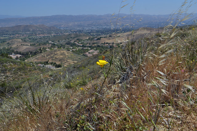
The houses are down in the valley, the trails are up in the hills, so I start off climbing a short way. This does have the effect of bringing more houses into view. They are all over the place but most the hill tops have been left open.


The trail loops around to skirt beside some irrigated trees and then, so soon, a chunk of paving. Paving! First an emergency road to cross, then an older road to walk along. There is a bit of gravel beside it, but that dwindles, vanishes into weeds, and then becomes a wall against the creek below. The creek is a little swampy right now, but it does mean some different vegetation to check out for a brief way. Then it pops out into the parched hills once more.

Once past the paving, I am into the larger open space area. A great big intersection ahead is the joining spot in the double loop plan for the day. The track is a pinched loop, but I decide to make it a figure eight and head for the high parts of the hike. In fact, a trail past a bench looks attractive enough to go and tag a random high point. The trail fades out as it keeps on going.


I do not keep going from the top, but return to the prescribed route. First, I take advantage of the bench to pull grass seeds out of my socks. I have managed to get a few that found a way to painful stabbing. I also watch a gopher snake cross the trail and vanish into the grass on the other side. It has no problems whatsoever with the seeds.


After a brief exploration of some slight caves and popping up onto another random high point, but then having to pull more grass seeds out of my socks, there is a junction with an actual sign and off to the side, a map. Rocky Incline is marked "not maintained" on it. This might discourage a few from using it. I follow the trail down to the better used lower trail and another big junction, then up and over to the top of Rocky Incline anyway. I am not worried about the lack of maintenance.


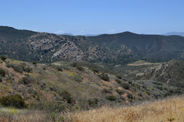
The trail is much thinner than the others, but hardly looks unmaintained. After a brief up, it sets me up for a long, twisting downhill. The "Hidden Canyon" name seems more apt at first, but I can see a lookout point about halfway down that steps out onto a collection of old river stones.

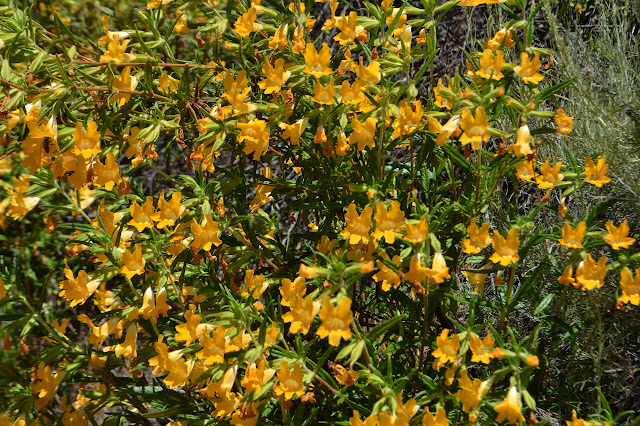
I drop down. The lookout point is indeed on big, rounded stones. The trail turns away from those briefly, but then drops down through the layer of them and is covered in large rolly cobblestones that have gotten loose of the soft dirt they were buried in however many million years ago. The bottom offers some nice oak shade. The canyon has a little more bird song than the surrounding area and a little more flowers. The wall of yellowy orange turns out to be sticky monkey and the chamise is going crazy too.

The trail is quickly done, and then I am on Meadow View down to Albertson Motorway. It has some shade in this small section, too, and offers purples with clarkia and the start of some thistles. There are a few little fat black bumble bees moving about it all industriously.

Albertson Motorway passes through some private property and the public route turns into a trail climbing up and over a small hills instead. I come out just above that bit, so find myself with a little more work than expected to just continue on down the canyon. Once up and over, though, it is quite smooth sailing down.

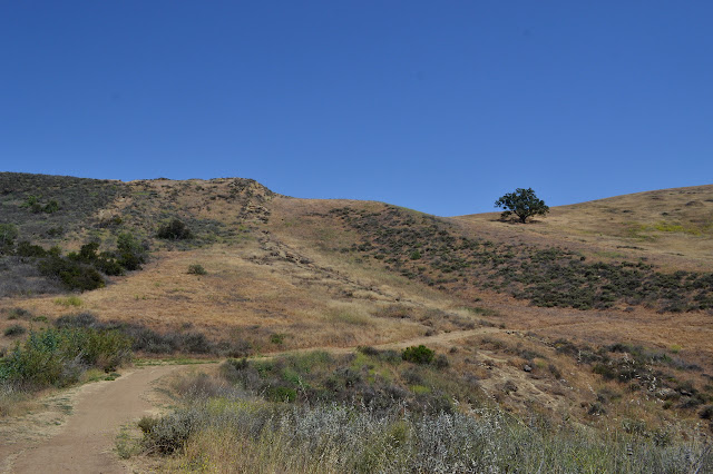
Down at the bottom, I am out into streets again, but not yet finished with the hike. There is a rather flat, gravel path all the way around, but I do not remember that until after following Steve's route up and over the hill to the trailhead on the far side. This trail is fire road and has a gate with a name: Autumn Ridge. I already did the ridge part of this one.

It is a short way to finish off the second loop and start on the second half of the first loop.
Up and over a hill, I am about to turn toward houses again. Down another trail, some kids are making a movie on one of the rock outcrops. The super-bee buzz of a drone overhead might go with them. Something about the scene they are putting together seems really familiar to 30 years ago. We had nothing to film our movies, but we made a couple at the fringes of our own civilization. I cross another emergency road, then off to flirt with more houses. Well, I did just walk through a neighborhood, but the trail on either side of it quickly got away from the houses. This trail is sandwiched between the fences of homes and the fence of the reservoir. I can hear the music floating up even when not played particularly loudly.

I stall at a rocky spot with a nice seat just because I realize I am hungry, then get to poking in the rocks just enough to notice a very large snake down a partly covered hole. Its markings look a little like the blotches of another garter snake than the sharp diamonds of a rattlesnake, but I cannot quite bring myself close enough to get a good look at it. Heading away seems much more comfortable. Almost to the end of the trail is another I thought I might take. With a careless look at the map, it looks like it goes over by the lake and loops. From the trail, it clearly goes up and over a ridge before doing that so I am not sure I want to, but I go for at least the first climb.

The trail follows along on the tops of hills never getting particularly close to the lake. That is always a thick chain link fence with barbs leaning over toward me at the top and a dirt track on the other side from when it gets checked to make sure it is holding. There is definitely no getting closer to the lake here. This looks like it could be a cool place for sunset. (It is called Sunset Hills.) For now it is just getting closer and closer to the freeway, so I take the lazy way and turn around before going too far down the other side.


Back to the trail, it is not very far back down to the road and all the manicured plants. The roses are very enthusiastic and the planters probably get replanted each week. They are certainly solid bloom now.

©2018 Valerie Norton
Posted 1 June 2018
Liked this? Interesting? Click the three bars at the top left for the menu to read more or subscribe!


Comments