Big Four finish: Santa Barbara Potrero
Los Padres National Forest
DAY 1 | DAY 2 | DAY 3 | DAY 4
Click for map.
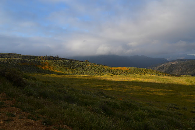
Finally, a night that was as promised by the weather predictions: not cold enough to freeze, not even in exposed places. There was still a bit of wet wrung from the air overnight. Clouds rush in once again as the sky brightens, but they are weaker today. There are open spaces behind them. The cows did not come around in the night, so the closest large animal is still the probable bear that thrashed past the edge of camp at Madulce Station.

Since it is only 6 or 7 miles out, I am in no hurry to get started, but since the morning is an easier temperature to live in, getting breakfast and packing up flows along quickly. With everything tucked away again, I head back up to Sierra Madre Road and then turn down it toward the car. Many of the cows are hanging out at the junction, but they take off along a path over the hill when they see me. As I gain the road, it is windier and feels a bit colder. That is probably just due to the wind. I had not thought the spot I had was sheltered as it is a very wide bowl, but now I suspect it was. I had nothing but gentle winds all night although there had been harder winds up here as I walked in.

I may have felt like I was going downhill more of yesterday, but camp was still up around 5000 feet, higher than the first night and lower than the second, and the car is down closer to 3000 feet. The road takes it at a very easy pace.

I try my best to just roll along it. This kind of slow downhill can leave me in pain in a few miles, so I try not to do the sort of breaking or whatever it is I do that brings on that pain. Trying to roll means knees bent more, which tends to be good for hurting less on a steep hill. It seems to be working here, too.


As I walk, I notice a set of rather crisp footprints. A second set is on the other side of the road. They stay so determinedly on opposite sides of the road that I suspect they came up together, chatting. Probably yesterday morning. It is the closest I have come to seeing anyone while I have been out here.
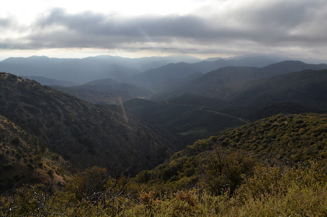
Up ahead, there is a rocky gash in the side of the valley that looks to have cottonwoods pouring out of it. I expect that canyon is a lot more reliable for water than the dry one I am currently following. As I get close, the leaves rattle in the breezes. It seems, for a few brief moments, that there is still the sound of rattling even when the wind dies and the leaves move very little. There might even be water in it now.

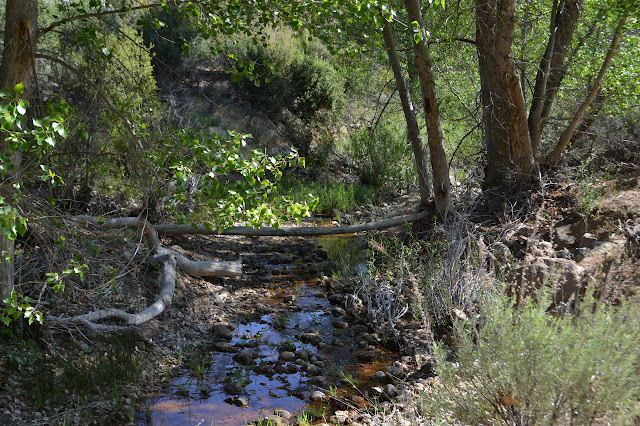
There are a couple chances to glance down into the creek bed and determine if there is water and indeed there is. With that curiosity satisfied, I start to notice how the far side of the canyon has had regular land slides where a bit of the wall slumped in a single chunk. Good reason to put the road on this side. Then there is the gate. It has quite a bit of parking available around it as it is permanently locked.

It becomes abundantly clear just past the gate that there is water in the creek as the road fords it. I find it simple enough to get across with dry feet along the side although the road itself is a wide pool. It is a pretty little creek in places. Eventually I turn the corner to find that my car has gained some buddies. The other hikers must be out for a loop, too.

I am finished even well before lunch time. There have been times when I would say that means I did not plan enough for this last day, but today I am alright with it. Sometimes it is just dandy to have a short finish up day and an easy drive home.
©2018 Valerie Norton
Posted 25 May 2018
Liked this? Interesting? Click the three bars at the top left for the menu to read more or subscribe!


Comments