Big Four finish: Samon Peak
Los Padres National Forest
DAY 1 | DAY 2 | DAY 3 | DAY 4
Click for map.
Clouds rush in at the first light of the day again, but this time it is happening down below me in the valley and not threatening to encase me as well. The picnic tables got soggy in the night and I avoid so I do not want to touch them or sit on the benches at all. It feels a little too chilly for getting wet. After breakfast, I put out one finger to find that the water is quite hard. All the dribbles and blobs of clear water is an illusion, it is all frozen. There are no air bubbles within to give it away. When the sun finally hits it after hiding behind the mountain for an hour, it simply transforms from matte to glossy. I am on my way out, so do not get to see the change finish. There are miles to walk and one more peak to bag.
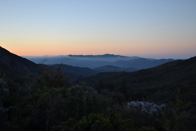
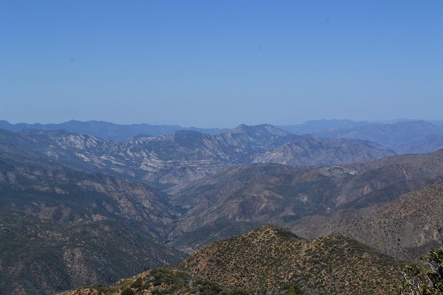
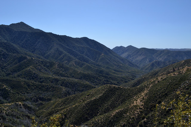
I head back toward Madulce Peak. Everywhere, there are hints of thick clouds leaking into places from off the Cuyama River.


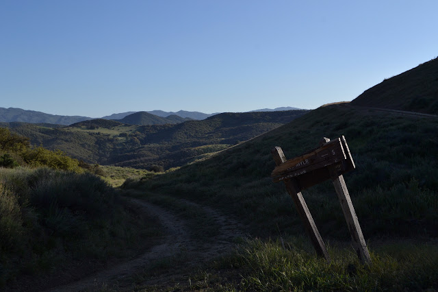
I keep on going up and over the top and down the road on the other side. I probably would have chosen to take the trail down the upper Sisquoc again and back up Judell Trail to head out, except for that goal of going up Samon Peak. The usual route heads up from the road and it might be quite difficult to do an unusual route. Actually, I am a little worried about the usual route too. One fellow said that although he usually gets himself up these Hundred Peaks Section listed peaks on his own, he has tried and failed to find the way up this one twice. The second time, he even had a GPS track. I took the liberty of grabbing a track myself in my preparation a month ago and still have it now. We shall see if it serves me better than him. Maybe he tried to follow it too closely? It is not something to worry about now. Do and find out. And enjoy the misty paradise that is the valley on the way.


My real worry of the moment is not the travel to the peak anyway, it is the spring that I expect to be my last water source. Chokecherry Spring spews water right across the road, but it dries out in the summer. I am expecting it to be there, but perhaps quite small. As the plants around me suddenly take on the bright greens of maples instead of the grey-greens of oaks, I think I must be close. The deep spot of the cleft in the mountain just has a general rock slide and no visible water.

Determining my location, the spring should be a little further. I try to relax a little. Probably the spring is not buried under rubble. Anyway, maples are not quite the same indication of water underneath as sycamores. The next dip is not nearly so green, even as I round it far enough to see the afterburner tank, trough, and various pipes all reaching out toward a thin line of water coming down the steep hill and wetting the rocks around it a little.

The trough water looks unappetizing. It is full of green stuff and tadpoles. The pipe to fill it is not actually in the water on the other end, so the water is slowly vanishing. I set about collecting and filtering. A broken bit of pipe proves very useful for moving the water away from the little channel it is following in the rock and into my bag. Gathering takes almost as long as filling. I completely fill one bag for hiking after the peak and tomorrow and a second for camping. The water I have left is not quite enough for hiking to and up the peak, so I go for another half liter. Well, I never get just a half. I grab a whole liter and tuck it away in the dirty water bag. If I do not need it, I will not have to filter it. Then I try to arrange things such that the trough is filling again. It seems a little rickety, but there is a little water coming out the end when I am done. There is more leaking out the middle, but so it goes. I have water to finish my trip and I am ready for another peak.
The use trail up to the peak should start less than a quarter mile further on as the road loops around a ridge line. While still expecting a couple hundred feet left to go, there is a rather unremarkable cluster of rocks set dead center in front of an unremarkable break in the bushes. Taken together, they cause me to pause and check my route up. It starts a little way off, but as I zoom in really close, it looks like I am on it. Right then. I head up a few feet and it looks like it could go somewhere, so I purge my pack of extra water and gear, tuck that into the shade, and start up.

Where to go up is not immediately obvious. There are a few choices all close enough to the track in the GPS to be whatever that person went up. I try one, cross over to another, almost cross back over before noticing that I had crossed over because that one was about to end, and start to think it will not matter much anyway and just push upward. If I get it wrong, I can probably push through to a better path. The track gradually gets more obvious, although a little concerning as I find myself powering up a slope near the angle of repose. It looks to be ready to do that some more as I spot something like a switchback on a grassy hill to might right. I go for that instead. Then more up. Looking back shows quite a lot of climb already done.
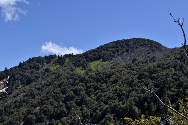
With a little trial and error, but mostly with following trail, I get up the ridge line. It has some nice, nearly flat areas that are nice for a little resting before climbing again not quite so steeply. There is even a cute little meadow up here. There is a trail dropping slightly to the right with cuts on it and everything, but it goes into a dead end. I try something sticking more to the ridge and it does not work either, then I just bust through some ceanothus. It is greenbark up here which is much softer than the white thorn below. While I am doing it, I notice a detail about the meadow. At the far end, there are a couple cairns. Also, the track in the GPS has been bending away to the north. On the other hand, I bust out on a very nice piece of trail continuing up the ridge. I ponder it a bit and decide it belongs to a bear who will give me a very nice route down to the meadow. Turning down it instead of up, it does show itself to be bear trail. It goes through some spots just a little too short for me to comfortably get through. Scratch nice. It is workable and I am out to easy walking on the meadow with very little brush busting.
There is a little confusion again at the far end of the meadow. I follow one track rather too directly upward and find some obvious trail for a bit. It plods out to a thin line in some more greenbark. It looks like this shortcuts the track I have, but there are little cairns down in the middle of the trail. I go for it and break out just short of the ridge having saved a tiny bit of climbing along with the few feet with the shortcut. From here, it is a rolling romp along the increasingly rocky ridge up to the peak.


I start off along the ridge. There are many trails to choose from again. I note lines of cairns below me as I follow something else a time or two. The dips are a bit deeper than I expected just looking across it. My instinct is to dip toward the north of the ridge when the top is not easy, but the trails always dip toward the south. Coming to a stand of oaks, I am uncertain if I should follow apparent trail in. The deer go this way, it must go somewhere. It does. Right along the top of the ridge and gets more obviously human as it goes.


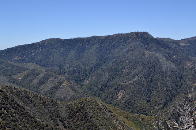
There is a little bit of rock scrambling at the end, but no exposure that I note. After a couple false alarms, I am finally at the high point. It even has a register and some surveyor trash. Oh, and it drops off quickly down the other side, although not so quickly as from Madulce. Since there is surveyor trash, I look for some marks. The first thing I note is a small washer that seems to be marked ION in a rock. I expect it serves the purpose of a reference mark, but it has no arrow. Looking a little more closely around an upright stick, there is a Forest Service benchmark. It is the only place where the peak name looks spelled correctly! It is not. The peak is named for a fellow, not a fish.
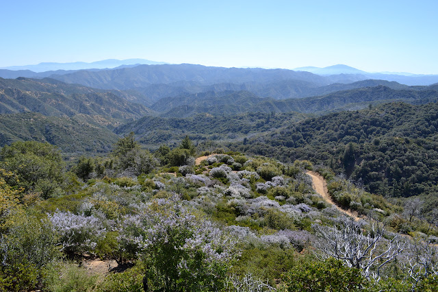
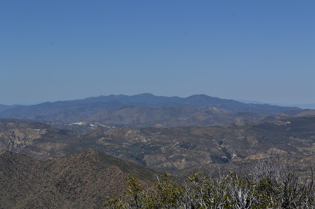
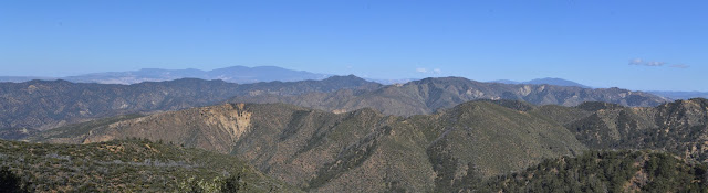
What a spot. What a spot! I think I will sit here for a good long time. Oh, and my water is almost out. I set up the water filter and then lay it all on a rock to let gravity do all the work for me. Then I look and I look and I look. Hurricane Deck is especially something to look at. I have never had anything like this view of it before. It is very interesting with its stark rock layers.

Eventually, I have to admit that half the day has gone and I still have some miles to go before I finish. In fact, it is more miles than getting here. Heading back is not so bad. Somehow, in spite of now having the additional trail marking of my own footprints, it does seem to take more trial and error to find my way. I almost miss the shortcut through the greenbark, but the GPS sets me right as the ridge line becomes suddenly uncertain from unfamiliarity. I try a new way down to the meadow, but it is worse than the way I took up. Some hunter sat at the bottom of the meadow and left his trash when he was done. That is annoying to find. I follow the other track briefly to find where to exit the meadow. There are a pair of cairns to show the way to the trail I missed coming up. With a little push through some green bark, I find myself exactly where I expect to be. Next to a little cut on the brush beside a short trail that appears not to go through. Oops. Then keep on going down. Very carefully on the steep bits.
I manage to get down without any slips and there is my gear waiting for me. It is a good thing I got that whole liter because I am almost totally out of my peak hiking water. I drink down the last of it before hooking in my rest-of-the-hiking water. All the rest of the hike is out on the road exposed to the sun on this faintly warm day.

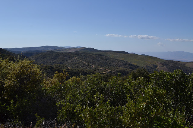
All it takes to enjoy the walk along the road is to ignore the immediate fact that it is a road. I must not have paid enough attention to the map, because I gradually come to realize that my left is drained by the Sisquoc River and my right is drained by the Cuyama River, which means I am walking a divide. It rolls on its way, mostly staying very close to the divide. I get relief from the sun when it cuts to the east side of some particular bump. Mostly it goes west and so I drink a bit extra.

My feet start to hurt. The road or the extra weight of water? The water is not that heavy, especially considering the food weight my pack has lost and how things felt at the start. It is probably the hard road. Also, just a little bit, all the downhill. I feel better on the uphills. It just seems like an awful lot of downhill.
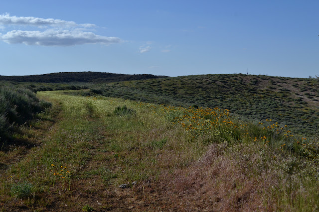
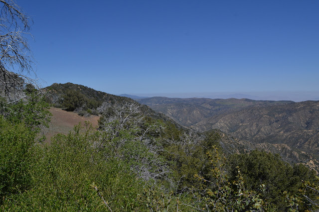
Arriving at the potrero, it is grasses and flowers and sage brush galore. And a weather station up on a hill. The bursts of orange I had seen from above are actually the deep, dark yellow of fiddlenecks. The abrupt change of vegetation at the edges is probably due to changes in the soil beneath.


Coming to the junction, I am at my arbitrary camp site. It just does not seem like a very good one. There is a spring just a little over a mile out of my way from here that I thought I might visit. I do not expect much of it, like water, but it could be fun to know. I have plenty of time, so I go for it. West to Oak Spring. Also, it means I get to walk more of the potrero. My feet still hurt, but just in an unimportant sore way.


It soon becomes abundantly clear that this place has a very active cow infestation. They look up at me, they moo, and then they run. And they plop here and there while they do it. Arriving at the little spur road to the Judell Trailhead and Oak Spring, I turn down into the thick of them. Well, it seems the thick of them will move when they see me.
At the end of the road, a table. Hey! The spring seems to be two repurposed afterburner fuel containers and a third container to hold more water. The valve at the bottom of one turns, but is already open and has a wet red dirt starting to come out of it. Pipes run down the hill where there are a couple troughs. One has a tube with a very slow drip of water. The other has a pool below it. Neither has water within. Now I do not feel silly for carrying my water in. Back at the table, there seems to be good fencing all the way around except the entry, which has no gate. A coiled bit of barbed wire over one post might be long enough to cross the space, but getting it uncoiled without injuring myself seems unlikely. I will just have to trust the cows not to come around. I get on with the camp chores, then off to sleep. The thin moon seems to hang in the sky forever before suddenly dropping away. The skies have taken more than an hour to darken each night, and tonight is the same. I can see more of it tonight and when it does darken, it is very impressive.
Continue on to the next day ⇒
©2018 Valerie Norton
Posted 24 May 2018
Liked this? Interesting? Click the three bars at the top left for the menu to read more or subscribe!


Comments