Big Four finish: Madulce Peak and Big Pine Mountain
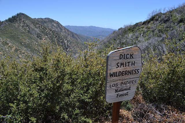
Los Padres National Forest
DAY 1 | DAY 2 | DAY 3 | DAY 4
Click for map.
The bear did not come back in the night, or at least not while I was awake enough to notice. When I woke, it was clear, but first light comes with an inrushing of clouds. It is not a weather pattern I am familiar with. Clouds build at night in my experience. My bag is as dry as it will ever be once the clouds become fog, and I stuff it away quickly. Although unexpected, the clouds do not worry me. I will climb above them or they will burn off by the time I am on the first peak and ready for the view.

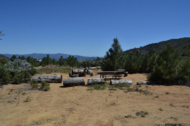
The trail is less obvious above the camp, but still easy to follow. After the first creek crossing is another camp site with a pair of stoves and a shovel.
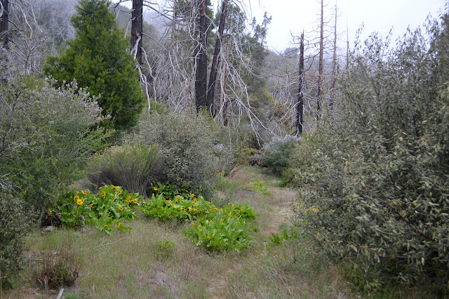

The trail starts to climb a bit more after one crossing and I suspect this might be the start of the real climb up to the ridge line of Madulce Peak and perhaps I should get water here. A few more steps and a log along the side of the trail with all its limbs chopped off. I remember this log from another bout of trail work when we came down from above. This is definitely the last chance to get water. I will probably need about ten pounds more of the stuff before I pass any source along my route. My plan is to drop my gear at Alamar Saddle and take the half mile trail down 400 feet to get it from Upper Bear where I know there is a nice creek flowing. Maybe it would be easier to just haul it up with everything else now? It is not that many miles a climb. I dither a moment, then decide the water looked a little mucky by the crossing whereas the stuff at Upper Bear is really pretty, so stick with the plan and start to climb.

The less obvious trails must have been due to the meadow character of some of the areas it was going through. Once the trail is climbing, it is just as obvious as it was before. As expected, the clouds are lower than my destination up on the peak and they tend to be burning away at the edges, retreating back toward the central mass, before I get to the high places.


Nearly to the top of the high ridge line and out on the edge of one of the descending ridge lines, there is the sign to mark the trail to the lookout. The fire lookout went long ago and the trail has been following suit since then except for a few determined people who do not want to quite let it die. The reason to put the lookout way out there will remain for quite some time. By all accounts, the trail has gotten a lot better in the last few years. Time to see. The tread is easy enough to find at first. It curves around past some small, cut logs and one large, intact log to a cleft in the ridge for the first view to the south. The downed trees start off in earnest shortly after and many of them are quite large. Someone has nicked each one to give a foot hold while clambering over the top. Given the size and slope of a few of them, they might be dangerous to cross without it.

The trail seems to be constantly traveling downhill, which is disconcerting. I am supposed to be moving toward the peak. Above, huge slabs of sandstone cover one of the intervening peaks and I suspect that it is getting down below that. Between the intervening peaks are sharp ravines. There is not much area for them to drain, but in the event of a sudden deluge, anything that is flowing down them is going very fast and it looks like there have been a few sudden deluges. I am just getting suspicious there might have been another place they old trail went through when I notice a pair of perfect rectangles, one over the other, carved into the tree ahead so long ago that the bark has filled it in again. The tree behind it also has a blaze. Okay, this was the trail. As it finally starts to climb, it seems to have dissolved into peakbagger trail. Up a ridiculous slope in short switchbacks with random bits of braiding. I look for the scars on the trees here, too, but there are none. The map indicates I should have turned to climb earlier, but it also puts the junction much further down the mountain.

There are lots of interesting water carved sandstone caves on the way up. It seems incongruous with being a peak. The upper sections climb through meadow right up to the high rocky ridge line at the top. Reaching the top does not make it any easier. There is trail down and around again and more trail staying high. My instinct to stay high does not serve me well as I end up carefully hugging a bit of tree to get at the easy footholds down a slab of sandstone to get to the lower trail after all.

Once satisfied with the lower trail, the route is much easier out to the peak. I keep rounding one more bump certain this will be it, but there is never anything to suggest fire lookout. Maybe there is nothing left of it? A piece of pipe down one slope teases me. Maybe there is still a little more up to go. I walk a little further and repeat the exercise over and over again until things become very clear. Up the last bump, a set of very narrow footings come into view and beyond it the land just falls away.


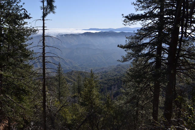
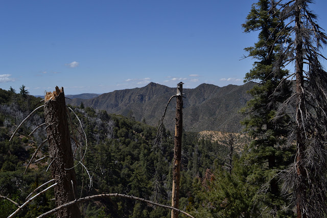
Gradually, I pick out the peaks. They feel a little skewed from here and it probably would have helped if I had grabbed the Dick Smith map instead of San Rafael. The rocks forming this mountain form more ridge, all quite low for a while, that flow into Pine Mountain which I initially think must be Pinos, or rather Abel. It is too sharp for that and once I think it might be Pine, I spot the road going up it. That makes the large potrero between Potrero Seco. And the ridge just so, the closer peak looking higher but not actually as high as the next one is Hildreth. The fuel break across it is wide and new like a single tan skunk stripe. That one, and the back fires from it, held. The Thomas Fire ended there. The high bump behind it is Monte Arido and I cannot pick out Old Man Mountain from here. This really is a good spot to be. I pick out a mountain to be Caliente Mountain, but it is probably wrong. That should be more to the west.


But this is only a third of the day so far. I still need to get to camp, drop off some gear, get some water, and finally head up Big Pine Mountain, the Santa Barbara County high point. I head down. It should be easier with footprints to follow, but I take a turn or I miss a turn or I find a different angle along the way and I get on some other route as I navigate the short switchbacks down the steep, forested slope. The actual area seems familiar, but I am on some track I was not on. Somewhere below should be something that looks more like trail and I take it carefully until I find it and then need a little bit of effort to sort out which way is down since in the short run both ways are. I decide to take a left, swing two more times, and then am traveling along back to the junction with only the meadow wiggles left to get me. Which they do, but with easier visibility to find an eventual target of trail.

After all the big trees and picking through the ravines, it is nice to be on the better traveled trail after the junction. On that part of the trail, there is only one very small and easily stepped over tree a few feet from the road and no challenges at all. The whole thing was harder than I expected and I somehow got an extra mile clocked on the GPS during it.
From here on out, it is road. Sometimes it can be too easy. Well, the spurs to get to water and peaks are not road, but otherwise it is all road. Some of it cannot be traveled just now. I pass some large jumbles of rock and then one very large rock blocking the road. That part cannot be driven. Below it, there are tire tracks from where someone made sure it would be good for bringing volunteers up for the weekend. There were a couple large cube rocks further down the road when I was deciding it was too cold last month. I expect they have been moved now. Soon all those trees I hopped over, around, and even the few I crawled under will all be cut out of the upper Sisquoc. Otherwise, the road is absolutely covered in bicycle tire tracks as I make my way to camp.
At camp, I ponder another option to getting water. Maybe I could go out and see something new, Big Pine Spring. While standing in the cold and wind, I thought that there was no trail down from the sign, but my photo of the sign seemed to indicate there was once I looked at it in the warmth of home. There are few water reports on it, but it is reputed to be reliable all year. It would be a little longer to go to get the water, but less steep uphill to bring it back, but a lot more gentle downhill. Also, I may not have quite enough water to get there. There is gamble embedded in it. If there is no water or I cannot get to it, I likely have to forgo Big Pine again. There is a little new discovery too. I feel a little foolish for it, but decide to go for the gamble, drop off my camping gear, and head on up the road to the further water at Big Pine Spring.

Now that I am not generally just trying to run along, the trail behind the sign for Big Pine Camp is obvious. It has even had a bit of care and is not quite so steep as I feared. It drops 200 feet in a quarter mile, half the effort as to Upper Bear. There is a flat area without even a fire ring out on a small shoulder that looks like it has actually been used recently for camping. From there, the trail takes its steepest turn to get down to the bottom of the tiny canyon. At the bottom is a ribbon and behind a thin bush is a spring box. There is not a lot of water, but plenty for me. It has a good lack of color and flavor. I was a little worried about what the quality might be after some things I had heard. There are trails further on, so there might be sites further. I just want water, so that is as far as I get.

After a couple bags of Big Pine water has been filtered, I drink down the last few drops of Madulce water and swap in the new bag. On to Big Pine Mountain! The junction is easy to find although there is not sign, not even so much as a slapstick marked "wilderness". There is just a mysterious bit of road starting up the mountain. I start up it and so have quite a few bicycles. The huge trees crossing the road start quickly and so the bicycles do not get far. These are too big or awkward to climb over and there are quite a few hiker trails forming to skip up to the next bit of road when the bit in front becomes impassible. I have only seen very occasional running shoe prints down on the road, but a couple people came up here recently in heavy hiking boots. They seem to know where they are going. I suspect someone taking a break from driving a truck and moving rocks, but it could just be that their prints were drowned in all the tire marks below but not up here. Whatever, there are at least a dozen big trees on the road and further up, parts are choked in ceanothus and these prints provide some guidance if I choose to take it. Sometimes I do.

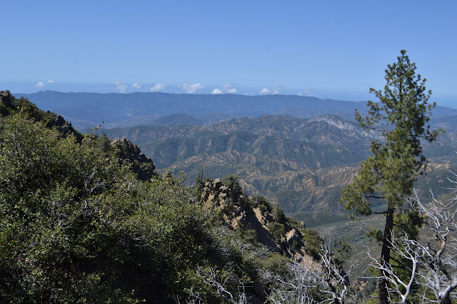
The top of Big Pine Mountain is huge and flat and once treed. Nearly every single tree was killed, presumably in the Zaca Fire. I take a couple false starts to look for a register before finding a can marked "Cobblestone". Curious, that one has had a special register for many decades. Is this the can it replaced? Some vandal took a can opener to it at some point, so now the books are stuffed into a second box. I sign it and try to take a look around. It really takes a bit of walking about to really get the views. At the moment, those include the islands. I can see some of the cliffs on Santa Cruz and the channel of water between it and Santa Rosa.


After a while I head down again. My route echos my route up, but I make no attempt to follow it exactly. I feel more confident about navigation on this peak than I did on the steep side of Madulce. I am down again in no time and then it is just the long, gentle road back to camp. I did have some temptation to head up West Big Pine again, especially after I was already hiking nearly all the way to the trail on the way to the spring, but it is already getting a bit late by the time I get back to the saddle. Time for another sadly low fat supper and then tucking in as sheltered as I can find against the wind under the clear sky.

Continue on to the next day ⇒
©2018 Valerie Norton
Posted 22 May 2018
Liked this? Interesting? Click the three bars at the top left for the menu to read more or subscribe!


Comments