Big Four finish: Madulce Staion
Los Padres National Forest
DAY 1 | DAY 2 | DAY 3 | DAY 4
Click for map.
Those three peaks of what the Hundred Peaks Section call the "big four" still need climbing. Well, maybe not need, but I do want to go up them and one of them is the county high point. I have visited all these surrounding county high points, it is time I got my own. Besides, I am feeling a little bit of pressure to go ahead and do it. I have little idea what my near future holds, but I am fairly certain that it will involve leaving Santa Barbara. This time, I headed out to the more traditional starting point for them in Santa Barbara Canyon. I am planning four days with easy ones at the start and end. That way, if I cannot get my car along the road, the last couple miles of which are technically only 4WD maintained and the rest of the dirt miles cannot be expected to be much better. Not that I left early enough to do the road miles if I had to. I actually only packed up in the morning, so it is a good thing the road was fine all the way to the parking at Willow Flat.

The weather looks lovely, at least until the weekend, for Santa Ynez. It even looks warm, but bearable, for New Cuyama. I did go ahead and check what the mountain forecast said about Big Pine Mountain and took a look at a fairly relevant spot on the map before heading out this time. They both predicted lows around 44°F and highs more like 56°F on generally sunny and dry days. A temperature variation of about 10 F° is absolutely bonkers. It might be able to vary that little with a really thick blanket of cloud consistently covering over, but not when clear. I have noticed some hot and humid places seem to be able to do this sort of thing, too, but that takes a whole lot of water in the air and it does not hold enough at these temperatures. Meanwhile, I have looked at predictions and seen low 44°F then woken up with a bit of ice on me enough times that it is starting to be a bit of a trigger. It is nonsensical to see 44°F and think "ice is immanent", but slightly less so than a tiny temperature variation and clear skies. It will change that much just in the hour the sun goes down. I am ready for it to freeze at night, but then warm up a bit more in the day. No tent again. There is a new moon tonight and it would just block out the stars.
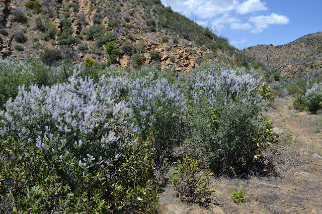
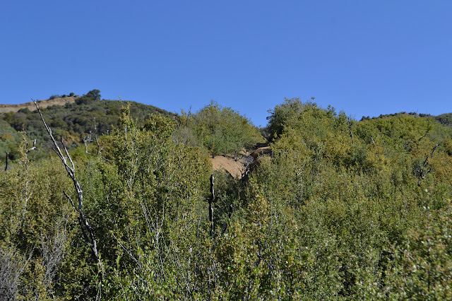
The canyon is wide open and the trail is too for the first three miles except for a few downed trees, mostly long dead cottonwoods, and willows at the creek crossings. It is easy and flat and familiar. I helped cut the brush back off the trail some years back and a few other groups have been through since then. The creek is dry at first, but then there are a few stagnant puddles and then flow. Realizing it was already past lunch when I started and I have only had breakfast, finding the flow inspires me to sit and snack and listen for a bit.

Our camp had been exactly three miles in just short of branch in the canyon where the trail turns. Little is noticeable of it now. Our main goal had been to clear trees on the trail above so that it was passable by stock who would supply more workers based in Madulce Camp later. There is a little more work to be done now. Some of the spots I find myself maneuvering past a fallen tree seem very familiar. The oak down a few feet from what was a monster mess of an oak will be a much simpler matter to clean up. The canyon is narrower here and the babbling water is a constant companion. The trail alternates between narrow, sometimes oddly routed and wide, appearing to have once been a road. The trail dumps right into the creek for about 200 feet. The challenge of keeping my feet dry is not all that great.

Doing trail work sometimes will make quite random bits of trail very familiar. The barriers of flotsam that had piled up after a big rain have vanished now, but I still remember one where we found the feet and back of a very unfortunate bear. Finally, I feel like things might be new to me when there is the old slide we had to try to find a way around. It is at the outside corner of the creek and seems to be holding although some other group was by later to fix it in a little better. Such are the challenges of creek side trail.

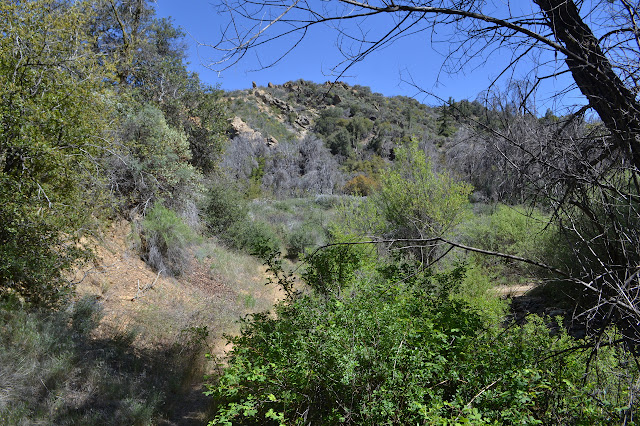
Past this that is known, or at least a little bit vaguely remembered, there is a big unknown: Heartbreak Hill. I have heard rumors about it. The first is the one partly embedded on the map in the name. It is a steep rut going directly up the hill and it will break you. The second rumor I have heard was, "We put in switchbacks." The canyon changes character and the water vanishes entirely as I continue to climb.

Around one corner is, indeed, a rut directed straight up a hill. That is probably it. The first section of the rut is choked with brush and the trail actually swings out and around it to hit the rut a little higher. It is steep, but I have seen worse where motorcycles play. What about the switchbacks? Just above where the trail hits the rut, there is a narrow line through the brush going back the other way. There is only a little tread along it, but I give it a try. Very quickly, there is a slide and now tread at all. I carefully cross it and continue, pushing through brush nearly closing it back up. It rises and falls and twists and eventually comes out again at the rut above the worst of its climb. I am not certain I gained anything by trying it except scratches from scrub oak. Someone has put sticks across the top to help direct hikers down the big rut instead. It seems to be going right back to where it was before. I look halfheartedly for a continuation, then start up the rut. One thing is certain, it is very effective in achieving nice views.


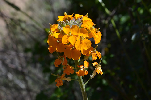
It does not break me, but my mind does wander far enough to realize what I forgot in my morning packing. My bottle of oil to add into my supper. Except for the miracle that is walnuts, somehow 2/3 fat and still a solid crunchy thing, dried foods tend to be a little low on the fats. Besides, it calls for "butter or margarine" right there on the package. It tends to be excellent for filling in that last bit of hunger. So it goes. Reaching the top, the view is even better and now has some sort of giant daisy. At first I am thinking truly giant coreopsis, but then realize it is mules ear. They do tend to high places.


It is nice walking along the top except for the certainty that I am about to lose some of the elevation I just worked hard at gaining. A couple trails head off southeast that I suspect are shortcuts into camp. Little meadows dot the area. The trail itself seems in no hurry to get anywhere, but does eventually turn and drift downward toward the valley below.


There is a clearing below with tall cedar trees to one side. The former guard station site. As I step to the side to look it over, I can hear the sound of water rushing along somewhere below. It is seasonal, so it is very nice to hear and know that the season is not up a bit sooner than expected. I drift the rest of the way down to the sign marking the junction with the Don Victor Trail and then turn into the clearing and my home for the night.

And so I look around to see what metal and rock bits are left since the rest burned. Rusting fuel cans make seats around the campfire ring and a large ice can sits on what may have been the porch. Trail leads out into the old camp site away from the cabin site, but it seems abandoned. I set to the chores of gathering water and cooking my sadly low fat supper and then it is still light and I have nothing to do. Well, nothing but paint and listen to the birds and water. Actually, that does seem like a worthy thing to be doing at the moment.


Gradually, it does get dark and so I tuck in. It takes an extraordinarily long time for the sky above to darken enough to see more than a couple planets. The moon is new tonight, so it will not interfere with star gazing. Shortly after it finally darkens and the stars are coming in one by one and then in clusters, there is a thrashing across the creek, then a bit more on my side. I shout a "hello" out to the bear, for no one else would ever make so much noise for so long. It is well gone by the time I dig out my light and take a long look around. I am a bit wary and listening carefully as I return to taking in the stars. There are so very many stars. It is not very surprising that my bag dampens in the night and even less surprising when I find that that damp is quite solid in places in spite of the rather warmer prediction and nothing but the slightest of breezes.
Continue on to the next day ⇒
©2018 Valerie Norton
Posted 21 May 2018
Liked this? Interesting? Click the three bars at the top left for the menu to read more or subscribe!


Comments