Posts

Showing posts with the label fire road

Maddox Lake

Image
Shasta-Trinity National Forest Click for map I thought Maddox Lake looked like a good candidate for a dispersed camp area, so set off looking for it. Just short of the closed road to the lake, I found a suitable space. I could hear rushing water and poked along to find a small but robust and quick flow down the hill. Then I wandered down the road to the gate to see the lake. Closure period all year, but there's a sign to explicitly allow walking. The parking is basically blocking the gate. It's a generally clear road lined with very tall trees. I spotted a small pond below the road and the stream didn't seem to have quite so much flow as above.

Lacks Creek: Beaver Ridge

Image
Lacks Creek Management Area (Aracata BLM) (Map link. Purple line for day 1.) DAY 1  |  DAY 2  |  DAY 3 It was again the day right after a bit of a rain, the second since the dry season, as I parked again at the main road junction at Lacks Creek. This time, I was packed up and ready to hang out for 2.5 days on the west side where the longer trails are. ( The visit to the east side is here. ) Finding information on these is difficult and someone at the Bureau of Land Management (BLM) is really bad at producing working links. (Many can just be edited. They've used an entire sentence as a link? Really? They do know the edit.blm.gov server isn't public facing, don't they? Some are utterly without relation to where they should be pointing.) The main page with summary information and directions can be found here . They do neglect to warn the casual planner that this area does not allow dispersed camping unlike most BLM areas. There are a number of official camps...

Redwood Park to Loop 8 and more wandering

Image
Arcata Community Forest Click for map. I got myself over to Redwood Park and wandered the Arcata Community Forest for a bit. The wander generally took me around Loop 8 and a little of Loop 9 and Fickle Hill. Here are a few pictures. The forest around Redwood Park is particularly cleared by the stomping action of those who are playing among rather than hiking past. For the first time, I hiked the road past the parking on Fickle Hill. It promptly passes a sign that mentions, among other things, that the forest is kept in a sustainable way meaning that logging is balanced by growing. Logging? The trails are a mixture of roads, used and not, and narrower trails. And then I found the fresh stumps and the long ribbons printed with "timber sale boundary". Yep. Logging. Big broken stumps are very old, but very old redwood so they stick around for a long time.

Lyons Ranch

Image
Redwood National Park Click for map. The trailhead for Lyons Ranch is at the far edge of Redwood National Park, so far out the road runs out of pavement before it gets there. I was disappointed to find the smoke visible as I was driving out although still not very thick. It had a rather nice smell to it for smoke, but who let it in? The likely source was Red Salmon Complex, which has burned most of the trail I was on in Trinity Alps Wilderness . [As of 20 Sept, it has less than two miles of trail yet to touch and less than half a mile of easy uphill crawling needed to touch it.] I dumped most my gear from by big backpack because I found I'd forgotten to get the day pack, then dropped in the water because in spite of the smoke, it was hot and the prairie almost devoid of shade. At the trailhead for Lyons Ranch. With the right key, you can just drive down. I walked around the gate and started the easy two miles down to the old ranch. I quite liked the view I'd got on...

King Range: Kinsey Ridge

Image
King Range National Conservation Area (BLM) DAY 1  |  DAY 2  |  DAY 3  |  DAY 4  |  DAY 5 Click for map. Going to be another sunny day over the water and I think I'll remember to put on my sunscreen even though I totally put it on already yesterday. I sometimes get a little too relaxed about sunscreen, but being on the beach does give a double dose of the high energy rays. There's no part of the trail that is restricted by tides, which is good because the low is still right around sunrise and sunset. The high is going to be higher than normal, so it'll be important to pay attention anyway. I guess it always is. Sneaker waves and all that. Getting ready for the dawn. It'll be a while before the sun is actually shining here. The morning is cool and soggy. It must have dropped below the dew point because my cheap little humidity gauge is reading 35.6°F and 98%. It is tempting to try to wait for the sun to hit. I'm packed up only...

O'Leary Peak and Lookout, Darton Dome, and Robinson Mountain

Image
Coconino National Forest Click for map. I almost went for O'Leary Peak instead of the wanderings I did on the fee free day, but it is actually just outside of the monument and requires no fee, so I came back for it. It didn't take long. Today I'll make my way to the lookout, which has road all the way up, then decide what I feel like stopping by on the way down of the various smaller peaks near the road. Three other cars have beaten me here. Gate and trail sign on the road to the lookout on O'Leary Peak. The road rolls a little, first dropping and then rising, as it wanders the forest toward the base of the volcano that holds the lookout. Trees and cinder and only the slightest undergrowth stretch out every way. It swings northward as it comes to the edge of the Bonito Lava Flow. Little signs march along the imaginary line between forest and monument as it cuts through one corner of Sunset Crater National Monument. Quite the nice road up to the looko...

Quemado Lake

Image
Apache National Forest Click for map. I decided Timmy should get a little stroll out to the lake. I don't want it to be too late in the day because the poor boy seems to start feeling the heat around 70°F with all that fur. It's the same start on Largo Trail #14 as before, and this time I'll get those benchmarks along the way. When the road tops out on a little hill, it'll be time to turn down a use trail and wander toward the lake. Following the road, driveway really. The overlook is above, but we'll not go that far. The little bit of use trail at the top of the tiny hill. Timmy knows benchmarks are boring. He gave it a sniff at least.

Mount Graham

Image
Coronado National Forest Click for map. The same caveats apply as when I was looking to backpack the mountain except now I have seen evidence that the map creator did know a thing or two about the local trails, since some that are part of the "trail system" are missing from the USGS base map used, so thoughtlessness or ignorance in the creation seems less likely. There doesn't look to be all that much snow, but plenty in spots, so I'm heading out with the same microspikes that call themselves "crampons" that I used yesterday for Heliograph Peak. While it saddens me to take the usual route up when I could do something extravagant, I can at least change it up by taking the trail down to Hospital Flat on the way back. I only pulled to the side of the pavement to park, but it is wide enough for travel and parking both. It also seems to have been a place snow was plowed to and a couple campfire rings have been built right in the middle of it, so it see...

Heliograph Peak

Image
Coronado National Forest Click for map. There is both trail and road up Heliograph Peak. The trail climbs up from Arcadia National Recreation Trail near Eagle Rock, not that it can be found on the National Forest quad. My initial plan was to start at the lower end of the trail at Upper Arcadia, but got lazy or loop happy and am at the upper end at Shannon Campground. The campground itself if actually locked up tight and under a blanket of snow, but there is parking a few feet up the road to Heliograph Peak, which is next door and also locked tight. I could bring my snowshoes for the snow, but have decided to go with the easier to carry rubber and chain "crampons" since it is a bit compacted and I am lighter without big pack and cat. They actually say "crampons" on them, but are more like spikey tire chains for my feet. They are too big for any of my shoes except my boots, so that is what I am wearing. Anyway, it seems like the right environment for waterpr...

Beith Creek Loop

Image
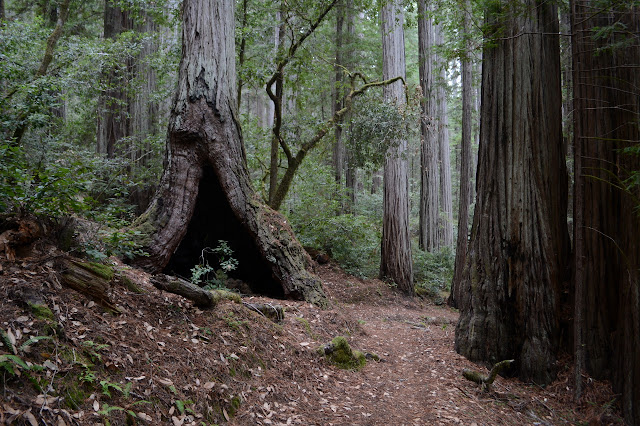
Arcata Community Forest Click for map. Out for a quick loop hike while there is clear air and patches of sun. Oh, and the threat of rain. In fact, it is actually sprinkling a little as I start, but I have my rain coat and the trees will probably put an end to most the thin drops. Sure, they'll replace them with big drips, but it takes a lot of thin drops to make a big drip. Not so deep in the dark forest looking out on the neighborhood horses. The eyes adjust and it is not too dark to follow the path through the redwoods even covered with redwood leavings. I know there are some spots up high to look out to Humboldt Bay, so power up the road to the top so that the weather has the least amount of time to fill in the air with rain or mist. Of course, the weather doesn't need more than a few minutes and it takes me longer to get to the top. On big stump cut off bluntly. This is a second growth forest, so the trees are tight and much smaller.

Grasshopper Mountain and Johnson Camp Loop

Image
Humboldt Redwoods State Park Click for map in new tab. I was wanting to do some redwoods "properly" meaning, well, wander beneath them for a while trying to look up far enough to see the top. Probably. I'm not really sure. But redwoods. Properly. I noticed I could find some and get a peak as well and went for it. I also noted that it is a bit of a long hike and I would want to use all the light of this short day and started off very early. The route up the mountain starts with a fire road signed as "lookout". The main parking at the bottom of the road is all signed no parking from sunset to 8 AM making it illegal for another 1.5 hours and I don't want the pressure of getting down before sunset (after all, there is still some light available after sunset) so continued on to something unsigned next to the gate. It is still quite dark as I park and a little lighter once my shoes are on, but still too dark for the camera to autofocus on the gate for a ...