Mount Graham
Coronado National Forest
Click for map.
The same caveats apply as when I was looking to backpack the mountain except now I have seen evidence that the map creator did know a thing or two about the local trails, since some that are part of the "trail system" are missing from the USGS base map used, so thoughtlessness or ignorance in the creation seems less likely. There doesn't look to be all that much snow, but plenty in spots, so I'm heading out with the same microspikes that call themselves "crampons" that I used yesterday for Heliograph Peak. While it saddens me to take the usual route up when I could do something extravagant, I can at least change it up by taking the trail down to Hospital Flat on the way back. I only pulled to the side of the pavement to park, but it is wide enough for travel and parking both. It also seems to have been a place snow was plowed to and a couple campfire rings have been built right in the middle of it, so it seems unlikely anyone will be trying to drive it anyway. No signs mark the start, but the locked gate just around the corner is a good clue. Even the gate is approximately placed on the Forest Service map. It has it a little way back the way I came just after Shannon Campground.
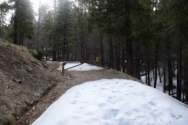
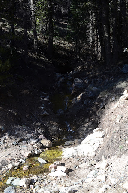
So I start up the road with plenty of footprints in the snow. I ran into a pair who were through hiking the Grand Enchantment a couple days ago and saw four more hiking down the road today as I came up. I wonder if it goes this way? Sporadic voice only signal greets me whenever I try to look up the route and although I've heard of it, I certainly didn't pay attention to where it goes. Also, big yuck to walking the highway, even if it is a highway to nowhere. (The couple said it was developed by someone who had just about run out of trails to hike and that they too have just about run out of trails to hike, but when I mentioned that there is a traverse that parallels the John Muir Trail they first thought I might be talking about the High Sierra Trail which is neither traverse nor parallel to the JMT then said they'd look into it, so I suspect they have some to go on the list Trail Journals will let you choose from. Oh, I should have pointed them at the sticker on the back of my car, too. They certainly haven't done the Condor Trail.) The creeks are running nicely and a copper pipe sticking out where it says "spring" on my map is running well too. I wonder why they would bother to pipe a spring just to dump it all in the creek?
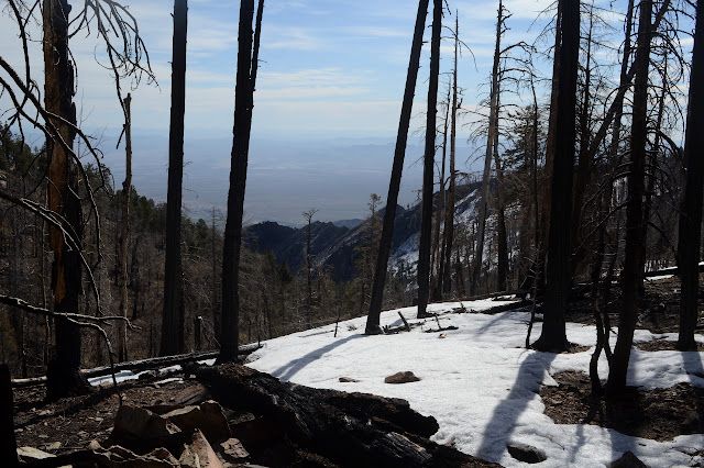

I am just getting back from poking around a ridge at the very edge of burn for the only remaining geocache of two along the road when I notice a backpacker headed the other direction. With his poles. Where are my poles? Leaning against the unburned pine instead of in my hands, of course. That was lucky. The one time I leave my poles behind, someone comes along to remind me of them! Although going back for them did sort of distract me from trail courtesy.

The numerous prints before did not seem to go up all that far. There was a mystery cairn to the left side at one spot, but that didn't seem to be where most of them went either. It leaves it easy to spot the fresh prints in the snow from the fellow going the other way, but also to search for the prints from his initial walk out. They are there, but often very faint. It is surprising how fast the snow eats footprints left in it.
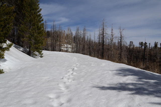
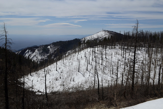
I should be approaching the trail down to Hospital Flat, so I look for a sign. Since they all seem to be wood and the trees here are very fire killed, it seems unlikely I'll find one. There is a bit of metal on a post, but further inspection makes me think it is a snow gauge. In the saddle just below where the trail should be, there is a line of creek that seems oddly placed. This could be it. Maybe. The saddle itself needs some better placed drainage if it is just drainage as it is full of water right now.


This really is a rather gentle hike, just long. It is made harder by the snow and the occasional fallen tree, but with the width of a road to deal with, there is usually an easy way past the trees. Some of them look like they've been down for a while, but it is hard to tell with so much standing dead to come down. There are actually three named peaks at the top and I may as well go for the two lesser ones while I am here. The first, Plain View Peak, looks to be most easily accessed off the end of a hairpin turn. As I step off the road, there is a ribbon marking the spot. Odd. Toward the top of the peaks, most of the standing dead have been taken down by the winds. There have been two fires through here in recent years and it looks like both hit the peaks. One killed off most the trees and the second burned up most the fallen and the standing, pretty thoroughly cleaning the area. I see the thin remnants of a few tall trees and many shorter sections leaving the cross country to the top rather easy.


Plain View Peak has another ribbon marking the cairn at the top and the view of the surroundings. It certainly is a plain to see far below. One would have to judge for oneself if it is plain in another sense. It certainly is increased by the killing of the trees.
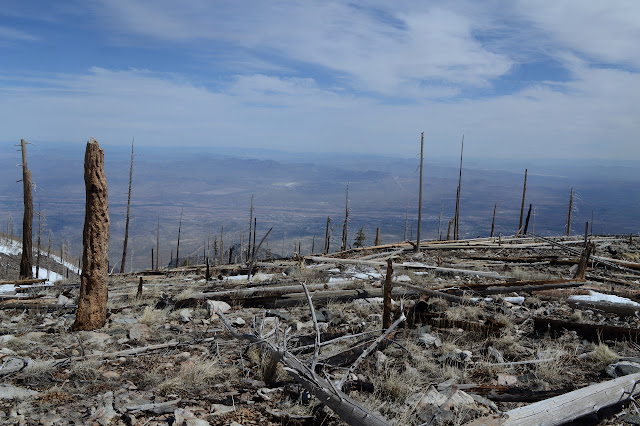


Next up is the big peak, the county high point, Mount Graham. Between them, somewhere under the snow, the Gibson Creek Trail should reach its upper terminus at the road after passing a spring. I don't expect to see any sign for it, but there might be a weak point in the snow where the spring comes up. But not such that I would notice, apparently. I follow the ridge up Mount Graham. Should I go for snow or no snow? Where the trees have fallen (and not burned) under the snow, it can make weak spots to fall through, but when it holds it flattens everything out for easy travel rather than having to climb over all those trees. I oscillate a bit, but the snow is just too dangerous. One more thing to avoid are the little trees someone has replanted. The very top is still forested, but all of it was. There are bunches of new trees easily seen by the blue plastic tubes given to the trees for protection. I wonder if they don't hurt more than help. Most are tilted fiercely in the wind and stay that way even if it lets up a little. Some are protecting snow around the little trees. Many of the trees do not look that healthy. Still, some look like they'll make it, and that can't be bad.

I briefly stop to watch a pair of hawks dance a little in the sky before flying off. There is no choice but to walk the snow at the top because the last living trees are protecting it a little from blowing away in the wind. The very top is marked by a pole. I expect it is very close to the benchmark and think I might dig for it, but it is at least three feet of compacted snow down. Maybe not.

I head back to a spot with views to eat. The observatory has at least one more traditional looking building for a telescope, but that huge box is making me wonder. It seems to be capable of rotating and it clearly houses something that is not affected by being enclosed in a concrete block. Neutrino detector? It would be likely to be housed in a mine or something to get less cosmic ray background. Cosmic ray detector? X-rays generally? Oh, I bet there's a web site to say, but nothing accessible to me here.


My next stop is little Hawk Peak. It looks to be covered in snow and have not one living tree on it from here. Between is a connector to Deadman Highline Trail and although I expect no sign of it, there is another thin metal pole right where it should be to mark it under the snow. Oh, I am wrong about the trees. A few little ones are trying to make it among the matchsticks. They actually look quite good now. I cross a line of footsteps that glisten like there is a little bit of water covering over each one. Ah ha! So he probably visited Hawk Peak at least. I saw no signs of prints on Mount Graham at all, but that doesn't mean there weren't any. I am wrong about the snow, too, as there is a clear patch right at the top.


Getting closer to the strange box doesn't make its function more obvious to me, so I turn and find a way back skipping Mount Graham this time. Although... weren't there some trees marked as benchmarks on it? I forgot about looking for them when I was up there! I may never be this way again... maybe I should go back. But no, there will be other trees to look for. Or maybe these again. The future is hazy. I'm heading back now and missed my chance for these. The different route does have some problems. Snow drifted heavily behind where there are trees so I have some rather large extra hills to climb on what should be a gentle downward slope. I guess it is just the reverse of getting to walk above the fallen trees instead of climbing over them.

I almost forget my intention to take the trail down to Hospital Flat, too, but something about the puddle in the road and the long stretch of snow past it helps me remember. This trail is particularly what they were warning me about with the sign about fire damaged trails at the start. It is all blackened standing dead trees and there is a bit of a wind. It is not so much as some days, but there is a bit. I go anyway. The shallow ditch that may be trail vanishes into some snow, but there seems to be a path continuing along, at least until I decide I'm too high. Down the steep side, there is a very visible path, so I go for that. It is an old logging road, misshapen with age, but it goes in the right direction. In fact, it climbs up to meet the old logging road, misshapen with age, that I was supposed to be on. This should make it fairly easy to follow down except that signs indicating which one are probably burned.

Passing a huge cable that someone has tied rope knots into to secure it to a now nearly burned out tree has me wondering why, then the road splits. I think I can see the developing tread of the trail on the road taking the right and the various maps I have seem to confirm this, so the lack of a sign is not so bad.

Lower down, there is actually some green forest to contend with. None of the burned trees still have branches across the trail, but the green trees do. I might wonder if it really is trail, but someone has clipped the very minimum of the branches once in a while to leave that clue and, usually, a bit of branch still there to get around. One spot has been cut through by water taking out the entire road with long, steep edges. It ends up cutting the upper and lower ends of a hairpin from the meeting spot and a turn around area. As a hiker, the turn around is unneeded, but the developing trail beside the rend is a little steep. So it goes and so I go, ever downward.

There's clearly more usage of the trail as it goes lower, including some in the snow. Trees are down here, mostly green. One clearly shows why as the break displays the burned out center. Weakened by fire. I am doing fine with the increasing snow that comes with the green trees, but when the creeks start crossing the trail, I start to lose it. The first, I have to go way off to the side to deal with both the far bank and the bank of snow, but I am pretty sure where the old road goes. The second would be easy to cross except I have no idea where there is trail on either side. The maps say I should follow this creek down or the other creek down. I decide to just make my own way the easiest way I know how, which is to retreat to the flat between and wander down between the trees. It works out well for me. The final end of the trail at the dirt highway below is only marked by a few stones although there is a random "closed to all vehicles" sign up in the trees.


Since I am here and there is still plenty of light, I might as well look around Hospital Flat. Upper Hospital Flat has some roads, one marked with a warning about the burned area, but I suspect that is not the trail. It does seem to be the best candidate for something official. The main portion of Hospital Flat has been developed into a walk in campground and picnic area. Turkeys run off as I enter. It costs the same to picnic as camp! There is another sign about Rumex like there was in Shannon Campground. There is a particular plant growing everywhere, but the leaves do not seem to be quite right. There is another sign about the area history so I know why it is called what it is.


I swing through Treasure Park too, on my way along the road. It offers a bit less to see among the trees. Then I keep on going along back to the car. This road is still rather well used when closed, so all the snow is off to the side. It is quite good, but getting a bit grooved where it stays wet from the melting snow. There are more old logging roads along the way although none seem to be trails now. A few pretty little streams flow past, but it is nice to finish the road section off.
©2019 Valerie Norton
Written 20 April 2019
Written 20 April 2019
Liked this? Interesting? Click the three bars at the top left for the menu to read more or subscribe!


Comments