Burro Peak
Gila National Forest
Click for map.
Time for some firsts, at least as far as I can remember. My first miles on the Continental Divide Trail and first New Mexico peak. Neither of them very big. Burro Peak stands just over 8k feet and the peak is just a little way off the trail after something more than 4 miles from the trailhead near the highway. The peakbaggers say I can drive a long road braving sand and rocks to make the hike about 1.6 miles, but that sort of thing just makes it seem smaller and less meaningful to me. Anyway, this bit of trail actually follows the divide, after an initial scurry over to it, then on up to the peak. Everything drains to the Pacific on the left and the Atlantic on the right (while headed north).

So I start the gentle climbing. The divide isn't all that high around here, in a relative sense, but it's getting higher. Thus the mountain. The plants are looking a little more high desert and a little more familiar, though I'm not sure they are. With the junipers, that's because the alligator bark is starting to look usual. With the mountain mahogany, it is because they always seem to be on the fringe of normal without quite ever getting familiar. Maybe it's that the medium distant hillsides look distinctly like soft chaparral. There's still a few cholla, but these have very short spines and seem to know how to keep their distance better.


There's a few people on the trail today and they all appear to be through hikers. One said that there will be Trail Days in Silver City in a few days. I guess it's sort of like the kick off party for the hikers on the CDT? Anyway, there could be a bit of a bubble coming through. He said 400 are hiking this year and some 6000 on the Pacific Crest Trail, but I'm pretty sure the PCT had more like 400 attempting just 20 years ago. I didn't ask how you prepare yourself mentally for all the road walking. I don't want to make it any harder than it already is. I'll come off the mountain to drive to somewhere else nice to hike. They'll come off it and hike 20 miles of highway.


As the divide and trail following it swing east for a short way, the north facing slopes give a chance for real trees. Not the mountain mahogany that is barely taller than I am or the juniper which might reach 30 feet, but real trees. Ponderosa pines by all accounts, although their cones seem rather small to me. The are the right shape and prickly, but half the size. Puzzle piece bark and gentle scents and long needles in threes are all there, too.

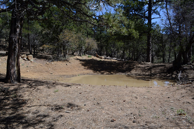
After a little bit of undulation (and some random tagging of slightly-higher-than-the-general-vicinity points) the trail spills out onto a road. My timing is perfect, for I get to experience it as a real road. The banging and whirring and grinding noises that were coming from Jacks Peak have finished, and now the workers are coming down with a couple trucks and a big ol' cherry picker. One even stops to ask if I'm okay with water. Yep. And if not, there was a great big mud puddle just before I hit the road. Yum. The trail breaks off again just before the peak. Jacks Peak doesn't sit on the divide. In the saddle where it breaks off is a curious collection of foundations, one with a chimney still mostly intact.


Once on trail again, it is a short dip and climb to Burro Peak.

The peak is generally wide and flat with a few bumps all over the place. There is a benchmark in one of the wider, rocky bumps. The peakbaggers have claimed another as the tall one including a note a few pages in that someone got a new toy and tried it out and the pointed rocky spot is definitely higher than the benchmark. I look through the trees at a few more bumps a little to the east and not very visible from this open space and think, what about them?

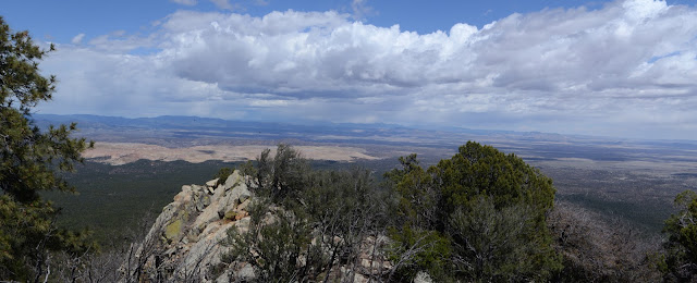
There is not much to see of a view from the very top. The trees are sparse, but the top is wide so sparse is all that is necessary. A little way further along the trail is a fence and the trees get thicker. Back the way I came, though, there are some lookout spots.


As I get back to various foundations and the road, I have finally seen a woman hiking the trail. There sure were a lot of men first. I also am wondering exactly why the high spot near the foundations has a fence. The answer, upon investigation, is there's a water catch up there. A large area is cemented over with a gentle slope to the middle of one side. There, a pipe runs from the catch to a water tank. The tank in turn can feed a box. Currently, there is a little water in the box, but I'm not sure if that's not from recent rain rather than the system working. The water tank has been broken into by, presumably, thirsty hikers with apps or books that said there was water here and they really needed it.

I'm practically there already, so I might as well tag Jacks Peak, too. The road dips slightly before climbing a short way to the top. Weaving around between the cell towers and microwaves, there is a pointed rock behind the last little building of strange noises to call the high point. There's a benchmark on this one, too. Another of these "seen area map point" marks placed by the Forest Service that I don't recall ever seeing until recently. It is also stamped "fire control" and "solar obs" and "9.11 1939" for the date. The last one was "fire control" but "solar obs" seems new. It also comes with different views.
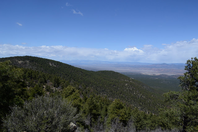
Then there is nothing more to do but to head on down. The last few days have had rain in the afternoon and the clouds have been showing a lot of energy today, too, but mostly off to the east. I can see it is raining out there now, but am pretty sure it won't come this way. A few drops try to make me wrong in actual fact, but it is barely enough to notice, so not so much in spirit. I explore a little along the ridge USGS says the trail uses to get up to the divide from below. As near as I can tell, there has never been a trail along that way. Cow paths do make it hard to read the dirt, but the trees are only broken. I might have been planned that way once, but the old wooden markers and the blazes on the trees suggest this trail has been around for a while.

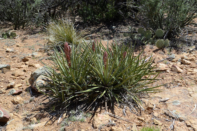
Meanwhile, spring is just getting started on bringing up some flowers. Only some early ones seem to be around here yet.

©2019 Valerie Norton
Written 7 May 2019
Liked this? Interesting? Click the three bars at the top left for the menu to read more or subscribe!


Comments