Big Tree and some Knobs
Gila National Forest
Click for map.
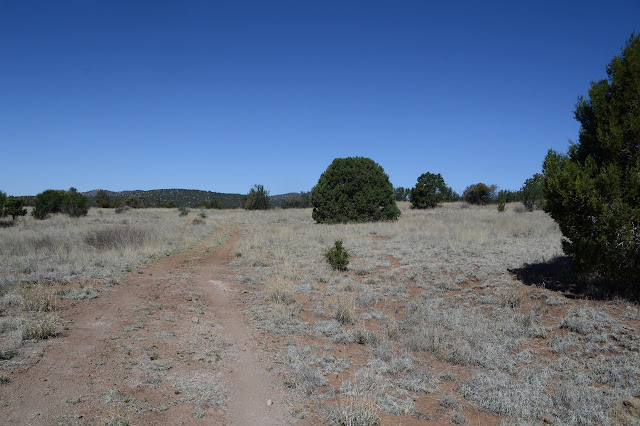
The pastures of Fort Bayard, where cavalry were once stationed, seem to now be the administrative pastures of the Gila Forest, although it is questionable if they are used as any such thing now. Upon them sits an alligator juniper of such unusual proportions that it has been placed on the map. The "big tree" is only 1.5 miles along the trail from the Big Tree Trailhead, but I have found some other map markings that seem worth at least a brief visit and will stretch the trip out a bit. The large and empty gravel lot has two trails leaving it, one generally north and one generally west. The one generally north is the Big Tree Trail, so I head out on the one generally west. My first major stop will be Signal Knob, but there are some benchmarks along the way I'd like to visit so long as they are not too far off trail.

The trail across the old pasture is long and fairly flat. As it crosses a shallow gully, Stephens Creek when it flows but for now it just shows a little mud, there are some signs of attempts to improve the trail route against erosion. There seem to be two routes to the Wood Haul Wagon Road, both through ranch gates in mystery fencing. The pastures seem to have been split up once. There are ancient stumps all over the place, though most are so far gone it is getting hard to say if they are victims of the wood hauling. Probably. There are more junctions than I am expecting based on my map. Some aren't signed and look like mountain bikes have simply decided they need more miles to roam, but some are signed. Oh, and I've already missed looking for a section corner that should have been about 2 steps off the trail, but there is a roadside benchmark nearby I could look for. Trouble is, it doesn't seem to be where it's marked or in any of the rock outcrops nearby. Oh well. I just keep taking corners until I am traveling north on the Sawmill Wagon Road Trail.


This trail follows near a fence line. There are ranch gates with trails and cut sticks to discourage use. There is another corner somewhat near, it seems that all the corners in what was once fort are supposed to be marked, but between the bit of terrain in between and the expected miles, I think I will miss it. Just north of it is an odd ball marking for a monument that is even shown on the Forest Service map which does not show the corners. That I will go for. It might be odd ball on the ground, too, and it will be a good shortcut to climb Signal Knob.

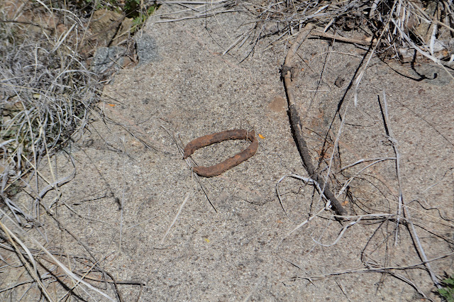
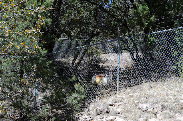
The only think near the marking that I see at first is a lot of old fencing. Oh, and quite an odd arrangement of rocks that has to be artificial. A large oblong rock sits atop two much smaller even more oblong rocks. Well, it could happen naturally with a very low probability, but if you look hard enough you can find lots of things that have a low probability of happening eventually. Next to it is a post that could be a fence post, but it has a lot of holes to hold a sign and two of them toward the top are occupied by pins, even if the sign has gone elsewhere. This is definitely the marker I am looking for. As I take in the view, I can't help but notice that the nearby fence extends along a slightly cleared line back to what is now the home base of the local hot shots and maybe some other things.

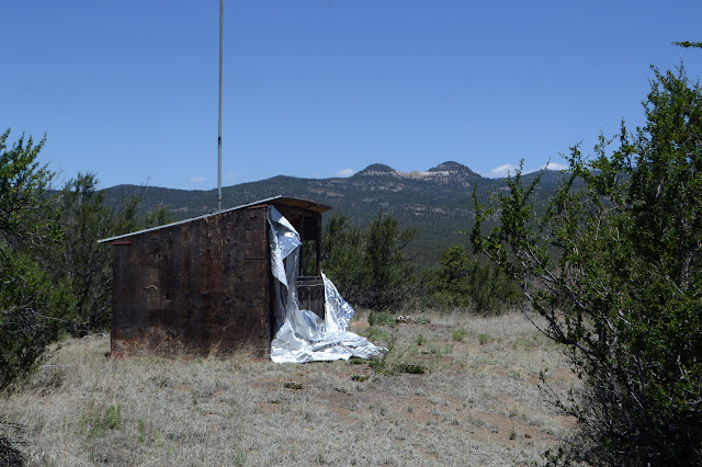
Onward and upward. I still want to get to the top of Signal Knob. It is easy enough to climb the rest of the way up, and the top holds a surprise. There is a reason for the name which becomes quite obvious as I spot the building at the top. It isn't much more than a shack, but it has a big directional antenna sticking out the top that drops down to a table marked in degrees inside. The whole thing seems to have been wrapped for fire once and then neglected and now the metallic wrap is getting pealed away by nature. I wonder where the other might be. This, along with another, would have been used to triangulate signals and say where they were coming from.


I head back down along the former road to the listening station. It is surprisingly hard to find, especially considering someone came up it and wrapped the station and cut away the brush within a certain perimeter as well as that at the old gate. Once back on the old road, I have another chance to find a section corner that is only 100 feet or so off to the side.

The section corner just a big rock cairn. This one didn't even get a sign warning against disturbing the nearby monument. Maybe all of the corners are like that. The fort was occupied in an era when that was common. Also, cavalry who weren't for parades and Geronimo to chase. Coming around to the next junction, now it is time to head out and see this tree so big it has to be put on the map.

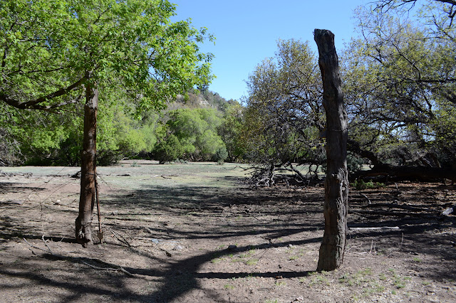
The tree really is quite big and comes with a picnic table for lunch and a fence to keep the stock away but with a gate to let in the people who have to have their photo with it. Perhaps it is not so tall for a tree in general, but it stands twice the height of the tallest of the alligator juniper. The creek flowing nearby might have a little to do with it. There is water in it now, but other trees have good water available. Maybe the soil? But even the juniper trees around it don't compete with its size, only the sycamores and oaks do.
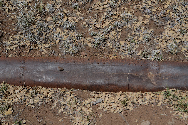

I dither a little bit about how I want to get to my next main destination, which is a geocache that has noted some points of interest that aren't on the map. One of these is pipes "high above the canyon" in an off trail location to the north. The spur of trail up to the tree was following some pipes. Not just any pipes, ones made of sheet metal and rivets down the side. Hundred year old pipes. People clearly have followed the pipes as they continue north. Perhaps I should just follow them or perhaps I should go back to the trail and could check it out with less "off trail" adventuring. Following the pipes seems the most straightforward thing to do. And people have been doing it. It does quickly get hard across a meadow where they have remained buried. There are a couple choices and I go with near the creek. I may have chosen the cow trail route as it takes some ducking under trees, but when I hit a fence, there is a ranch gate in it. Some (but not all) trail seems to drop down to and cross the creek. Again it seems more like the popular route for the cows, but as I get to a second of many downed trees, there are cuts through them. It seems more like an on trail route. And by this time, I have started to spot the high up pipes.

There are pipes crossing on concrete posts and pipes suspended from wires strung between wooden scaffolding. The older pipes are the ones on the wires. The concrete has longer, extruded pipes with flares at one end. The canyon splits here and the pipes appear to head off to the right. I figure I will go cross country to the geocache using the wider left side canyon and passing by a spot marked Comanche Springs. There seems to be a bit of trail that way, anyway, and as I climb I find new pipes using old pipes as part of their support structure. Guess I didn't get away from the pipes after all. Past a little dam, there are the springs. It probably shouldn't come as a surprise to find them fenced off and, well, piped.
Next stop geocache. It's somewhere up above and as I come out from under the trees, I think I know where I'm going. There is a bit of a shoulder out below the ledge of rock that looks promising. I arc my way along finding an increasing number of cow trails to use and more and more evidence cows might be about to use them too. Also, there is an interesting layer of white rock.


The geocacher promised me a good lookout spot and certainly does deliver. The high spot for today and it is a good one.

There are also instructions on how to get up there on something like a path that I can follow to get back down. They would take me past an earthen dam that I can see down below, but I want to swing a little further south to catch a pair of closing corners. Sure, they'll just be rock piles, but they're nearby and should be easy to look for along the way.

The trail down is more cow path that slides back and forth across the failed fencing. Near to the fence are the closing corners. They have actual monuments that were set in 1913. A little further down the hill, I hit a meadow with an old road. Off to the side, more springs are marked. I check on them, but they are locked up just as tight as the others. So I head down the old road until it reaches the mapped trail and then take off to find my way to the top of Castle Knob. I still have a second knob to climb.

According to one gate, I am leaving an area that is for the "youth only" deer and elk hunt. That sounds worrying. Fences meet both ways around here and I end up following one most of the way out to the top of Castle Knob. It seems further than I thought it should be. I might be getting tired.


I head back off the knob again, following the other side of the fence. Back at the road, there is one more thing I want to check out a little way up a trail I had not planned to go on, but was noted in the geocache description: wagon wheel ruts. So as the Wood Haul Wagon Road starts up the mountain, I follow it. There is actually a sign for the ruts, but they are not that obvious at first. There is a certain bit of funny striations in the rocks, but is it from wagons wheels? Around a corner, there is no mistaking the ruts through the rocks.


As I look over the obvious ruts, they show the same distinct lines that are visible on the rocks before those deep ruts. So that is probably also from the wagon wheels. Now I can head back down. This will take me not to one of the trails by the parking lot but to the main road just before the turn to the parking lot. There's quite a few trails out here served by that one lot.


The road walk isn't bad, but the fence to get to it is a bit stuck. I smashed my hand with the bolt once I figured out how to get it to slide out more easily. No lasting damage. Probably. And really fun to see those ruts.
©2019 Valerie Norton
Written 8 May 2019
Liked this? Interesting? Click the three bars at the top left for the menu to read more or subscribe!


Comments