Posts

Showing posts with the label snowshoing

Swift Creek Snow Survey

Image
Shasta-Trinity National Forest Click for interactive map We hit the Swift Creek trailhead for a day hike up to the snow survey cabin. Daniil wanted to do a survey of the terrain, but the fact of the cabin suggests it's pretty safe hiking in winter. We only hit snow on the road shortly before the trailhead around 4000 feet, although the trailhead parking was totally covered in white. We started out with the snowshoes on our backs. Snow exists, as we see at the trailhead. Into the wilderness that started a quarter mile back down the road according to the map. Soggy trail with a little running water at the second sign for the Trinity Alps Wilderness. The morning wasn't freezing and the trail ran with water. We passed several very seasonal streams and the ones marked on the map tended to need a well placed rock to keep the feet out of the water. When we hit snow, it was neither hard nor particularly soft. Swift Creek churning below. Closer to Swift Creek. Bei...
Frazier Mountain on snowhoes

Image
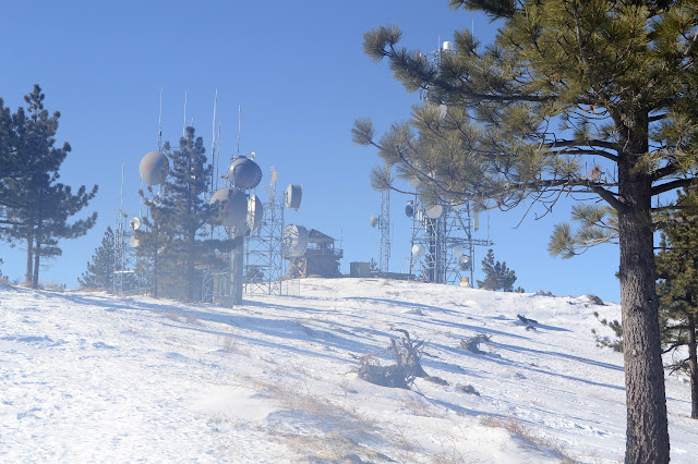
Los Padres National Forest Click for map. Frazier Mountain is the second mountain on the Hundred Peaks Section's list of peaks that I have been up, but only in a car. Since I don't feel like counting drive-ups, I need a plan to hike it. I've had one to go in from the east side at the edge of Hungry Valley, but with all the snow on the ground, a 20 mile hike is probably too much for the short days. From the north, I can get up and down by two routes in 7 or 7.5 miles. That's still almost 15 miles and the trip up Tecuya showed the snow can start very early, and that was the south side of the mountain. How long can one go on snowshoes in a day? They certainly aren't as fast nor as easy walking as hiking on dirt. Hopefully I'll have the good sense to quit if it gets to be too much, not that I have a good record of that. With the memory of the frigid wind at the top of Tecuya, I have my puffy mittens and a few other things to be sure I'm warm enough. ...

Tyee Lakes Trail

Image
Inyo National Forest We set our sights on South Lake for some actual snowshoeing. Well, I wanted Sabrina, where the highway ends, but I was overruled. We drive around a sign which would say "road closed" if turned the right way around, and start to hit snow on the road. Not too much further, it becomes a solid mass up the hill. Happily, there is a trail right next to where we have to stop that just happens to be quite covered in snow. Always nice when we do not have to wade through the snow melt on the first day of spring. We cross the bridge and strap the paddles to our feet on the far side. There are already a few prints to help with route finding. Unfortunately, there are a couple post holes to go with the prints where someone tried to walk it in runners. There are not a lot of routes available, but it is nice not to have to search for it. There is one patch of bare rocks after a few hundred feet, but then it is all snow. Good views come quickly. ...

Mount Pinos

Image
Los Padres National Forest Locate the trailhead. There has been plenty of snow dumping and the weather looks good, so it is off to Mount Pinos to crush some of it under new snowshoes. The road is clear all the way to the top with only a few wet spots to worry about actually being ice and there do not seem to be too many people about as we get there. A bit of snow on everything. We head up first along the road and then along a somewhat lesser used path that is a little more direct. It is above freezing but windy so still feels very cold. The trees full of melting snow rain down, especially when the wind gusts. We rather want to get out from under them, but find ourselves coming into cloud before we do. Some pine needles show a little bit of thaw and freeze. It is nice out in the open, for a little bit, but it is a bit misty in the clouds. As we go further, the mist gets harder. Under the trees again, the melt is even more pronounced. In view of the radio facil...

South Fork Trail

Image
San Gorgonio Wilderness Locate the trailhead. Starting off snowshoeing in the San Gorgonio Wilderness (well, not quite there yet, but we'll get there) on the South Fork Trail, we see a lot of mysterious white layering over all the land. We think this is what the people of the colder areas call snow. If so then that's good, for we are out to meet the snow! Starting off, we can still see a few pieces of dirt beneath the snow, but for the most part it's all white. Here a stream has been able to clear off the snow mostly so that all can see it.