Posts

Showing posts from December, 2017

Munch Canyon to Figueroa Mountain returning via Willow Spring

Image
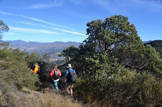
Los Padres National Forest Click for map. I seem to be out to "clean up" my climbed peaks on the Hundred Peaks List by making sure any drive ups actually have a climb. To that end, I plotted a climb up Figueroa Mountain. Sure, I will notice a curious lack of climbers on Peakbagger for the peak as I log it because it is not, in fact, on the list, but let us not get confused by the facts. (This seems to be a lesson I am constantly relearning for nearby Zaca Peak, too. These two peaks that sit so prominently in my mind as a Santa Barbara based person just are not that important to those based in Los Angeles. Besides, they are both too short.) Since I just did Davy Brown Trail , I looked to nearby Munch Canyon. Just have to find it. I know there is an old gate at the start and probably nothing else to mark it. One side of a double gate for an old road and a couple stickers to indicate this is a trail. This is the start of Munch Canyon Trail. Everything starts off w

Lower Manzana trail work

Image
Los Padres National Forest Click for map. The Los Padres Forest Association has a double header of trail work with camping at NIRA in between and I decided to join in on the fun. There is even tree felling promised for today, but I am in a group that will hike down a few more miles and clean up some tread. Better luck next time. We get to see a lot of the trail, but might miss big trees coming down. We collect some tools and head off for it. Getting on down the trail. There are five workers across the way on the trail. A little over a mile down is Potrero Camp, which is currently made dangerous by standing dead pine trees. Some gather to make it safe.

Lost Valley trail work

Image
Los Padres National Forest Click for map. The Los Padres Forest Association has a double header of trail work with camping at NIRA in between and I decided to join in on the fun. There is even tree felling promised for the second day, which I have not yet witnessed. Today is just ordinary sawyer work on downed trees in Lost Valley. Safety gear, safety talk, a gathering of equipment and tools, and we set off up the Manzana to Lost Valley. Everyone here today has done this before and it does not take very long to start. Heading up the Manzana in the morning sun. And up along the Manzana Creek, but high enough above to generally not see it. The junction is still hidden up a hill and probably will continue to be for the foreseeable future. Still, someone did manage to accidentally find it once. I wonder how that happened. Maybe got into camp, which is practically on the trail, and decided that was the wrong way then looked around for where it did go. It seems a plausible

Browns Canyon to Oat Mountain

Image
Michael D. Antonovich Regional Park Click for map. A group of geocachers were heading up Oat Mountain via the canyon just east of the one featured in my first, somewhat more elaborate attempt at the peak . This neatly sidesteps the requirement to poke through some private property wandering right past the ranch house. (Well, I could probably have done the cross country on cow paths up the canyon, which does appear to be park.) This is the more usual route. Getting to the parking requires ignoring a few signs that, as far as I know, were really supposed to be taken down when the park opened to the public. One sign demands that only residents are allowed to use a bridge. Beyond that is a ranch that boards horses and is mixed in how welcoming it is about the public using the road past it. At the end is public parking so the public is definitely expected to be allowed to arrive here. A $5 fee is required for parking, but today there is no envelope to use with the iron ranger. We par

Liebre Mountain

Image
Angeles National Forest Click for map. I may have been spending too much time staring at Thomas Fire information and worrying. In those first few days, I looked at that footprint and thought this close bit coming at Carpinteria may look threatening to Santa Barbara at first glance, but it is really this bit almost at the furthest side of the fire creeping up Topatopa Bluff that is dangerous to us. That part raged across Nordhoff Ridge one night to breath its menacing breath over the entirety of Ojai and then kept on going. It jumped the highway and started in on devouring the Santa Ynez Range. It dropped into Matilija Canyon with a dreadful finality to many homes there. It raged to Romero in another jump sending those in Toro Canyon fleeing on the way, then crept over to San Ysidro. It followed the path I expected and feared it would. People watching Romero flare up a week ago from the west end of Shoreline Park. Flame could be seen above Summerland and Carpinteria as well.

Travertine Pools along Cold Spring Trail

Image
Los Padres National Forest Click for map. The blurb said a hike down to Forbush Flat and then 1.5 miles more to a natural spring. Cryptic. What could it mean? If they head down Gidney Creek, it would be somewhere I have not gone before. Maybe they would hike up the creek and it is that far to the spring that should be feeding Forbush Flat? That seems rather long, but I have not done it and with enough twists, maybe it is. It is rated strenuous for just six miles. That could mean off trail or just try to discourage those who might get in trouble with the "upside down" hike. Most likely, they mean the travertine pools. It would be easy to ask, but also easy enough to sign up and get to either see the pools again or something new. Up toward the top and heading down. A beautiful day for it. The loose cliffs of Little Pine Mountain are looking especially stark today.

Santa Paula Canyon, clean up to the punch bowl

Image
Los Padres National Forest Click for map. There seem to be certain trails that attract a class of thoughtless hiker that acts like the greatest value the place they are hiking through is as a land fill and tosses their trash off to the side as they go. Unfortunately for Santa Paula Canyon, it is one of these trails, so Los Padres ForestWatch organizes regular clean ups along it. And for the volunteers, Figueroa Mountain Brewing has provided free beer. This is not so cool because it comes in the form of a coupon that is only good on the same day. They have also provided bags. This is very cool because they are former grain bags and are tough enough to take on lots of broken glass tossed within and plenty of thrashing into bushes on the outside while being a reused item. We will have no trouble tackling whatever trash comes with these. After signing three forms and listening to a safety lecture, we are ready to head out to the trail. First, there is the paved hike through the colle

follow by email