Posts

Showing posts with the label Lost Coast Trail

Lost Coast: Punta Gorda Lighthouse

Image
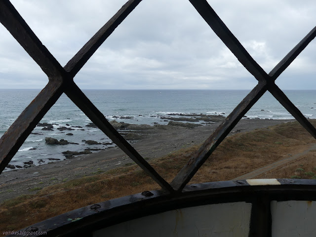
King Range National Conservation Area, Arcata BLM (brown line, map link ) DAY 1  |  DAY 2  |  DAY 3  |  DAY 4  |  DAY 5  |  DAY 6  |  DAY 7 With just a short way to go and since it takes a long time for the sun to get over the hills, I took a while to get started. Powerhouse and fuel tank in the morning light and a bit of processing to see what's happening in the shadows. In fact, the first hikers of the day came by just after I finished packing and wandered over to the sign about elephant seals. Listening to their strange clacking noises and thinking how I'd now seen them in very different seasons (October before), I wondered when you don't get to see them. The sign promptly answered. August. You don't get to see elephant seals in August. And you might miss them at the end of March. At this time, there should be molting females. I'd seen a few clearly molting and hadn't managed to spot a male. I should have ...

Lost Coast: Cooskie Creek Route

Image
King Range National Conservation Area, Arcata BLM (purple line, map link ) DAY 1  |  DAY 2  |  DAY 3  |  DAY 4  |  DAY 5  |  DAY 6  |  DAY 7 I looked around at how soaked everything was from the dew and decided I had enough water to cook breakfast right there (well, on a rock under the Douglas fir) while waiting for everything to dry out a little. My windbreak trees became morning shade trees, but they were still blocking some strong gusts most excellently, so I wouldn't want to trade them. Good soggy morning! So I headed out on the faint old road to join a much better road until getting pointed off to the left at a gate. Trail gets really faint there, but it's all much easier to follow on the second pass than it was on the first. A bit sunnier, but most spots aren't much drier than they were. After the short road section, follow near the fence on the faint track. If truly desperate for water and it ...

Lost Coast: Rattlesnake Ridge

Image
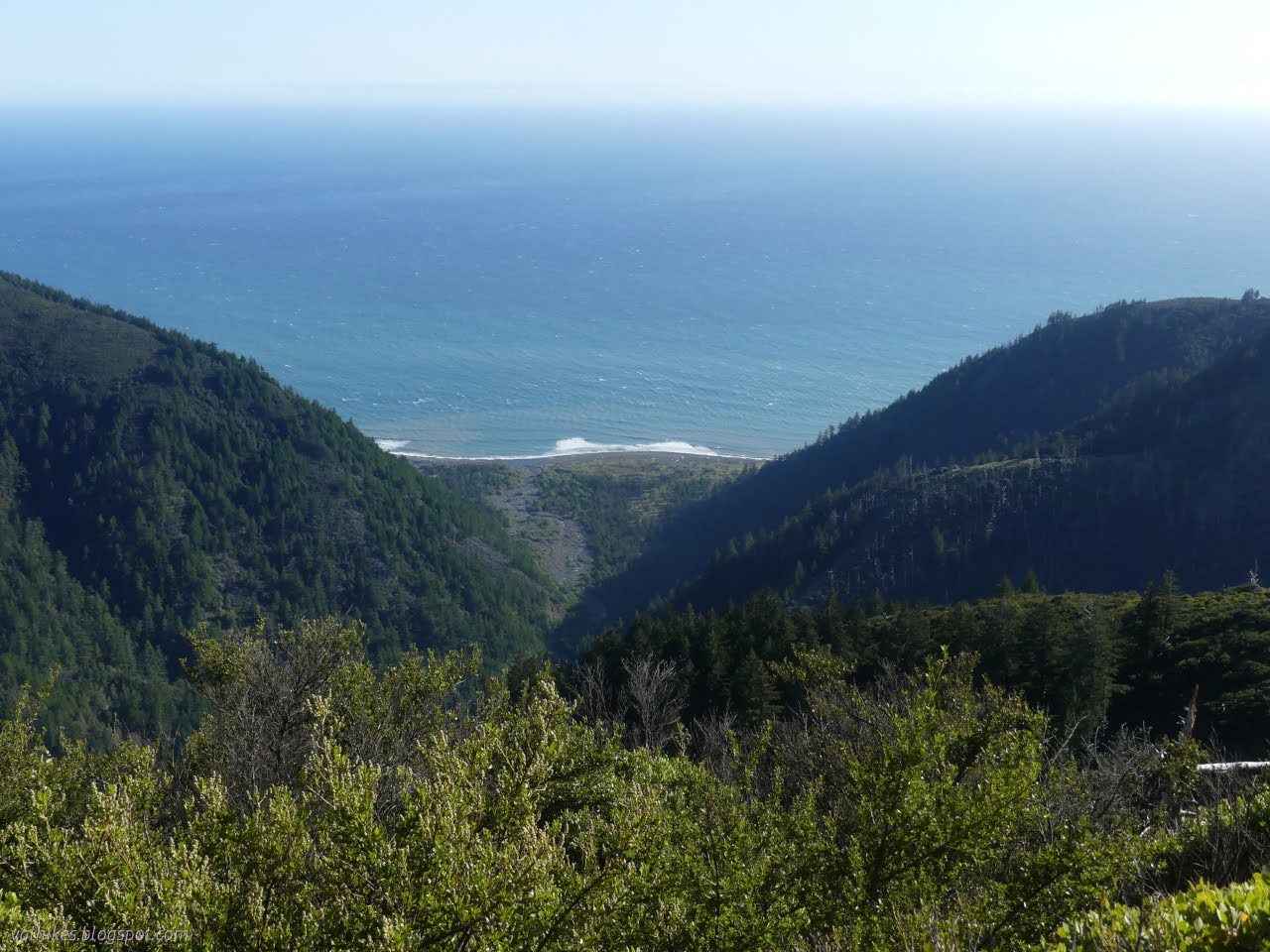
King Range National Conservation Area, Arcata BLM (green line, map link ) DAY 1  |  DAY 2  |  DAY 3  |  DAY 4  |  DAY 5  |  DAY 6  |  DAY 7 No rain, but my tarp was soggy with dew for the morning. A big fat moon sat above the ocean and I realized that except for a brief blurry light in the sky the morning before, I'd seen no sign of the moon at all so far. I breakfasted and packed not intending to head up Horse Mountain Creek Trail after all. I also didn't really care to go up Buck Creek Trail. I figured I'd camp at Randall Creek. I just needed to be reasonably early traveling the impassible zone on the way back to Miller Flat. A delightful tease of sunlight played on a piece of the waves, let in by the window of the canyon of Horse Mountain Creek. Otherwise, I was consumed by the shadow of the cliffs. The short way to Shelter Cove under the morning moonlight. Shadow and sun across the hills ahead as mists p...

Lost Coast: Big Flat to Shelter Cove and bounce

Image
King Range National Conservation Area, Arcata BLM (yellow line, map link ) DAY 1  |  DAY 2  |  DAY 3  |  DAY 4  |  DAY 5  |  DAY 6  |  DAY 7 So, my tarping didn't perform so well for the storm. I'd let the one stake go without dropping a rock on it, so I had to get up in the middle of the night and resecure it. There was a rock all of 2 feet away to drop on top of it. That left the foot of my quilt wet on the surface. The wind kept changing direction, but it didn't do so laden with rain until early in the morning. I'd figured I'd just use my poncho for protection if it did that, but hadn't decided how that would work, so it took a while to sort and wasn't very effective when done. I simply pulled it across, hopefully wet side out in the dark. Anyway, things only got moist and it's not down nor particularly cold. The rain seemed to encourage the broadleaved stonecrop flowers to pop open. Big Creek after a ni...

Lost Coast: Punta Gorda to Big Creek

Image
King Range National Conservation Area, Arcata BLM (orange line, map link ) DAY 1  |  DAY 2  |  DAY 3  |  DAY 4  |  DAY 5  |  DAY 6  |  DAY 7 Waves of rain passed in the night and it was dry but windy when I started the day. I needed to make it early because some parts of the trail can only be done at a low tide (below 3 feet, generally, but a couple spots are getting reported as below 2.7 feet now) and the first 4 mile section of this (referred to as the impassible zone) was coming up in 2.4 miles. The low tide was early and one of those especially tight spots is the north side of Randall Creek, the very end of this impassible zone. Yes, the tide would be coming in rather than receding as recommended, but it was a rather flat ocean and I have been here before. I had a pretty hard deadline of noon for the first 6.4 miles, which is tight but really shouldn't be hard to make. However, that rain overnight wasn't the r...

Lost Coast: Windy Point

Image
King Range National Conservation Area, Arcata BLM (red line, map link ) DAY 1  |  DAY 2  |  DAY 3  |  DAY 4  |  DAY 5  |  DAY 6  |  DAY 7 Well, an air fryer was obtained and even though this one doesn't have a "dehydrate" button, it turns out beans dehydrate well at 180°F, taking only about 3 hours for a pound. In 3 days, I had 3 pounds of various varieties and it was suddenly much easier to think about going out backpacking. I could try out the Lost Coast Trail the way everyone tells me it should be experienced, then wander back my own way because that shuttle is way too expensive and there's more to see than the beach. The tides would be super low in a couple days and the only weather a brief storm zipping past mostly in the night. Clouds (and storms) make things more interesting. Yeah, that's how it works, right? I decided on doing the biggest loop, so after pounding along the beach from north to south (as the ...

Lost Coast: Punta Gorda and Mattole Beach

Image
King Range National Conservation Area DAY 1  |  DAY 2  |  DAY 3  |  DAY 4 Purple line for day 4. Click for map. I got started with the dawn and the rain started up again a few minutes after I left the tent. I pulled on my puffy jacket for the first time in the trip and quickly traded it for my rain coat. The rain wasn't hard enough to worry about, but it was just too warm to have a full jacket on. I packed up and was on the trail with the sunrise, wherever the sun might be. The pair by the beach were long gone already while the more sheltered pair weren't even stirring. The tide was at its lowest for the day, right around 0, as I started north. It marked the first time I tried traveling one of the sections denoted "impassible at high tide, travel during a receding tide" during a rising tide. I wasn't too worried. I had a little over a mile to Cooskie Spur Route, and after that there is an overland route. Leaving Cooskie Creek, which soaks in...

Lost Coast: Kinsey Creek, Spanish Flat, and Cooskie Creek

Image
King Range National Conservation Area DAY 1  |  DAY 2  |  DAY 3  |  DAY 4 Blue lines, light then dark, for day 3. Click for map. Things were still quite moist when I got up in the morning. I wasn't at all worried that I ended the first day short of my goals and the second day even further behind. The plan for the third day was so shortened due to tides, I was originally thinking I might hike down to Big Creek (it's a nice spot) just for a little extra to do. I still had plenty of time to get south as far as Kinsey Creek, then north to Cooskie Creek. On my previous trip, I turned up at Kinsey Ridge Trail , a little closer, but I stopped thinking about the Lost Coast Trail and started thinking about the ridge at Kinsey Creek, so is how far I need to go to complete the north portion of the trail. There are certainly advantages to wake up at 1000 feet instead of 20 feet. The wisps into the the canyons were quite lovely. It takes a little time ...

Lost Coast: Windy Point and Gorda 2 Benchmark

Image
King Range National Conservation Area DAY 1  |  DAY 2  |  DAY 3  |  DAY 4 Red line for day 1. Click for map. I originally had a permit for 29 March through 1 April to take this trip, but that got derailed when they closed the Lost Coast Trail on 28 March and revoked all overnight permits as some sort of COVID-19 measure. They left the other trails open although the trail generally on the beach must be the easiest for allowing people to keep their distance from strangers. After they reopened and I finally figured out when I wanted to go (near the new moon for that dark sky with lots of stars potential), I managed to pounce on a released permit to do it 15-18 September. (The required permit is $6 to reserve and is obtained from Recreation.gov .) In that light, I greeted an email on 9 September that they were considering closing for the fire danger with quite a lot of grump. Well, that light and the deep red light that enveloped the entire state...

Hidden Valley, Quest Trail

Image
King Range National Conservation Area (BLM) Click for rough map. I remember starting and then stopping the GPS to get a track, but there was none for this hike in the GPS. The second stop after finishing my Lost Coast backpacking trip is actually at the north end of the southern section of the Lost Coast Trail. This is generally not considered at all or considered as the part in Sinkyone Wilderness State Park, but there's actually about 7 miles on BLM land before the 22 miles on state park land. My interest for today is a short nature trail. The box beside the trailhead has both the lovely free maps and a Redwood EdVentures Quest brochure . I've seen these around a few times. It says that if I bring in my Quest Clue to the King Range Office, I can get a prize. Well, I'm already planning to stop there, so I think I very well might. The start of the Discovery Trail and the middle of the Lost Coast Trail. The quest is like an interpretive trail, but there ar...

King Range: tide pooling

Image
King Range National Conservation Area (BLM) DAY 1  |  DAY 2  |  DAY 3  |  DAY 4  |  DAY 5 Click for map. One single wave must have come up almost to the bottom of the short dirt cliff, not that I noticed. I slept far better than expected. I'm not seeing any of the light weather that was supposed to be coming in for Friday. Just clear skies and sunshine. Well, mountain shade. The sun will get here. From my perch just barely above the beach. The sand is wet far up and the prints (bear, deer, mostly human) are more rounded now, but only those halfway down have had enough washing to smooth away. I obviously should have camped a little further along to get the sun more quickly. Time to move. Just a few short miles to get back to the trailhead, but I have plans for the day, spots I want to visit, so I don't want to take too long to finish it off. My speed is not helped by the tide going out. This was such a bland bit of beac...

King Range: Buck Creek

Image
King Range National Conservation Area (BLM) DAY 1  |  DAY 2  |  DAY 3  |  DAY 4  |  DAY 5 Click for map. Today is peak day! Again! I have to hike back up to the ridge and the spur to the peak is even shorter on this side, so I might as well see it in a little different light of morning instead of afternoon. My first discovery in the morning is that there is a little more color to the place than I could see before. The sun, slow to come even to the slopes around, found a nice clump of madrones to light up eventually. My second discovery is that I didn't look around quite enough for water. I was sometimes hearing some above because about the same distance above as below, there is water in the creek. It just dives under for a short distance. I still have no idea where the spring might be. It's dry down by me, but there is water coming down that little canyon. Then I turn and climb with the trail. It is quickly up onto a ridge line...