Lost Coast: Kinsey Creek, Spanish Flat, and Cooskie Creek
King Range National Conservation Area
DAY 1 | DAY 2 | DAY 3 | DAY 4
Blue lines, light then dark, for day 3. Click for map.
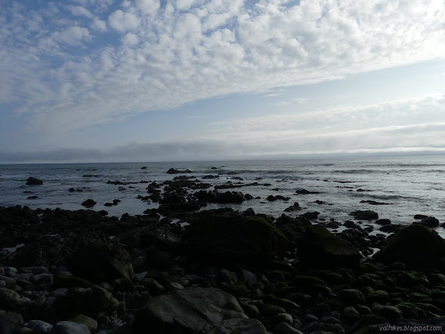
Things were still quite moist when I got up in the morning. I wasn't at all worried that I ended the first day short of my goals and the second day even further behind. The plan for the third day was so shortened due to tides, I was originally thinking I might hike down to Big Creek (it's a nice spot) just for a little extra to do. I still had plenty of time to get south as far as Kinsey Creek, then north to Cooskie Creek. On my previous trip, I turned up at Kinsey Ridge Trail, a little closer, but I stopped thinking about the Lost Coast Trail and started thinking about the ridge at Kinsey Creek, so is how far I need to go to complete the north portion of the trail.
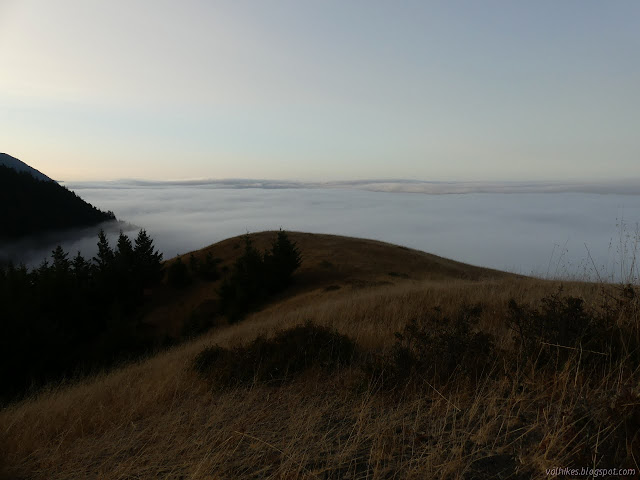
I got things fairly dry before packing up and following the remnant of old road back to Spanish Ridge Trail and its remnant of old road. It was good if twice slightly brushy until it took a turn to be out on the hill over the ocean, about 600 feet up, where the wide bed has gone and the game trails compete with it quite well. I think I found it, but I nearly got onto another decaying road. Just above the last cliff, the old road becomes visible again but the used trail goes for a steeper route. I stepped over a bit of tall grass to get back on the old road and was rewarded with stepping ankle deep in mud where it tangles with a seeping spring. It was all over my sock and into my shoe! I stepped more on the vegetation to get out. Most of it was dry down to the sign at the bottom. (See, I was on the right track ultimately.)


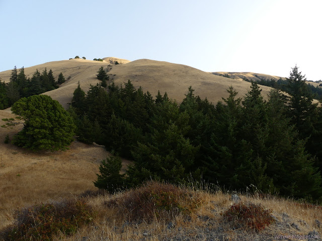
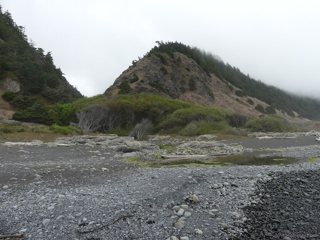
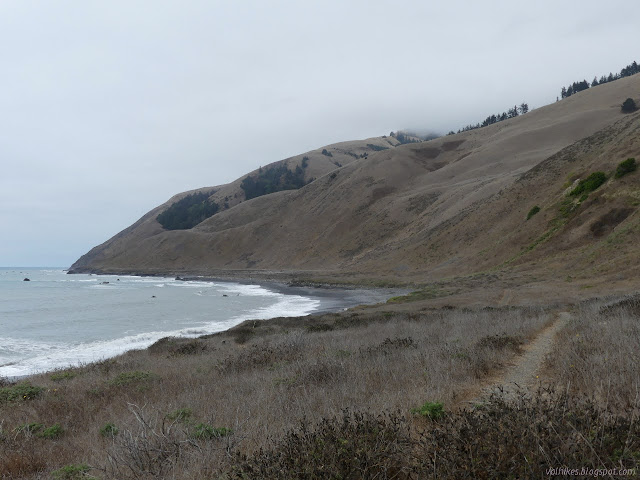
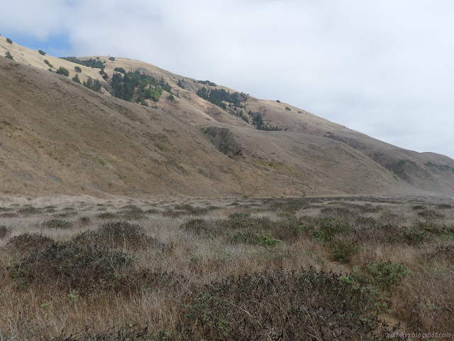
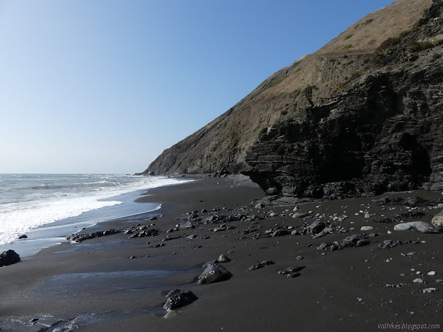
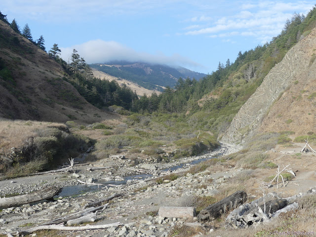
I turned south along Spanish Flat to tag Kinsey Creek. The flat is just a smooth rise from the beach sand, sometimes with a foot or two of cliff. The driftwood trees that stay are thrown up onto the ocean third. Some of the driftwood has bolts and I wondered what it was before it was ocean smoothed wood. The transition up to the hills is more distinctive than the transition from the beach. It gives a nice, easy place to be walking on a trail and an easy place to find camping. Although there are more green spots in the hills showing seeps, the easy water is at Spanish Creek.
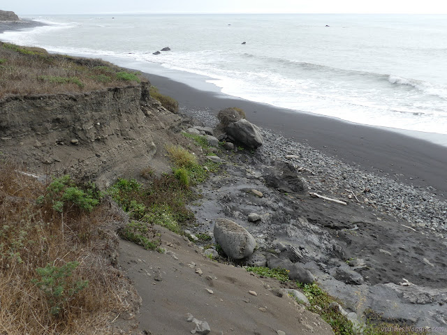
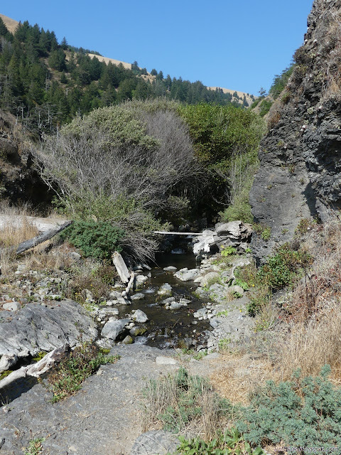
The creek has cut down into the the debris of the flat leaving little cliffs that grow to quite large cliffs near the rise of the hills. The trail has moved toward the sea to compensate. On the far side of the creek, it is more clear that the trail is also an old road. In fact, there's a sign directing hikers off it as it gets closer to being a current road for one of the remaining cabins. I followed the trail, but ended up back on the road just before the cabin anyway. I'm pretty sure that's not how it's supposed to work. No one was there to disturb anyway. Oat Creek has found some different geology to cut it's mouth through. The sides are steep an rocky and a jumble of rocks spill from it.

I got to Kinsey Creek and sat on the bench out by the waves in the camp site that would have been less of a dream if I had actually camped there. I followed some of the extra trails around and found another camp site just across the road and a third down the road a bit too close to the creek. I relaxed for a good, long time before gathering some water and starting cold soak experiment #3. There is near agreement that Knorr pasta sides are inedible when cold soaked as is expected of a pasta dish since pasta needs to cook. There is a difference of opinion for the Knorr rice sides, which also have pasta pieces in them. They can take up to 6 hours, so I decided noon was the time to get my broccoli and cheese started.


With the tide just about as high as it would get, I followed the beach back for a few miles, coming back to the trail a bit short of the cabin. There was soon a sign to push me away from the road before the cabin which forced me to the edge of the foot or so cliff and eventually didn't quite join the trail from the other side.

I followed where the USGS map said the old road once was as I got near to Spanish Creek. It goes inland to the edge of the hills and there is practically nothing of it to be seen on the ground. I followed it to the edge of the precipice where it says there's a witness corner. Of course, it is either buried or long gone. It looks like there's a scrambling route in the crumbling cliff debris to get down to the creek there, but I chose to go back and cross where I had crossed before.

I was already tired of sand walking, so I stuck to the packed trail as I traveled back north across Spanish Flat to Randall Creek. There seemed to be a lot of seeps as I got closer to the creek.

There is a section that is "impassible at high tide" that starts at Randall Creek. I got there a little early and it was looking a little impassible, so I took a little time to explore. There is supposed to be a benchmark near the cliff, so I looked for it. I wasn't expecting to see anything, but I did find an old and very rusty fence post. They are often used as witness posts or just to hold a sign imploring the general public not to destroy the mark. On the other hand, they are also commonly fence posts. The road someone tried to direct me onto while coming down Spanish Ridge Trail drops to that point, so I looked for it. I couldn't really see it, but there was a small path along it. As it came up to the time I should be able to leave, the waves were still requiring good timing to pass the first rocks, so I found my way up the cliffs on the far side of the creek. That just got me to cliffs. To stay high, one probably has to go very high. The hill side looks very unstable for the next mile at least.

I timed my passage by the first point and, a little more easily, past the second, then had plenty of beach to simply wander. The beach gets rocky quickly, but I didn't find it too much to navigate the surface. When I ran out of water, I couldn't worry much and just continued for another quarter mile to a nice pouring out of water. The hill side ahead had looked disturbed and somewhat unsightly, but became much more interesting as I got closer.


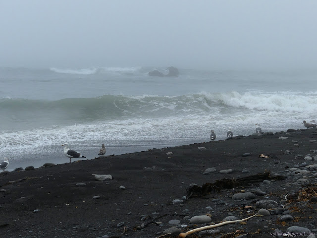
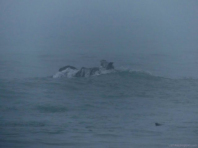
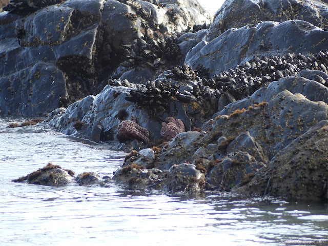
As the beach traded rocks for sand for rocks again and the water got lower, I took some time to look into the tidal areas. The tide wasn't going all that low and the rocks probably didn't keep much water for pools. I found a lot of kelp and a few limpets. It wasn't a satisfying bit of tidepooling.


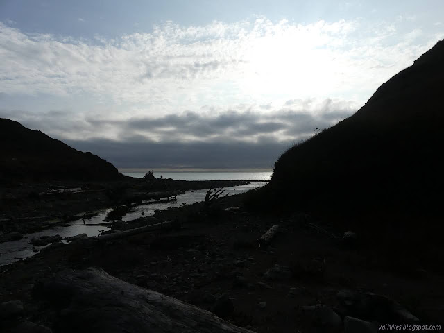
I got to Cooskie Creek to find there were already two pairs already in camps. One set had a spot near the beach and near a driftwood structure. A loud site, I expect. Further in, the next set had taken a spot with a lot of room and selected another for their kitchen. That left plenty of other room for me to find a place.
I crossed the creek on a bridge that was more structure than substance. There were lots of places on the far side, but the further back I went, the more I found the area absolutely lined with toilet paper. This place certainly gets a lot of use and too much of that is by less astute campers. Who looks at all that toilet paper and thinks it'll be alright if they add to it?
I found a nice seat to eat my hydrated rice. It was serviceable. The pasta bits were certainly pasty, but still intact. Without all my dried beans stuck in it, there was actually enough cheese flavor to go around, so that was an improvement to my usual. My old split pea soup was quite nice with a bit of milk powder that remained. I decided to put up the tent with the fly again. There was a little more wind and a squeaking came with it that turns out to have been heavy water drops. Rain really was coming.
Continue on to the next day. ⇒
©2020 Valerie Norton
Written 27 Sep 2020
Liked this? Interesting? Click the three bars at the top left for the menu to read more or subscribe!


Comments