California Coastal Trail Last Chance Section and Damnation Creek
Del Norte Coast Redwoods State Park
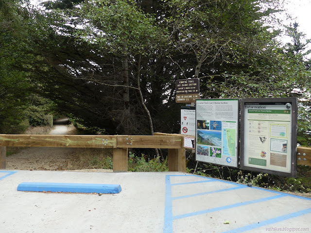
With the days getting shorter, I felt a little pressure to go ahead and check out the Last Chance Section of the California Coastal Trail, which I wanted to do including the trail down Damnation Creek and stopping to see Enderts Beach on the way. The information I found put the out and back length of Enderts Beach parking to Damnation Creek at 12-13 miles. Del Norte Coast Redwoods State Park was the only one that would say where to park, around the 15.6 mile marker. They also mention that heading south is great in May or June when the numerous rhododendrons are in bloom. I knew from trying to find the trail before that there is no sign to indicate it, so I pulled into the first turnout after a section of one lane highway and found I was at a usable location, so I parked. It was actually around the 15 mile marker.

I found a nice gated road to follow and got confused when I quickly came to a sign indicating the CCT goes up a small trail, but of course it does. The DeMartin Section is above the highway, at least mostly. I think technically I was on the DeMartin Section until crossing Damnation Creek, but that's a rather unimportant detail. I poked my way up the trail a little before continuing on the road in the other direction for the CCT indicated by the sign.

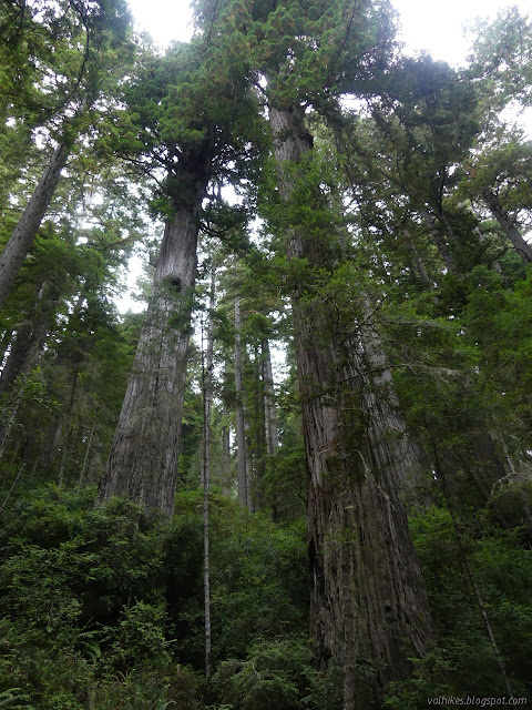
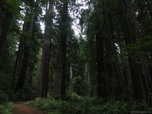
I found a lot of nice, big redwoods shortly after that. They seemed distinctly short. I liked it. The stocky trees felt more relatable, which is rather silly. It is still a tree with the top far out of my reach and hard to even see.

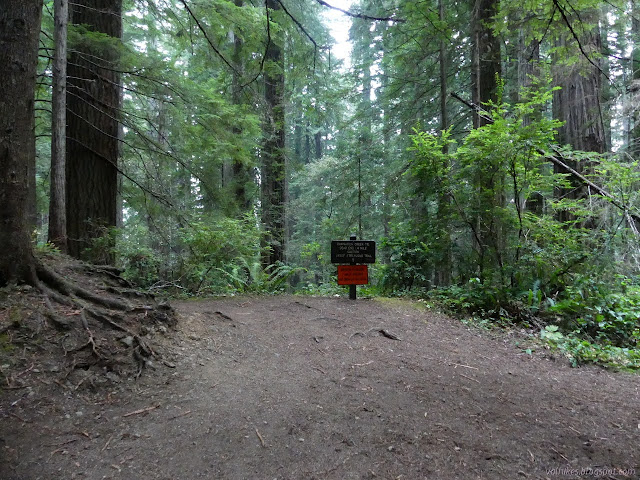
I came to a mystery trail with a fallen sign that I suspect is an old route for the Damnation Creek Trail between the highway and old road, then found the current route around the corner across from the trail down. Dead end 1.4 miles, it said. Below it was an orange sign saying no beach access because there has been a bridge failure. The geocachers say don't worry, you can just go around it.
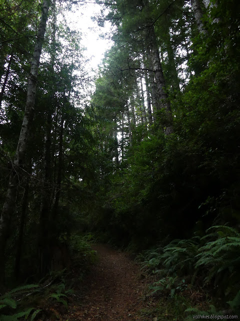
I headed down. The trees got taller as I got down in the canyon. They're more sheltered from the salt winds there and just need to reach further for the sunlight. The trail didn't feel steep at first, but it got that way in some spots toward the bottom.
There's actually two bridges near the bottom of the trail. The first has some rotted out pieces at either end. These holes were marked with some bright green ribbon to help bring people's attention to them, but weren't enough to close the bridge. The second had a sign in front to say it was closed and plastic fencing doing the duty of handrails. I've seen that on other bridges, so it probably isn't what has closed it. Some of the geocachers claim the bridge is fine, but since those don't offer up any engineering credentials and I can think of ways for a bridge to be about ready to fall but feel fine to a random human crossing it, I think it's a good idea to keep off. There are a couple choices for going around.

I guess the rest of the way down is off trail since the trail is closed "because" the bridge is unusable. Some of it sure felt it. It's being allowed to get overgrown and steps cut in the rock to get down to the creek are partly worn away.
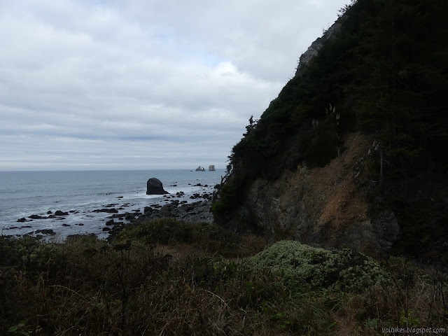
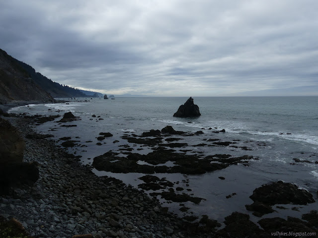
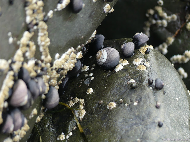
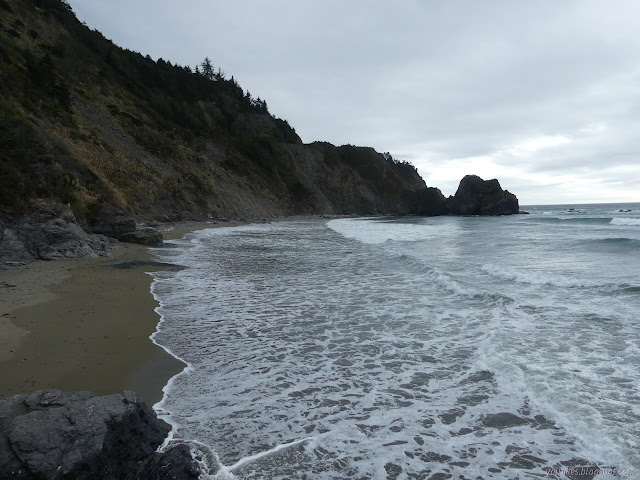
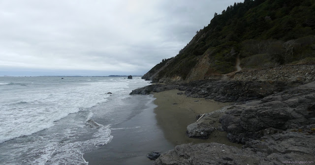
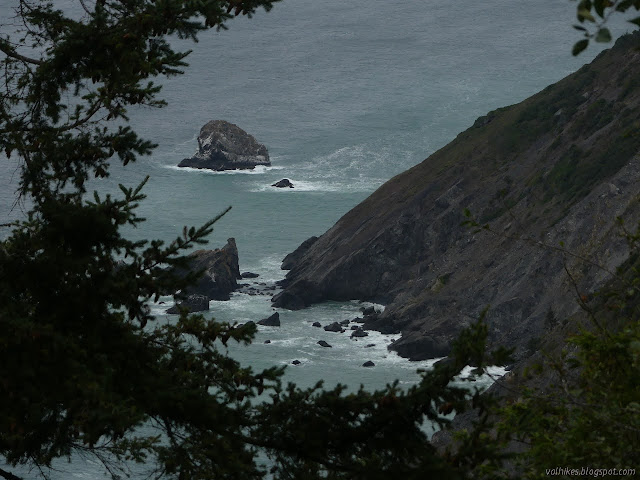
I made my way carefully down the surface that was once steps to the creek area. Damnation Creek was flowing, but sinking into the sand as usual for such things this time of year. I went to check out the tide pools, but wasn't expecting much. The tide was about halfway to high, halfway from low. There were lots of snails and barnacles. I poked around on a raised rock with a pool in it, but still found not much more.

I wandered the beach a little the other direction before turning back to climb again. Although I had the beach to myself, I passed no fewer than nine people coming down as I went up.

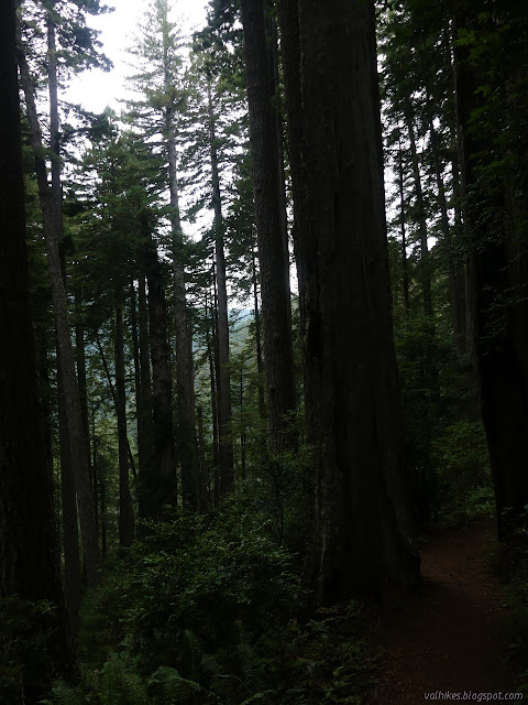
I turned to continue along the old road and expected to see no one for a few miles. The trees got taller as I got closer to Damnation Creek again, but this time high up.


The traffic noise dwindled quickly as I started getting further from the highway. It didn't get overgrown the way the Klamath section did a few miles from the trailhead.

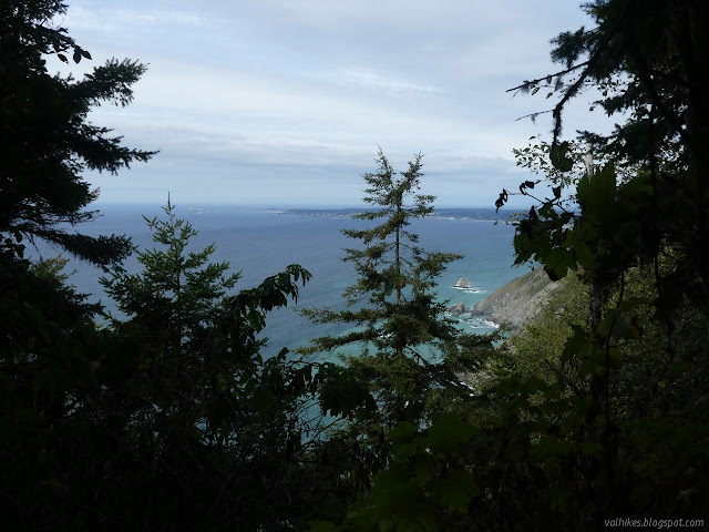
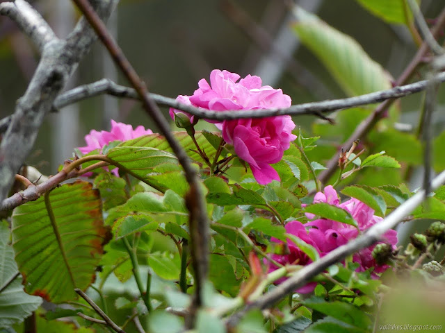
The vegetation changes drastically as the trail turns north high above the ocean again. Up until then would have been particularly impressive in June with the rhododendrons in bloom, but they and the redwoods stop when no longer in the shelter of the Damnation Creek drainage. It turns to alder and Sitka spruce instead. The old road is not as smooth or as wide.
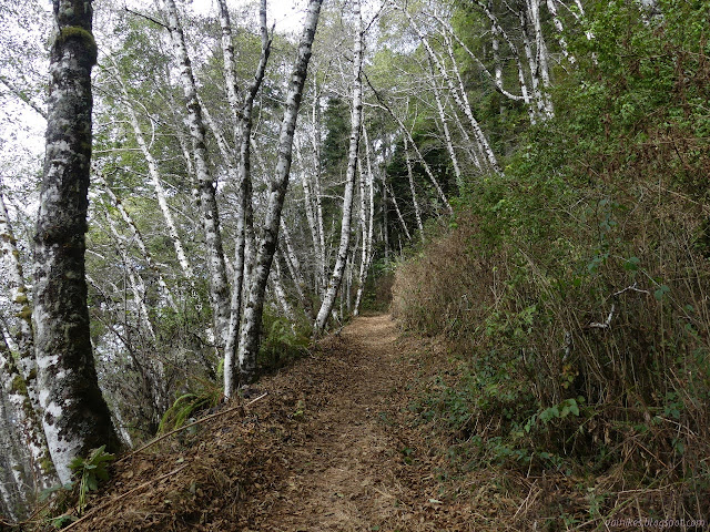
I started meeting people again in this section, although only three. The route changes from coastal road to logging road in character and the trail climbs to trace along the top of a ridge that may be redwoods, but they are all small and growing thickly. It wiggles down a long way to get down to a high earthen bridge over Nickel Creek.

Trails split off along the creek on the north side of the bridge. I explored up the Creekside Trail going upstream. It is very short and seems to exist just to provide access to Nickel Creek for water play.

I headed the other way, passing two more people on my way to Enderts Beach. There was little indication of where Nickel Camp once was except a narrow, overgrown trail followed by a "no camping" sign. I passed two more people on the way.
This side of the trail gets closed in the wet season because they are worried the trail will slide away. I was wondering where that closure might be when I noticed the flat spot in the saddle to the south where there was once road and the rest of the cliff where any remnant of road has long gone. The 15' USGS map from 1945 confirms there was road there. (It was not the highway which already occupied the route it takes now. The Klamath section also does not occupy old highway.) The 7.5' map from 1956 shows the roads that are now followed by the trail. The trail north certainly looks solid, but maybe that's how the south side looked in 1945. It would also be legitimate to fear the earth fill "bridge" might get washed away eventually.

I briefly looked about the beach before checking the old campground and returning to the CCT to finish off the section.
The trailhead was abandoned of all other hikers, but the wind was picking up and the coming storminess was already noticeable. It was already 4PM, my latest turn around time to give "not too much" hiking back in the dark. Two signs set one atop the other argue about how far that is exactly. It might be 6.5 miles to Damnation Creek or only 6 miles to the highway past it. (The longer one is correct.) I got moving, trying to put on some speed, or at least not be slow.

That first climb up to the redwoods is pretty much the only climb in the whole section when heading south. I chugged up it with a few pauses for photographs.

I actually got a few sprinkles on me as I traveled under the young redwoods. Rain was expected for the night, but less than an inch total.
Once I rounded the corner to return to the bigger redwoods, it was distinctly dark, but it was from clouds and those trees.


I could hear a lot of wind and even a few limbs falling, but only got the slightest breeze down on the ground under those big trees. I watched them wave a bit. Most waved a little, it was not all that great a wind, but one with a particularly misshapen top waved a lot.
The redwoods thin when approaching the highway. It was still light when I got to the little bit of trail climbing from the road to the highway a half mile from where I parked. I decided not to try it then. I will just have to do it at the end of the DeMartin Section if I do that. What I see written on it encourages me more than looking at it on a map. Another time. I packed it all in and got into traffic waiting for the light to change on the single lane section of highway.
©2020 Valerie Norton
Written 4 Oct 2020
Liked this? Interesting? Click the three bars at the top left for the menu to read more or subscribe!


Comments