Lost Coast: Punta Gorda and Mattole Beach
King Range National Conservation Area
DAY 1 | DAY 2 | DAY 3 | DAY 4
Purple line for day 4. Click for map.
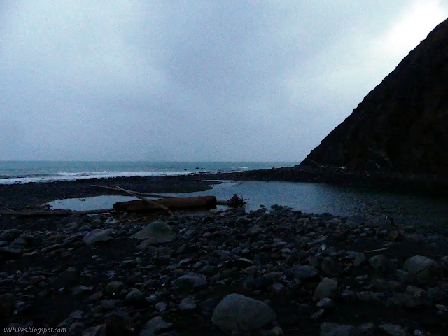
I got started with the dawn and the rain started up again a few minutes after I left the tent. I pulled on my puffy jacket for the first time in the trip and quickly traded it for my rain coat. The rain wasn't hard enough to worry about, but it was just too warm to have a full jacket on. I packed up and was on the trail with the sunrise, wherever the sun might be. The pair by the beach were long gone already while the more sheltered pair weren't even stirring. The tide was at its lowest for the day, right around 0, as I started north. It marked the first time I tried traveling one of the sections denoted "impassible at high tide, travel during a receding tide" during a rising tide. I wasn't too worried. I had a little over a mile to Cooskie Spur Route, and after that there is an overland route.
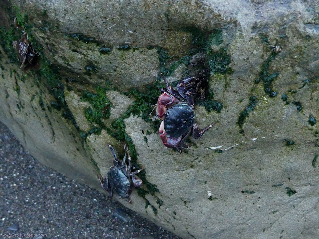
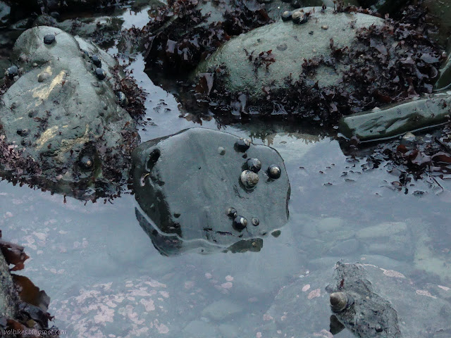
The beaches told me there were more than my near beach neighbors moving in the very early morning. The sand washed smooth by the last high tide bore four lines of footprints from another southerly march. They never seemed to wander over to the water to check the pools, but I have to admit that my own wandering were still unsatisfactory. Lots of kelp. Limpets. A starfish. Some gooseneck barnacles and muscles. One hermit crab. Turban snails. Without wandering, I got to see the antics of the shore crabs. I started worrying that I would crush a few.


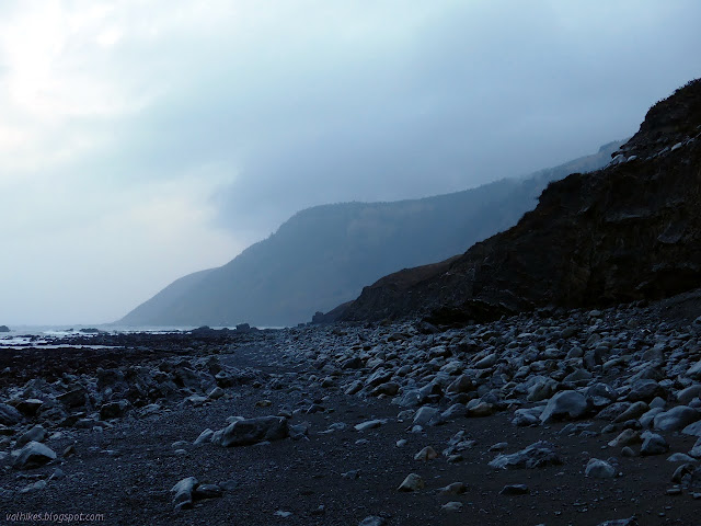
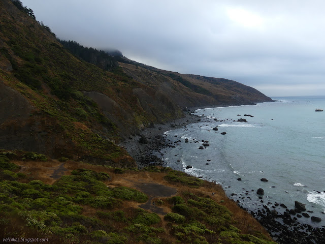
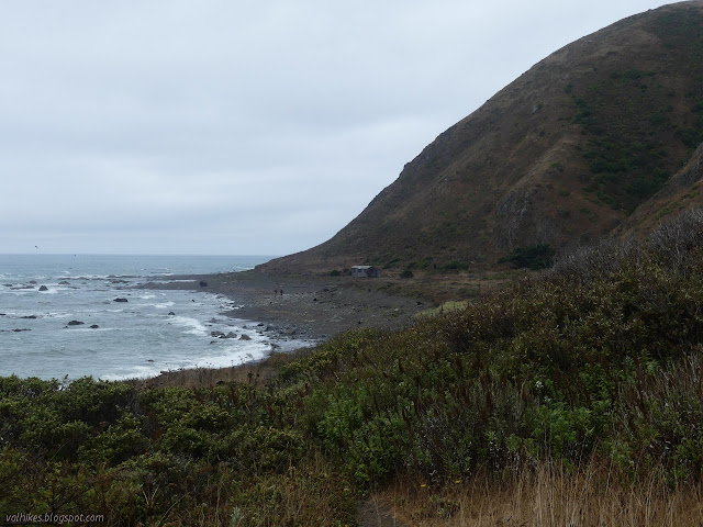
The rain came and went and my thoughts that maybe I should put the rain coat back on came and went. As the rocks on the beach got larger, I found myself slipping more often. I fell once and managed to get my foot so stuck in one slot between a pair of rocks that I had to remove my shoe before I could reverse the action. I looked around and noticed that there is a sort of trail developing just below the cliff where lots of footsteps show in a collection of smaller rocks. I stepped with care to get up to it and follow it.
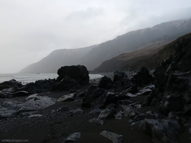
I passed the remains of a building visible hanging from the cliff as I approached the Cooskie Spur Route. I could see no trail and no signs beyond a tall cairn in a bit of erosion with a fence suspended above it. I went for that and found myself with a bit more trail at the top and some more collapsing buildings.

Just past the buildings, there is a sign pointing left marked LCT. No mention of the Cooskie Spur Route since it is "unmarked and unmaintained". Hiking north again, I passed what was once a garden planted with agave and a tent that wasn't ready to go anywhere yet, then I was dropped right back down to the beach.
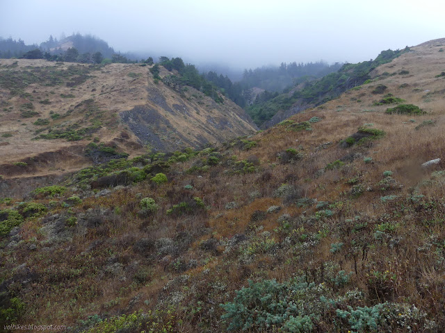
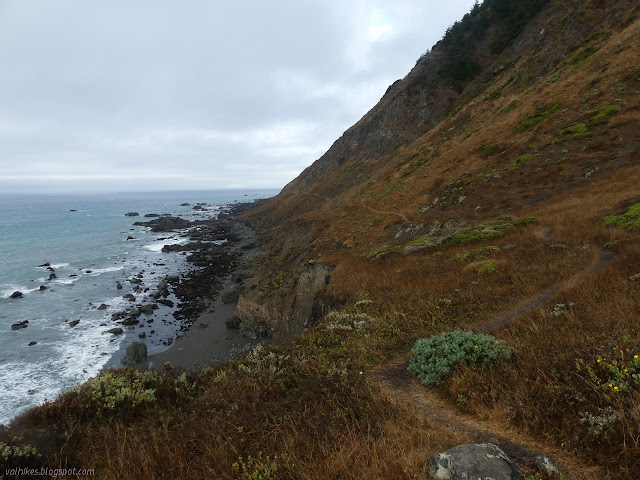
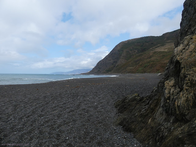
After the stretch of beach, the trail goes up again by Sea Lion Gulch. Where wasn't very obvious until I accepted that it might be right next to, and sometimes in, the water coming down a rocky cut. I found a steep way up and was in another camping area, but this one wasn't occupied. I felt it offered a good perch for snacking, though.
It took me a second try to find the right trail out of the camp area, but once found it was quite nice.

The trail dropped down to the beach again and walked the sand until, very quickly, I was done with walking in sand. But first, I almost missed a waterfall on Willow Creek.


The trail passes through a gate and past some concrete foundations before coming to the lighthouse. The interpretive sign near the lighthouse mentions "stately two-story homes" that were once on top of the foundations.
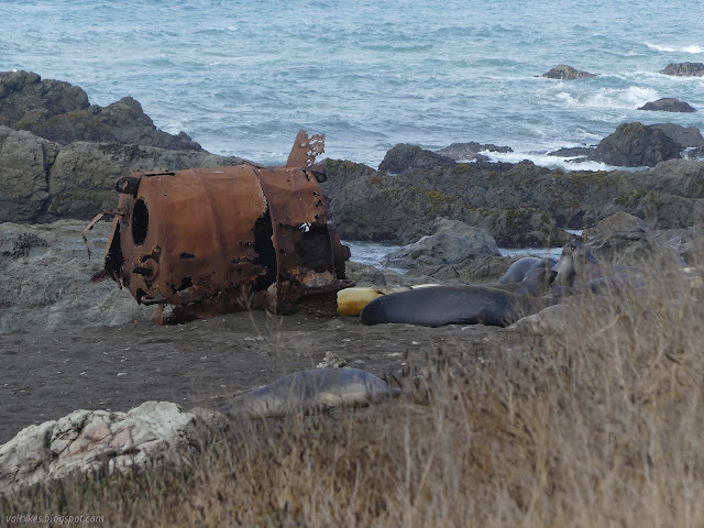
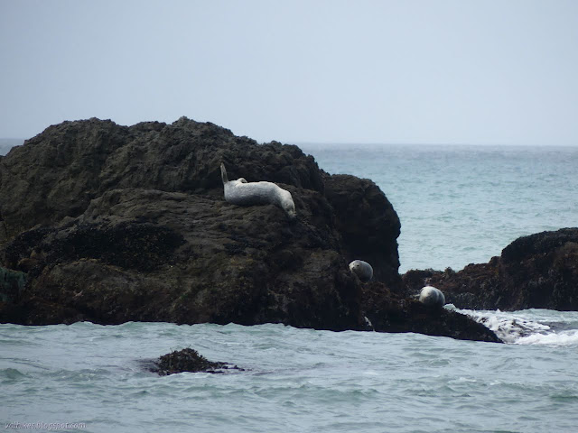
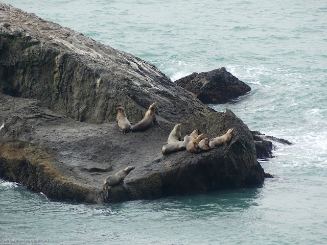
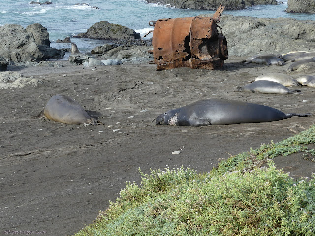
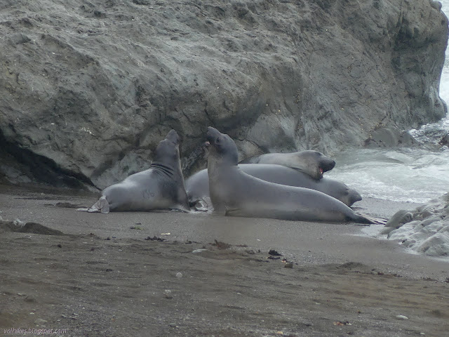
Then I got distracted by the seals on the beach. A little noisy and constantly posturing at each other, they were a bit different from the spotted ones I have been finding. They are why there was a sign warning about elephant seals when approaching the lighthouse from the other side. The geocachers tell me these will come all the way up to the trail to relax in the sun. I was happy to no longer be on the beach, but felt brave enough to wander to the edge of an unoccupied camp site to get a closer look.


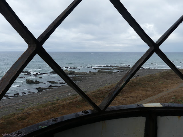
I eventually made it to the lighthouse in spite of all the distractions. Really, I wasn't in a hurry because the map says there's two points that aren't passable except at low tide and the rising tide was well past the 3 foot mark. I took a little time to look around the lighthouse, but it doesn't take long. There is a circular center with stairs (iron, but not yet too far gone) like a circular ladder up it to the lamp area. There are rooms on either side with closets filling in the spaces around the circular center.


I decided to hang out a while and watch the elephant seals a bit longer, especially when I saw there was another bit of rain coming up from the south. While the rain fell, the seals were almost quiet on the beach, just resting. The few out in the waves were still playing and posturing. I took off after the rain although it was setting me up to hit the choke points at the highest tide.
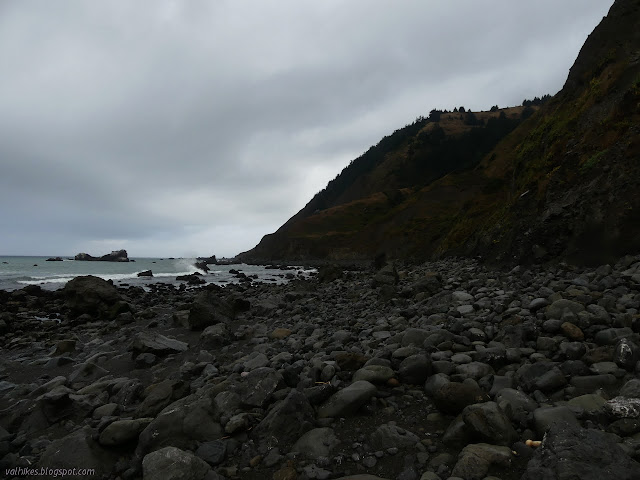
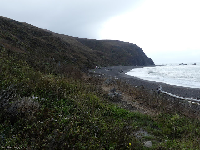
I followed trail and a bit of beach and came to where things indicated was the impassible point. I saw a lot of sand to pass on even though the tide should have been at nearly six feet. I read the logs for the geocache just on the parking side of the point and found that people really did get turned back at that point. Certainly wouldn't if it looked like I saw it.

I even got a little sunshine, and when I did, it got hot. I guess sometimes you can't win for not losing. Just as the rain wasn't bad, neither was the heat.


The last bit looks to be inland, but is still a slog through sand. I got back to the trailhead and finally looked over the kiosk there. Since I'd gone the other way from my parking spot, I hadn't seen it yet. They have maps on this side, too, although not so many. I decided to walk out to the river before finishing. I had seen a trail from the other end of the campground when I was up high, so I made my way through it. It had a lot more people in it than before, but the trail was right where I expected it to be.
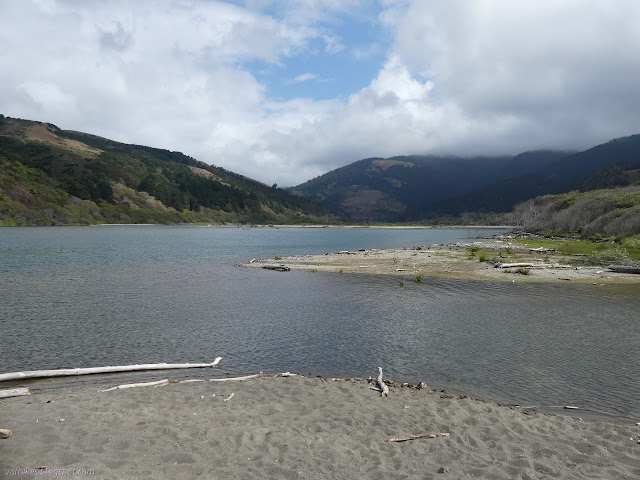
I relaxed on a driftwood tree for a while, then headed back to the car. Even with all those people I saw going south, there was only one more car in the lot than when I started. The guys with the mules were still out there. What dreadful luck them must have been having. And to think they walked so much extra to get to their hunting areas too. I'm sure they got something when the time was right.
©2020 Valerie Norton
Written 28 Sep 2020
Liked this? Interesting? Click the three bars at the top left for the menu to read more or subscribe!


Comments