Lost Coast: Cooskie Creek, Lake Ridge, and Spanish Hill
King Range National Conservation Area
DAY 1 | DAY 2 | DAY 3 | DAY 4
Orange line for day 2. Click for map.
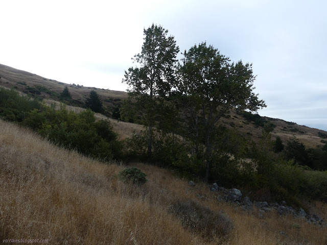
I woke up feeling a little dry because I would have liked a few ounces more water for the night camping. I grabbed bandana (which isn't lost after all, it was just in the wrong pocket) and bottles and scoop and headed for the water I knew was 400 feet from camp. There was actually a good flow, but it was spread out over a large flat area. The hole I dug was nice and clear until I walked upstream looking for a nicer spot to gather it. I decided to explore south while waiting for it to clear again. Maybe I should have practiced techniques for water gathering when it is not so easy. Line the hole with rocks and push the bandana down into it to keep it from getting muddy? Something like that. I really like just holding the bag under a spot where the water is pouring over an edge. It's like a spigot.


I picked out a spot I wanted to check for water walked a fairly level path on well established game trails across the side of the hill. I met Cooskie Spur Route, also "unmarked and unmaintained" but had been very clear to me as I meandered down the hill the night before, just before I found a nice flow of water. It even had the "spigot" I was looking for. It was actually a little before the spot I was aiming at. I got the water and headed back to camp for breakfast. Breakfast is not an experiment. I've had it cold and it just means the creatine (to keep my feet from getting too numb due to bad genes) and green tea powder doesn't dissolve so well. Food is just instant pudding with chia seeds and coconut pieces. Nido whole milk powder makes the pudding do its thing. There was a light breeze, but it was barely cool enough to put on my rain jacket, so the pudding didn't do more than a soft set.

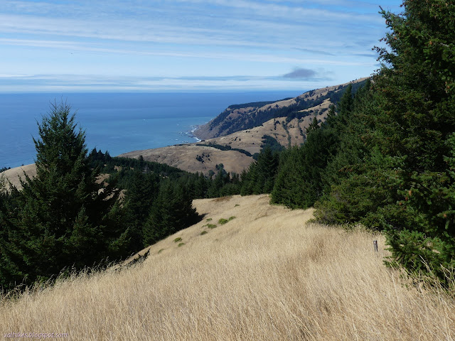
I enjoyed the view and struck camp. I hadn't really gained anything by cutting off a bit of my planned hiking the day before. I probably used just as much energy surveying the springs as I would have getting down to the creek. I took the same generally level paths across that I used to get water and then started climbing Cooskie Spur Route to the junction.

I found some spots where the trail is almost washed out on the way up, not that getting around them would be hard. Looking back down the way I'd come, I saw that the cow paths offer very tempting mild adjustments to the actual route that could lead people astray. I passed some weathered wood that looked like they were once part of a structure. There's a bit of history out here. They were near a possible dug out area and right where the old road started looking like old road.


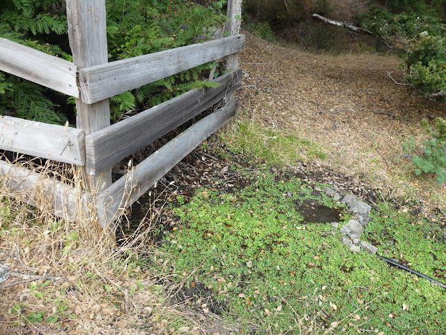
I was quite surprised to arrive at the junction to find it has a corral and a rather well used camp site. It also has more artifacts including a plow an something wheeled, maybe a mower, by a section corner. The corral has a trough which I didn't check for water, but the grass was a bit green around it and at strategic points along the hose leading to it. I followed the hose back, then followed really good cow path to the point where I could hear a lot of water rushing down a more accessible gully than the one I'd been camped by. I didn't have to do any wandering to have had a suitable site earlier than the creek.


Finding the trail as it continued past the corral was difficult. I followed the line on the electric map and eventually got to a point where I could see the old road. It was just below me. I couldn't follow it for very long because it came to a short and distinct cliff. The solid land just isn't very solid sometimes and slides away and quite a large section had taken to moving downhill at some point in the past. It makes a slope that is not so simple to navigate as the one I wandered the night before, and I was a little happy I hadn't done it then. I turned back from the cliff to follow game trail and then just pick and choose downward toward Cooskie Creek below.

I found trail winding down a nicer path when I got down toward the creek when I got low enough. I wasn't too surprised. There is a possible camp down by the creek, but it isn't very good. It's really part of the flood plain of the creek. There was a crossing beside the flat area, but evidence of trail continuing downstream and even a marker to tell me I was going right. I stopped to make sure I was filled up with water before starting up the other side.

The trouble was, I couldn't find the trail on the other side. Two electronic maps said it should be further downstream, but differing amounts. The paper map said it would climb rather directly. Indications on the ground were that I should go back upstream. I probably should have searched harder, but I was seeing what looked like cuts above and went up a bit of game trail for a thicker trail above. The cuts turned out to be illusions. I followed the game trail back to where there should be trail, but it became solid brush. I went upstream, but that wasn't where I should find anything. I went up again, then worked to my right toward more illusionary cuts. I worked even without a game trail for a little bit, crawling through poison oak and finally getting under the trees where travel was a lot easier. (Some of the travel to get to that spot was ten minutes for two feet.) I was again where the old road should be crossing, but it wasn't there. Just illusionary cuts. I stayed under the trees rather than try to work toward the second crossing, but when I did get to it, it was there, coming from my left just like it should. I'd done 300 feet the hard way, but the next 300 were a nice rest comparatively as it still climbed steeply.
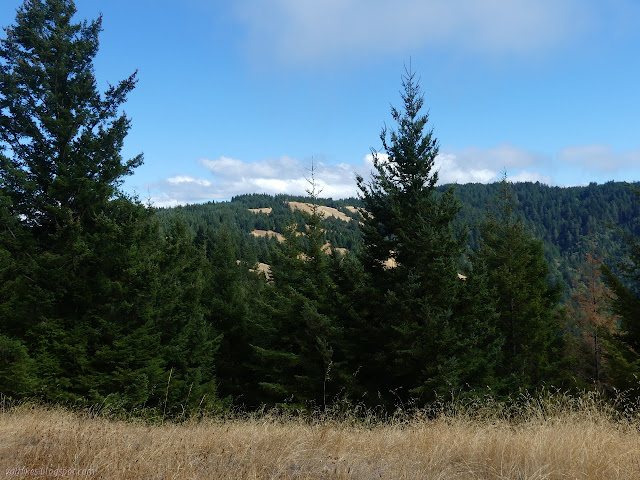
The trail was clearer than it had been for a while. Signs mark a short crossing of private property that even comes with a gate for another incoming road. None of them have been used as road for a while. I glanced at the USGS map once in a while as I climbed and couldn't help noticing that a lot of the treed area I was hiking was marked as open with some small islands of tree. It got me started on wondering about the history of the land. Fire, suppressed or encouraged, and grazing, which is different for deer or cows, and logging all change the landscape dramatically over time.


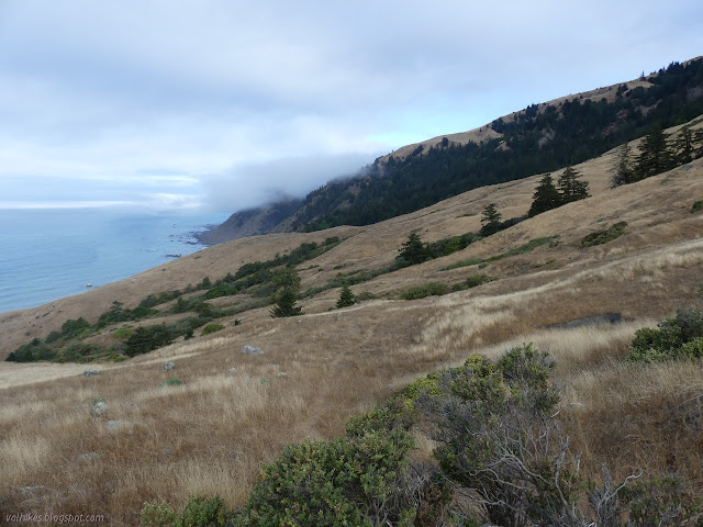
My electronic map was out to send me wrong, but I found another of those markers that doesn't exist pointing away from the old road and up Lake Ridge. I figured I'd get to see the "lake" it is name for better that way. I passed by Douglas fir that were obviously pioneering new areas. Suppressed fire leads to smaller meadows and denser trees, which looks like what is playing out here. On the other hand, a couple fires can take a forest, kill it in the first round and clear it away in the second round, leaving meadows for trees to reestablish themselves in. One can approach the question of which is "right" from a number of different angles. If the goal is a fire resilient landscape, the areas of recent fire are evidence that that is not where this land is now. I saw them on the previous trip along the Lost Coast, but only when my track overlapped that trip on this one. Perhaps this area is closer to that ideal still.

I got to a three way junction and no direction although there had been some shortly before. I decided the right side would probably take me to a benchmark, whatever else it might do, and the left was the trail. That worked out until I got to the "lake".

At the "lake", trail faded away. I suspected it passed to the right, but the sensible thing would be to go left and get back on the old road. The USGS map showed a building along it, but that was passed. I tried it and just encountered fencing. I followed along right back to the other option and a gate with very direct indications that to pass through it is to enter private property unlawfully. And there's trail off to the side anyway. I took the trail until it finally tired of paralleling the road and rejoined it next to another gate and a spattering of property line monuments.

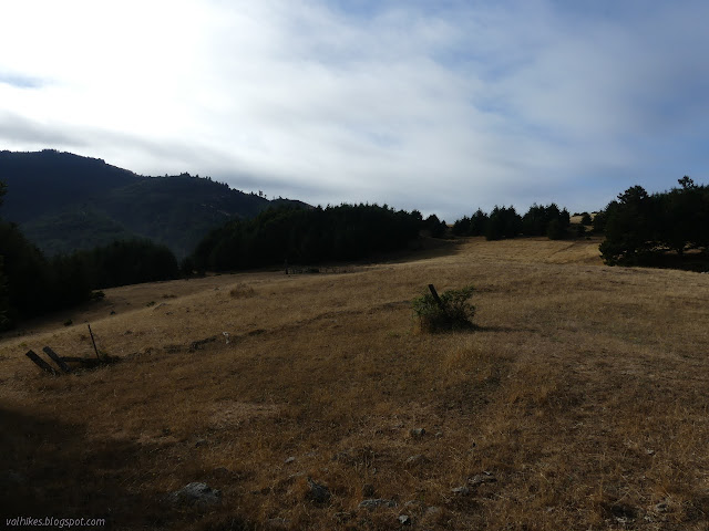
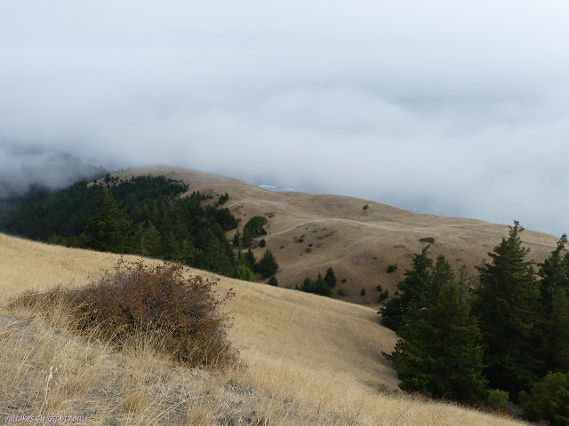
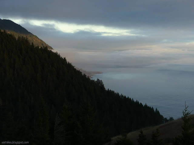
I was getting into a little different environment as I climbed once more to a bit over 2300 feet. The previous was just 50 feet over and this one 80 feet over, so it is the high point of the trip. Just as before, the fog rolled in just before I got there so I wouldn't have any views. Okay, it probably was merely obeying physics rather than having a mind of its own.


I came to the Spanish Ridge Trail where the Cooskie Ridge Route ends. There is a marked post, but it only points the direction for the trail. The route remains "unmarked" in its way. The trail goes right over the high point, but with nothing to see, I proceeded fairly quickly. I was getting under it when I got near the Spanish Hill 2 benchmark, so I paused to search for that and, entirely on luck, found the station.


I sat near where the reference should have been and grabbed a bit of food while setting up cold soaking experiment #2. This time it was pearled couscous, which is the larger couscous. I found claims it works in about 2 hours. I had whole wheat, so I figured I better give it the whole two.

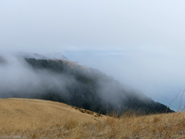
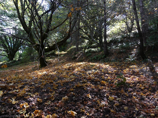
I headed down and the clouds came down after me. As I got lower, some of the islands of trees were actually bay laurels. I sniffed a leaf, but it wasn't very strong. I came to a junction of old roads. The paper map only shows one of them, but the shape of that one is the one on the left. It looks like a bad trail because it is almost in the bottom of a deep wash. Someone had taken some time to place a row of large rocks across the left side and added a medium cairn to the one on the right. I wasn't sure if maybe it was just a reroute to avoid the wash. If I wanted to come down to Randall Creek, where it should arrive, I would definitely have taken it. I particularly didn't want to end up there, so I ignored its indications.
It was late again and I felt it was really time to be finding a camp. My original plan was to go all the way to Kinsey Creek for a camp site which, if I'm honest, would have been very loud. I spotted the spring on the map. Oh, no, you won't be tempting me again! I spotted the trail on the ground. It was a human trail, at least partly. I could see a bit of wooden fencing in the area where the spring should be. So I decided to at least go and have a look. I arrived at an old road that comes down across the gully the spring feeds into and out to meet the one Spanish Ridge Trail comes down. The spring is piped to a trough, but not filling it because there is no plug. There was a camp along the other side. I could definitely get water. I didn't like the camp. It was under trees and I was still harboring hopes of seeing stars. I did like the saddle shortly before the old road joins the trail. It was mildly sheltered and offered a nice perch for trying out my cold food with a view. I gave in. It was camp.
I ate my cold soak. It was a bit of a fail, but because I had done a very bad mix of spices when I packed it. I had enough garlic in it to burn my tummy. I generally feel there can't be too much garlic, and this proved me wrong. I poured in split pea soup I made and dried a little too long ago. (I had some for every night and it rehydrates well in 10 minutes or less.) That helped tone down the garlic a bit but I ended up leaving part of it for breakfast. As to the pearled couscous, it mostly works, even if whole wheat. It was a little more like tapioca balls than it should be. I rate it workable, at least as long as it is not otherwise sabotaged.

I decided to go with the tent, but no fly, since things seemed to be clearing. It would mostly keep off wet that came down and when the stars came out, (which they did) I would be able to see them. Damp is just the start of how the tent felt when I reached out to open to door and get a look at the stars without the mesh attenuation. A lot of water had squeezed out and everything was damp, but everything that needed a little extra protection had it and I was comfortable. It was all good and the stars were stunning.
Continue on to the next day. ⇒
©2020 Valerie Norton
Written 25 Sep 2020
Liked this? Interesting? Click the three bars at the top left for the menu to read more or subscribe!


Comments