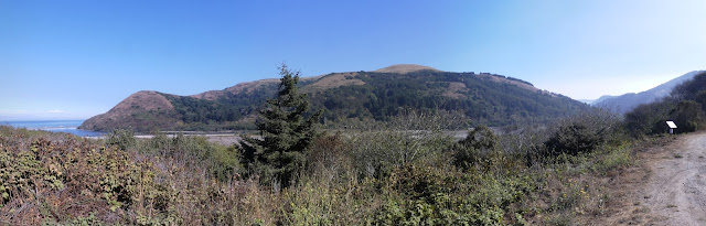
Lost Coast: Windy Point and Gorda 2 Benchmark
King Range National Conservation Area
DAY 1 | DAY 2 | DAY 3 | DAY 4
Red line for day 1. Click for map.
I originally had a permit for 29 March through 1 April to take this trip, but that got derailed when they closed the Lost Coast Trail on 28 March and revoked all overnight permits as some sort of COVID-19 measure. They left the other trails open although the trail generally on the beach must be the easiest for allowing people to keep their distance from strangers. After they reopened and I finally figured out when I wanted to go (near the new moon for that dark sky with lots of stars potential), I managed to pounce on a released permit to do it 15-18 September. (The required permit is $6 to reserve and is obtained from Recreation.gov.)
In that light, I greeted an email on 9 September that they were considering closing for the fire danger with quite a lot of grump. Well, that light and the deep red light that enveloped the entire state, even Arcata which had not seen smoke at all so far. I wasn't too optimistic that people suddenly bathed in that light would settle on leaving the place open. But at least they gave me more warning this time? The danger is real for this one. The area really is a tinder box and there really are insufficient resources to deal with the fires already burning. Tweets about the crash rescue vehicle and Marines to go with it that are helping out on the Slink Fire are cute, but the subtext is they're having to get creative with vehicles that were not built to navigate rough, twisting forest roads to have enough water tenders.
However, there was no follow up email. They didn't close it. Apparently they were satisfied with simply discouraging people from coming and asking that they not cancel their reservations which would allow others to come in their place. Stoves are banned! (Although when I logged on to print my permit, I was only told that campfires were banned and stoves still okay. I was already planning cold soak meals.) Alder is raining from the sky!

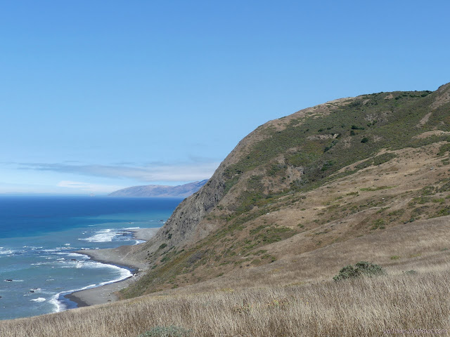
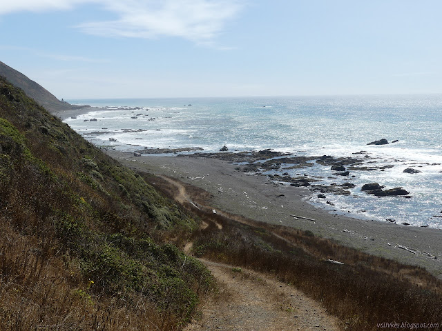
I got to the trailhead to find a rather empty parking lot, but that might not mean anything. For some reason the norm for hiking the trail has become driving to the south end to park, get a shuttle to the north and then trudge as fast as you can, tides willing, back to the car in the south. I think there should be something more than scampering over the sand and rocks with the sun in your face. Apparently the overriding consideration is a wind that comes from the north and will blast you in the face with sand if you dare to look north. I didn't experience any of it on my first trip to the Lost Coast, when I found I vastly prefered going north to going south, so my plans were overland to the south and return north on the beach heading north. To that end, I turned around and marched right back up the road I'd just driven down.
I only needed to go about 0.4 miles up the road where a smaller one starts climbing. There's actually a lot of parking near some interpretive signs at the junction, so I didn't really need to drive all the way to the end. I turned up the small road and started climbing. With some buildings and a corral, it looks like the area could be private property, but it is just to do with the open range grazing.


I decided to pop up to a named rock not too far above the road along a rougher road. I'm not sure what makes it important enough to name, but it was an easy climb with a nice view. Unfortunately, it also the sound track of someone target shooting. This is somehow still legal as long as you are a hunter in legal pursuit of prey. How you can both be standing around shooting at a paper target and in pursuit of prey, I'm not sure. If the person somewhere behind me shooting hopefully not toward me cared about legality, I also don't know. But otherwise, it was nice up on top of the rock.
I got moving along the road and turned onto the jeep road that drops to Windy Point. It looked like a likely place to end up stuck, but there were a couple trucks at the bottom.

The parking area is not quite at the bottom. There are two roads heading down although the map only shows one. That's the one I took, down toward Fourmile Creek. It is actually the driveway for a couple of cabins although I'm not sure anyone still uses it.

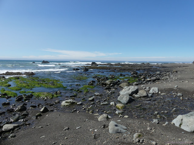
I had planned to grab water at Fourmile Creek and was surprised to find I'd already drunk most of what I started with. I found the mules were only slightly ahead of me when I heard someone shouting from above. One of the guys was giving the halter a big tug as the mule was passing a big bush as they made their way up the Cooskie Creek Route. It is marked as "unmarked and unmaintained" in multiple spots on the map. After getting water, I followed up after them. There was no sign at the bottom, of course, but the trail is quite distinct. There are big bushes to navigate and just a bit of poison oak for an icing.
I found them all resting on the trail not too far up. They wondered when they'd passed me since they saw me pulling out my gear in the parking lot but didn't notice me go up the hill. They also had some advise for springs near the top if I didn't feel like going all the way to Cooskie Creek that day. I quickly forgot again because, well, I was going all the way over to Cooskie Creek. I stopped on the shoulder above them to try to find the benchmark that is supposed to be there, but couldn't sort it, then continued up. Well used trails continued up and more trail followed the old road to the left. I tried to follow the road (they said it would get brushy and it sure did) and kept somehow getting below the road walking on the brush. I'd go back up and find a tunnel through the trees and ribbons and then things would get torturous again, but I'd gone wrong. The electronic map gave me options and I decided to try to follow the right hand line, which didn't actually work out but I did find a path going toward another benchmark. There were even footprints on it and the trees were cut to make passing easier. I turned away from it to try to get to the benchmark and had to give up 180 feet away. Without help or the determination to just crawl it, I couldn't get there. I turned back and tried the trail with footprints the other direction. That got me on the far side of a meadow from the left hand option for trail on the electronic map. I never saw it, but I did find an almost buried trail marker that got me to a hole in the trees that got me to old road again. All of the trail is old road, but that doesn't mean it's visible across a meadow area.


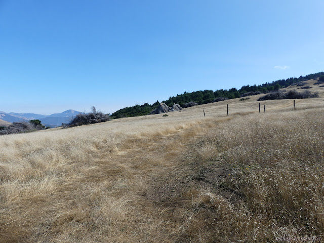
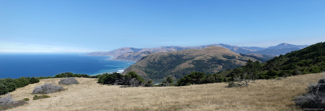
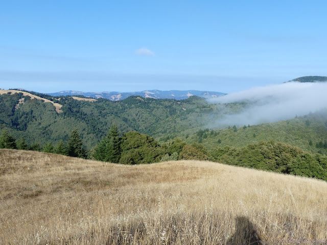
I spent a while under the trees. Extra roads came and went and sometimes had a marker directing me away from them. Cow paths made their way off the side in random spots. Cows can really make trails with very nice tread that are quite tempting, but I stuck to the obvious road area. The road stayed obvious when it once again left the trees for the large fields. The view got quite amazing.

I tagged the high point of The HJ Ridge for kicks. It was maybe 50 feet off the side and the views were just getting better with every foot gained.

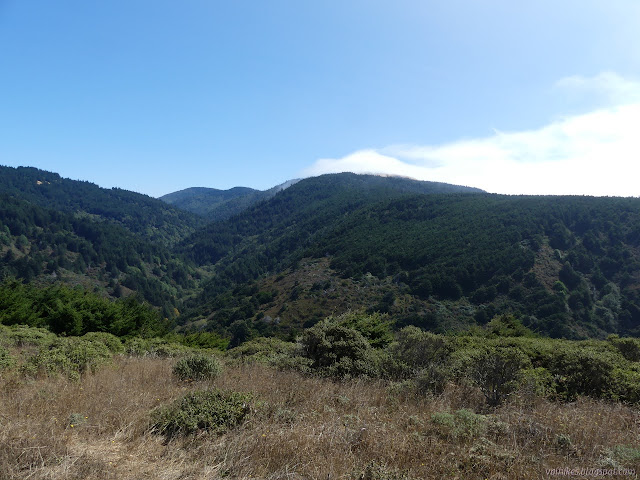
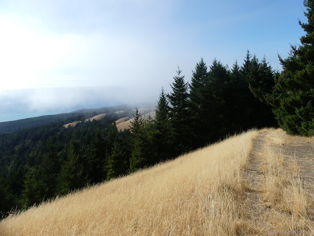
I found myself back in trees as I followed the road up and around as the markers showed. It meets roads that are still used and connects the long way. I noted the shortcut and skipped it just because it looked to involve ducking. Marine layer came in to envelope me as I made my way to the high benchmark of Gorda 2. Again, it is a few feet off the trail, so I went to tag it. It didn't take too long to locate a reference and a little longer to find the station. It was almost under the legs of a very accurate GPS. I found entries for that as a benchmark including where to go to get its exact current position. I was satisfied with here, a bit over 2300 feet up.

I dropped back to the road and followed it over its high point and down the far side. There are two old cuts, one seems more like a fuel break while the other is a very steep road and is the more distinctive cut. It also had the more distinctive trail going down it. I did have to give it up where the land had fallen out below it, but got back on it again quickly. I was feeling like maybe I didn't really want to go all the way to Cooskie Creek after all, especially if there was a good spring among the many on the map. I would go exploring it if there was a good game trail at a certain bend and the land conducive to finding a spot to sleep.

I found the game trail I was looking for, but not the spring. I found a nice spot I could sleep by some trees, but still wasn't sure about water. I expected to find some in the gully under them, but didn't. Maples and Douglas fir could indicate water, but don't need it to be there. I wandered further down the hill. My shoes were sticking to the game trails better than the old road, so it was a more pleasant way down anyway.
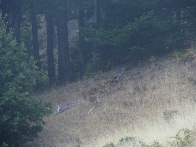
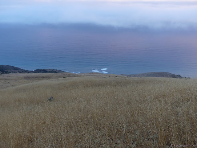
I saw a few springs as I explored, right where they were supposed to be. None of them met the standard of being easy to gather from. The gully below the trees I hoped would have a creek had audible water, but not even the deer were navigating the sides of it. There were no trails down. As it became dark, I selected a site to sleep. A little back from the slopes on one of the little shoulders was actually nice and quiet. I had enough water for the evening and had located some for the morning (and even dug a spot deeper so it would be easier to gather when the dirt cleared) so I was feeling settled enough.

So I started in on cold soak experiment #1. Since I'd not got anything started during the day, I started with the most likely to succeed which is also the shortest soaking time. All of my experiments actually contained the seed of failure because pasta cannot properly be cold soaked. It needs to cook, so it needs to boil. All my experiments had pasta in them. I also had a packet of emergency instant potatoes, which I am never thrilled to resort to. The first experiment was a couscous mix. Couscous needs very little cooking. I soaked it while I put up the tent and came up with something nearly the same as if it had had boiling water poured over it. This was as expected since nearly everyone says it works and I might have even done it once for a breakfast couscous. (Breakfast couscous that I do is just the grain looking pasta, lots of cinnamon and maybe allspice or nutmeg, and dried fruit, usually cranberries and raisins.) I tucked myself in the tent when it became obvious that the clouds were trying to soak me very slowly and insidiously. The night would have no stars. So much for my plan to go near the new moon for that better star view.
Continue on to the next day. ⇒
©2020 Valerie Norton
Written 24 Sep 2020
Liked this? Interesting? Click the three bars at the top left for the menu to read more or subscribe!


Comments