King Range: Lost Coast
King Range National Conservation Area (BLM)
DAY 1 | DAY 2 | DAY 3 | DAY 4 | DAY 5Click for map.
I want to hike King Peak (Humboldt County's most prominent peak) properly and get in a bit of the Lost Coast Trail as a bonus. I should not have squandered all those unseasonably sunny days during February, but with a little chance of rain in the forecast for Friday I finally picked up a permit to hike the King Range last night. (It is $6 and must be gotten online.) Starting Tuesday and Wednesday went from about 10 open spots to 0 while I figured out how many days I wanted, but I actually wanted to start Monday. With still needing to pack, it was tempting to try to push it to Tuesday, so the others booking helped me buckle down and do what I knew I should. I think it might be starting to be the popular season. So the morning saw an hour spent on getting food into the bear canister and another on everything else into the pack, then the drive down to the King Range Ranger Station. I already got one of their nice maps from the Arcata Field Office a couple years ago. Turns out, they have free ones at the ranger station. Mine is the waterproof version, which is still available for $5. The free one feels tough and thick enough, at least for the sunny calm weather I am mostly expecting. I also have the Wilderness Press map (5th edition, 2004), but instantly had buyer's remorse upon seeing its lack of detail. The BLM map is far superior with the only problem that it doesn't cover Sinkyone Wilderness State Park. (And, frankly, the state park brochure is almost as good quality a map for that part. It even has smaller contours.)
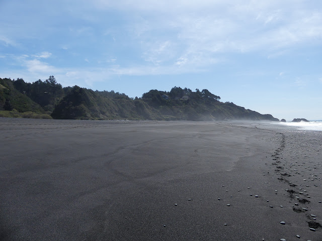
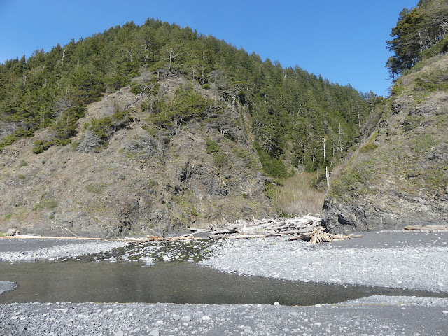
Besides maps, they also have tide tables and will print out the more detailed graphical tide chart. Tides are important since some of the trail, just hiking the beach, is "impassable at high tide". That means 3 feet or lower. The graphics show that better than the tide chart. A little more driving, and I'm down at the lot for Black Sands Beach and ready to face those tides. Just a couple cars. There's map boxes for another chance at a free map, but the one at the lot and at the end of the road where the trail starts are both empty. I load it up and grab my poles. The tide is high (somewhat) but receding and will be below 3 feet by the time I get 3 miles along to the first section where that matters. I follow the short switchbacks off the end of the road to the creek and beach below. It's rather dark, as advertised.

A second creek comes down on the far side of the parking area. It stretches out to the north on the beach and forms a pool. The water empties through the sand. Another flow of water looks more like a vicious scar. Another shows hits of small debris flows. I'm a bit suspicious that there isn't much holding these mountains together.

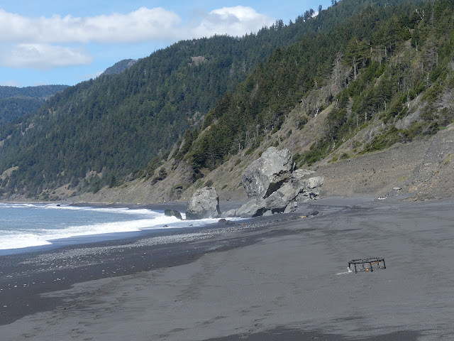
A pair of lobster traps on the beach. Typical debris. Fallen rock blocks ahead look challenging. The water washes around the easiest ways to walk and it looks like a lot of feet go up and over the top. I follow a scrambling route through the middle. I wasn't quite expecting a little class 2 climbing while walking the beach.
There's a lot of water coming down the hills around here. I can just marvel. And it's been dry. The Eel River on the other side of the mountains looks like the middle of summer already and Shelter Cove has a sign showing that their water supply is already critically low.

I wander on, pondering the fresh water and fragile hills on one side and the salt water on the far side and the bits that settle in between.


A single post with yellow writing up on a low, grassy shelf marks Horse Mountain Creek Trail. My initial thought for looping included coming down this to minimize repeated bits of beach walking. I have mentioned that walking flats like beaches causes me great pain quickly. There must be something wrong with my stride that a little slope can fix. Between that and the extra energy required to walk on sand, I'd just assume minimize the beach walking. On the other hand, doing so requires about 7 miles walking on road open to the public, so I'm pretty sure I'll take the shorter loop and a little more beach walking after all.


Rocks are starting to poke up out of the water as the tide retreats to the 3 foot mark. It comes around 3PM and as expected, I am just short of the crossover to the first section of low tide only. I started off feeling I'd got started late, but I guess I couldn't have got going too much earlier.


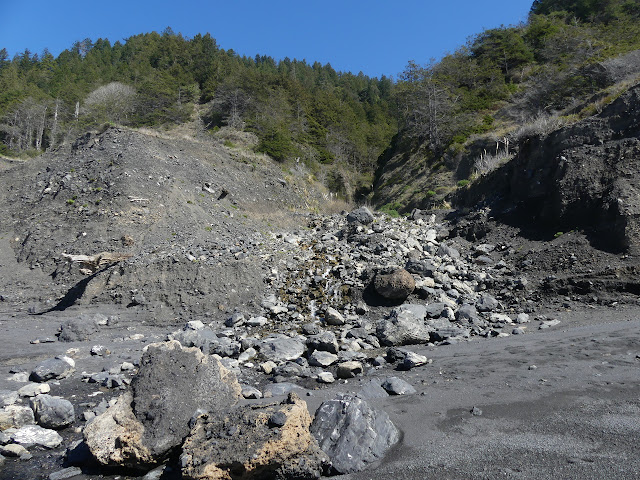
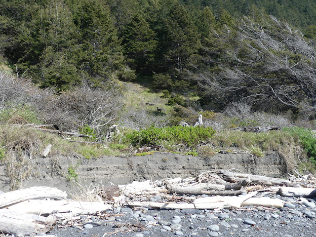
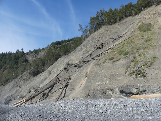
Passing by a hillside that has recently lost ground to the sea, I find where a lot of the trees stacked up in lower areas come from. Nearly a dozen have tumbled down the hill with half reaching down to the beach. I am reminded that the cliffs are also untrustworthy even if no one mentions it. The focus is mostly on how untrustworthy the ocean is. "Never turn your back on the ocean," proclaim maps and signs alike. Cliffs will come down on top of folks too. The shale cliffs in Santa Barbara certainly did from time to time.


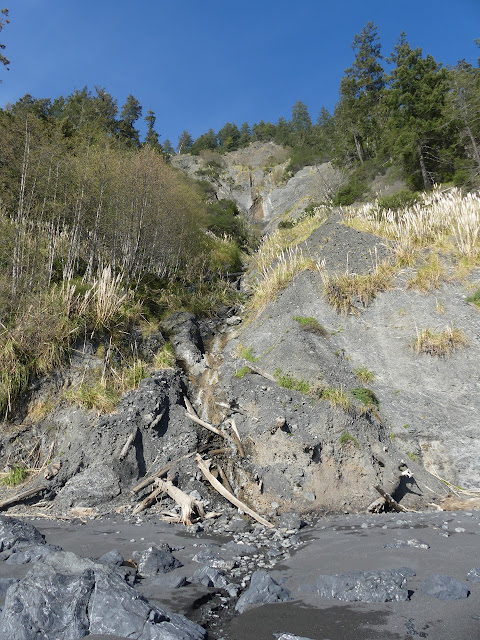
I'm still documenting all the bits of fresh water coming down out of the hills. At first it was because I was expecting there to be few with the low water elsewhere, but now I'm getting to some pretty little examples of flowing water and rock.


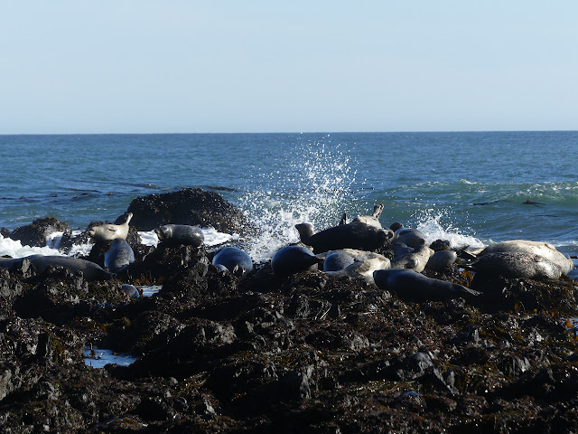
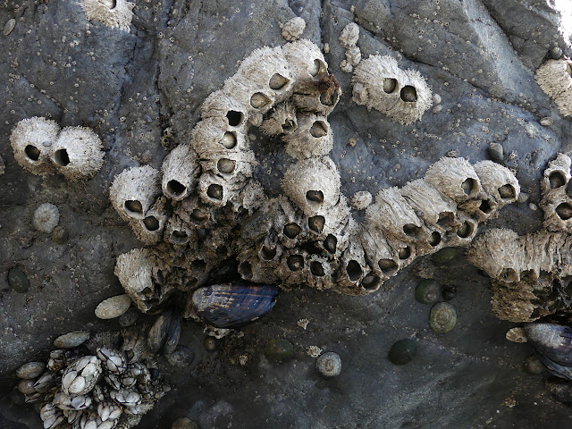
As the tide continues to retreat, there turns out to be quite a lot to see where there was only surf. I believe the full moon was technically at 7AM this morning, but this will still be a very low tide.


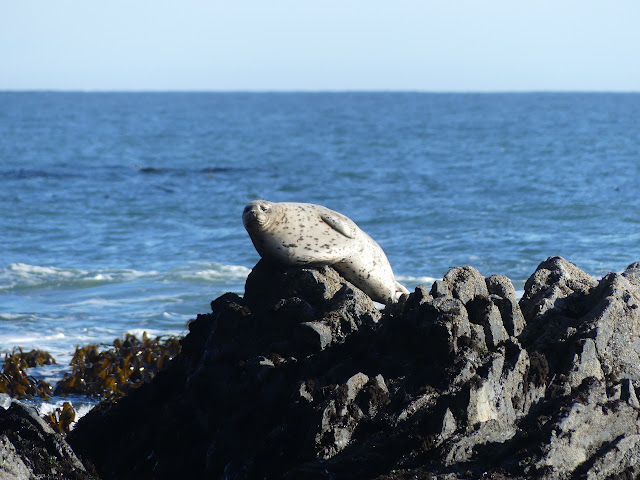
The seals have been watching me for a while by the time I notice them on the further rocks. They're not particularly concerned and only a couple are paying any attention at all.


I had no trouble with all the previous creek crossings, but Shipman Creek is rushing quite well. I go for some rocks to cross it and one rolls under me. The guy in the ranger station was very specific about not recommending rocks or trees for crossing these creek. Wade them, he said. Unless they are thigh high and then they're too high to cross safely and you should wait. My yip of surprise gets a different recommendation of the log up by the tent. I'm not sure how he heard me as the creek noise is all consuming around my ears. Anyway, I was able to retreat from the rock to the previous steady one and now I know how it moves and there's only two more steps so... I take the step again, modified to deal with the instability. Two more solid rock steps put me on the beach again. Two more steps and I can hear stuff other than the creek. Ah, he could hear me because he wasn't standing quite so close to the loudly rushing water.


The beach that has been sand and sometimes pebbles turns to big rocks. It is now a rock hopping exercise again, although with no worries about falling into a rushing creek. I'm not sure if it is slower or faster going. It certainly is different.


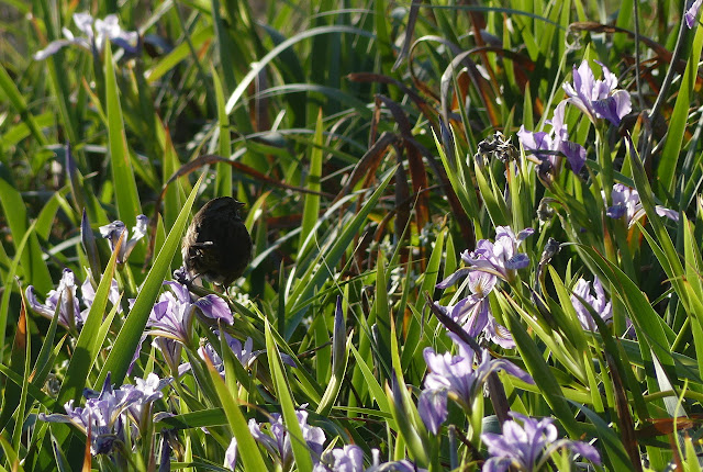
There's starting to be a ledge above the beach and below the hills and one rock looks like many have passed over it. It doesn't look like too hard a scramble to get to an easier walking surface. One really good hand hold and some slightly better than mediocre foot holds get me there to find trail and irises. A cairn marks the way from here down although some have tried to go further.


Travel is much faster and easier up on the flat. I only have a mile to get to camp somewhere by Flat Creek on Miller Flat. There's another tent set up already. I'm struck by the moraine like successive rock walls from old debris flows across the flat. I keep getting struck by the evidence of debris flows in this area.

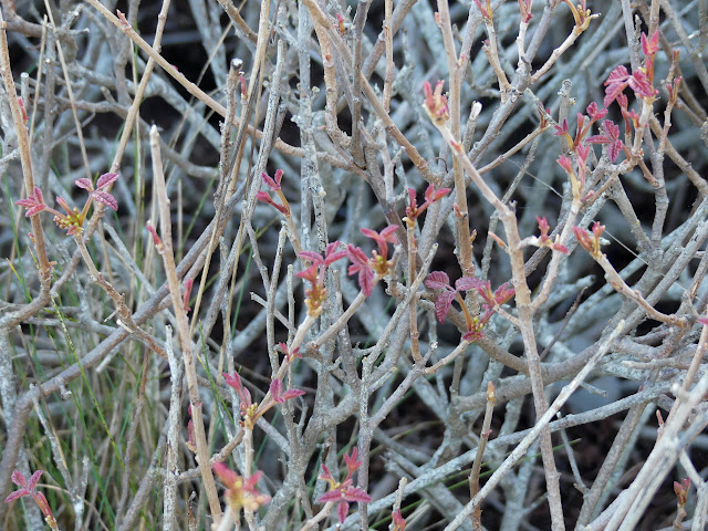
My first site selection makes me uncomfortable, but I'm not sure why. It's far enough from the waves and such. There's some nice bushes for wind break if any comes up and some random bush that hasn't got any leaves. Which is definitely poison oak. That'll be the problem. There's even a board set out for a seat by the fire, if one lights one in the ring, that is set to put half the occupants rubbing their backs into the bare twigs. Yikes. Besides the bare bushes just coming out with new leaves, there's also lots of new poison oak sprouts coming up where the rocky soil looks disturbed.
So onward a little more to something better and a little more exploring while getting water from the creek. There are spaces full of the stuff and some with none. Right beside the creek under some low trees, there are lots of camps and, for some reason, a broken surf board. I start thinking about stars I wouldn't see when I see those camps. Silly, since the moon is nearly full.


With my water, I can make supper and watch the sunset. Long after the sun has gone, the horizon remain red. The moon is slow to come up since it has to get above the mountains first, but the sky still seems bright by the time it does. There are few stars to see.

I feel like I won today. I couldn't have started much earlier because of the tides and I finished the ~9 miles planned well before sunset. I don't even feel that pained by the flat walking. This beach climbs and falls a little more than usual. I would generally want my site further from moving water so it is a little quieter, but this one will work. I watch a couple head lamps pass by in the dark. They aren't getting to see as much and there's more to see than I expected.
Continue to the next day ⇒
©2020 Valerie Norton
Written 24 Mar 2020
Liked this? Interesting? Click the three bars at the top left for the menu to read more or subscribe!


Comments