King Range: King Peak
King Range National Conservation Area (BLM)
DAY 1 | DAY 2 | DAY 3 | DAY 4 | DAY 5Click for map.
Today is peak day! First I've got to finish off my little bit of closed road walking. Although I expected it to freeze last night, there seemed to be warm air move in instead and the morning is warmer than the evening. There's better opportunities to see the view to the east and north. Eureka looks foggy. I think I had the single proper camp site along this 2.4 mile stretch of road. There was a mediocre pair a quarter mile short of my poking around to get to Hadley Peak, but there's really not a lot on offer up here.

The North Slide Peak Trailhead is easy to find. Its information sign is intact and tells me to fill in a permit from the box to overnight in the wilderness, so it's two years out of date. The permit box is gone. I even have a sign to tell me how far things are. It's going to be a short day, not even 8 miles. I think I'll stop by Miller Camp on the way. According to the sign, it's 4.0 miles to Miller Camp and 5.0 miles to King Peak. That's a lot closer than I thought and the distances being so similar makes me irrationally feel like I'll almost be to the peak once I get to the camp. (The map indicates 3.4 miles to the camp and 6.2 miles to the peak, but where would we be if mileage signs were accurate? Or even consistently wrong?)

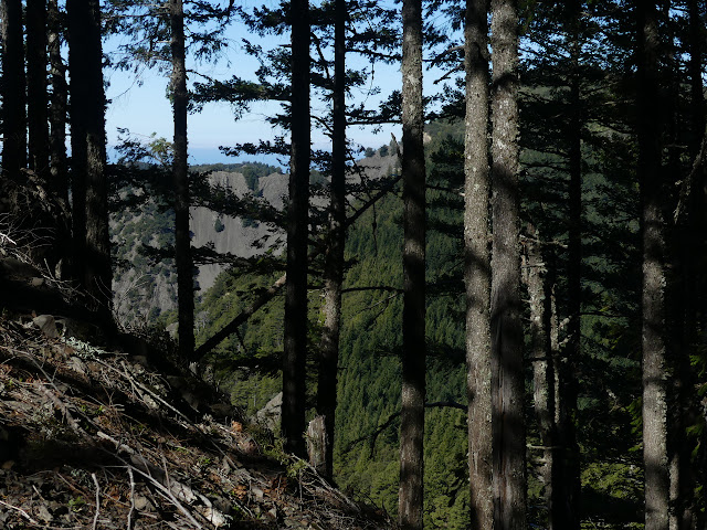
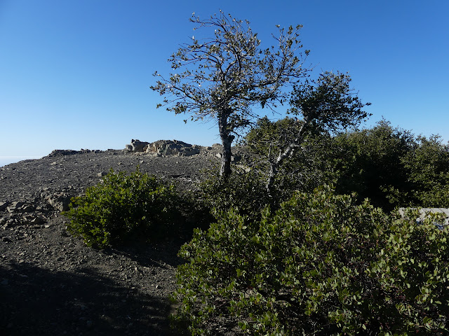
My experience yesterday with tough brush on the ridge lines has dampened my spirit for trying to tag North Slide Peak as I pass. It's just hundreds of feet, but I leave it. There's a bit of a desperation spot for sleeping just past the start of the trail, but still nothing of any quality. It's lovely to get to come out from under all the trees and out into the sun and properly see the verticality of the area.


The trail looks like a bulldozer cut it until it reaches a saddle. After that, it looks like something smaller might have cut it, but then it finds some rocky and steep stuff. After that, it is ordinary trail with a few spots that are getting uncomfortably narrow as it makes its way beneath the trees.


I'm still feeling like checking out the camp when I get to the junction for the loop. I miss a bit of ridge, but get a bit of variety. Springs and old growth too. It does mean an extra 840 feet down and up according to the guide portion of the map. (It also claims the King Crest Trail from North Slide Trailhead to King Peak includes 900 feet descent and 800 feet climb even though it is overall a 600 foot climb, not a 100 foot drop. The map can be a bit wrong too.)


The camp is, er, another debris flow. At some point some land slide or similar filled in the canyon so that it is flat at the bottom. It was a long time ago and there are some very large trees growing out of it. Old growth as promised. A sign next to the trail points up the canyon for the spring. I follow the trail back, but it doesn't get to any spring before becoming indistinct and leaving me with more thorns than I care for, but I think I can hear water. Exploring a little and making my way over a log almost as big as I am tall, I can't find anything but a bit of dry stream bed. Following that upward can be a good bet. There's not too many thorns in the creek bed and when there is an obstacle, there's trail around it, until I come to a long log with water dribbling at the far end. How to get there is a bit of a question.
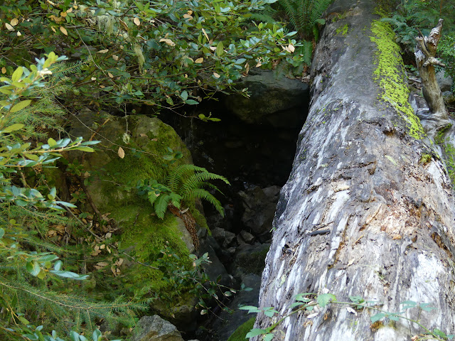
I want to grab a quart just to be sure, but how to get there is a problem. People clearly have walked the log. My second step on it slips and since the middle is crested and 20 feet in the air over rocks, I don't think I will. The thorns are like a wall to the left, but upon closer inspection, there is space through the thick growth to the right and under the log to get at it. Erosion seems weird on my way back. It looks like even in the fiercest of storms, the water sinks into the rocks before getting to the end of the flat area where the trail comes through.

There are only a couple sites right near the trail as near as I can see. I still haven't found any spring. It's more of an anti-spring. Still, got my water. It takes me a moment to figure out where the trail leaves for the other side of the loop and start to climb back out. The trail switches back by a big log. On the other side of it is the best camp site in the area, I think.

I keep on going up. Where I expect to find Bonus Spring is a leaning sign by a spur trail. It doesn't mention how far, but I can see it curving downward at not too absurd a tilt. It winds toward the crevasse of water flow, which is further than I want to go just at this moment. I'm done with my diversion. Now I'm climbing.


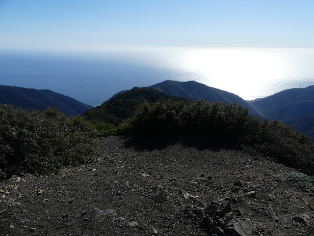
There's another marker at the top and an old note at the bottom of it. Apparently there was no water down there in December. I wonder if that's true or the person just didn't look hard enough. I stopped and listened to reassure myself I could hear water a couple times before actually coming onto it. My view is quickly more open than it was before along the ridge.


I hadn't expected to meet anyone up high, but there is a pair heading the other way on their way hiking the King Crest Trail out and back. Lots of ups and downs. I was warned it might be extra tiring, but I'm finding it quite nice to have ups and downs and ups some more.
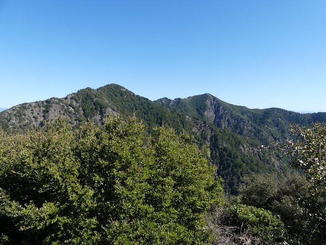
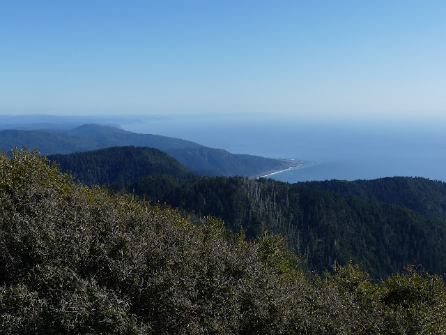
I follow the trail around to finally get to a junction down under little trees, and then head up. Not much longer and I'll be at the top of the Humboldt County prominence point.

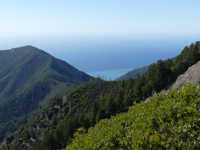
At the top! Cha cha cha. And time to get to drinking that little bit of extra water I grabbed at Miller Camp. It's been a little bit of a warm day. I'm distracted looking for a little bit, first, and then a lot after. It's a clear day with a little bit of haze and there's a lot out there.


I retrace my steps down. I'm camping by water tonight. None of this carrying the stuff up loads of feet. My legs still hurt from yesterday. I keep right along the next two junctions to come into Maple Camp. I'm not entirely certain there will be water. The guide portion of the map mentions it can dry up in summer and that river down there still looks like summer already. It is lovely to hear the sweet sound of it running as the trail levels out and warps around the hill to the camp.

I'm not too impressed with the camp. Actually, I can't even see the camp at first. Gradually, I notice little trails and flat spots. There's more than half a dozen flat spots starting just above where the water comes out of the ground. I'm a little annoyed that the camp is above the water, but it is what it is. I take one fairly high up where I can just hear the flow. Sometimes it just sounds like it is coming from above instead. Just for a moment. It's rather odd.

It's a bit dreary. The ground is grey and the tree trunks hardly offer any more color. Somewhere above, there's a little green, but this is all deeply into the side of the mountain and in shadow even with an hour of sunlight left in the day. An hour. What will I do with all that? I should have wandered a little more. Grabbed that very near North Slide Peak and poked my way over to Bonus Spring.
Continue to the next day ⇒
©2020 Valerie Norton
Written 28 Mar 2020
Liked this? Interesting? Click the three bars at the top left for the menu to read more or subscribe!


Comments