Hookton Slough Trail

Humboldt Bay National Wildlife Refuge


Click for map.

The second trail on Humboldt Bay National Wildlife Refuge has a parking lot on up the road, but they've closed the gate on that one too. Parking is a little harder to come by nearby, but I did manage to get off the pavement safely to give the trail a try. There's no long hike to get to it from the road.

closed gate on the trail parking
Another closed gate, but a lot closer to the regular trail parking.

yellow and white in the grass
Daffodils have joined the wild onions in bloom here.

The trail is nice and wide to keep that mandatory "social distancing" if there was anyone else here. The slough is along the right side and water puddles on the left. It is split off from the ocean by the dyke the trail follows, but is likely to be a little brackish. The ducks and herons and egrets seem to like that side better.
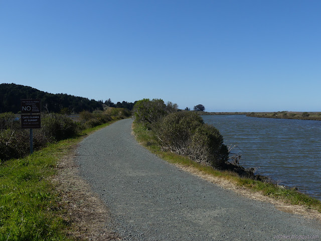
gravel trail wide enough to drive on
Some of that wide trail beside the slough.

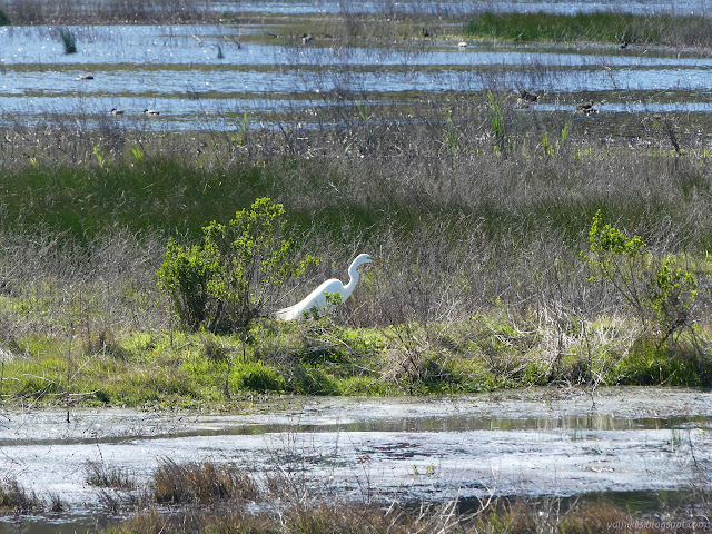
great egret with wispy feathers
Great egret stalking along some sort of dry land.


ramp to nowhere
At a little distance is the ramp to nowhere I walked up on the other hike to perch above Salmon Creek.

ducks landing
The ducks felt I was too close, so they moved a few feet along.

great tall things standing in the weeds
Great blue herons among the great egrets.

great blue heron tucked in tight
A great blue heron much closer than the rest. The wind is still blowing plenty of cold.

There are still a few birds out in the salty slough.

pair of female ducks
Some ducks paddling into the wind.

fluffy feathered swimme
Another swimmer in the not quite open water.

Teal Island edges
More views of the remnant of Teal Island. A boat ramp at the parking area allows folks to follow a set trail in the slough and around the island.

pools of water
An interesting look to these pools.

itchy faced godwit
A godwit stops for a scratch.

uncomfortable ducks
More uncomfortable ducks getting a little more space.

ducks with shovels for bills
The female shoveler is giving me a look.

As the trail winds to connect with the mainland, the edge begins to resemble a beach. Only the smallest waves ripple their way up the sand a few inches. The bay is well sheltered from the waves of the open ocean.

end of the trail at a gate
The end of the trail as it encounters private property connected with the mainland.

old fence marching into the bay
Someone fenced out into the bay at some point.

pink flowers
A bit of current near the gate at the end.

There seems to be a bit more sand as I head back. The tide must be going out. I see no difference in the water level on the other side.

hills behind Ferndale
A bit of a peak across the way.

heading back
More little peaks in the distance on turning back.

godwits in the mud
More godwits poking around the freshly uncovered mud.

godwits winging it
The godwits take flight sometimes, too.

goose egg eaten by something
I hadn't noticed the goose egg on the way out. It looks eaten rather than hatched. It's about as long as my finger.

beach with godwits on the island remnant too
There is beach around the remnant of island, too.

There's actually a pair out for a walk as I head back. The only folks I've seen, and they turn back and wander the boat launch a little rather than use the eight feet of trail. They still give me a little "hi" as I pass because proper hikers are social even if at a mandated distance.


©2020 Valerie Norton
Written 8 Apr 2020

Liked this? Interesting? Click the three bars at the top left for the menu to read more or subscribe!


Comments

popular posts:

Jennie Lakes: Belle Canyon and Rowell Meadow

California Coastal Trail - Arcata to Crescent City - hiking guide

Bluff Creek Historic Trail

Loleta Tunnel