King Range: Kinsey Ridge
King Range National Conservation Area (BLM)
DAY 1 | DAY 2 | DAY 3 | DAY 4 | DAY 5Click for map.
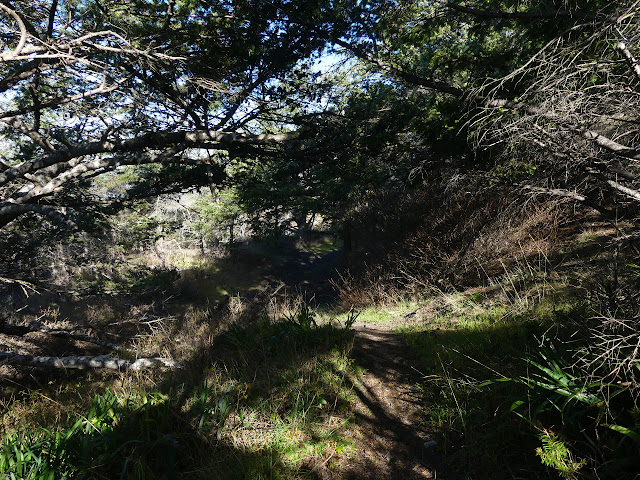
Going to be another sunny day over the water and I think I'll remember to put on my sunscreen even though I totally put it on already yesterday. I sometimes get a little too relaxed about sunscreen, but being on the beach does give a double dose of the high energy rays. There's no part of the trail that is restricted by tides, which is good because the low is still right around sunrise and sunset. The high is going to be higher than normal, so it'll be important to pay attention anyway. I guess it always is. Sneaker waves and all that.

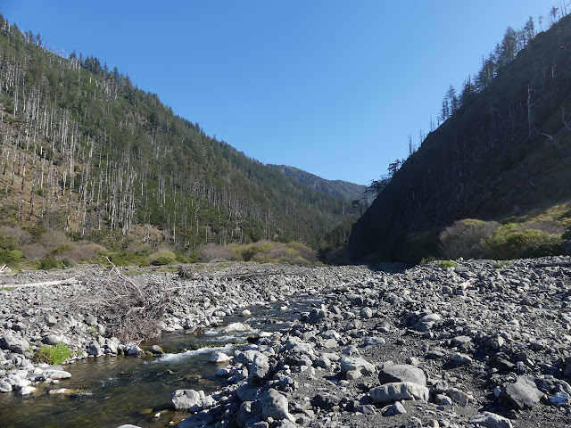
The morning is cool and soggy. It must have dropped below the dew point because my cheap little humidity gauge is reading 35.6°F and 98%. It is tempting to try to wait for the sun to hit. I'm packed up only a little before it the sun finds its way over the mountains anyway. Crossing Big Flat Creek is a mild challenge. It looks like I can just walk the sand near the waves, but the flow is just hiding behind more sand. Across a log? Thin and unstable, the water runs deep under it so I can't stabilize with my poles and I just make it harder to balance by trying. A most excellent example in how to fall in only marred by not actually doing so, I reflect from the far side.
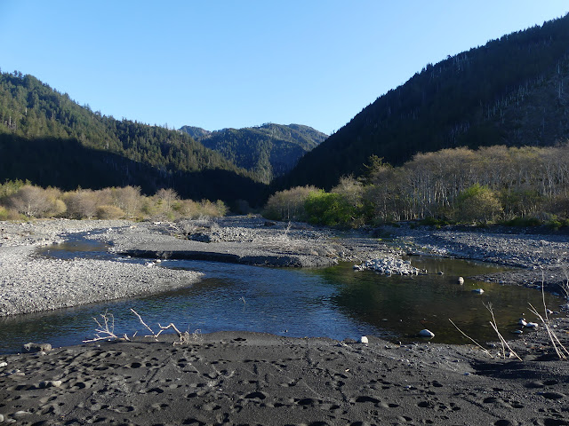
Trail climbs up onto Big Flat on the far side of the creek. There's more private property on this side, but it even includes an airstrip and a pair of buildings and a resident out gathering driftwood for firewood. I assume that is the only person who would be out here with a wheelbarrow and a 5 gallon bucket anyway. Deer are grazing today. I walk past more camp sites, one quite decorated with trash that has washed up. That falls under the category of random things people do, but what about the water faucet? I think it is probably at the edge of the property.


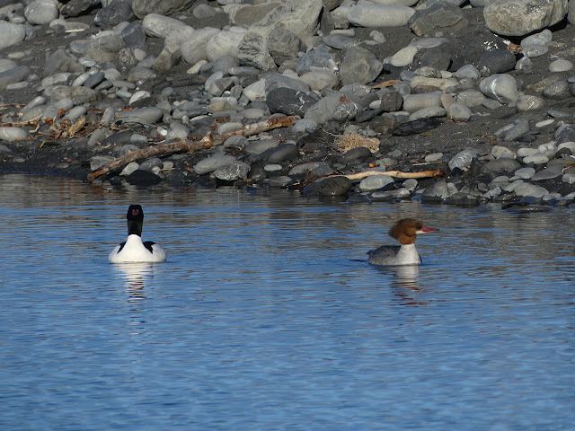
There's loads of animals around on the flat. As I look for a good photo of the turkeys, I can't help but notice that they're quickly getting bigger. Um...

And they're displaying a bit...
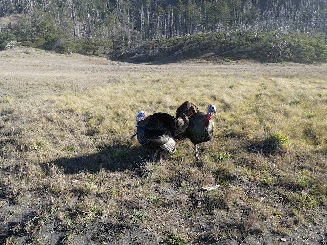
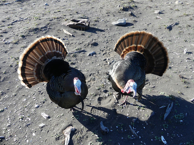
And they're pecking at me! Why are they attacking me? Arg! I'm forced to aim my poles at them, which just makes the aggression worse but does keep them a pole length away. I'm following a faint old road and am not going toward where they were, but still they're being highly aggressive. The road falls off the cliff ahead, but there is trail that winds up further. I head for the beach instead and as I hit the sand, the toms finally leave me alone.
I can get back onto the flat on the far side of the slide that took out the old road. There's more road there. It was even covered in gravel once. Sometimes I can see where it was cut again when the cliffs fell under it, but mostly it comes and goes. The trail makes a way around each.
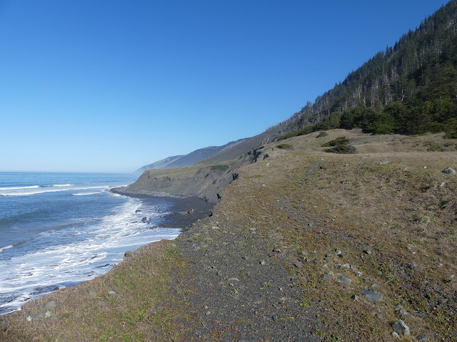


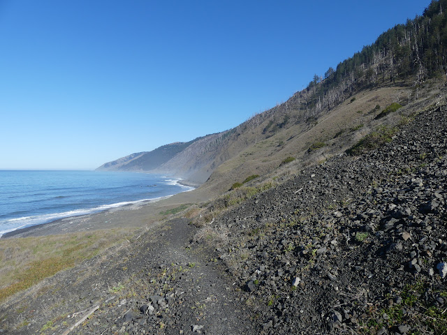
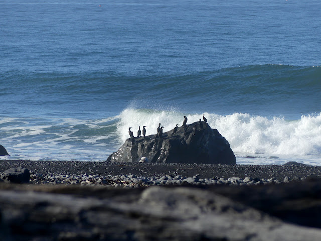
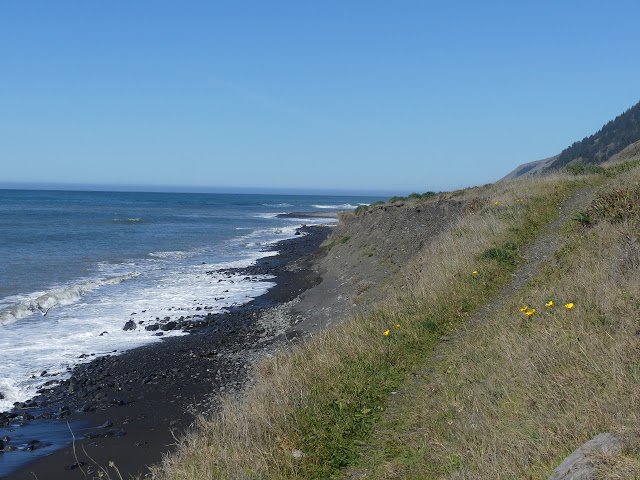
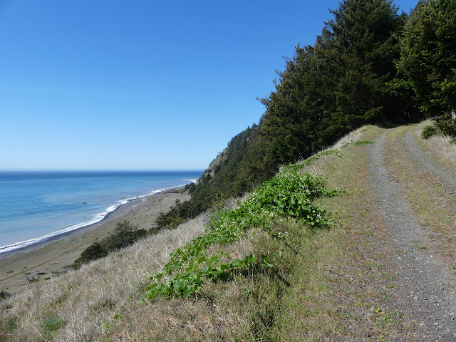
Down once more to the beach below as the flats end. The rocky beach looks like it is getting a little narrow with the rising tide, but I'm not the only one hiking it.

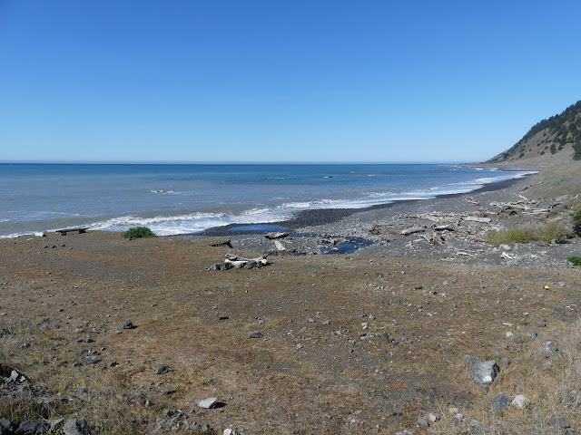
The beach seems to dip deep into the hills as I come to Big Creek. There's lots of camp sites and even some found wood structures around it and bear tracks. They aren't teasing about the bears and just being mean making us carry bear canisters. The bears are very much in the area.

After a little more beach, I scramble up a dirt path to once again have easy travel on a flat. The faint road is there again. I wonder how it used to go along that last section.
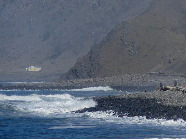
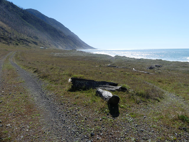
The road stops looking faint as I pass the house. It has a sign directing southbound traffic away from it and onto the beach, but had nothing like that for me. Do people generally go south? Every time I turn around, I am reminded that it's quite nice to be heading north. The sun really glares.
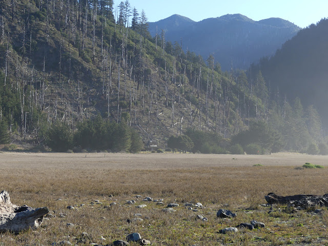
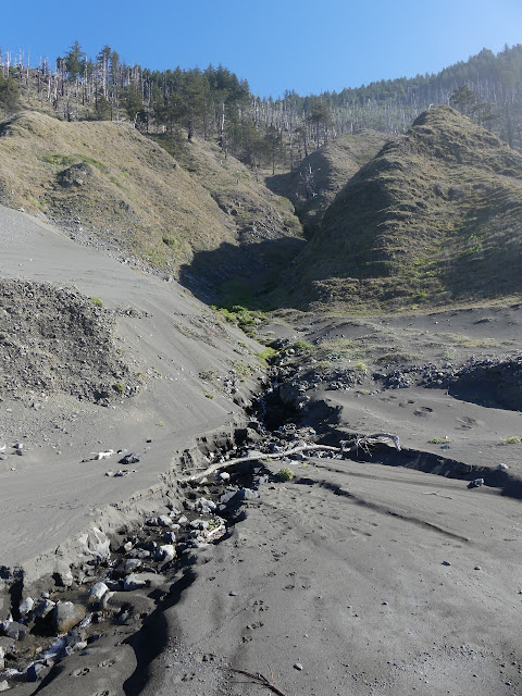
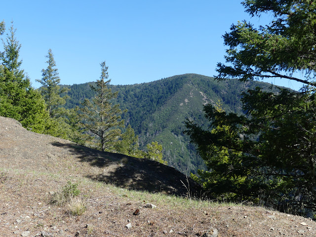
Kinsey Creek marks a decision point. I'm going up Kinsey Ridge in a quarter of a mile and will not see any water before a dry camp except maybe at Telegraph Spring. The spring is a mile out of my way and when I asked about it, all I got was, "Could be hard to find." Being most of the way up the 3000 feet I'm about to climb is really nice, but it will really have to be there.
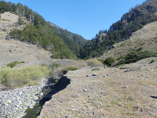

My pack is some 11-12 pounds heavier as I leave. Water for the rest of the day. Water for camping. Water for about another half day. It's starting to feel a little on the heavy side as I follow the road to the junction. It's road that climbs, too. The tire tracks make me think there's not going to be any big obstacles on the way up.

It's warm away from the water, but I soon have shade to walk in. As for obstacles... I notice something scraping away at the dirt a the side of the road ahead. It is very cute as its tail slowly rises with each scrape and then it adjusts and everything is low again and the trail rises absentmindedly again as it scrapes some more. The tail is like a giant flag as it rises. It's a big, fluffy thing with big white stipes right up the middle of black. It has clearly found some good grub and even as I make noise doesn't notice me.
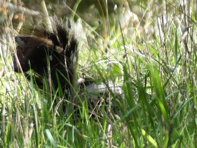
I creep along on the far side of the road against the dirt wall. Don't spray me. Please don't spray me. I'm almost past it when it finally notices and flattens to the ground, nose pointing my way. I decide not to point out to it that it is still very visible and take a couple more steps away and turn my back. That's what it was waiting for as it scampers down the hill. I look back to see the last of that tail vanishing into the green. Phew. It's just the turkeys that want to be vicious.

I'm slow going up with all the water. Maybe I should have packed lighter otherwise. There's a section of road that looks ready to cleave away. Big cracks are showing in the mountain side although they are smoothed over a little where the cars have rolled. There seems to be a ridge following trail and I'm getting bored of the road, so I try it. It isn't any good. At first, it is easy to travel across grass, but then it is choked with manzanita. There's some trail through it, but even that is gradually pushed to the side where there are steep slopes instead. I don't really want to travel on those, so I return to the road after all.
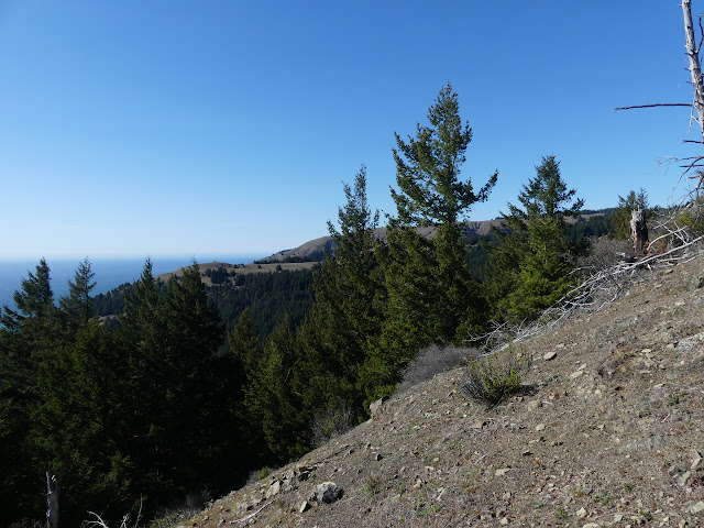


There's one last brief view of the beach below, right down Kinsey Creek to the bench I was sitting on beside it, before the road ends at Telegraph Ridge Road. After carrying all that water up, I'm not tempted to go check on it to see if the carry was unneeded.

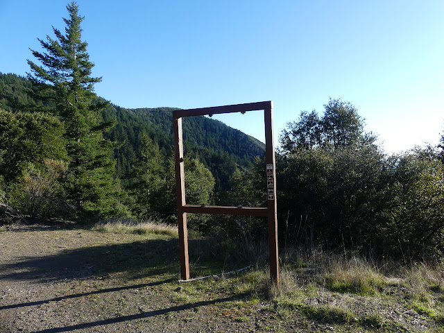
This public road, currently closed to general traffic, doesn't have very good signage for the "trail" I just came up. One is missing and another is down a hill and probably misplaced. I just turn and go. It looks to me like the ridge to Hadley Peak should offer a good site, so I aim for there. Do I want to try to grab the peak today or tomorrow?
There's not much to see besides road surrounded by skinny trees along the way to the ridge line. There's no dispersed camp there although it looks from the map to be a prime candidate for one. The little details have deterred folks for turning it into one. I follow a trail up around the south side slightly to see if there might be an open grassy space further on. That would work great. It just gets thick. I make a second try down the middle. Thicker. This is post fire regrowth madness. Oh! Cuts along a trail just to the north... which is far too old to be passable. So I won't tag it after all. If it will be this difficult to travel, it could take half a day even though it's less than a mile away. There is a dispersed camping spot a little further along by a marked elevation on the map. Heavy equipment flattened the area once upon a time. It's got a bit of view. It'll do.

I'm just short of 3000 feet higher than last night. As near as it was to freezing last night, it'll definitely freeze up here. I got my puffy pants. I'm ready for it.
Continue to the next day ⇒
©2020 Valerie Norton
Written 25 Mar 2020
Liked this? Interesting? Click the three bars at the top left for the menu to read more or subscribe!


Comments