Lacks Creek: Beaver Ridge
Lacks Creek Management Area (Aracata BLM)
(Map link. Purple line for day 1.)
DAY 1 | DAY 2 | DAY 3
It was again the day right after a bit of a rain, the second since the dry season, as I parked again at the main road junction at Lacks Creek. This time, I was packed up and ready to hang out for 2.5 days on the west side where the longer trails are. (The visit to the east side is here.) Finding information on these is difficult and someone at the Bureau of Land Management (BLM) is really bad at producing working links. (Many can just be edited. They've used an entire sentence as a link? Really? They do know the edit.blm.gov server isn't public facing, don't they? Some are utterly without relation to where they should be pointing.) The main page with summary information and directions can be found here. They do neglect to warn the casual planner that this area does not allow dispersed camping unlike most BLM areas. There are a number of official campsites on the map that must be utilized. The map is actually here. (That's the one the mountain bikers had and seems to be the most recent.) 'Tis the season for fire restrictions, so those can be found here. That banned everything including stoves. Oh, except that I'd noticed that the oldest press release visible on the Arcata Office page was about easing fire restrictions. That press release is very specific to the Lost Coast Trail, but with a little editing of the link, the actual order can be found and that refers to the entire region. [As of this writing, the fire restrictions are still listed incorrectly. Let's hope they're faster with updating when it becomes more restrictive. The fire prevention order and the termination of that order.] I ultimately decided to go stoveless out of laziness. That was the food my hands fell on first. I had been considering it anyway. So, after that introduction and link dump, on with the story.

It was sunny with low clouds clearing in the canyons below as I pulled my gear from the car. I've gotten a new pack for day hikes, but not actually tried it yet. It's even bigger than the last one at 33L, so I decided to try it for this little trip. Everything went right inside including an unnecessary tent, except at the last minute I decided to bring the puffy pants. There's a freeze warning for the deepest, darkest, most north facing-est places right now! (As severe weather warnings go, this is pretty minor.) It was looking pretty full, so I just tucked them into the compression straps on the side. I looked at the road and I looked at the decaying road with good use trail around the other side of the near peak and I decided that's the way. I could wander along, pop over a few feet to find the CROW benchmark, then catch the old roads that are the trails along the top of Beaver Ridge. This did have the advantage of getting in my 2nd biggest mistake right at the start.

There's a big area a short way up that has been used for target shooting. After that, it is much less used but still easy travel on foot. On the far side of the peak, another old road comes up from the current one. This goes over the top and down again, past a gate with a sign that it's not a public trail. I knew that south was private property. I failed to notice (and there was no indication) that as I followed the fence line west on the ridge road, it also passes into private property. It was still alright trail all the way to the benchmark.


After the benchmark, the old road following the fence line got difficult to follow. Surely there aren't enough benchmark hunters to keep up a path? I got to the mapped road that would get my onto Beaver Ridge, except where it splits to follow the ridge doesn't exist. It only doubles back. In comparing the BLM map (which is not georeferenced) with the USGS maps (which don't show much more recent Lacks Creek Management Area), I finally realized I was well outside the tan and into the grey and probably ought to just follow it as it doubled back. I probably got back into public lands about the time the road became a thin trail winding between wet trees that had reclaimed it a few decades ago. It was faint road again as it connected to the public road.


Just one vehicle in the parking area (and no one else sneakily parking at the top like I did) means not a lot of potential to bump into people on this mid-week trip. The information board contains a map that is a little older than the one where I parked, which is a little older than the one online. They show that the lower trails were getting built from the south to the north. I would expect one more connection to get built between prairies and this suggests that if I find trail on the north side, it'll go through to the south.

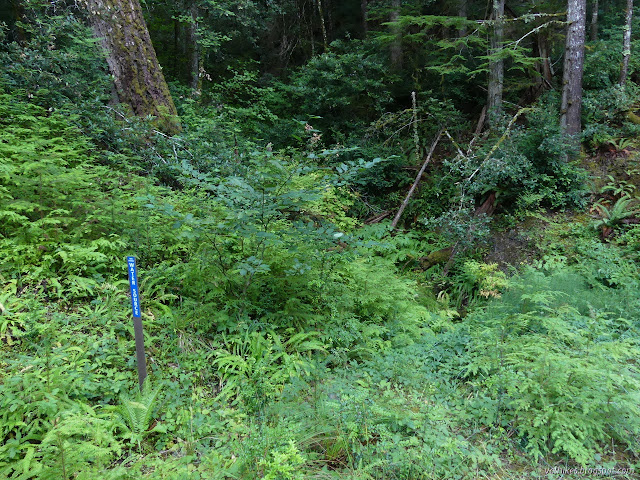
The trail is well established on old road. There are other old roads and sometimes it seems to leave these old tracks, but the correct direction is clear, at least for this initial stretch.


One person reviewing a circuit of the trails on the east side on MTBproject says whatever you do, don't go on the west side! Without any more information, I tend to assume that means it isn't all the gentle slopes favored by mountain bikers. After crossing Lacks Creek, there's a steep, but short, section they wouldn't like. Most climbs are quite easy. At this point, Lacks Creek is seasonal. The couple of rains have only been enough to leave a puddle below the trail. There is no water here, nor at the location marked on the map on the way.


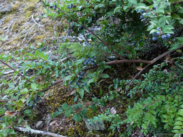
There were some trickles of water flowing already, but nothing quite like the water welling up out of the ground just above the trail near the second campsite on the map. (I saw no marker for the first site. Maybe it's aspirational.) Judging by the obvious cow path pounded into the service road, this has been a reliable water source for the summer. The maps on the information boards even go so far as to claim it is potable, but not all springs are. I passed a hunter on the way out, so I did meet the person with the truck. Forgotten about hunting season and was there in light blues and browns and greys. He said there were lots of big bears back there. Do people say this sort of thing to cause worry or excite? I mentioned I'd seen quite a lot of scat only, so far.


I had made it to the main portion of the trails, which are generally made up of service roads. They're well signed, so following Beaver Ridge was quite easy. Left past the trail (road) down to Faulkner Prairie and left again at Prairie Trail. I stopped to see what the next marked water source was and found a trough and sign, but no actual water. Onward and upward, the trail is directed off the road and into the trees. A masticator has been at work thinning them and it has made a mess of the trail. Happily, someone took the time to flag it in a nice, bright pink that was easy to follow to the next road. The trail was not well marked there, unless a big arrow of wood on the ground counts.


Continuing on, the junction with the spur to the next camp actually had a sign indicating mileages. I wanted to take the spur because it promised (and delivered) the only views over the Redwood Creek along these trails. Besides, the sign promised two water sources and a camp to check out.


There is no indication of where the campsite is meant to be except that it is the same distance as the second water source. So you are supposed to set up camp next to the stock pond? A road turns sharply and continues down and onto private land while another climbs. I climbed and found a couple spots up there I would use were I to camp in this area so long as the wind isn't too bad.

Back on the Beaver Ridge Trail, I found a few unsigned junctions where the trail might have gone off the largest road. It didn't. I passed junctions signed to go to Round Prairie and more water sources that were just little stock ponds. I was finally noticing that calling this trail a ridge trail is a bit of a misnomer. This ridge is well wooded and wouldn't offer the sorts of views I expect of a ridge trail, anyway.


On I went, past the road signed for Preston Prairie. There was a surprise with the water source after that. It is a stream flowing so well it is probably spring fed. It has pretty easy access. I wanted to camp at the next camp, which also looks to have a stream as the water source. I should have gotten water on the way. The spot beside the designated camp has no easy access and the stream was little more than a trickle. The camp was another looking unused.


It was less than 10 minutes to preferred stop time, but I decided to go on to the prairie. My legs were complaining I hadn't been walking enough. (They weren't lying.) The sign at the junction gave mileages to the water source, designated campsite, and Flyette Prairie. These were the only clues to find the camp or water. This is the only water source that was actually there but not marked.


I heard water flowing at one turn, but saw no trails going to it. I found the probable water source: another stock pond at the start of the prairie. Another tenth mile or so, there was a probable campsite with some evidence of use. I continued along the road, not entirely certain since things had been marked before, although the sign over a mile before could have been the marking. The road goes on, then there was trail along decaying road. It was certainly past the campsite. The mileage to the prairie and the campsite were the same and the prairie was behind me.


There were a bunch of ribbons at one point, and then frequent white ribbons with reflectors stuck on marking the way. The trail was good enough, even when it hit brambles. I kept on going expecting it would at least bring me to good water. I heard the water coming up. The trail gets poorer as it crosses a dry gully, but it wasn't too hard to cross. Then I heard the water flow behind me. It goes underground where it crosses the trail! I went back and chose upstream to scramble and find the water. It looked easier although it might be closer downstream. I found a big, lovely flow vanishing into the gravel, filled up all my dirty water bags, got them in the pack (implying those puffy pants could have been on the inside the whole time) and scrambled back. I did manage to find a sharp rock (in a stream bed) to catch a weak spot at the knee and put a hole in my trousers. But I had good water. I headed back to the probable designated campsite for the night with my haul.
As I entered the prairie, I heard a noise high in a tree. There had been a bear sitting up in the top of an oak, enjoying the evening. It was hauling downward. Once at camp, I found my other big mistake: the Kevlar rope was missing. I had no way of hanging my food. My private hope that there would be bear boxes anyway (in spite of what I'd seen on the other side) hadn't panned out either. Truthfully, there's no good trees to hang it in. Maybe that one the bear had been sitting in. I would just have to sleep with it. I know some people with some very strong feelings about sleeping with food. (Makes a great pillow, among other things. They're very pro.) The thing is, it's sort of defending your food with your life. I've also heard a few stories of people getting mauled accidentally as the bears went for, say, half a chocolate bar in a sleeping bag. The people for whom it didn't work might not be saying much about it now. That the bear I saw was noticed because it was running away does seem a good indication they won't approach me. I ate my cold dinner and set my cold breakfast to soaking before brushing my teeth looking at the stars (a little thing I miss so much when having an inside available) and tucking in cowboy style. Hey, it's not supposed to rain at any point in this trip.
On to the next day ⇒
*photo album*
©2021 Valerie Norton
Written 14 Oct 2021
Liked this? Interesting? Click the three bars at the top left for the menu to read more or subscribe!


Comments