Lacks Mountain and Stormy Saddle
Lacks Creek Management Area, BLM
(Map link.)
Lacks Creek seems to come in two sections. The east side has been developed for mountain bikes and the west side is oriented toward horses. Hikers are allowed on all but two of the mountain bike trails. The best map I found of the area is hosted by the local mountain bikers who continue to maintain (and develop) trails on the east side. My original plan was to day hike the mountain bike side, then two days backpacking on the horse side. As it turns out, Things got in the way of being sure I would be able to do the backpack, but at least I got to see if I would be driving the last 1.6 miles to the west side trailhead in a Scion. (The answer is "no" and I do wonder about the logistics of taking a horse trailer down a narrow single lane 4x4 road. It actually might be smooth enough, but unwise without knowing for sure and the prior two days of rain left some impressive puddles in the first 100 feet.) It was still quite cool as I arrived, but Willow Creek (3000 feet lower) was expecting to get up a little past 80°F. The National Weather Service spot forecast for Pine Ridge was predicting about 20F° lower, which seems an unusually large drop for the elevation difference.
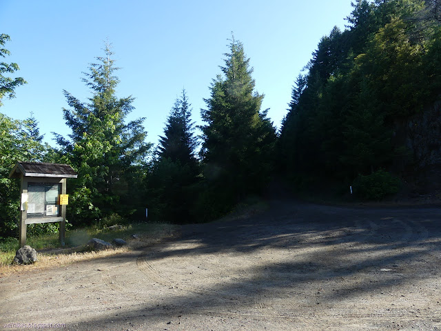
I started up Pine Ridge Road on the right. I could easily drive it, but the plan was a loop that would take me past the information board, so there would be no gain in doing so. I chugged up the first near mile to the first camp site (camping is only allowed in the designated sites) and trailheads.
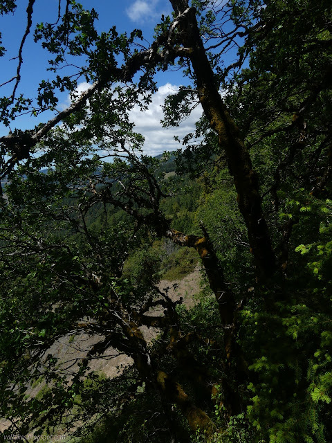
I walked around the site as it was occupied with someone packing up to leave, then started up the right trail up Lacks Mountain. Got to bag that peak, even if it won't be the high point of the day. As expected, the trail makes a very easy climb upward, seeming more interested in getting miles than getting somewhere.


I almost missed the mountain top. The mountain bikes certainly aren't bothering with it much, but someone put a log seat with some feet up there, and before that someone put a benchmark up there. It may have been clearer from logging in 1942 when that happened. I headed down the other way, which is clearly the preferred downhill for the bikes too. They've been rounding off the corners a bit. The old logging roads were clear in places as I made the long, slow way back to the now empty camp site.

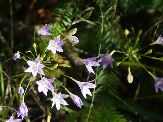
I didn't quite make it to the camp site because I wanted to take Punchbowl as an alternative to road walking. It is a loop, and I chose the longer part further from the road. This seems to be the only beginner rated trail, although I didn't see any reason to rate Lacks Mountain harder than it. It strays through a shallow valley before returning to the road via a connector marked "parking".

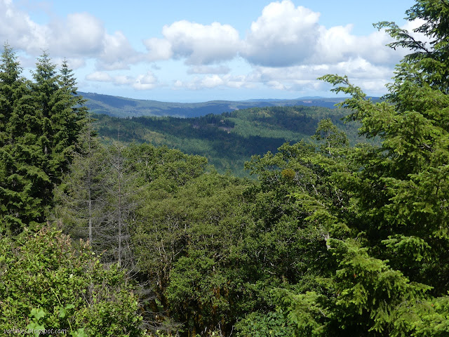
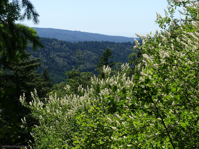
My alternate to road walking was all too soon exhausted, so I was on the road until the next junction. There, I found an opportunity for citizen science. "Help keep a record of nature," say various signs that also identify the nearby plant and show examples of the simple record they are looking for. Then I broke away from the road onto Tomfoolery, or really one of the two connectors. It got me some views over Lacks Creek and the ocean beyond before I continued up the other connector. The downhill was for later.
That brought me to the main staging area for the mountain bikes. There is a toilet and a map with details about the trails on the east side. I decided to take a spin around the runaround hoping there might be a view spot for the east. Unfortunately, it was true to its name and just meandered through the trees. While the junctions at the road are generally well marked, the ones within often aren't and I think I got onto the mountain bike only Hot Lap for a short way on the way back. At least I was going the correct direction?

I cut over to the road at the northernmost part of the trail and continued along it. (Trail for the way back.) I did get an easterly view from it, and was less disappointed about not having one on the Runaround once I saw it.


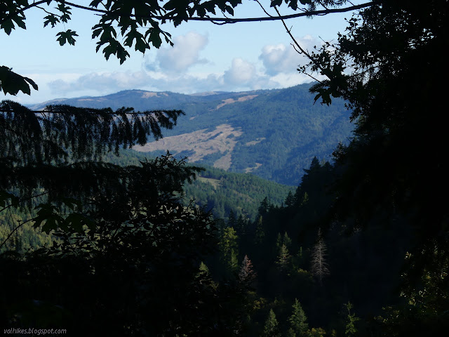
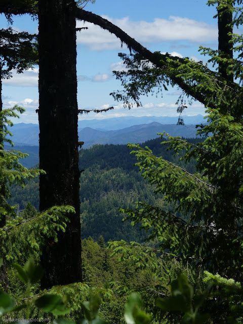
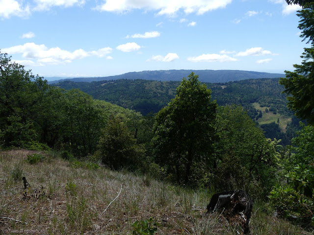
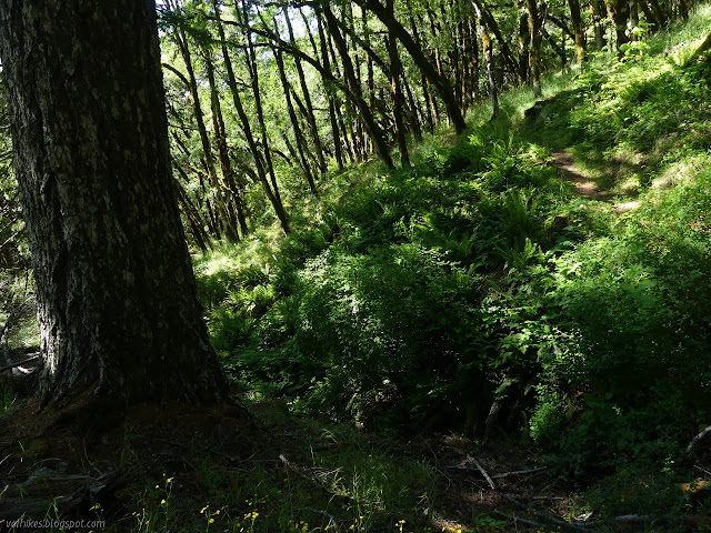
After the disappointing Runaround and later eastern view, I was debating skipping Stormy Saddle. That would have been a pity. At the junction, a sign pointed up a side road to get to the trail and left the actual trail without any markings. I turned for the trail anyway. It winds a little in the trees and isn't much until after crossing that side road. From there, it gets into some dry prairie and views to the west.


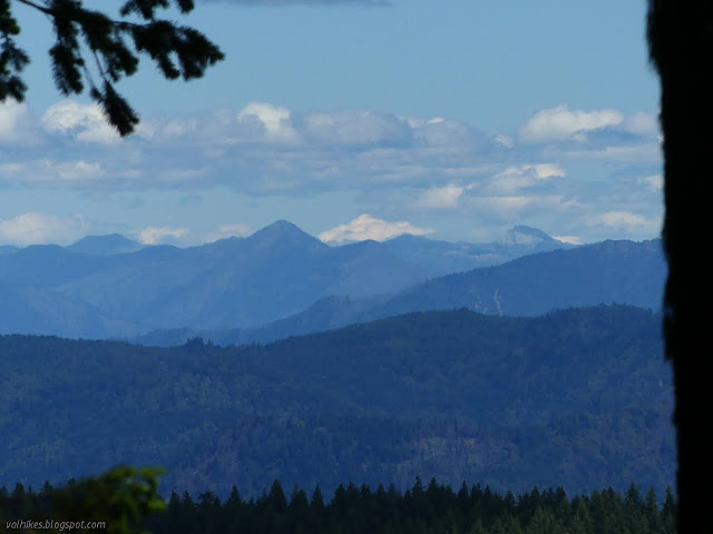
Then the trail wrapped around to look out over the northeast. I had passed a ridge and there was a lot more to see out that way. Probably not Shasta. That was just a pointy cloud and I couldn't find it again as much as I tried once I reached the top. This is a top the mountain bikers do bother to stop at and there's a much larger bench in better repair to rest upon.

There weren't a lot more views as I wound my way back down to the next trailhead on the side road. Then I headed back on the road and another quarter mile further on the main road for a viewpoint. It's not that I knew about the viewpoint, but there was a geocache just a little past it that I was actually searching for.


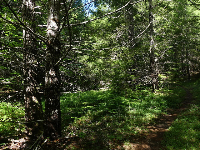
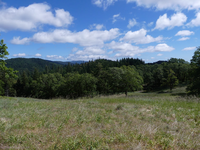
I turned back and this time grabbed the Pine Ridge Trail. I passed a pair of mountain bikers, the only ones I saw all day. They registered some surprise on the first pass. The trail climbs up in the trees, then wanders through some little prairies up high and on the way down. The humidity must have dropped because the far off buzz of chainsaws quit for the rest of the day.


Almost back to the main mountain bike staging area, I stayed on trail to the downturn of Tomfoolery and then turned down. It's a long, easy downhill. Unlike some mountain bike trails, I did actually know I was going downhill.

Halfway down, I found my eyes wandering up a particularly tall pine and realized I was looking at a long lightning scar. Lightning strikes in all the places. Continuing down, I wandered through prairies with more view than I had expected for getting down into the canyon.


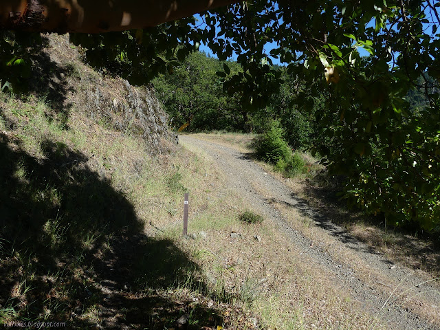
The trail seemed to find a patch of old road, then found the current road. I only had the walk up the road left. It actually drops a little first. This 4x4 road could be done in a car except the low point and another spot where water crosses have the potential to be difficult. The bottom of chutes is unmarked, but rather obvious.

The area might work better as a bunch of short hikes, with Stormy Saddle being particularly nice. It made an okay long hike, too.
I found a tick trying to make a meal of me and a second crawling and plotting at the end of the day even though I had only seen one during the hike. I've had a couple of hikes with hundreds of ticks, none of which bit me, and now I've had multiple ticks bite in the same year. I'm not keen on it. There's something about the legs sticking out and the diseases they carry that get to me. So, here are some podcasts on the diseases ticks carry. Most of them are on Lyme. This Podcast Will Kill You have done both Lyme and Rocky Mountain spotted fever. Disease Ecology on Lyme disease. NPR has a whole series on Lyme disease.
Some random pieces of information:
©2021 Valerie Norton
Written 2 Jul 2021
Some random pieces of information:
- Removal is recommended using the sharpest tweezers you can get hold of and grabbing as close to the skin as possible, then giving a quick, determined pull upward. This isn't the motion that was promoted by the tick key I used, which was of a typical design. You won't "leave the head in". (I'm sure you could squeeze so hard, it gets left, but the typical break point between the barbed mouth piece and the rest of the tick is that mouth piece. If that's left in, it's like having a tiny splinter and isn't a worry.)
- They glue themselves on, so there's a little to pull against.
- They have a bit of an anesthetic to help you not notice.
- The pathogen lives in the midgut and have to move upward (triggered by the feeding) in the system to get spit out in the final stages of feeding.
- The blue bellied western fence lizard are a bit of a double edged sword. Sure, they have a protein in their blood that kills the pathogen for Lyme, but they are such a good host for ticks that the absolute number of infected ticks may increase even though the percentage goes down.
- Here in the west, some areas have as much as 25% infected (Lyme) ticks.
- The bulls eye rash (rash with central clearing, typically not painful or itchy (and I thought itchy was part of the definition of a rash)) occurs in ~80% of cases. It often occurs at the site, but can be anywhere. Common places are the backs of the knees or the groin area. In untreated cases, it can come back repeatedly.
- Tick larve only have 6 legs. The last pair pops out in the first molt.
- Ticks cannot pass on Lyme to their offspring. They can pass on Rocky Mountain spotted fever, but the particularly bad kind (there's more than one) has adverse affects on reproduction in the ticks, so that's a less likely propagation method.
©2021 Valerie Norton
Written 2 Jul 2021
Liked this? Interesting? Click the three bars at the top left for the menu to read more or subscribe!


Comments