Look Prairie and Peavine Ridge
Humboldt Redwoods State Park
Click for map in new tab.
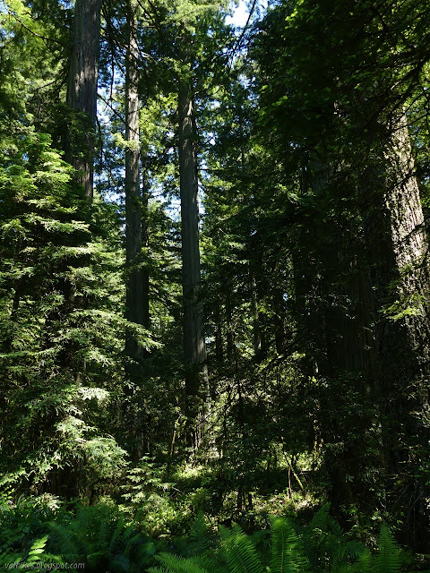
I should probably visit Humboldt Redwoods more often. It's actually a little closer than Del Norte Coast Redwoods. It does suffer a little from being "inland", but it's a place the redwoods like, so the summer temperatures can't be all bad. It also has a minor $8 day use fee, but even that only applies to developed parking. I decided to believe the weather-machine somewhat that it would be cool in the park, but hedged a bit by bringing more water than would be reasonable. This hike that climbs the ridge is bound to be a bit hotter than down under big trees by the river. I think it was already topping the claimed high for the day as I pulled into the unimproved dirt turnout parking at the bottom of Look Prairie Road with a couple of mountain bikers.

They got going just ahead of me and I didn't see them again until near the top when they were coming back down. The trail starts off in redwoods, but then just edges them and crosses through Luke Prairie and Look Prairie, running upward, for long enough to make me worried it would be all prairie. That's nice, so long as it's not hot, but it was at least thinking about being hot.
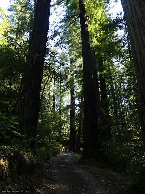


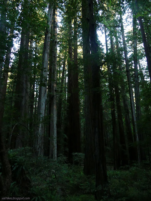
The road found some more trees, many of them redwoods, to climb the rest of the way up. A high pitched whine behind me heralded the arrival of another pair of mountain bikers, but these on cheaters. Although not going down, they still insisted on telling me I was "almost there".

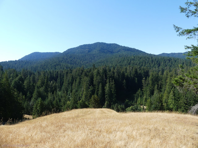
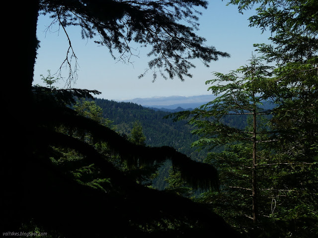
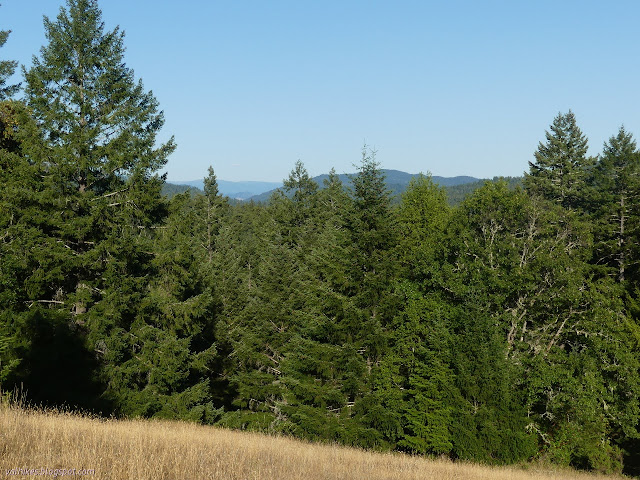
I did get there, so long as "there" is the junction with Peavine MUT. That's not quite the end of where I wanted to go. I had aspirations of wandering the 1.9 miles east along Peavine to the end (at least for the public) to see if I could partake in the view suggested by Redwood Hikes, so started that way.
That aspiration didn't last long as I kept passing through big, sunny breaks and it seemed hotter along that bit of ridge than it had seemed coming up. I looked at how many feet I would lose to get to the end and concluded it was roughly too much, so turned around and climbed back to the junction and then on to the hike's high point, about 1000 feet higher than the view point. Any extra energy would be better spent on a spur trail to a grave site near the end instead.


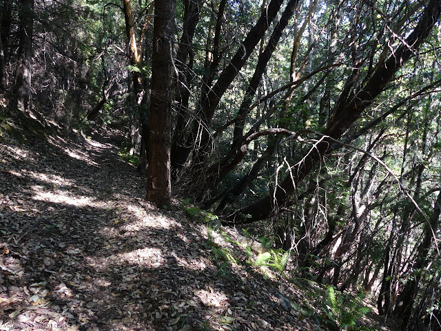
The MUT traverses the space roughly along the boundary between state park and timber company. It alternates between areas that are scruffy and cut and those that are stately and old. There are plenty of stumps on the park side, which may explain the profusion of markers along the edge. More likely, it's historic. Unfortunately, there were no longer great swaths of pristine forest to become parks. Less than 5% of the original trees remain, but if we can hold on for a bunch of hundreds of years, there can be great swatchs again. Mortality being what it is, I enjoyed what there was and took in the views that often, but not always, were helped out by cuts.


At Thorton MUT, I checked my water and decided I probably had enough to go down the long way. Then I checked my time and decided to stick with the shorter way. It's still surprisingly long, according to the sign. None of my maps were suggesting why. They, including a recently downloaded state park map, didn't show the correct trail route. Much of it has been rerouted to a shallower grade. It follows a lot of old road beds, but none of them are still being used, so resembles single track quite often.


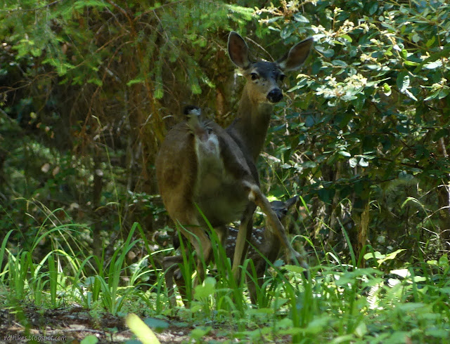
I ran out of water shortly before the horse trough. Yes, that water that I had checked not too long before. My shiny new Hoser 3L didn't quite hold enough for the hike and the heat. I hadn't brought my filter (Where would I find water on a ridge? Besides near where the deer were?) and was still well hydrated, so I didn't partake in the horse trough. I did start to wonder just how long it would take to get down. The trail gets a little more determined to lose elevation shortly past the trough, so not all that much longer.


I came to a mystery junction. The others had been well signed and one random disused road coming from the private side had even had signs, but not this junction down near the road. I suspect right (southwest) is the official way, but I went left reasoning it would be more likely to take me past a spigot in the nearby campground. It did, but first it got really steep past the supply for that spigot. I did partake in that spigot, for a glorious dose of pungent chlorine. There are three trail choices for getting back to where I was parked in addition to the road the bikes are forced to take. I found them poorly signed as they left the campground, but managed to correctly take the Homestead Trail, which is the only choice that doesn't require crossing the road.
As I passed the well signed junction for the Addie Johnson Trail, I decided against hiking up it to the old grave site after all. The big loop was enough for the day.
*photo album*
©2021 Valerie Norton
Written 11 Jul 2021
Liked this? Interesting? Click the three bars at the top left for the menu to read more or subscribe!


Comments
The original acquisitions for the state park were focused on the groves along the rivers and Bull Cr. Even at the times of the first acquisitions, and the addition of the Rockefeller Forest, there had been a lot of cutting in the area of the current state park. We have to remember that's what prompted the founding of the Save-the-Redwoods League in the first place. It wasn't until after the 1964 flood carried away hundreds of old growth trees that efforts begain to buy up complete watersheds.
When I click on your loop, I see it was 14.7 miles. Quite a hike. The switchbacks on your return route seem excessively long and gentle. IMHO we see this kind of overkill too much with reroutings. But I get it that keeping grades gentle is deemed necessary when building "multiuse" trails, to keep down erosion problems. Another reason to grumble about mountain bikes. We need to keep some of the horse and hiking trails as horse and hiking trails.