Rhododendron Trail, CREA Trail, and West Ridge Trail loop
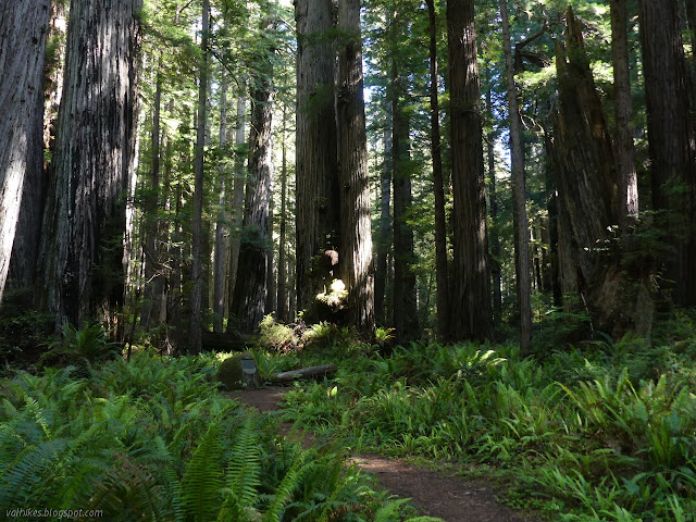
Prairie Creek Redwoods State Park
(Map link.)
Is it too late for the Eastside Rhododendrons? Or still too early? I don't think they like these dryer winters. Nothing has looked happy yet, unless it's on a forest edge and might be getting watered. It is getting late, though, so I thought I might go off to see them, then I thought I'd take a shorter drive to maybe be disappointed and went for the Rhododendron Trail instead. I decided on a route that would get me on a trail or two I hadn't hiked while hitting the north portion of the Rhododendron Trail, then got myself to a trailhead. There is a level of guesswork in finding trailheads in Prairie Creek. They have very nice signs, but the ones you can see while driving are generic warnings that there is a trailhead in 500 feet and there may be pedestrians crossing. I was aiming at the north part of the loop, but landed at the south side. I didn't feel strongly enough about it to move, but did flip my direction from clockwise to counter-clockwise.

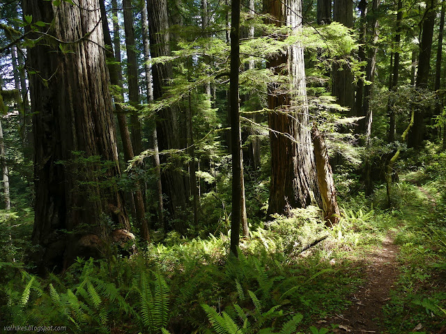
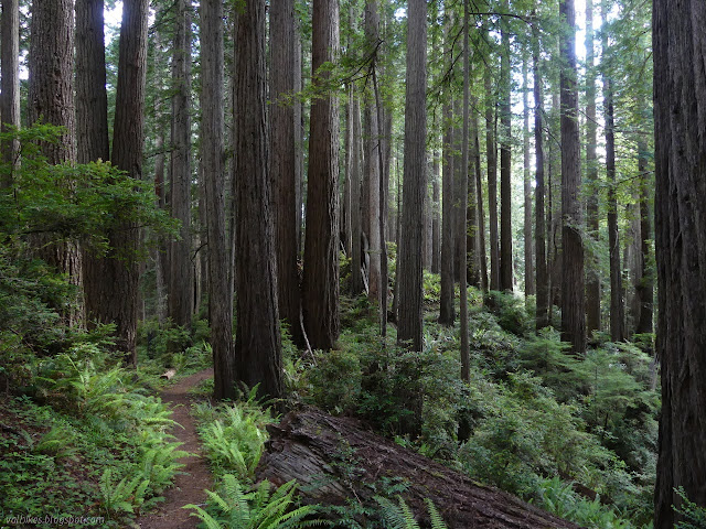
I wasn't sure how far I was planning to hike because the brochure only lists the distances for full trails and my plan had some partial trails. The detailed trail sign at the trailhead has mileages for the closer trails as well as an "easy walk" and "longer hike" suggestion. It didn't help better my approximation. About 12 miles? There were plenty of hours of sunlight for it, whatever it was. I started up Brown Creek, which gave the impression of a creek coming in from the left, then wandered off right.

There is a junction with Foothill Trail, which I had forgotten about, then for South Fork Trail, which I had remembered. Taking it would mean getting more Rhododendron Trail for an extra mile or less, but I was feeling more interested in the Brown Creek Trail. I kept left and crossed over the bridge and followed the trail as it backtracked then started a very gentle climb.


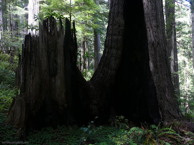
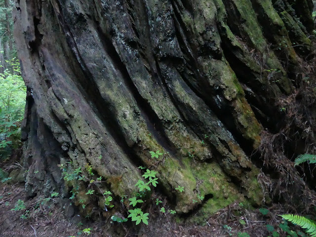
The easy hike suggested on the starting sign is up the Brown Creek Trail to a side loop trail in the Carl Schenck Grove. The way there is extraordinarily flat. I expected a sign to point the way at the junction, but the bridge makes it hard to miss and the plaques around the place identify it well enough. Schenck was the third trained forester in the country and opened the first (by a month) American school of forestry. I crossed the bridge to see the grove.


I found the second, larger loop to be partly blocked by a large, fallen tree. Many have scrambled under it, but that wasn't something I wanted to do when getting started on a long hike. I turned back and completed the smaller loop before starting up Brown Creek Trail once more. I quickly came upon a grove dedicated to Frederick Law Olmsted. Not advertised as part of the easy hike, but I would highly recommend getting that far if the easy hike is your goal and you have a little extra time and energy for more rather flat hiking.

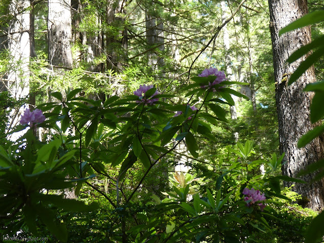
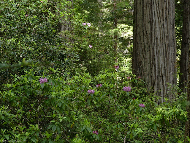
After the grove, the trail starts some mildly steeper climbing. I found the first blooming rhododendron just short of the junction with the rhododendron trail.


I had forgotten about the catastrophe that had befallen the sign at the junction between Brown Creek Trail and Rhododendron Trail. Poor little sign. There is a memorial trail near the junction with a warning sign that it doesn't go through anywhere. This apparently includes not going through another tree that has been down a lot longer than the one at the junction. I could barely find the trail to the barrier and couldn't find it past and still hadn't found any memorial indications. I turned back and started northerly along Rhododendron Trail.


I skipped the CREA Trail (stands for California Real Estate Association, but I tried not to dwell on that) the first time past. This time, I decided to go for it. I expected more rhododendrons along it, and more there were. It shows a little less use than the other trail, but still easy to follow.


The trail hits a top and goes down. I dithered a bit about actually going down and having to come back up, but managed to make it all the way to the end. The edge of the old grown is extremely noticeable as it approaches US-101.


The opening next to the freeway is marked by a lot of ribbons and absolutely no parking. I'm not sure who the ribbon are for, but I think people hike some of the old roads on this side of the park. Somebody likes to have it marked. I turned back to climb the few hundred feet back up and over. On the way, I pondered the marked groves, one indicating there was half a mile of trail. I could see something faint and overgrown with huckleberry to a small downed tree, then nothing.


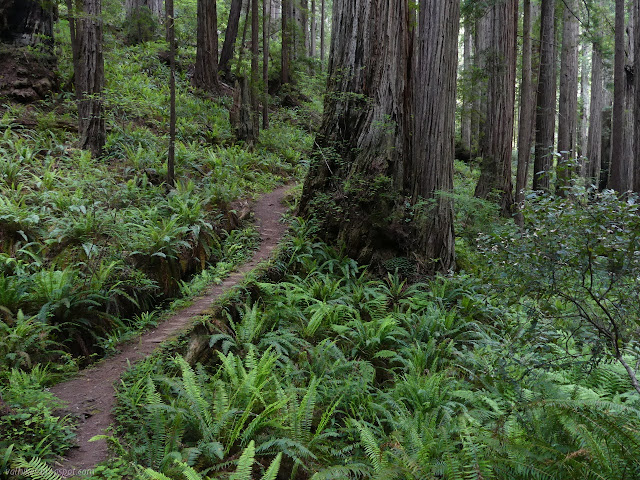
I made it back to the Rhododendron Trail and proceeded along it. There is some more up before it drops down to the road.


Arriving at the trailhead, I cross over the former highway carefully. The speed limit is still 45MPH and the sightlines not all that long. I started up the north Prairie Creek Trailhead, but was determined to walk the ridge back rather than the creek. I took that quick turn for Zigzag #2 and started to climb.


I have hiked West Ridge Trail north of Zigzag #2, but not south. I turned south to see more of the ridge, which I have found pleasant in the other areas. Well, except that patch of logged trees. It doesn't have one of those going south. It rather gently rolls as it goes. I thought I'd see more rhododendrons, but I didn't.

I got to Zigzag #1 and turned down. It has a flat spot in the middle to rest the knees.

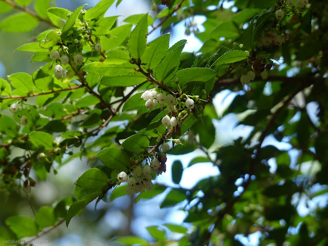
Back down along Prairie Creek Trail, I was rather happy to be in long sleeves and trousers. It is a bit overgrown and some of that stuff has spines. I tried some salmonberries along the way, but found them somewhat lacking in taste.


Back at the start, I was a little disappointed with the rhododendrons. Most of them were not displaying in the fullness that I hoped to see. Perhaps I have too great expectations. There still were plenty of mighty, massive flowers on the tall shrubs.
Liked this? Interesting? Click the three bars at the top left for the menu to read more or subscribe!


Comments
I don't know how you manage to provide us with so many of these detailed journals, but please keep them coming!!