Loveland Pass to some westerly peaks
Arapaho National Forest
Click for map.
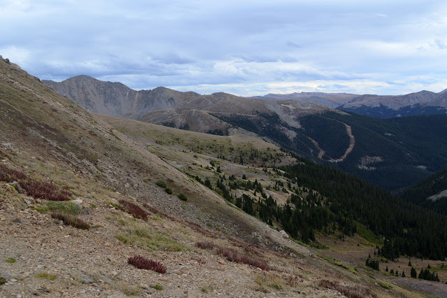
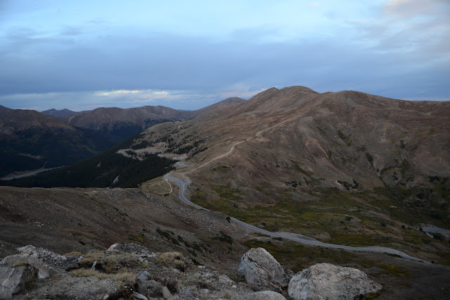
I may have claimed a few hours before that I would not get to go up any peaks in the Rockies, but there was an accident ahead blocking the tunnel on I-70 and the four lanes that feed the two lanes were turning into a parking lot. I decided to show that I could read and take the alternate route suggested. I wasn't sure I was in good company after watching someone take the sharp corner to exit via the entrance, but so it goes. Once at 10 feet short of 12k on the Continental Divide, it was too much to pass up the chance for an evening stroll. Parking is marked 7AM to 7PM, at least on some of the signs, but I suspect no one will bug me while it is still light. The peaks to the east look quite impressive. (They should. There are a couple 14k peaks over there.) The peaks to the west look a little closer at hand so better with only a couple hours to dark.

There are no signs regarding hiking in the area, but the first few peaks are well trod. Obviously it is a done thing. It does look slightly official right at the start, but I turn to follow the huge track along the ridges instead. I may not need to go anywhere to get a view, the treeline is below the start, but I am going up anyway. Up! And feeling like I might have gained 10k feet today, mostly in the last couple hours.

My turn just serves to add a little up and down to my trek as it rejoins the other trail on the far side of the first bump. Still, I can see a big track leading up a more distant, higher bump, so onward to the real up. Up! Up! Edging around some bump off to the left and climbing to a higher saddle first.


The saddle comes with new views down the Pacific side of the Continental Divide. It also comes with wind. What was quite comfortable for hiking is becoming a little chilly. It is still fine for climbing, even the gentle one ahead.


The trail sticks very close to the divide as it goes on. The wind, well, it is blustery and chill but not particularly bad. It can be of a level to knock one right off the edge, so today is quite nice.


The peak the track comes to is a little indistinct with a couple possible high points. Over the far side, another ski area becomes visible. Denver and the surrounding areas have a lot of places to play in the winter up here. They take advantage of the summer, too, and the traffic on either side of the weekend can get to be a bit much.

The wind may have picked up a little. It is definitely getting colder. I go for my windbreaker but soon think I might have wanted to go all the way for the puffy jacket. The windbreaker does not quite take on the stiff wind, but there are enough still areas that I do not cool off too much while walking back. There is still a little light, so I follow the thinner trail up the peak that the main trail skips. This one is actually higher as it overlooks another pair of ponds by the road far below.


It is fun to be up on the peak. It is not so windy as some of the ridge line. The light is getting red and I am already overstaying my parking time, so I have to turn back. The trails to this peak thin and vanish away from anything that concentrates walkers, so I just make my own way, walking in a direction that makes a bit of sense.

The dips and rock collections make it so it may have been easier to follow the route back to the original high saddle. Even that trail thins and vanishes in places. I am back on the main trail without incident anyway. Here, the air is nearly still, but it is cool enough that I do finally pull on that real jacket as soon as I reach the car.
*photo album*
©2018 Valerie Norton
Posted 6 September 2018
Liked this? Interesting? Click the three bars at the top left for the menu to read more or subscribe!


Comments