Pine Mountain, Dawson Peak, Wright Mountain
San Bernardino National Forest
San Gabriel Mountains National Monument
Click for map.
I seem to be on some sort of kick to climb a bunch more Hundred Peaks Section listed peaks. I signed up for an official outing to climb three peaks clustered north of Mount San Antonio, better known as Baldy. The section will let anyone come along, free of charge, although they do like to know something about you for the harder hikes so it is best to sign up for something easy first. This one mentions some "loose and exposed Class 2 terrain" as a reason it is "not for beginners", so probably counts as a harder hike. But they know me by now. At some point years ago, I had taken note of Pine Mountain, the North Backbone Trail that crosses it, and the Blue Ridge Road and put them in the list of things I wanted to experience, so an outing doing Pine Mountain and a few others seems like a perfect way to do it. Meeting at the turn to Blue Ridge at 6:30AM to beat the heat a little is just early enough to find a parking spot before if fills with photographers trying to get pictures of the runners 9.4 miles into the Angeles Crest 100, which seems to be today. It runs 100.2 miles from Wrightwood to Pasadena along the crest. We spot the first one before heading down the road. The Pacific Crest Trail, which is the race course along here, crosses the road repeatedly making the drive to the trailhead slightly challenging.


There are 22 total, participants and leaders, today. Kind of a lot, but it is all on trail. Well, for certain values of trail. Why did I put the North Backbone Trail on the list of things to experience? Because I hear how scary the Backbone Trail is even in summer but have not noticed it myself. The North Backbone is supposed to be more so as it follows a knife edge ridge across the tops of a couple peaks to Baldy.
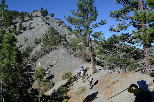


I am confused by how much the trail right along the ridge is difficult for me to pick out at a distance. There is no mistaking it while I stand on it. It is a deep ditch right on the edge. We climb steadily with plenty of stops to stay together and grab a snack or two.

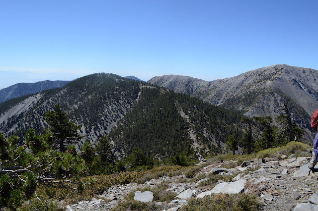
The climb mellows out after a while for a nice final hike up to the top of Pine Mountain. I am still breathing hard on the mellow stuff. The thin air at this altitude needs a lot more huffing and puffing and I am often slightly light headed. This could either be too little or too much. The ease with which I can hold my breath suggests I am overcompensating for the thin air and the light headed feeling is from hyperventilating.


There is a short spur trail off to the side to the top of Pine Mountain, the high point for the day. We stop and take a summit photo then look around or snack or whatever else. There are a couple nice camp sites at the top. The rock walls hint that they are sometimes a little windy. We just have a nice breeze to make everything comfortable.
Not too long at the top and we head back to the trail and head down. It is a steep down and I anticipate a certain amount of discomfort for the exposed south slope climb as we return. Never mind that now, we must get our peaks!

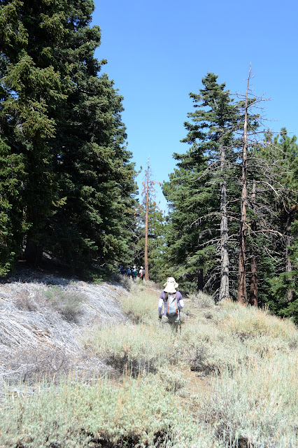
A little way up, we pass a signed trail. Needle covered and with a low bridge tree barrier early on, it is faint and generally unused, but it is there. We keep on climbing, which is initially a little steep, but levels off into an easy walk.


There is a boisterous peak picture that I miss because I am distracted by the slightly distant geocache finding. I am not sure what made it so boisterous. The first one was quite sedate. We head back to Pine and the climb is not so bad as anticipated. There is a little trail going more directly up to the top and we stop there again. It is the high point for the day, after all.


After enough time to gobble down a little more energy, we are off again, heading back toward the cars.


Back at the cars, we are not quite done yet. We jog to the left to find the trail connecting to the PCT as it paces the road above, then keep on climbing as the rather unofficial looking connector ends. Near the top, there are faint old roads we follow for a short way before coming to a marked point to call the top.
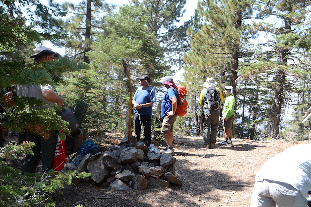
Wright Mountain feels just a bit like list padding from this approach. With lots of trees and no views, there is not much to call one up. We mull around slightly, take a (calm) summit photo, and head back down. I am still wondering where the exposed Class 2 stuff is. The day did not seem so difficult to me.

Then it is off to our various carpool points before heading our separate ways. Everyone related to the race has wandered off, but there are still plenty of people wandering about the area as I wave to the rest.
©2018 Valerie Norton
Posted 10 August 2018
Liked this? Interesting? Click the three bars at the top left for the menu to read more or subscribe!


Comments