Upper Sisquoc trail work
Los Padres National Forest
Click for map.
I signed up for a little more trail work, this time along the trail I bailed along when it got just a bit cold and snowed on me. At the time, I hopped over, around, and even under quite a few trees in just a few miles. Since then, there have been a lot of work to clear them all out. They said 300 trees have been cleared. Surely it was not quite so much? Then again, maybe it was. Another 20 remain and that is what we are out for today along with plenty of brushing and a little tread work. (It isn't that I have any influence. I'm just lucky to have hit the trail shortly before the work was done.) We drove the 20 miles behind the locked gate up to Bluff Camp for the night yesterday afternoon, so had a few miles drive still to get to the trailhead at Alamar Saddle. Safety talk and tool grabbing is quick with a group that mostly has been around and done this sort of thing. So we head down with a plan to make the trail nice from Upper Bear to Lower Bear. The tread above Upper Bear will have to wait.

The trail down to Upper Bear is narrow, but not that bad. It feels steeper than I recall. I was at the end of a longer day with a heavy pack then. Surely it should feel easier now that I am hitting it fresh in the morning. Maybe the urge to get down out of the wind and exposure in the freezing temperatures then was working in my favor.

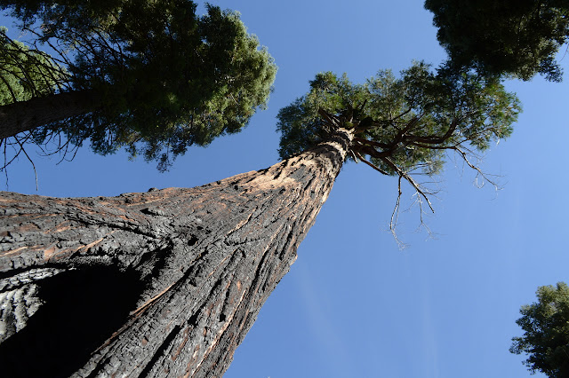
There are a couple bushes in need of a trim on the way down to Upper Bear, and I go for a few just short of it, but it really is very close to the delineation between work needed and not. Beyond it, we get into areas where the big trees burned in the Zaca Fire and died and now let in the light for the little scrub. Oh, yes, and they fall.

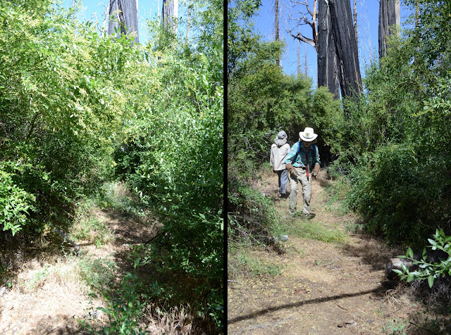

We hit Bear and even with the memory of that faint thing with three trees across it being the trail, my instincts are saying to look somewhere else for it. There are two trees down next to the junction and one more in a few more feet, then more beyond that. They are all different sizes leading to the rather illogical suspicion that they fell at different times. I poke around the camp, then come back to find that I'm not the only one with those instincts. My fellow trail workers have been clearing the brush from the trail into camp and half of it has landed right on the main trail. I have to make sure, so edge around the pile following the thin line. It does go, it is the trail. This is a particularly important one to get.

But it is lunch time and we are not too keen on having it in the burned camp. Those who have actually stayed here say they went far down into the meadow, such as it is, to find somewhere safe. It has a few trees too, but thinner, so the challenge of finding a safe spot is less. We head down toward Lower Bear to find a nice waterfall for our lunch spot. Leaving those trees that so clearly must go.


Of course, lunch cannot last forever, not even beside an interesting waterfall. We fill up on water and pack up and head on up, except for a few who head on down to Lower Bear where there is a little bit of tread work to be done before we go. I stop for one last small tree just at the top of the bad tread section we can do nothing about. No need to leave it even worse. There is plenty of brush work as well as we climb. Oh, and there is a reason these camps are all called Bear. (Although the lower one is also called Fall Camp. It fits too.)


It is getting late as we arrive back at Bear Camp, but we are not going to leave those trees. It is too important. The brushing has run out, so we set about them a little like sharks smelling blood. The smaller trees look just a little too big for the Silky big boys we have for the brush, but the big saw is occupied, so we may as well try. And succeed. The logs all fall to our saw teeth.

As we roll out the last section of the last log, I (for I can only speak for myself) have a greater sense of accomplishment than I can recall ever having had after a bit of trail work. Now the trees that indicated "probably not this way" are making the trail obvious instead. For one last task, we move the camp sign from where it was behind some bushes to be next to the trail, then head on up. Every inch of what we came out to do has been done and has filled the day. Now we do have to hike back up and out of the canyon.


One fellow brought watermelon and passes around pieces at the top. It is delicious and perfect. We sort out a little differently for the drive back to Bluff because many will stop by Big Pine Mountain to climb the county high point on the way. I dither shortly and decide against.

I second guess a little my decision to not take the easy way up Big Pine just because I have recently been there. It is a little bit clearer day today than it was then. Too late now. Those who did really enjoyed it except for the moment when the fellow who took the lead decided to push through some ceanothus. None of them had been up before and they didn't find the register, so I could have been of some help.
©2018 Valerie Norton
Posted 7 August 2018
Liked this? Interesting? Click the three bars at the top left for the menu to read more or subscribe!


Comments