Grass Mountain
Angeles National Forest
Click for map.
I have been thinking I will hike Grass Mountain for a few years now. Today is the day. The trail crossing is already familiar from previous visits, but this is a new direction. Guess I will add a few more miles of PCT to my done pile, for what it is worth. It is still too early for the ~3600 through hikers starting from Mexico this year. This is northbound mile 478.2 by Halfmile's current reckoning, so it will not be quite that many when most of them turn here to find out the secret of Case de Luna down the road in Green Valley. For now, there is just one set of footsteps visible in the otherwise clean dirt of the trail ahead.

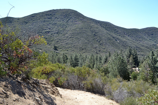
The trail hits a utility road and I turn west along it because that is the way the trail is going. I do not even consult the scrap of map I have to help me in finding some section markers later. It would not help anyway, the utility road is not on it. After a quarter mile when the road turns back toward the fire station below, there is still no sign of the trail. Backtracking to when I hit the road, there are some clues. A little further the other way, there is a pole with long faded stickers that may have once had a crest. The single set of footprints go that way, too. Around the corner, a little past the pole and hidden behind the road carved rocks, is a very obvious trail climbing again.

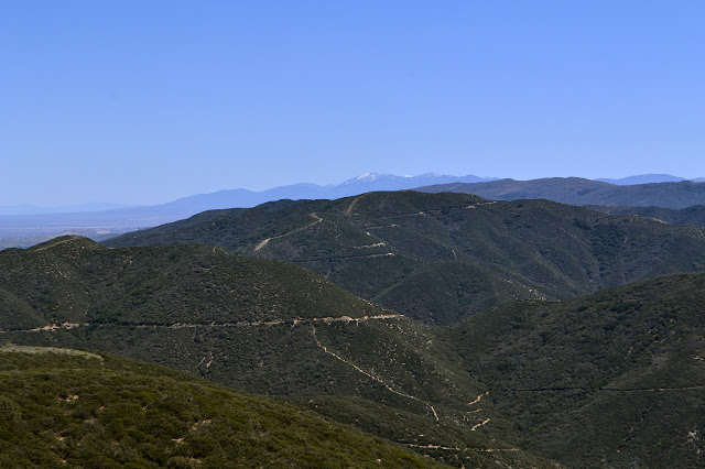
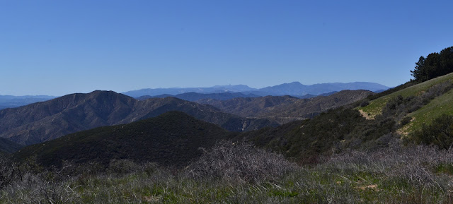
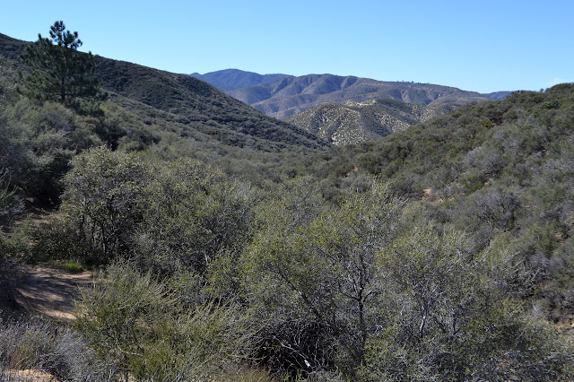
And so I continue upward. It feels like a gentle climb to me as the trail carves long wiggles around the ridges. The view quickly opens up down the canyon and across the range traversed by the PCT. The sights are somewhat familiar. I have already tucked away the miles between San Francisquito and Bouquet Canyon in two separate loop hikes as well as climbed Jupiter Mountain to the southeast.


The trail crosses the road and the start of a marked OHV trail going up the ridge, then drops around the north side of the mountain. There are more footsteps here than below. It is nice and cool under the oak trees that grow there. I enjoy it until I think to check the map and backtrack to take the road up to the top of the mountain. Another wrong turn. I guess I am going for consistency? I will have to pay better attention on the rest of the hike, but I probably will automatically since it requires more creativity to plan that part of the route.

I take a couple short, exploratory excursions down side roads that go no where as I go. They probably get used as camp sites sometimes. The road wraps around to the top past a remote weather station and repeater right on to a big, flattened area of dirt. The trees on the north side are quite stocky at the top and smaller on down the hill. I suspect a planting. The grassy face looks well grazed and maybe with a few tire tracks. It is a particularly thick grass. With my late start, it is a good lunch spot.


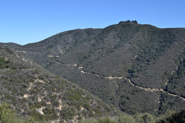
Having got up to the top of the peak, my next goal is to find a section corner along a fuel break down the side it. There is trail down the far side from where the road comes up that follows the fuel break I want to follow, so I take it. It has some tight spots, especially when the rut gets really deep. It gets up to a false summit also covered in grass and then heads back toward where I saw it marked as an OHV trail between the road and PCT.

This second grassy bald is my signal to hang a left turn and start down another break. I follow a little extra just to get a good look because the chaparral around here seems quite thick for struggling through if the fuel break I expect is not there and there does not seem to be the slightest bit of trail going my way. This is an area where I expect trails wherever it is possible to go. While I still see no trail going that way, there is a break in what I can see of the brush.

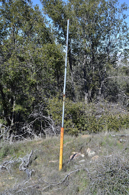
I turn and wander across the grass to the slot in the brush I can see on the far side of it. There are some very faint trails that are likely due to animals. As I near the far side, the ground is littered with cut brush from when this fuel break was last cleared. Picking my way through the long dead sticks is slow as it sits about in jumbles that are hard to get around or through. The faint animal trails tend to show the easiest way. There is less to pick through as the hill gets steeper. Halfway down, there is a yellow metal pole with a second pole, the sort surveyors seem to leave lying around all over the place with wires hanging off the top to secure it in an upright position, sticking out of it. As I get close, I note the actual marker is next to the yellow pole. It has no date, but it notes the location exactly. This one is not just a section corner but a township corner as well.

Below the monument, the hill gets even steeper. My slow pace down is as much from the scattered cut brush as the slope until I run into the PCT at the bottom. From here, I can cruse. There are two more section markers I can go looking for a little more than a mile away. I am bolstered by the first find and feeling like there is plenty of afternoon left so I go after them. I follow the PCT down to the road, cross it, and then follow the PCT down to the next road crossing. The trail is almost perfectly flat between the roads. There is a spot about midway where it passes a cliff and seems to be having trouble holding itself together, but otherwise it is good.

Once to the second road crossing, I turn left a short way until getting to another expected fuel break. This one has brush piled up high at the bottom to try to prevent motorcycles from using it, but it has not worked. Their route makes it easier for me to get up on the ridge too. Their track climbs and turns a corner, which is where the next section marker should be. It is not immediately obvious and my estimated way point for it is a little way into the brush. It is only 4 foot tall or so, but the branches reach out between each bush from the ground to the top making very little space for anything other than bushes in there.
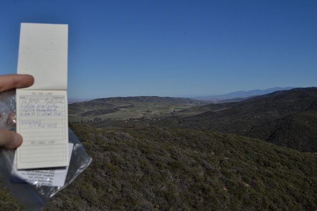
If I really want to look, I will just have to find a way to crawl in. I drop my pack and try to see another yellow pole, maybe. A block of concrete perhaps. Maybe just a stack of stones. A fence post. There seems to be nothing in the brush. There are ways into it though, and so I try to crawl closer to where it should be. I try to watch for anything that is not brush off to the sides as I go, then work another way and then a bit further. My efforts are not rewarded. There is not so much as a rock that looks a bit like concrete under there to get my hopes up. After a fair bit of misery, I just have to give up. There is still one more to look for. I head up the hill a little way where it is marked again by a yellow pole and almost as easy to find as the first.

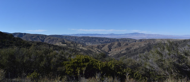
I ponder continuing up to the unnamed high point up ahead. I sort of remember it being not far from here, but my map scrap cuts off after the markers. (It is actually a little over half a mile.) From here, it looks as though the ridge could just drop and climb again and again and again. I decide against and turn back, pausing to glare over the bushes for a yellow pole and crawl in one last time for a little more looking. They are probably just a little bit too tall for the pole to show and the only reward for this last excursion is another scratch.

I head back the way I came, this time following the road. A pair of posts on one hill gets my curiosity and I climb to find a metal cover. Within it is the wet cap of a water pipe. The map shows the aqueduct passing below just west of the second section marker I found. It must be a half mile away. I drop the cover back on and continue on the road. I have one last secondary goal for the day being a peak just north of the road that has a somewhat neglected geocache on it, so I keep to the road at the next junction too. The road winds around toward a saddle. There, an old, decaying road carves around the side of the northern peak. Motorcycle tracks pass fencing and "no motor vehicles" signs to follow both the old road and a route directly up the side to the peak. I take the road since it looks like it is going my way. It has nearly fallen completely away in some places, but is very open and easy to climb.

The old road goes a little further to a track coming over the top of the mountain and following the ridge. It looks like it goes all the way down. I follow it up to the top. There is a bent fence post at the high point and a cross made out of bricks a little way down again. Coming down the side, the track becomes a rut, sometimes as deep as my knees, and quite miserable to try to follow. I was wondering if I might double back on the road to be sure to walk the little bit of PCT in the middle of my route that I have not yet followed. Once back at the road and somehow without actually making the decision, I find myself walking toward the car and not backtracking. My legs are getting tired and it feels like they just overrode everything for a moment and turned me to the shorter route.

There is a junction with two options back to the road. Burns Canyon, continuing downhill all the way, looks tempting, but I go for Leona Divide instead. I can hear a motorcycle coming closer. That one passes and then there are two more, one of which is particularly stinky. They and a bicyclist who was going up the road to the peak are the only people I have seen today. It would not be too much more climbing to follow the trail back down, but I keep to the generally higher road along the divide for my route back. This does mean I have to walk along the road a little way once at the bottom.
Some bare bones stats:
Hike up Grass Mountain (one way): 3 miles, 1200 feet
The rest of the wanderings: about 10 miles
*photo album*
©2018 Valerie Norton
Posted 31 Mar 2018
Liked this? Interesting? Click the three bars at the top left for the menu to read more or subscribe!


Comments