Vista Del Mar and Prickly Pear Trails
Dos Vientos Open Space
Click for map.
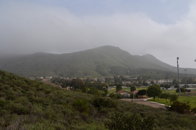
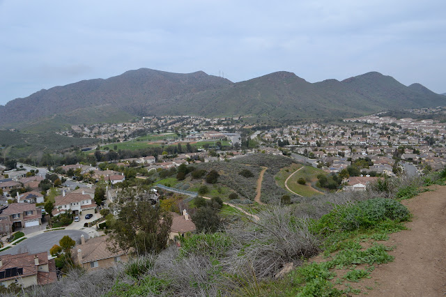
For the third (only the second for me) COSCA Challenge related geocaching hike, we have two required trails planned: Vista Del Mar and Prickly Pear. The main streets in the areas do not allow parking and most side streets seem to be gated, so we met at Dos Vientos Community Park, where there is quite a lot of parking. I had thought that this would be high enough and far enough from the beach to get out of the coastal gloom that has recently closed in, but no such luck. The area is socked in. There is a little lifting as we wait for the start time, but not enough to see the little mountain peak. Due to the holiday, there are only five total once start time rolls around. We take off across the park, somewhat uncertain as to where the trail is exactly. It sorts itself out easily enough as we get into the right area and we start up Park View Trail.
There is no sign as the trail splits. The right goes off to Powerline Trail and the left to Vista Del Mar. We follow the left as that is our required trail. It starts as we cross over a road and into the next patch of open space. This one is a bit bigger. The trail quickly gets bigger too. There is a spur to get up higher, and we take it to try to find the puzzle cache up there. For this one, we have to line up the photos to find where they were taken. The fog is just lifted enough to do that. Still no distant views before we head down and continue on our loop.

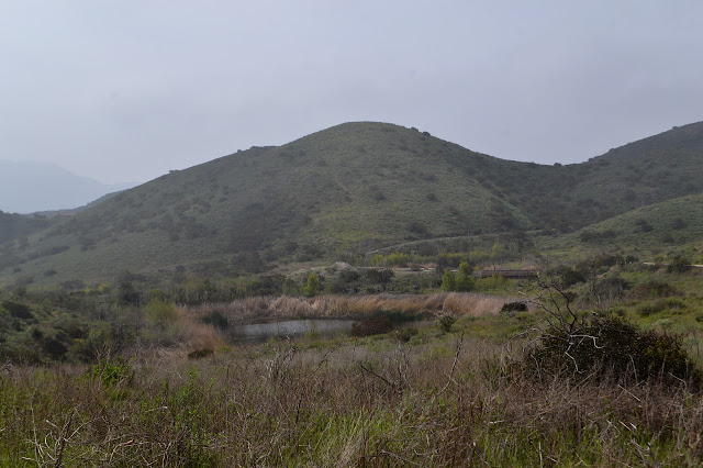
As we approach the pair of lakes, it becomes obvious that one among us is a bird watcher as well. I follow the line of the binoculars to see a bit of black at the top of a reed. Probably a red winged blackbird. There are also some non-mallard ducks among the more easily discovered birds. A moment more of looking shows a few more darting among the plants surrounding the water. Until recently, the lakes were dry, so there might not be as many as there could be.
Past the lakes we have a couple choices again, and we start to climb. The other trails will get down into the houses, and we are not quite done with Vista Del Mar yet. There is also a trail to a gate that would go on to a nice climb, but is off limits to the public.

There is brief moment of excitement for me as I spot a survey marker. I walk into a stray bit of barbed wire on my way over and find it has not cap when I get there, so come away disappointed and bleeding from a wild gash. A little bit longer on the trails shows that there are quite a few markers, all uncapped, strewn about the place. I get no sympathy except an offhand remark hoping I am up to date on my tetanus shot. Considering the uselessness of blooding myself in this way, it seems about the right amount.

We cross over another road, signaling the end of Vista Del Mar. The other side is Las Brisas, and gets us closer to Prickly Pear, so that is where we go, climbing up into hills again. This bit of trail is tucked a little more tightly among houses than the last bit. As the trail splits, we turn left on El Cerro.


When we hit El Rincon, one makes way to leave which pretty much opens the flood gates. The rest of the trail is not part of the required trail (and I am not even sure any of us is really doing the challenge) so the rest follow along. I do want to go ahead and finish this trail, although I am not keen on the planned piece of road walk to get to the next one. I wave to them, but will probably be following after in not too long.

Suddenly there is a motorcycle behind me and passing me. It is so far beyond the pale, I have no idea what to say. As he rides off, I figure saying something lame is better than saying nothing at all, so state it is not a motorcycle trail. I expect I am already too late, but the cretin shouts back that none of the 30 other people he has passed have said anything and asks what that tells me. Well, it tells me that they were just as flabbergasted and speechless as I was, mixed in with a healthy amount of wanting to avoid confrontation. I am sure his version is that they are quite alright with him taking one of the noisiest pieces of traffic from the other side of the thick wall of houses and bringing it right under their ear while they try to enjoy the local park. If we actually were to ask them, we might come up with a few other positions as well, like they might be worried that if they report his trespass, then everyone will lose access. That would be a valid interpretation of the signage at the start of the trails. Thinking back to the discomfort in his body language when I looked behind me to see what the ruckus coming was, I sort of suspect a few of them have told him to go somewhere he belongs. I hope a few more do too, before others decide it is something they can get away with and the open space really is lost.
As I get to the street again, I turn back. Las Brisas meets El Cerro a few times along the way. At the first opportunity, I miss the chance to take that other trail, but at the second I go for it. This is even though I know it will cause me to overshoot the exit trail. It is a short enough way back. At the bottom of Rincon, it is not totally obvious where to go to get into the park, but there is a dirt path on the other side of the road. I head a little way out of my way to get on it and once a little way down it, it is definitely going to the park. Flawless returning after the loop.
With plenty of afternoon left, I decide to drive over to the other required trail. It is a tiny little thing. The area has a few strategically placed dirt paths along the road and it does seem to have one to connect this little trail to the other. I suppose I could have saved the gas. Prickly Pear takes off from beside another Del Prado Playfields, so there is plenty of parking for it too.

The trail passes along the side of the fields, then splits to loop along a hill, one high and one low. I start off low. A trail leads down to the far side of the field before coming to another pond. There should be extra bird watching opportunities here, too.


Around the corner is a tiny canyon that is just a touch toward lush. Live oaks and a few leaving maples make their home within it. Placed properly, even a very short trail can have a lot of variety. Of course, this one also has all the chaparral I fail to mention because it is ubiquitous.
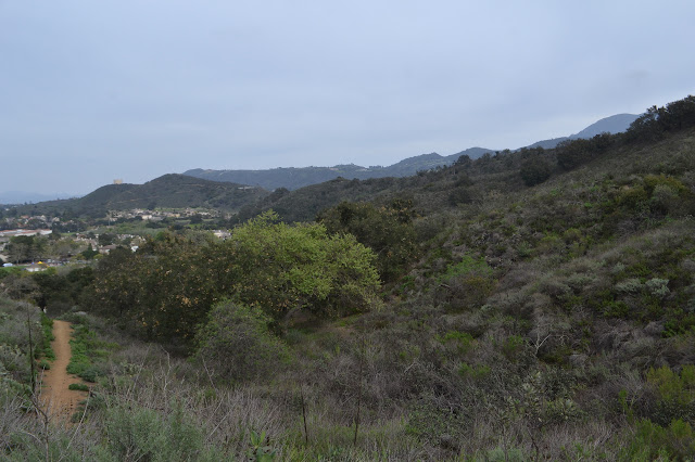

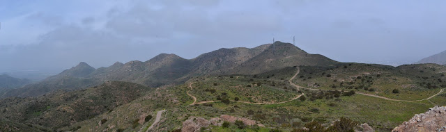
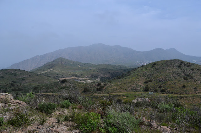
The higher part of the trail of course gives longer views. At least a little. It does not quite go to the top, so it does not get those other side views.


The trail joins up again, and I head back to the car.
©2018 Valerie Norton
Posted 5 Apr 2018
Liked this? Interesting? Click the three bars at the top left for the menu to read more or subscribe!


Comments