San Rafael: West Big Pine Mountain
Los Padres National Forest
DAY 1 | DAY 2 | DAY 3 | DAY 4 | DAY 5 |
Click for map.
My quilt got a little moist in the night, but there was a lot of visible moisture in the air yesterday. What did I expect? My sheltered spot is practically dry. There is a spot by the table that is downright soggy. Around behind the oaks beside me, there is a set of three standing dead and very tall pines and I am well inside their topple zone. Arg! Must be more careful with site selection. I get some breakfast and head out in a cloud. I have in mind to go climbing up what peakbagger calls "Peak 6080", but could sensibl called Mission Pine Mountain on my way out to West Big Pine and then to Upper Bear. This one is going to be a long day and I am not even sure how long. At least the uncertain portion comes early so I can try to make it up.

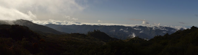
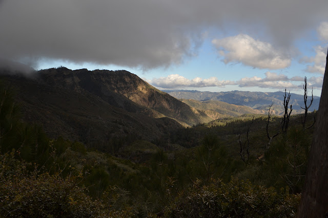
Just down the trail from camp is another stream that I am sure is also spring fed. There has always been at least some mud here when I passed. The clouds get thicker as I climb and descend on my way toward my break off point, just before a spot where the trail turns suddenly south. The view opens up in just the places I expect as the clouds burn off in the morning sun. Or maybe it is just that they are thin wisps hanging onto the mountains. The higher peaks are still enveloped in cloud.

As I get to my break off point, the GPS says the peak is 0.81 miles away. It was actually closer down lower, but I think I would rather follow a ridge line. My recollection of sparse manzanita for this area is not quite right. It is covered except where dead ones still occupy the space they possessed in life. It takes some picking to find a way through. At the top of a big, open gully, I see no way further keeping to the ridge. Gully it is. Steeply down, then a break in the brush to the side allows access to the next one over as this one becomes choked. The second gully is full of green bark ceanothus as it joins one off the next bump I want to cross, but this is actually not so bad to push through. The new gully is rocky as I head up it. There seem to be routes up out of it, and I take some with deer prints. Hopefully those go somewhere. I work one way and find a stop, then work another way. Working toward the peak quickly (in terms of distance, not so much in terms of time) starts to look hopeless. I still have 0.65 miles to go as the crow flies and I do not seem to be a crow. Oh, and whatever it takes to get back and the 10+ trail miles to camp. I turn back, just not wanting it enough.

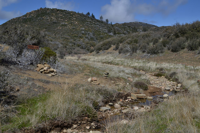
Getting back to trail is not as much of a hassle as I thought it would be. On I go, down into Mission Pine Basin. I am always noticing the cairn off to the side marking the shortcut into the camp, at least in this direction. Why not? I finally actually try it. It passes through what could almost be a creek bed containing pools of standing water. The water probably will not last much longer. It seems like a better trail in than the one following the creek bed from the sign to the west of camp. Camp almost looks safe now. Just three dead trees still stand, but it is getting hard to find clear flat ground. I am still thinking about the peak and cannot help but notice that it looks easier to get through the growth from here. Next try, should there be one.

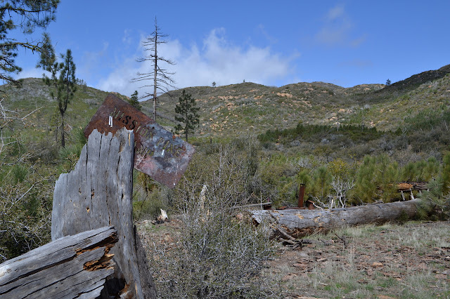
The junction ahead provides the luxury of a table still. Also, no dead trees waiting to topple. I rather suspect the sign nailed to the live tree may have been moved just because it points in different directions for Fall Canyon and West Big Pine. I have to fight the disconcerting feeling that I am going wrong as I follow the bit of trail those two routes share. I know this bit as Fall Canyon because that is the way I was going when I first took it. Finally the second junction takes away my discomfort.
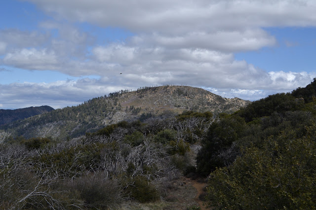
Once relieved of the stress of being certain I am going wrong, it is just a matter of following cairns through a maze of gullies being uncertain I will know where to go next. I am looking for a ridiculously steep hill under oak trees that marks where the higher trail was found. From there, it is easy street through manzanita cut back maybe a little too far. Then, well, more gullies and cairns and a steep climb out to a ridge line that looks like an old fuel break. There is a tiny bit more water just before the climb. A short stretch across a steep slab of rock is barely holding. The trail swings down and around in another random seeming loop then climbs up to some scrub oak. At the high point in the oak is where we finished our trail work a couple years ago and the start of new trail to me.


The trail takes a rather abrupt turn directly downward through brush closing in a little more than it was before. It has been a little longer since this section was worked, but it will take a little longer for it to close in. There are more open spaces and gullies once the trail drops to a saddle, then more after it has climbed a little again. There is a lot of little rolling even as I think I am climbing to the top of West Big Pine Mountain. Toward the top, there are grassy sections and a few trees to step over.


There is something fluffy and white coming through the air, but I cannot quite examine it to see if it is snow or some seed fluff. It does not feel cold enough for snow, but that never seems to stop it being so. It certainly seems to vanish before I can get a look at it. At an old sign post without a sign, I turn up the mountain. It seems like the sensible place to go for the top. I was a little early. Just above is an old road cut. This peak used to have a fire lookout, so it makes sense that there might have been a road up to it. Not all had roads. Following it up, there are only a couple footings and scattered metal remaining of the lookout. Someone has gathered up the nails onto a rock. Someone has always done that. I pull on my Frogg Toggs jacket against the cold and wind, but it does not seem to block the wind as much as I expect it to. I hope the rest the trail is not very brushy, because I do not expect to pull this thing off.


There is supposed to be a benchmark up here, and I find the first reference mark pretty quickly. The second only takes a little more looking. Try as I might, I just cannot seem to find the station. There is not even a hole where it should be. It looks like they were reset in 1992 and although close to the cliff, they do not quite point off it. There is really something odd about them. Reference 1 is actually marked as a "horizontal control mark" while reference 2 is an "azimuth mark". Probably they were just running out of the appropriate disks.


I head down the mountain along the old road to the still maintained road below. I had thought I might hit the other peak on the way, but am just feeling cold now and give it a miss. It is brushy from time to time, making me worry about the soft rain jacket which is my only piece of gear to protect against precipitation. Meanwhile, the weather is making it obvious that there are other options for it besides being too hot. My lazy check using Santa Ynez as proxy is about to bite me hard. There was a clue. I did notice the very low chance of rain throughout the time I would be hiking. I did think there must be some cold front coming through without thinking too much about what exactly that means while visiting the highest point in the county, a mere 6000 feet higher. That puts the 40°F lows at 10-20°F lows instead. Actually, this could test my gear for staying warm a bit too.

I break out of the last bit of green bark ceanothus wondering why that has not been trimmed to find the ground absolutely covered in motorcycle tracks. The ceanothus is doing a much better job of keeping the motorcycles out of the wilderness than the rather obvious sign. They have to pass some permanently locked gates to get here, so are already chosen to be the type looking for what they can get away with. There are three sleeping bags lined up beside a boulder. They look abandoned, but the compression sacks are only just starting to fall apart. Tempting. I pull on my puffy pants to make sure my working muscles can stay warm and then pull out the map. It is decision time. South of me is actually still rather clear. Maybe I could escape it all that way. I am just not certain where I would want to go. On the other hand, maybe it will have already passed over Upper Bear, my planned campsite for the next two nights, by the time I get there. This late in the season, there probably is not much moisture to this thing and if it is cold enough, it will not actually be wet. I decide to stick with the plan. The camp should be sheltered. I entertain an idea of an insulated tent but leave the sleeping bags.

There is a sign for Big Pine Camp, but I cannot see much trail. It should be a quarter mile down and what little I can make out of the area does not seem to offer much shelter. I pass a road on the right and suspect it is the "trail" to Big Pine Mountain. County high point! Not today. Too cold and no view. It is planned for the day after tomorrow anyway, then a long chug down to Kellogg Camp. There is another mysterious road as I suspect I am getting close to the saddle. It tracks below the main road and even seems to have some sheltered spots to settle into. Maybe. I could drop my gear, then head down to Upper Bear to bring up water for the next couple days and stay there. I would be better set up for going for the peaks in the morning. I spot the camp at Alamar Saddle, then drop all my gear and walk the whole road to see if there is something I like. Even the exposed camp seems nice right now, but nothing quite looks like it will stay nice. Below, the storm could be getting stuck against the mountain. It certainly looks like it might be. It is still lovely and mostly sunny to the east. I just do not expect it to stay nice here.
The trail down is very thin on a steep dirt slope under oaks. There is not enough balled up snow to obscure it. It flattens out into a place covered in downed branches and a sign announces I have arrived. This does seem sheltered, particularly a spot between two rocks with a large cedar blocking another side. This will do. There is no table. I head out for water and admire the huge mutant ice can stove with an oven, perhaps? I also admire that there really is quite a lot of water as promised by previous reports.

I leave the extra large and elaborate ice can stove alone as I set up my own little thing to cook my supper. I already feel like my fuel is low for this trip without trying to cook in such cold. I get it going and boiling and then off wile I set up camp. I have decided it is a good time to deploy the emergency blanket and set to that first. This being the second time I have tried to extract one of these from its folded storage, so I am not surprised that it takes a very long time. Were this an actual emergency... I figure I will be able to see stars by the time I get it all the way out. Once unfolded, I tie it to a long log for my foot end and then set out my Tyvek, mat, and quilt and pull the thing over them. A few rocks keep it in place. Finished, I look up and there really are stars. They last only 30 seconds. I can not get rid of the weather that easily after all.
Supper time! My meal is very nearly cold already and did not manage to finish cooking the way it usually does. I never use a pot cozy, but today I definitely needed one. It does not matter anyway. After two bites, my stomach feels stung and rejects it anyway. Too much garlic? Whoever heard of such a thing? It is a bit of an experimental thing mixed up at home. I need fuel to stay warm, but it is clear that this will not be it. The gnawing hunger has mostly vanished with the experience. Now I am just cold and mildly wet. I pull off my shoes and carefully slip under the quilt and emergency blanket still in my puffy jacket and pants. The Frogg Togg jacket goes over my head to complete my improvised shelter. It really does breath well. At least there is that.
Continue on to the next day ⇒
©2018 Valerie Norton
Posted 23 Apr 2018
Liked this? Interesting? Click the three bars at the top left for the menu to read more or subscribe!


Comments