Monarch Point

Bears Ears National Monument


Click for map.

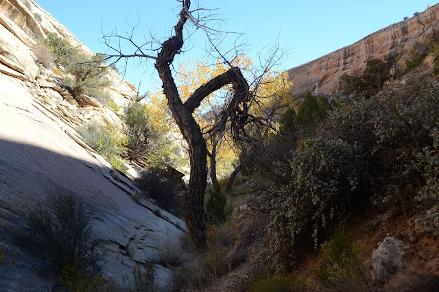
Today is another day for peak bagging, but there may be other goals along the way. The name of the peak may even be a clue. There's actually a couple peak goals, but I decided to break it up into different hikes with the usual checking out one canyon on the way up and a second on the way down. This one starts off not just on trail, but with an official trail marker! There can still be a challenge to follow it among all the other trails. Most of the challenge is in the wash. Once on the rock, there's a clear trail of cairns going right into the canyon I'm aiming at for the climb.

trail marker and a lot of plants
Marked trail. The trees may look a little funny, but that's because they are growing from a level about 20 feet lower.

cairn to mark the way
A cairn to at least suggest a way to those who pass.

shallow canyon
Just a shallow canyon at first and even with some fall colors remaining.

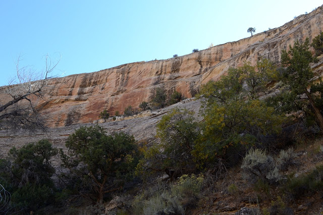
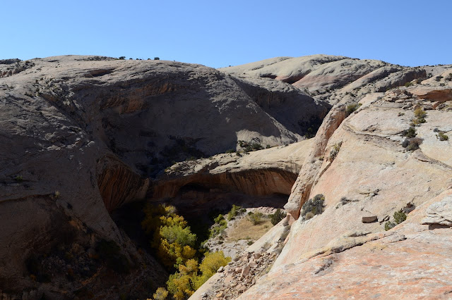
The trail finishes under a magnificent waterfall, at least I'm sure it would be with some water flowing over it, and no way out of the box. I was watching ways out on the north side, though, and picked one I like, so after a look around below the waterfall and not quite behind (imagining where it would be) it, I'm heading around it with ease. This does come after trying to shortcut and noticing that no, really, there's a spot I can't pass any way I go if I start up here. It does take going practically the whole way out because the north side is mostly overhang and the south side is nothing better.

like a proper canyon
Looking out from near the waterfall. This is not a particularly accessible portion of the canyon.


slopes keep going vertical
There may be just a chance that somewhere in that mess, if I stay high up, there is a path that doesn't get too close to vertical. This wasn't a good way up.

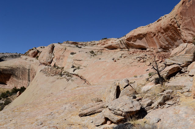
There's another couple coming up the canyon following that path. I wonder if they noticed me up here. I wonder if they know how utterly changed the area is for climbing up just a few feet. I guess not everyone considers it just a few feet. And while I'm up here and there's rock sidewalks all the way, I might as well find the local section corner.

section corner sticking out of some rock - at the center
There's the section corner right in the middle. This one is from 1947. The surveyors returned over and over again to mark out the claims to mineral wealth.

less deep canyon
The upper section of the canyon as it goes above the waterfall is not nearly so deep and quite accessible from this side.

series of depressions in the rock
Other grooves are available and there's something very groovy about this one.

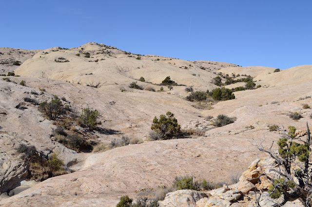
So I go higher and higher. The area is some rather easy walking. The air is just clear enough to see some distant... clouds? No. Crisp white jutting peaks. It's snow. The southern San Juan Mountas are now covered in the stuff.

peak away from the edge
There's a peak to the north that has retreated determinedly from the edge. That is looking familiar up there.

Butler Wash
The changing face of Butler Wash. The snow is just sort of visible in the far distance on the left side.

peaks before the peak
There are earlier peaks to get to before the actual peak. Generally, one has to go around the far edge on them.

wide area where layers are removed in steps
This canyon top isn't very broken up and the layers are carved down as it goes down instead of stacking up.

spots of lichen
All sorts of different lichens doing chemistry to the rocks.

canyon with high walls
Now looking down that canyon with the giant, regular bowl at the top.

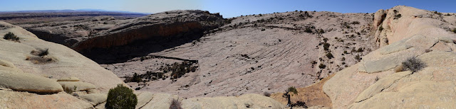
Up at the top, there is again the grand panorama of Comb Wash and Cedar Mesa.

curve of ridge to the south
Looking south along Comb Ridge. That fang at the end of the curve is just on the other side of the San Juan River.

cliffs and peaks
Looking north, it hides itself a bit. Abajo Mountains still haven't got sticking snow.

rolling bits of rock, figuratively
Looking back over those hills of rock on the way up.

canyon to follow down
Looking over my route back down in the canyon to the north.

tall monuments peeking over the top of Cedar Mesa
There is just a little bit of the Valley of the Gods visible over the mesa.

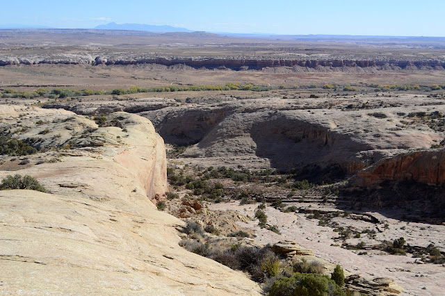
For a variation, I head north for the new canyon to head down. As I pass the top of a minor canyon, there seems to be a well established trail along it. I wonder why. I expect it is going toward that section corner, but there didn't seem to be trail at that end. I keep to the ledges at the south edge as I go down, dropping to the next one when necessary. The procedure worries me at first, the ledges are just a little too tall to get down, but when I get to the end they are broken up and getting down just takes a little care.

squiggly hole through the rock
Another new canyon with new carvings and other wonders.

ledges with broken edges
Down the broken up edges of the ledges made by water working on the rock layers.

water stays higher leaving a step
Right back up the layers again as the rock drops faster than the canyon.

The canyon gets very narrow and there is little trail from humans along it. There is also no obstacle to continuing all the way to the wash below. Well, there are a few low tree branches to scramble under, but that's not such a problem if I ignore how the skin on my knees feel about it.

spot of green against the curved red
A moment of fascination with the high tree in a concave spot making a spot of green against the red.

V shaped canyon with rock on one side, dirt on the other, and plants growing from both
A new character with a sharp shape and plants growing from all sides, be they rock or dirt. The dirt does yield a bit more.

high canyon wall
Still some high canyon walls with trees peeking over the top.

The canyon gets into low areas just before the wash, so I can climb out onto the rocks and back to the original path I took in quite easily. Except for the maze of paths down in the bottom of the wash among the cottonwoods. I do end up coming up slightly differently than where I went down. I'm still basically next to the car.


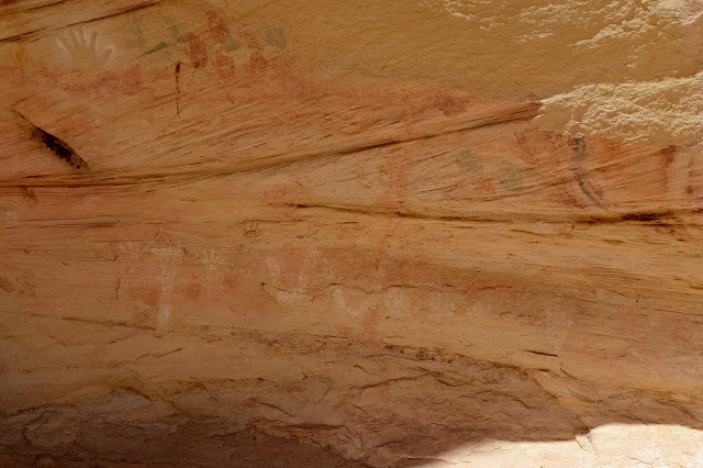
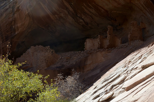
Ruins with petroglyphs and pictographs were along this route. An ammo can contained some information about the site including that there are petroglyphs on the ground (and there is), so these aren't ones one can explore.

wall petroglypsh
The walls are covered with petroglyphs that are often quite deeply incised.

wall in tree shadow
Petroglyphs of interesting lines are even tucked away behind a tree. Unfortunately, people are squeezing between the tree and the rock as a trail. Also, the tree branches do a bit of their own rubbings in certain spots.

paint around holes for beams
Paint is everywhere. Here holes are carved out for wooden beams (I think) and below there are hand prints while above there are geometric objects.

many colors
Quite a few colors in use for the pictographs.

broken walls
The remaining ruins are below a sheltering overhang, but there is evidence there were buildings all the way along a long wall near these.

nature and ruins
A bit of nature too pretty to fail to show even if it might show too much location...


©2019 Valerie Norton
Written 1 Dec 2019


Liked this? Interesting? Click the three bars at the top left for the menu to read more or subscribe!


Comments

follow by email

popular posts:

Jennie Lakes: Belle Canyon and Rowell Meadow

Lost Coast: Cooskie Creek Route

Mount Lassic

Elliot Peak