Procession Points
Bears Ears National Monument

Click for map.
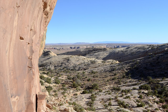
I drove just a mile south of where I had been hiking to hike a little differently. I followed to roughly the mileage from the highway below that was indicated on the pullout that couple a couple weeks ago strongly suggested I should photograph to have for myself and now I'll just follow the trail that seems to present itself most. I might as well make some sort of use of this thing. I expect I'll then proceed to a couple peaks marked and named on Peakbagger as Procession Point and Little Procession Point. Little is taller than not Little. Go figure. There is another parking area a little further up absolutely full of cars that also might be the indicated spot. I'll ultimately explore two different canyons again. Anyway, this one does have a very distinct trail that does, in its way, present itself.

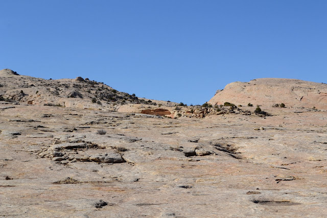
The trail quickly breaks from the canyon and wanders up the smooth rock top instead. It's quite a different feeling. Sure, I did it a little a few times, but those times I was still focused on a canyon to edge along and sometimes return to. This time I'm not really focused on anything.

After some iffy moments, it drops down a long easy slope into the next canyon. Then things get questionable. Cairns continue up the canyon, but the ones that really present themselves climb out the other side. In fact, those separate into two rows demanding attention. Neither wants it more and they don't seem to split far enough for it to matter.
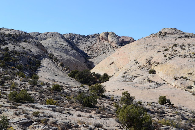


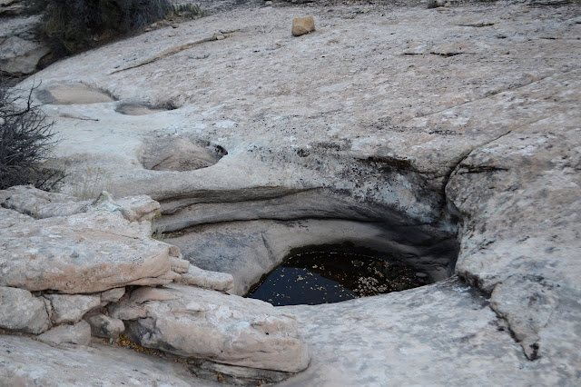
This lovely stroll along the tops of the rocks also lasts only briefly before I am once again dropped into a canyon that does a better job of catching me. There has certainly been a lot of traffic up the middle of it since the last rain.

There are about three other groups in various stages of wandering the upper canyon. I have clearly found the same place the folks all parked together were heading. This is not the place to be for some alone time. One woman contemplating the rocks is also contemplating that it is now busier on a weekday than it used to be on a weekend decades ago.
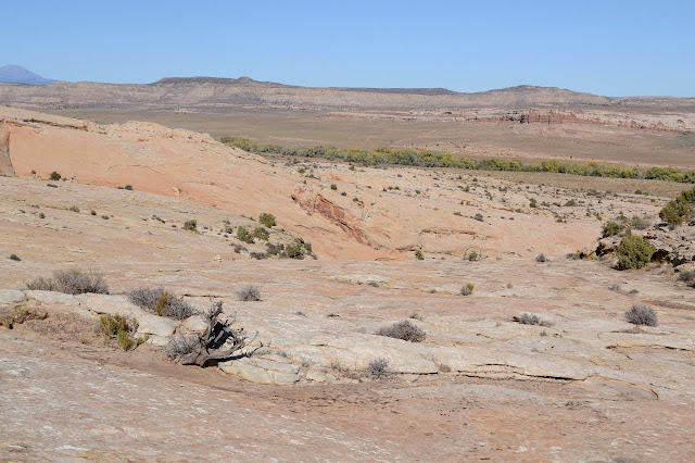
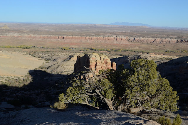
I edge my way around the side of the canyon up to the high point marked at Procession Point. It is a simple climb up to another high point that edges right out over space with Comb Wash far below. They really are magnificent if not a little inspiring of a belly crawl and a worry about how often these rocks might shed a little.


Getting late, so I don't stay long. I follow the huge curve of the layers around and back up to the "Little" point. This one has a little more challenge in getting up to its loftier perch.


Another lofty perch! Even grander and higher! And getting into some late day light that sets off the craggy pieces of landscape so well.


I make my way down a little differently than my up only to get pushed back to the path I originally took. I must have picked well coming up because everything else is a ledge that is just a little bit too high. Once the way is easy again, there's just more and more to explore.


Once things are familiar, namely the cattails show up, I just have to follow the trail back up onto the rocks and over to the car. It is clearly marked in this direction, too.

There was just one more wander I was going to do based again on the sketchy map in the photograph, but it is too late now. The "map" just lists a mileage from the highway to park and a mileage from the parking to a named place. The names mean nothing to me, but they mean nothing to the places too. They are generic things given hundreds of years after the people who had a right to name them were gone. It will be my one more thing before being gone myself. This was an extra good day even without getting to that third hike.
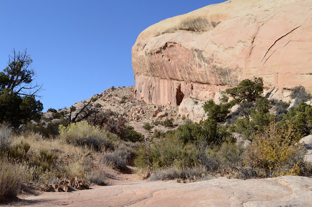
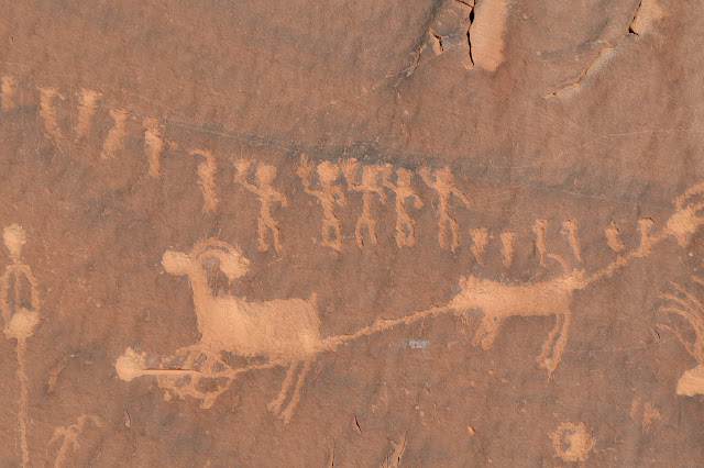
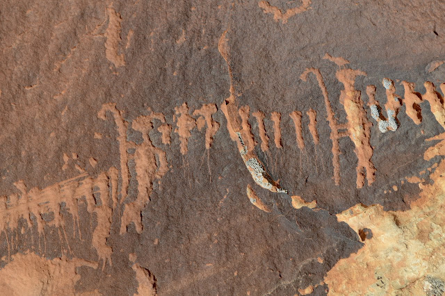
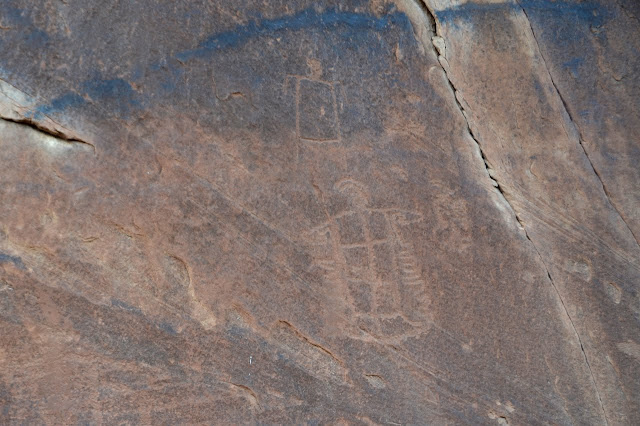
While there were ruins in the distance, this hike mostly held petroglyphs. One panel was a well known and visited area. I think people particularly like this one because it features figures that seem to be part of a coherent whole and tell a story. The second was less visited and very dark from age. It appeared rather free of vandalism although there were shotgun pellets embedded in the rock around the corner from them. The sort of location that these panels occupy is similar to others I have a good hard stare to, but from below and afar, so likely without much chance of seeing if there was something. I was left wondering what I missed.


©2019 Valerie Norton
Written 2 Dec 2019
Liked this? Interesting? Click the three bars at the top left for the menu to read more or subscribe!


Comments