Tsegi Overlook
Navajo Nation
Rough location: 36.67588, -110.53802.
I was debating stopping by the Navajo National Monument and decided, well, why not? It's only a few miles off the road. The landscape was getting very different, so I stopped for the overlook on the way. Besides, the snow on the red rocks can't be beat. The overlook comes with a pair of interpretive signs, but the one I find interesting is the one about how the climatic zones found going up mountains are reversed here and found going down into the canyons.
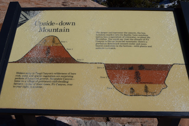
Not that one can really see these changes in vegetation without descending down into the canyon. I believe that requires a permit in the general area and can't be done here. The canyon is closed to hiking. Still very pretty to look at.


©2019 Valerie Norton
Written 9 Dec 2019
Written 9 Dec 2019
Liked this? Interesting? Click the three bars at the top left for the menu to read more or subscribe!


Comments