Lower Mule Canyon
Bears Ears National Monument
Click for map.
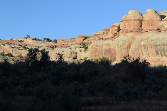
There's no need to drive anywhere from Comb Wash Campground (which is free to use but very much in the shadow of Comb Ridge in the morning) to find somewhere nice to hike. Had I not already learned I don't want to brave the sandy wash crossings in my little car, I might have driven the mile to the mouth of Mule Canyon. That would have been silly. There's all sorts of trails out of the campground, many of them going to the mouth of Mule Canyon, and at least one passing by ruins before even getting there. The lesson of the place is constantly just walk about and look and you will be rewarded. But do keep off the living crusts while doing it and take great care around any ruins or art sites.

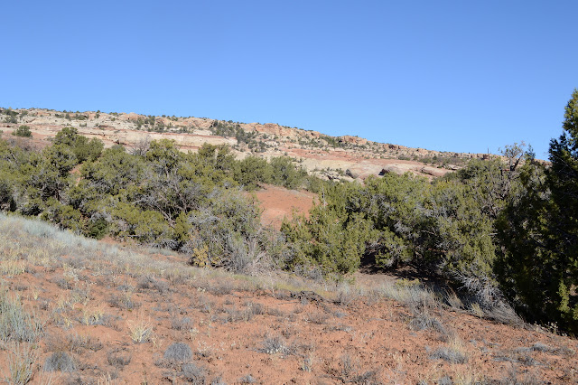

There's a fence that presumably should be helping to keep cattle out of the canyon, but it has been compromised. The canyon is wide and sandy at first and there are still a great number of trails to choose from. I go with one that looks about a bit close to the northern cliff edge before getting on with just hiking up the canyon.

Continuing up the canyon, the trails seem to gather a little bit, but there are still a lot. The wash is choked with vegetation for a little bit and probably a bit wet, but once it turns more open and sandy, there does seem to be one solid trail. I wonder if it might not be helped out by the stock that are allowed in this lower part of the canyon for people who would rather ride than walk. There's some indication in the trail that folks have taken them up on the offer to bring their horses.


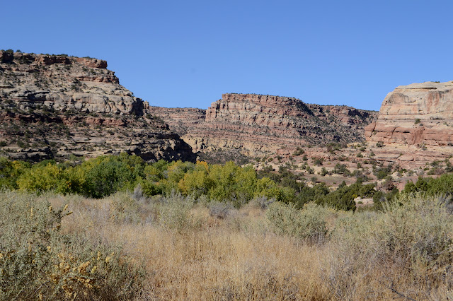
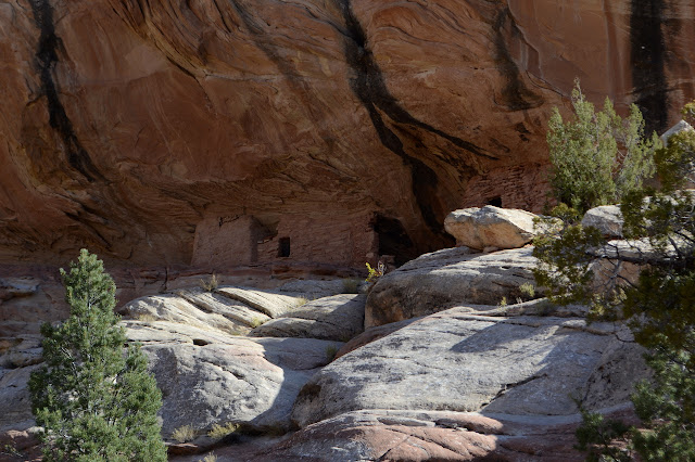
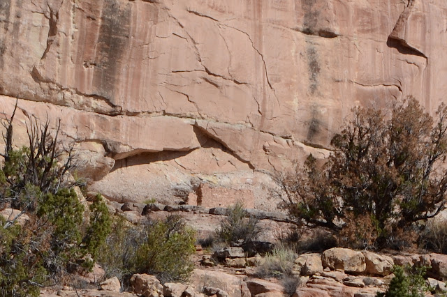
From time to time, I can see walls on the distant cliffs. I think. There are no trails going that way, which tends to support the idea that the use here is often on stock. There were hundreds of footprints on the trails into the canyon, but once actually traveling it, I can only see one set in the stiffer sandy dirt.


The smallest bit of surface water is evident as things start to look like they might flow more often than the sandy areas. Then there is a smell and a narrow channel of surface water. Further along there is flow and not so much smell. Also not so much freedom to jump across the channel to the easier footing or just go up the middle.


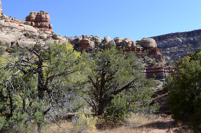
The canyon is narrower and the trail hard to follow. I must have passed the point where people are willing to ride. There are still those few footsteps. There might actually be two pairs. The water doesn't last long and then there is a rocky jumble to navigate. Somewhere up by the road, there is a "waterfall" that is basically the end of this lower section of the canyon. I look around for ways out, but they are not forthcoming. The canyon is tall and many layers look ready to make a barrier, but there are places where tumbling rocks might let a hiker pass. There must be. The footprints only go one way.


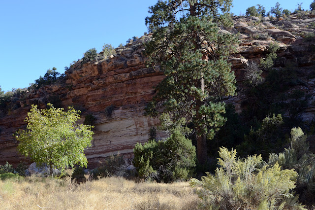
I am coming on less of anything like a trail and the end of the canyon is soon. I'm reluctant to not actually see the end, but also reluctant to keep maneuvering over these rocks. I've been 7.5 miles now and think I'll turn back now. I'm fairly certain the other footprints went further, but I have no plan to get out of the canyon and find a different way back. I'd have to choose just the right place.


The trail comes up quickly. I choose some other trails on the way down, but sometimes these become all too much of deer paths. I expect them to be as strong in the middle as they are when they start, but sometimes they seem to just fade away. The deer get a little way and vanish? I'm probably just not seeing their little prints when they take off into the surrounding area instead of keeping to the trail defined within the biological crusts.


My choices for trails through the more choked areas are not as good as one the way out. I think there was a steep slope I failed to climb back up. Instead, I get to be up close and personal with that growth. There's plenty of footprints here, too, but I often have to duck branches. Indeed, there is surface water in the area and it is stinkier than that last little bit above.


I take a different trail back to the campground, too, but this is on purpose to see things a little differently. And I do. It might be a little longer.


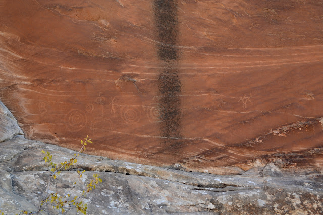
There are ruins everywhere. I saw only a few.


©2019 Valerie Norton
Written 20 Nov 2019
Liked this? Interesting? Click the three bars at the top left for the menu to read more or subscribe!


Comments