Fish and Owl Loop
Bears Ears National Monument
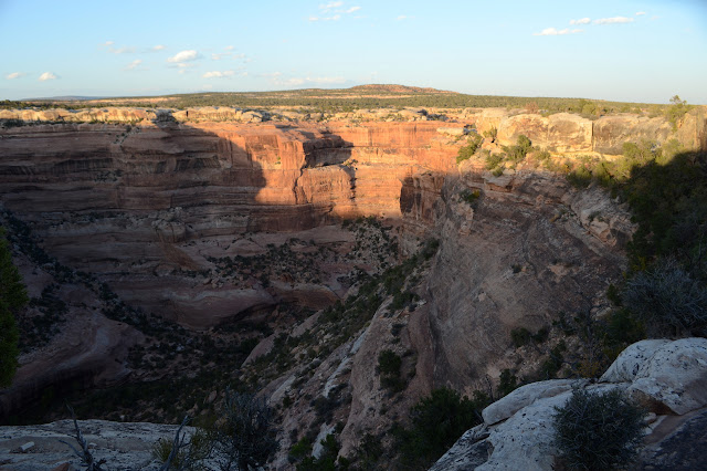
Click for map.
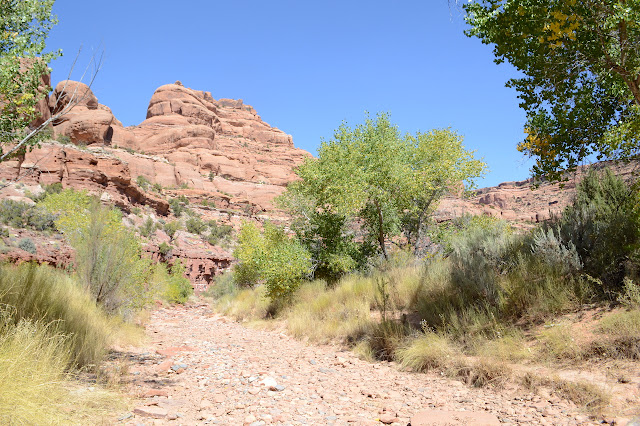
Today is the day to try the long loop through the canyons of Owl Creek and Fish Creek and because it is so long, I will not be visiting ruin sites that may come up. (This is in the Cedar Mesa area, so the hiking fee is required. My $5 per person per week already paid covers this one.) I made breakfast the night before more so I wouldn't have to stick my fingers in water to wash dishes while it was freezing out than to make it go faster. Then down 5 miles of rough road my car can do only because it hasn't rained in months. The road stops at another pipe with welded on lettering marking more oil exploration. I should have an hour more than I need of light and have decided to do Owl Creek first since there is more of the Fish Creek Trail that I don't mind getting to after dark. There is one worrying thing. The sign says if you bring your dog, you should probably bring some webbing to help haul it over the 12 foot vertical climb. Say what now? It doesn't say anything else about this climb. Surely there's going to be cheats of some sort to make sure the humans can do it? I mean, this is an official trail and everything. Putting Fish second means this climb will hang over my head unknown until it is literally over my head and I can see it. If I decide I can't do it, that is an awful lot of miles to backtracking and it could be getting way too dark to get creative. But I don't want to "waste" the light on crossing the mesa tops, so I am taking the gamble.


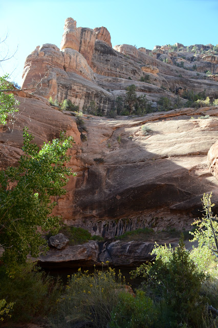
Sand to a wide shallow wash with cairns, then right over the side the trail goes. Down and quickly. I look back to see the first temptation of the day tucked under a lip of rock. Cairns march back up the canyon to visit, but I'm sticking to the ones marching downward. There are a couple of drop offs to navigate. Still, nice spot to try to live. Even after unusually dry summer months, there is a trickle of water coming down the rocks on the far side.

The trail misses some bits of canyon that are narrow and easily plugged with rocks when they are, in fact, plugged with rock. It just stays high and then picks a way downward. Then the rocky bottom of dropping elevation is replaced by sandy, wide areas full of cottonwood trees. Well, not always wide. One bit of narrow teaches me that while sandstone may be nice and sticky to step on when dry and clean, it can be extra slick when wet with a little bit of loose sand. I banged my knee and ripped my pants for that. I don't think it was worth it.

So I wander along the ever changing canyon. There are a couple side trails I would explore if not for the desire to get to the climb while it is still light. I estimate I have an hour extra, but one never knows what unexpected things might pop up.


Uncovered flat rock is a signal that a waterfall is about to come up. It makes a bit of sense. It has managed to stay flat because it is hard and it is uncovered because there's nothing further on to hold the sand in. I've got USGS maps for the area now and can see not just the waterfalls marked on it, but the trail as it traverses around them. One goes a long way along a side canyon then down. It is a jumble of rocks dropping steeply instead of the overhang of the main canyon. I don't really need the extra clues. The trail seems pretty clear.


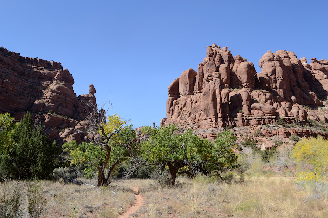
It is 3.5 miles, according to the GPS, before I see the first tamarisk. It was nice while it lasted. The canyon seems to be settling into a wider, flatter, sandier thing. Above, travel was a little slower just because the route was uncertain and the footing uncertain. Now it is only slowed by soft footing. The canyon wall carvings never stop changing, of course.
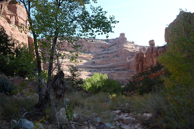

I'm really excited about one bit of carving sticking out into the main canyon, when I noticed it is just getting started. A little further and I can see the natural arch. I was looking for that and it's a good one. No wonder it got named.

The trail goes up to it and climbs a little. I'm a bit worried that most people just get this far or maybe I've gotten on the trail to visit it. I don't intend to take the extra time to get up to this one and do the pose, either. I've got a big loop to get done. Admiration from afar is enough.

The canyon continues on in its wide stance, barely dropping elevation, until finally there is a line of cottonwood trees coming in from the left. Along the way, trail often seems to just take the channel down the middle where water flows.


Then my trail just sort of runs itself into the side of another strip of pounded dirt edging along the side of another channel. Fish Creek? The map says this is the confluence. It must be the trail. Maybe. Well, at least a trail. They are more like use trails around here, especially in canyons.
I've already done a little over half the 15 miles expected, at least according to the GPS. The high canyon walls can lend it some creativity. Still, it seems long since there is a mile more across the mesa at the top for this canyon. It is straighter and seems to lack the waterfalls of Owl Creek. I'm feeling good about the time and figure I can go ahead and try to find the section corner. They're not up any big hills nor will they try to keep my attention for very long. The area really seems to be well surveyed. I expect it goes with all the oil exploration that led to developing the roads.

Guess I'm not lost and this definitely is Fish Creek. Onward and, very gently, upward!


I can't find the second section corner. It is among a lot of rubble, but it looks like it might have been there long enough for the corner to come after. I can find water here. At first it is just a thin puddle surrounded by a lot of salt, but that puddle is the final bit of a long arm of, well, salty water. There's an awful lot of white residue around it anyway. I can even hear the tiniest bit of flow. It vanishes in the sandy areas and even some of the rocky areas, but this canyon has water in more than pools.

There's more flow when I see the water again. I don't have to be still to hear it now and there are lovely ripples to watch rolling over the stones. And fish! Tiny, but there really are fish. There are also great big pools and if I get going up the wrong side, there is no longer the option to bail to the other side easily.


There is supposed to be another natural arch in this canyon, but try as I might, I can't see it. I can't even see rocks that look like they could be an arch. A little further and on the other side, there might be one. There is certainly a deep overhang at the top of a bit of wall set back from the rest.


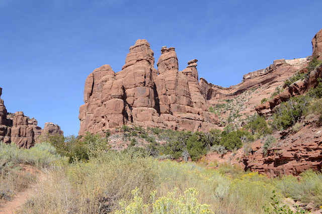
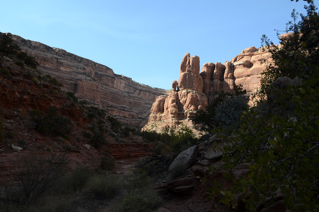
There's the crumbly purple layer (dinosaur track occur below that one) and then the canyon starts throwing some small obstacles at me. No big waterfalls, but if done correctly, a little one can stop me in my tracks. Trail seems to take me up one side, but then up on a ledge past a danging "rope" of cactus. It gets more and more slanted and narrow and it takes me a while to decide not to risk the plunge into the pool below. I slipped and knocked my knee on a slant like that. Then it takes some searching to find the weak point of one ledge. Oh, and I almost get lured down the wrong canyon. Well, still Fish Creek, but the trail is goes up a tributary.

And then there is a little sign saying the trail is going up. And the GPS reads 17.5 miles. More importantly, there is a 600 foot hike up with a 12 foot climb at the end. The whole rise from the confluence below is just under 800 feet. There is a little bit of dirt trail at first, but then just a row of cairns. And another over there and probably a few more in other spots. The route I'm on looks well used, so I don't worry about the other cairns. They are probably easier to follow going down or something. Anyway, some footprints I've noticed going both directions are going this way.


It's lots of walking up slanted sandstone. I picked out a spot that looked maybe a little weaker for the wall at the top and the trail does go to it. I'm not so sure about the climb. The weak spot isn't quite as weak as it looked at first, but people have piled up rocks to help the first couple feet. From there, cracks have to do.
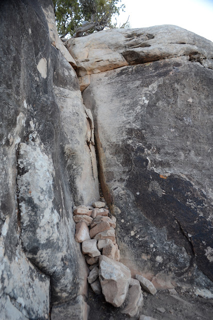
I get the camera and poles out of my way and then just give it a try. It is not quite so hard as it looks at first, especially with the piled rocks to act as a foot stool. Hand holds that look a little iffy at first work out well when coordinated with everything else. It just takes a couple pulls to get to the top. A pair of cairns mark it on either side for those coming the other direction. Looking down the climb, I'm not sure I'd have decided I could do it if I'd walked over to check before hiking. No worries now that I'm standing above it with no intention of going down.
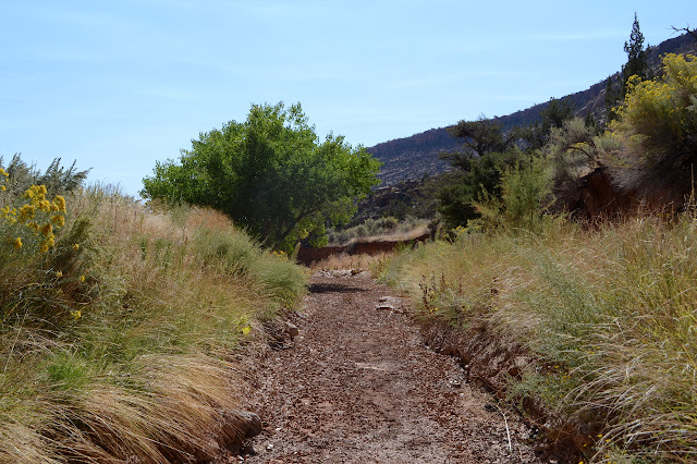
Trail is easy to follow through the dirt from here. There is actually a little more up to do and a bit more to see from the top of it than I expected. Then it drops and finally gets into a bit of a wash until arriving back at the parking lot beside the old "drill hole".


The GPS says 19.3 miles at the finish, but I made it all the way around to the climb before dark. I even made the high point for sunset. I only saw one ruin along the way. It seems like there are ruins about one per mile so far, so that would leave about eighteen I missed. These canyons are said to have fewer than the surrounding area, so maybe I didn't miss quite that many. I definitely missed some. I'm sure I'll see plenty more.
©2019 Valerie Norton
Written 14 Nov 2019
Liked this? Interesting? Click the three bars at the top left for the menu to read more or subscribe!


Comments