Upper Butler Wash
Bears Ears National Monument
Click for map.
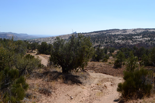
For today, I am out to find Posey's Trail, which is #32 in the free "101 Ways to Experience San Juan County, Utah" guide. It says the trail is a quarter mile north of the turn for the Butler Wash Ruins. Unfortunately, since UT-95 is an odd numbered highway, it should have a north direction and a south direction. It is actually signed east and west, which are the dominant directions it goes. Out to the west, it does also tend north, so west must be the north direction. Through here, the generally west direction actually goes south, so by "north", they mean south. So, following their directions, I have found a perfectly serviceable turnout right at the sign pointing out the turn to the Butler Wash Ruins. There is a notch in the fence, a slapstick noting this is a hiking trail and only for hikers, and, once I slide my way through the V notch in the fence, a register identifying it as Upper Butler Wash. So not what I was aiming at, but I'm here, I might as well see. I find it odd that people checked off "hiking" as their reason to be at the short trail to Butler Ruins while here they check "viewing cultural ruins" and not hiking although it will undoubtedly be longer. Since I don't know anything about these ruins, I check "hiking". There are no signs about it, but if there are ruins those cutesy rules about "keep your feet off the furniture" definitely apply and those are tucked into the register. After all, fingerprints are harmful and footsteps can be downright detrimental. Incidentally, this area is free to hike now, but will be within the fee area come the start of 2020. Then it will be $5 per day per person or $10 per week per person. As it is a hiking fee, not an entrance fee, the interagency pass (America the Beautiful) does not apply.

With a little drop, I find myself in a shallow dirt sided canyon with a scattering of cottonwood trees. They aren't quite as determined to be in water as sycamore, but there is likely water somewhere down there. At least a little bit. The dirt sides don't seem very promising for what the others have checked and I'm not sure I'm too keen on it either.
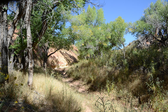
Unexpectedly, I find myself walking up the smaller branch when the canyon forks. Of course I have no reason to expect the larger one to be more desirable. There was certainly no visible trail up it. On the other hand, this trail crossing back and forth over the thin dry wash looks like so much use trail. I'm indecisive about actually following it again as a well used trail appears to my left where I think Posey's trail should be, eventually. It's definitely not the main trail, but I have no idea where I'm actually "supposed" to be going on the main trail either. Has it evolved to go somewhere completely different from what was intended by those who placed the register? I go for the side one. It isn't well marked, but there are enough paths slamming their way through the biological soils that it is easy to pick up the pieces.
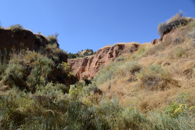

The trail gets thinner as it goes and people give up or, I suppose, find what they're looking for. I'm aiming at meeting up with a road at the top that I think might have something to do with Posey's Trail because it says Posey's goes over Comb Ridge and that one eventually gets to another, rougher road that goes down the other side. From there, I can do an elaborate loop if I don't pay too much attention to how far too long it is. Posey's Trail is not marked as such on my map and may not even be there. To get to the road, I have wide swaths of slickrock interrupted by great islands of biological soils that can be difficult to get past, but I no longer have the excuse that a bunch of people before me have stomped through it, so I must go around it to avoid leaving an outsized mark on this landscape for years to come.


Usually, but not always, there is a place where water flows that gives me a way to cut up through the islands of living dirt that tend to stretch out in long lines across my path. Sometimes there is a flow that has spots that are also living, so is not a path I can use. I never quite get to feeling I'm the only one to have walked out on this bit of rock, but I am getting pretty close when I spot a cairn. Guess not. I can't find a second, so I won't be following that path, but maybe someone knows something interesting out here. I keep going upward.


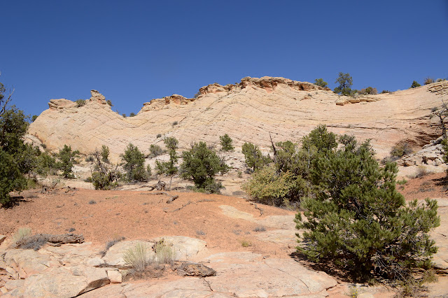
I get to the road and turn north. It is, quite frankly, boring. Comb Ridge climbs until it drops off suddenly and the road travels far enough below that that I never get to see out over Comb Wash below. On the other side, the berm and vegetation usually block my view of anything. The berm can be quite high. Up ahead, there is a place where the road dips and gets close to the edge. I have to find a way the rest of the way to sit on the edge and really look.


I sit with my lunch and finally figure out that my loop is going to be too much. Way too much. The connector area, cross country, is 4 miles further for a crow. Maybe I should just make my way back to the wash and see whatever it is I'm supposed to see there then get back to finding Posey's Trail properly. And in between, I ponder which bit in front of my might be Arch Canyon (pretty much right there) and if I can see the namesakes in it from here (no). Also, I marvel at this ridge. It's much more impressive from this view than from the road.


If I continue on, it will be well over 10 miles to make some sort of loop with roads and cross country. The road isn't exciting me at all. So, yeah, back to the wash and see what happens there. I backtrack to where a bit more water than usual seemed to have run once and follow it down hoping it'll get me there without destruction of the intertwined and tiny growing stuff in the sand. Barriers of juniper branches seem to have deer trails around them, which seems promising. If the deer can make it, surely I can.

Admittedly, the little wash doesn't give a grand view of the surrounding country either, but it does it in style. Strange overhangs in the cliffs and constant flourishes in the surface greet me at every turn.

There doesn't seem to be anyone walking up here, at least not since the last water flow. That's rather odd if there's a bit of trail a mile or so down the canyon. I zoom in on the electronic map... maybe this waterfall icon has something to do with it. I pass a rather distinct trail about a third of a mile above it, so that'll give me a way out of the canyon to make a different way. First, to see this "waterfall" and determine if it really is a barrier.

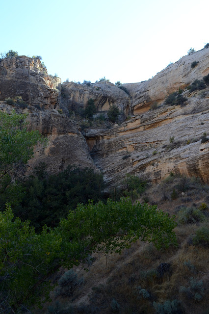
At first glance, I think I'm not going this way. But it isn't totally certain and there's another viewpoint to check it out from. I loop my way back up to see the ledges I was approaching.

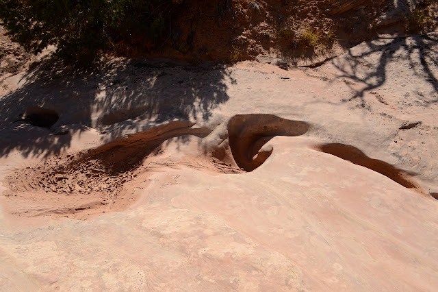
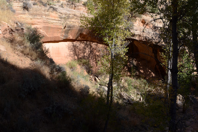
The ledge past the dry pool is indeed the end of a proper box canyon and very vertical to overhung. I will not be going along anything in this direction. I can see the trail down below, so I know I would be in the right place if not for the ledges. My excursion does give me the chance to notice the little natural bridges forming.

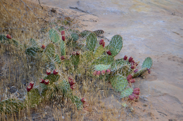
So I head back to that trail and head out the east side of the wash. It splits for north and south. Whatever north might be, that's exploration for another time. I go south and follow it, checking for ways down and what might be hiding on the far side of the canyon walls when there is a chance. There aren't all that many chances. The biological crusts are much more prevalent here than they were down south when I was hiking peaks and avoiding cholla. I'm swapping to the bigger telephoto enough that I want to have it more easily at hand than clipped into my pocket makes it.


I'm down past where I left the wash originally when I finally find a way down. This one gets steep, but the deer use it too and have made a trail off to the side that is slightly less so. I probably could have found a way earlier, but didn't venture out enough to be sure. The rocks like to be so vertical. Now that I'm down, I have some desire to see where the trail actually goes and now know it's only about another mile to get there. So I crash through an abundance of reeds that grow between me and the current trail in the wash and then turn up it once again. Odd to notice in the sand that apparently I've come and gone on this trail already. Someone is wearing my shoes!

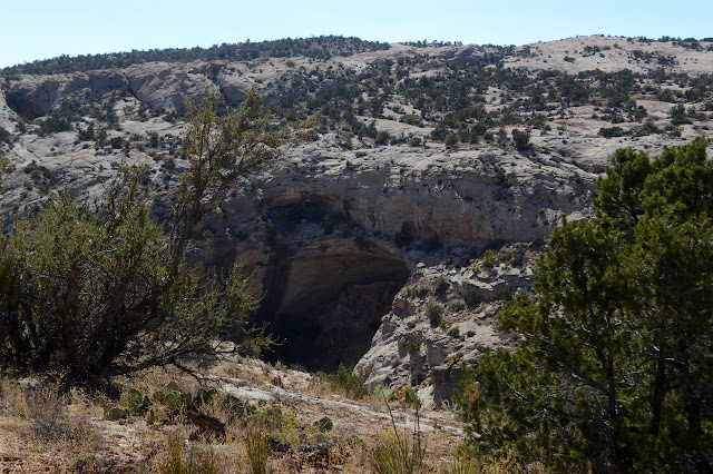
The trail points me right up to some of what everyone else said they were coming here for. There is an ammo can with information about this one in particular and a lot of information about in general. That includes the etiquette since it's really important to follow if any of this is going to be around for just the next generation to see. Seriously, fingerprints are harmful and footprints can be detrimental. Stepping near walls can put pressure on them and cause them to fall. Stepping on a big clear spot may actually be the midden. It may be "trash", but it is also a huge amount of information. Areas are chained off to help visitors know where they can go in this one, but the chaining is not always clear and someone may have come by and adjusted it in a way it should not have been adjusted, so it is important to know better in the first place. When in doubt, refrain. It is a good idea to drop items that stick out from yourself, like hats and packs, somewhere before entering since those have a habit of touching more than you expect. The alcove itself is scary to enter. It has collapsed at some point, although it seems to have been before much of this was built. Still, I'm sure I hear something crack when someone comes up behind and shouts up at me. (They are wondering where the ruins I visited this morning are. The ones with the sign to point the way. Had they opened the register, the paper on top would have told them where to go.)

I have been pondering the canyon and the dirt within it that forms ledges in front of the rock walls and wondering what the sequence of events might be with this. It looks like the rocks were carved, then the canyon filled in with dirt, then that got carved away again. Did it fill before or after people lived here? The next cave suggests the dirt was deposited before. It also looks like anyone climbing up to the floor level is contributing to there being no more floor left. Footprints can be detrimental. I look for places to look across to see inside and leave the alcove alone. There is bat information at this one with bat monitoring equipment. That actually is another hint to leave it alone.

Then there's the end of the box canyon and there were definitely candidates for routes out along the way. Still, seeing a deer print far up the canyon makes me think of a reason to want to be in a box canyon long ago. Any deer who passed this way could have been easily trapped.
There's still some spots I want to check as I turn back, but it turns out nature is pretty good at building walls too, although tends to drop a very odd choice of rock somewhere. Or perhaps I don't have the eye for it. I also need to try to enjoy the canyon itself instead of peering into shadows so much. The carving can be so delightful, at least when it is of sandstone rather than dirt.

Once back to my reentry point, it is generally the dirt. I suppose it has a little character to it. It isn't all bad. I add a check to my register entry for my reasons to come as I exit. I still have an hour of light to sort out Posey's Trail, but now I've noticed a big clue for finding it.
And where there ruins? Yes! Somewhere along that track, these could be seen.


©2019 Valerie Norton
Written 2 Nov 2019
Liked this? Interesting? Click the three bars at the top left for the menu to read more or subscribe!


Comments