Sandal Trail and the rest
Navajo National Monument
Click for map.
Navajo National Monument was formed to protect well preserved cliff dwelling ruins and prides itself on being a free monument. That's not just a lack of entrance fee. The camping is free. The tours are free. Water is available and its free. The items in the visitor center shop aren't free and donations are happily accepted, so there is still a way to support them in some little way. Unfortunately for me, there is also a season. The seasonal rangers have gone and the snow fall last night has put an end to tours until spring. The actual land of the monument is just a couple of quarter quarter sections and you can't actually step foot on it without a tour. With the tours shut down, the only hiking is a few short trails around the visitor center. There is a longer trail to get to the further portion of the monument, but that is closed to entry when there are no tours on. I had time, so I set off to hike every inch I am allowed to hike over the rest of the afternoon.

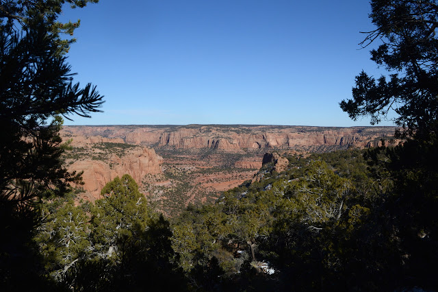
There are three trails that leave off from behind the visitor center. The main one is the Sandal Trail that comes to an overlook with a good view of the Betatakin Ruins, the closer one. Before they break up, there is an exhibit of housing used by Navajo. The Canyon Overlook trail breaks off to the left next. That goes to Canyon Overlook Campground. Next Aspen Trail breaks off to drop down into the canyon. That is the one that would be used for the tours of Betatakin. Today it is closed at an overlook of the canyon's aspen trees. That is the first trail I want to take.


One fellow starts down the trail ahead of me, but let's me pass after a short way. Then I am the first one down since the snow fell. I carefully keep my feet under me, but the new snow seems quite forgiving. Once people have crushed it down to ice, traction devices of some sort will be wise.


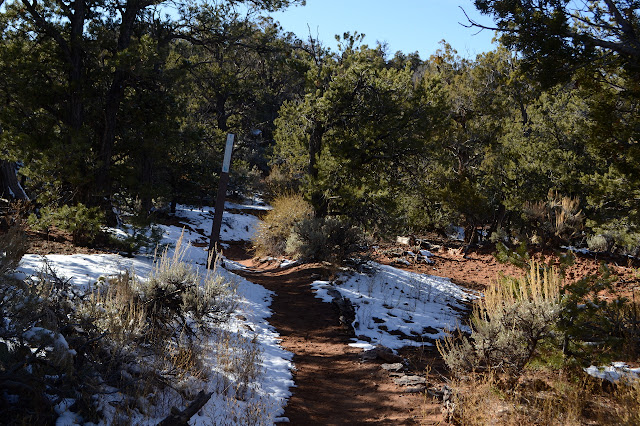
Heading back up again on the fresh snow is also easy, for now. There are a lot more footprints on the Sandal Trail and some of it has become ice, but most has melted. Signs along the way describe the local plants next to specimens of each.
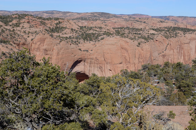

The overlook comes with fencing and signs to make it safe and educational. Trying to see it all from here is difficult. There is so very much of it to see. One sign shows a map that indicates rooms can be five deep. It notes that there were 135 rooms originally housing some 100-125 people.


One sign goes on about large petroglyphs, but of course I can't see them from here however large they are. I head back to the first split and try out Canyon Overlook. It promises a bit of history as it passes the original ranger station for the monument. This one is dirt, sometimes under snow today.

The only people I actually see on this trail are mildly lost. They are looking for the overlook to see the ruins and did not realize that the name of this trail is to signify the campground it goes to, not that it is the overlook. I look around a little more, decide I don't want to hike as the trail turns to road, and turn back.

©2019 Valerie Norton
Written 9 Dec 2019
Liked this? Interesting? Click the three bars at the top left for the menu to read more or subscribe!


Comments