Humphreys Peak, highest point in Arizona
Coconino National Forest
Click for map.
The San Francisco Mountains probably have a more interesting name as they are one of the four sacred mountains that mark off the cardinal directions of the Navajo world. I always liked that directions were so deeply important. There are six including up and down, so it's about more than not getting lost and dying. And I want to visit the mountains. When I got to Flagstaff, not only were the mountains almost entirely free of snow, but the weather at the top would probably be quite comfortable, especially for the time of year. Two routes presented themselves, but the one that is "just around the corner" from camp is also quite long, so I decided to go the more traditional route to climb Humphreys Peak, the high point of the San Francisco Mountains, not to mention the Kachina Peaks Wilderness, Coconino National Forest, Coconino County, and the entire state of Arizona. This starts in the Arizona Snowbowl, a ski area that seems to be doing what ski areas do in the off season: construction. Parking to hike the peak is in the first and very lowest lot and all the others are closed. I'm not particularly early, but there are only a dozen or so cars in the lot and that includes the few workers moving earth around below. I take it that some weekends can find thousands making their way to the top. Friday and a bit late in the season looks like it will be much nicer.

The trail starts at the far end of the lot from the entrance and is well signed. This includes the information that off trail travel is prohibited above 11,400 feet to protect the San Francisco Peaks Groundsel. Since my Forest Service quad doesn't actually show a trail to the top, I'm a little worried that cuts off the whole enterprise, but the signs certainly indicate I'll be able to go. The trail sets off across the bottom of the ski run, under the lift, and into the trees where a wilderness sign and another copy of the regulations for this specific wilderness. Then it gets confusing. People have hiked positively everywhere under those trees near the wilderness sign. It takes me a little bit of examination to determine that I should just continue straight over a couple sharp tall rocks. It is extremely rough.

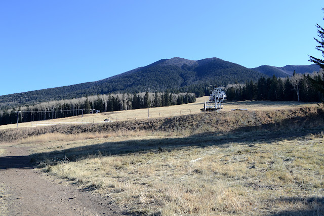


After two switchbacks, as the trail gets close to the ski run again, there is a second wilderness sign and a register. From here, the trail is much smoother. Rocks have been chipped or removed and even steps have been built. It is like a trail from a completely different era than the first part. There are still tree roots to get in the way, but there's no helping that in a forest and with high traffic. It takes a few miles of hiking in that forest to finally have even hints of views. The only trail side snow of the day is tucked into a sheltered meadow shaded by the trees. There is so little, I am tempted to call it "molecular".


As the trail curves around from a west slope to a south slope, it starts to actually feel a bit warm. The sun has been here longer. Down below, there is a huge cleft in the mountain that is riddled with the various ski runs. It is holding a lot more snow than anywhere the trail passes. I note the distinct shape of smoke rising in the distance. It is probably a controlled burn, but I still carefully note its position in relation to anywhere I might want to be.

At 11,400 feet there is a sign to remind me that there's no off trail travel now. There seems to be a use trail just short of it. I guess folks just have to get in that last bit. It's getting a lot more open now with tree line coming up.

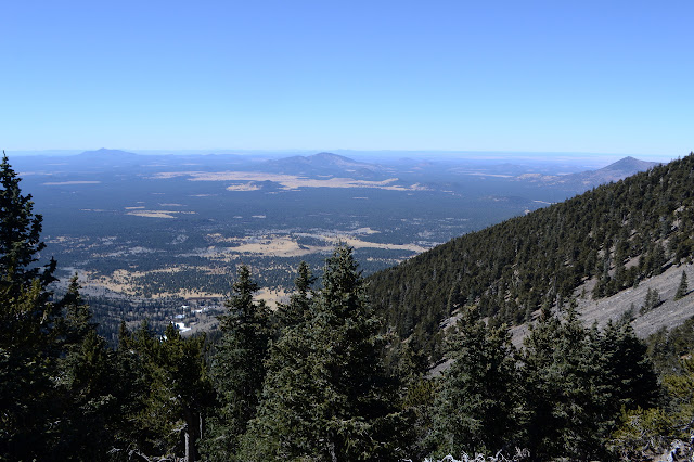
Topping out to the ridge, there is trail to the peak. At least, if the sign points there and there are posts with "trail" carved out on them along it, it's probably a trail.


There's all sorts more view now with only a few hardy trees left. The trail promptly drops down a boulder in a little bit of class 2 before settling into just a walk through a rocky mess. There are spots where it does small switchbacks that have been missed by people spotting the "trail" post higher up without noticing the one off to the side. Still, it is keeping the boots mostly centralized and away from the roots of the little endangered flower. Hikers pushing rocks around while they walk is their number one threat.
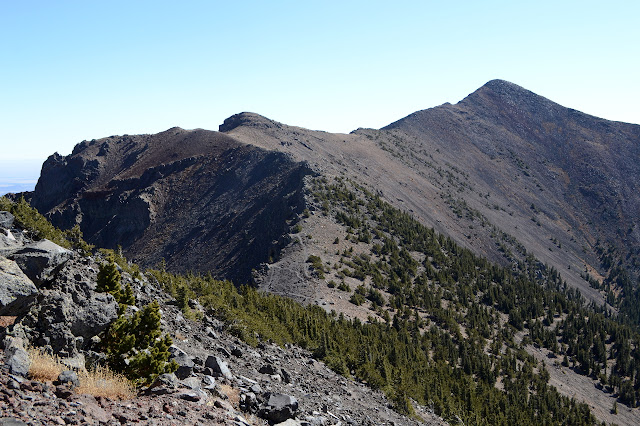
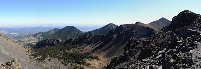


A sign and a reference mark sit at the top and when I do, everything for hundreds of miles sits below me. The rest of the land doesn't just drop off, it drops off quickly. Humphreys at 12,637 feet and Agassiz at 12,356 feet are the entirety of Arizona's 12,000 foot peaks.


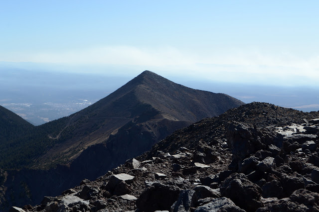
After 15 minutes on the peak, I even get it to myself. Sharing it with three people wasn't so bad either.
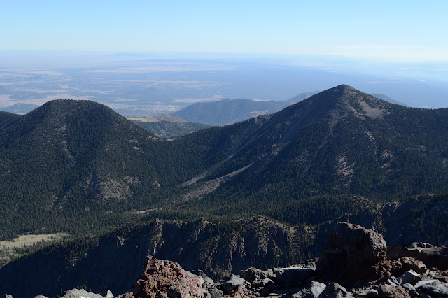
I head down the trail again, this time completely missing the tiny bit of class 2 I hit on the way in. I must have made a wrong turn to make the trail slightly hard. I have enough time for something else and since I can't do Agassiz today, I think I will stop by the B-24 wreck. It is off trail, but below the critical elevation. My guess for where to find a use trail is good although the use trail isn't all that clear. It splits many times.
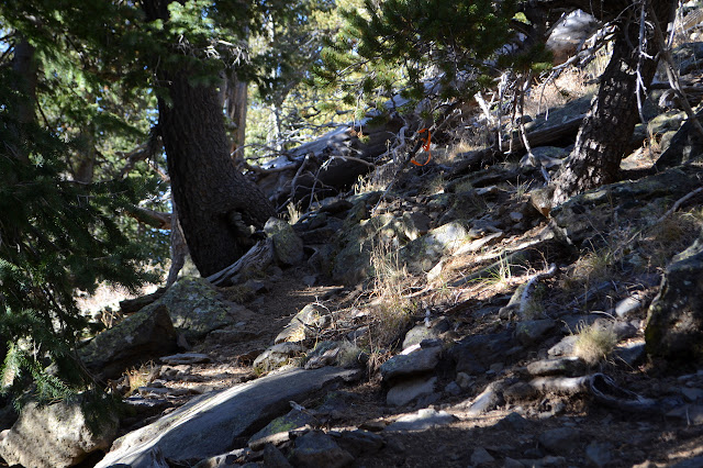
Not that it matters so much that it splits. It is easier to walk where a trail is forming, but as long as it keep level or climbing a little, I will get there. The debris field is half a mile long on an open, rocky slope. I manage to keep to dirt a little longer than some of the trails, which is nice. The rocky area is harder to walk along.


I have never seen a crash that has so much left in place. I have come upon a few pieces, but this is jarring. Propellers and wings and many other pieces all tell a story of extreme violence, but what else could there be of a fast flying piece of metal encountering a quickly rising bit of rock?


I don't seem to follow the trail, or at least good route, as well on the way back. Where people have walked across the rock field, the rocks are more stable, but I miss a bunch of the route through here and deal with wobbling. I still get back to the trail before too long. I won't be down before the sun or even before dark, but that's alright. It's a well used trail and would be hard to lose except by that first wilderness sign. I can't see anything of sunset except a strangeness to the light that is amplified by the smoke from the burn.

The trail seems to draw itself out as I head down into the gathering gloom and then dark. It gradually dawns on me that there are two wilderness signs because it was once shorter, cutting across the lift higher up to join a higher parking lot. The lower section of trail is so rough because it is from a different era and trail building is generally not practiced to the same art as it once was. I carefully step over the tall rocks that slightly block the trail thinking that it would greatly help if just that one spot got some extra care. As I cross the field cleared for skiers, there is one set ahead of me, and as I look back, I see I am not quite the last one.
©2019 Valerie Norton
Written 14 Dec 2019
Liked this? Interesting? Click the three bars at the top left for the menu to read more or subscribe!


Comments