Wing Mountain
Coconino National Forest
Click for map.
I seem to be collecting fire lookouts, but the inclusion of Wing Mountain on the list of Arizona lookouts on Peakbagger wasn't what got my notice. It was the simple fact that the quad west of Humphreys Peak is named for Wing Mountain. I'm a bit suspicious about it being a lookout because there is not so much as a trail going up it, much less a road that is common for such things. People who have climbed it seem to have just picked a side and gone for it. I picked the side where there is a shoulder called Little Wing Mountain so I could climb and get the benchmark, then move nearly halfway around the crater to the high point. It is a side that looked highly climbable from afar, which seems like another plus. Forest road 222 (Wing Mountain Road) in seems generally maintained, but 519 only happens to be passable for my little car by a bit of luck. I park at 9230C where someone has had a camp site. It is a little way down the hill from the high point of the road on the mountain, but I don't feel like passing up good parking for a couple fewer feet to walk.


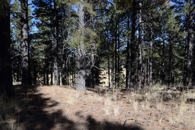
I head out upward and westward, eventually gaining the shoulder and then joining up with 9230B. This is probably the choice start for the 4WD vehicles and has some nice camping at the end if that's something that is wanted. There's trail past where the road ends, winding around the fallen wood along the little ridge that reaches out to the shoulder. As the ridge merges with the mountain and everything is steep, it even swings to the side for a more gradual climb and there's a ribbon.


There's no second ribbon or the trail doesn't switch back where I take it to do so. I am aiming at the benchmark rather than the high point and don't expect as many to do it that way. I'm back to finding my own way. There's still plenty of faint deer trails all over to follow. I quickly find that it is better to stay under the trees. Not only is the sun a little warm for climbing, but the needles really help hold the ground together. The meadows are unsteady.


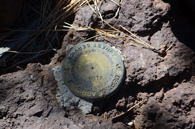
I seem to have aimed pretty well, because once I am at the top, I'm only a few yards from the benchmark. It has a cairn to help me find it. It's an old Forest Service mark from 1936, but NGS added a reference to it in 1958.
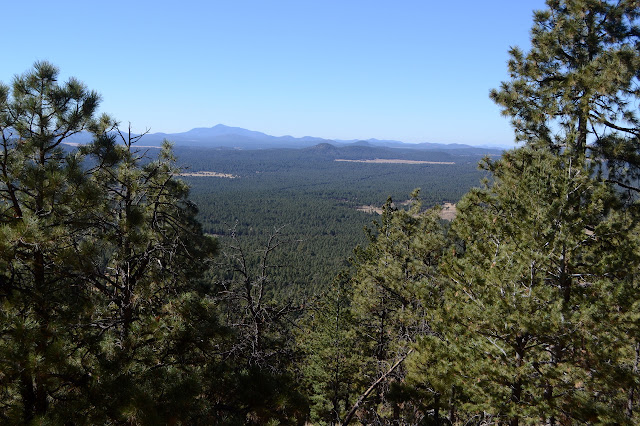
There doesn't seem to be anything else of man up here. I'd have guessed the benchmark was at the lookout since it isn't the high point. It's obviously sloping upward to the east. Now to that high point. It is easy walking and a gentle climb around the curve at the top of the volcano. There is no sign of a lookout anywhere along the way either.


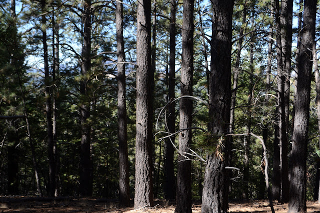
The top does have some very old cuts including one tree cut high up and a few short sticks. It isn't until I decide to sit against the very tallest tree at the very highest point that I notice the steps nailed to the other side.

Well, that might just be the lookout. The very earliest were tree based. This could have been one of those and abandoned for the modern locations before it ever got updated. Those were all 100 years ago and this tree looks like it would have been a skinny thing that long ago. Then again, I don't really have a good idea how fast they grow and thicken. It would not have been a thing of concern 20 years before the benchmark was placed on the other wing of the mountain.

Another popular route to climb this mountain is from a gravel pit below here. I can see the trail from those, but also hear that someone has set up for the more common use of the gravel pit: target shooting. I didn't even consider going that way. There's still faint trail continuing around the rim, so I think I'll follow that to the low point, then continue circling down to the road below.


Other than having to negotiate my passage with a barbed wire fence, the way is pretty straightforward. I can mostly find game trails to make the footing along the side of the peak a little easier and gradually they start to look familiar. Then there is even another little ribbon below, which, on second glance, is the little ribbon I spotted on the way up.
Once down to the road, I start following it, but can't bring myself to bother with it the whole way. Instead, I walk out toward where the Little Wing Mountain peak should be. It's just a huge flat area with wide, low rock outcrops. I can't figure out what is the highest of that which I can see and certainly have no idea if there might be something higher hidden by the trees. It's just a really big shoulder, not a peak. I give up finding what someone called "Little Wing" and follow the road to the car again.
©2019 Valerie Norton
Written 23 Dec 2019
Liked this? Interesting? Click the three bars at the top left for the menu to read more or subscribe!


Comments