Dams of Stone and Steel
Kaibab National Forest
Click for map.
The map says simply "Steel Dam Fishing Site", but the geocacher says it's the oldest and largest steel dam in the world. I resolved to go and see it and sorted out a looping route from exit 149. This does let me wander a piece of "Route 66", but I really should have used exit 148 for my starting point. The geocache description even says as much. From there, the dam is drivable in a sufficiently sturdy vehicle although all bets are off once the road gets wet as it is now. I wouldn't be driving it anyway.
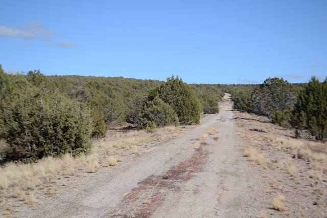

There's supposed to be a mountain bike trail along this segment of US-66 with a second piece that drops off it near the edge of the forest, but I don't see that segment. Maybe they just like riding the old highway to bother with the other piece. I'm not long on the road because I'm looking for a dirt road going north. One map says it'll take me right where I want to go. The other says it'll split and neither section will go anywhere in particular. The pessimistic forest map wins as it comes to a power line and is marked as following that, but has a second piece that wanders in another direction. Neither goes particularly far. All of it is difficult to walk, which doesn't seem to have prevented someone trying to drive it. Maybe it was yesterday when it wasn't quite so wet yet.

I just have to take it cross country. The mud is slightly easier to deal with that way. Seeing cliffs ahead for the other side of the reservoir worries me a little, but there's none on this side.

So I make my way down to the reservoir where there is a bench, a little display case, and a trail. That's rather unexpected. The display case remains empty, so it doesn't explain things any.

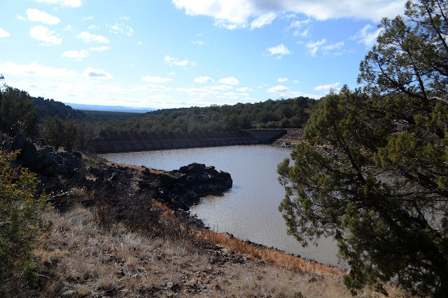
I still need to get to the other side of the reservoir to actually get the geocache here. The trail goes the other way, but maybe it just takes the long way around. I may as well try it out.

A lot of work went into this trail clearing off the larger rocks, but it doesn't go the long way around to the fishing area. When it should be dropping to cross the inflow, it is instead climbing some more. I pass some stacked rocks that are the remains of something, then an elaborate metal sign to say I'm halfway. I expect now that it goes to the "stone dam" on the map, so I'll get to see that.

When I get in view of the "stone dam" it looks like just an ordinary concrete dam to me. There is a spur for a viewpoint, then the start of the trail. It has a larger display case, this one filled with pictures of volunteers who did all the rock moving one weekend to make this trail. There is a nice gravel covered parking area and a lot of gooey mud between the trailhead and it.


And now I need to head back and either make my way down the other side of the reservoir below or cross below the dam. I stop by the viewpoint on the way back.

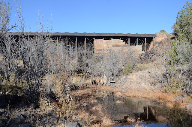
Some details about the far side of the reservoir make me hesitate to go along that side. I'm sure there's plenty of room to walk past some of the more vertical areas once one is there and if there isn't, it's not far to get up to the top of the minor cliffs. But trail does make some easier walking, so I'll stay with it. At the end, there's a thin use trail continuing on to a rock outcrop for a better look at the steel dam. I follow it and keep on going to the outcrop the dam is attached to. On the other side of it, an old road climbs to the top of the dam. This makes an easier way down. Hum. Down. To the outflow of the oldest and largest steel dam in the world currently with a full load of water behind it. It isn't making any sounds like it is stressed, though.

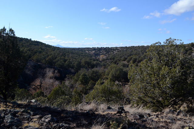
There's a lot of water down below it and I'm lucky to find some nice big boulders to rock hop across it. I climb up to a road well ruined by water and unused a long time. This goes directly down to the car, but I think I'll try the road in the directions for the geocache instead. That requires a little winding through boulders to the top of the dam on this side.

The road the other way does look in much better shape and even gets used. I'm not sure if this is due to luck or actual work put into it, though. I strongly suspect it is just down to the terrain it passes through.

There is a junction as the road tops out. The crossing road follows a pipeline and power line while this road continues on to Steel Crater and whatever else. Going downhill along the power lines connects up with exit 148. All the other roads are better used. Since I'm here, I think I'll check out Steel Crater. It's less than a quarter mile out of my way.

The crater hasn't got a rising edge, just the drop down to the water. I suspect it might actually be a sink hole. It's surrounded by fence to keep cows out, but people have left the gate open so that isn't working too well. It's a fun little feature. Now time to head down the big hill.

I don't stick with the utility road, though. I foolishly parked at the wrong exit after all. I cut down after a while and aim first at the Monte benchmark, then the rest of what was once US-66 to return.

©2019 Valerie Norton
Written 23 Dec 2019
Liked this? Interesting? Click the three bars at the top left for the menu to read more or subscribe!


Comments