Little Eldon Mountain
Coconino National Forest
Click for map.
Enough with common things, time for something a little out there. I think I would have visited Little Eldon on the way had Sunset Trail been open, but I think I could still do it. A nice little loop looks available with a few possible starting places. I pick Little Eldon Spring. From there, I will toddle along the Arizona Trail (as it follows Little Eldon Trail) for a few miles until Heart Trail. That climbs to Sunset Trail, but at that point, I want to start following the ridge on up to the peak, which is on the open side of the trail. Once I've been to the top, I'll follow a different ridge down to Little Bear Trail near its intersection with Sunset, then back down and around on the Arizona Trail again. Someone might think I'm just being sneaky in avoiding the closure of the trail, but with the peak as the goal, it feels totally valid to me.
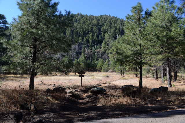
The first order of business is, of course, to visit the spring. Right beside the junction of the access trail and the Arizona Trail, there was once a huge concrete pool. The big circle is now broken up and has a juniper coming up through it. On the other side of the trail is a fence. I shimmy through the narrow V slot for access and follow the thin trail to a rock wall. It looks a little wet, and when I finally get to it, there is a black pool below it. More trail seems to skirt the side and climb the rock. Maybe there's something nicer beyond.

Or maybe it's the quick way up the mountain. I'm not out for the quick way. I have my long, wandering plan. I head back and start walking a first little piece of the long trail. The landscape is all sparse trees with very little undergrowth. It is hard to believe that it needs thinning and burns, but this is not the area where that is happening.


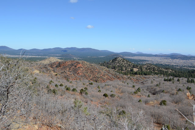
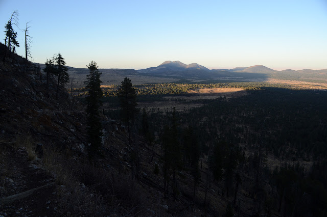
The trail curves around and climbs on a route that is clearly loved by bicycles. There is a jaggedness up by the ridge that seems quite in place with this being a volcano. As I get past some hills, it seems like I might be dropping into the huge caldera of a volcano that couldn't keep itself together. Perhaps I am just seeing things or reading too much into general circular shapes.


Another possible entry point passes with a sign, then there is Heart Trail with a warning about the closure above and a more permanent warning that this is not recommended for horses. That's always ominous. Luckily I'm not a horse as it is time for me to rise above it.


Nothing about the trail seems like it would be particularly troublesome to horses, but it has burned here recently. There are places where I can smell the odor of aging ash strongly on the mountain. I think it changes as the smaller particles blow away and this is still new enough. Most of the area was left, but there are long fingers of burn that came from above. There is more of it as I get close to the top. It is nothing like what greets me at the top and the trail junction.
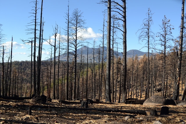
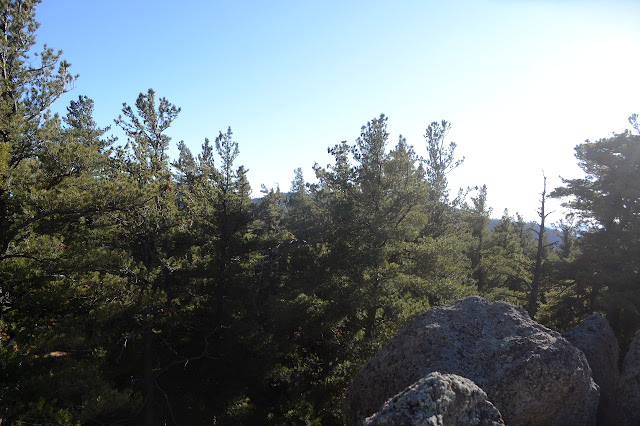
The sign at the top concerning the closure is outdated and encompasses more than the current closure, adding that there might be active fire in the area. It just smells like dead ash, but there is an awful lot of it. The ridge line I want to follow is all fire killed trees here. I walk up it listening carefully, but there is nothing to hear from this forest. I am glad when it turns back to green trees. I knew I'd seen green at the top of the probable peak.


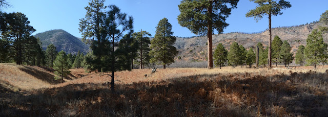
The ridge is wide and not so hard to walk as long as I don't get tangled in the rock outcrops. There are game trails to help suggest which way might be best to go around. I'm going around one more rock pile when I realize it is actually the peak, so I circle back and climb it along what could almost be a trail. The rocks take a little bit of study before I can find a way I'm comfortable with to get to the highest. It has a register with very few names placed by Gordon MacLeod and Barbara Lilly in 1988.

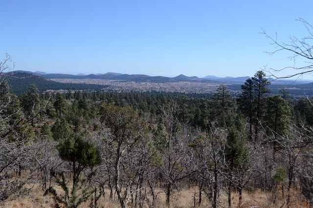
The view isn't much. There are some directions with a suggestion, but mostly it is trees. Still, I'm feeling happy about it. It just feels like a right mix of... I'm not even sure what all. Uncertainty with the jutting ridge sections, quick challenge with the final boulders, spots of view, rarity? Not much of any of it, but a little bit of all. Maybe I'm just in the right mood. It makes me happy.


I head down, initially overshooting the ridge I intend to start down. There seems like trail down a gully, but I get less and less sure of it quickly. Back to the ridge. Besides, I think the gully would put me on the closed trail a little bit. Something has been down along the ridge, too. This one was digging through the dirt the way pigs do.

The ridge is so gentle, it's hard to know if I'm following it at all. It gets steeper as I go and there are more and more small downclimbs until I get to the steepest bit and it is a boulder field. It takes a little searching to find a way down them. All the vegetation proves helpful as a fallen tree makes my way down. The slope reduces again as I find myself along the path of some machine that ripped out trees making a fire break. I retreat to the unburned side of the line for better footing until finally reaching the trail at the bottom. This ridge was distinctly harder than the first.

There are more signs warning of active fire rather than of the current closure at the junction. From here to Schultz Pass, Sunset Trail is open and I thought about going that way, but I expect Little Bear is shorter. It's certainly more direct.


I should have paid more attention to how the trail seems to have long switchbacks that barely get lower. It's another example of mountain bike grade. It makes stock grade look hard. I'm not even sure I'm going downhill. Half the time I'm pretty sure I'm not.


Somehow the trail gets down the 800 feet in 3.5 miles. The steepest of modern trails do 800 feet in 1 mile. Most seem to try to top out at 600 feet a mile, so it would take a little less than 1.5 miles. This one somehow draws it out to 3.5 miles without traveling anywhere in particular or grabbing particularly varied views or anything. It's just meaninglessly long. It is shorter than going out to Schultz Pass, but only barely. Little Bear is a dreary end to an interesting day and I wanted to just cut it cross country so much. Maybe I should have, but it is inappropriate to cut switchbacks. But I'm sure it's lovely on a bike. It's dark as I follow the last little bit of the Arizona Trail back, making an accidental run down the spur to the parking area just a little west of the trail I took in.
©2019 Valerie Norton
Written 16 Dec 2019
Liked this? Interesting? Click the three bars at the top left for the menu to read more or subscribe!


Comments