Medlar Mesa and Crater Mountain
Prescott National Forest
Click for map.
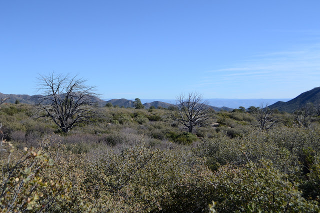
I stayed at Powell Springs Campground, which is a free campground deep in some ponderosas that only exist in the canyon area. Outside the canyon, the area is chaparral. A trail heads out the back of the camp and I plotted out a loop of travel along it and some connecting trails, then increasingly large roads. The last little bit to the campground road would unfortunately be paved, but most the roads are rough and narrow and unlikely to see much traffic. There seems to be no parking specific for the trail, just a small loop for turning around. There's also no sign for the trail, just the suggestion that road once went further.

Road did go further, and is pretty obvious as it crosses the creek and continues along it on the other side. The campground is surrounded by a fence and where the road encounters it, there is a slot to hike through and a ranch gate for horses. Then there is general confusion. One steep route goes up to a flat north of the creek where there is old road around the edge of the fence and some cairns that don't seem to actually be marking trail. There's something that looks like trail just a little up from the creek where the Forest Service map indicates it should be, but it ends abruptly. There's more old road around the outside of the fence heading south. I can't sort it and decide to head up the creek bed and see the spring at least.

There's hints at a trail sometimes along the creek. I go up one side that seems to have trail, only to have it close up on me. I go up the other and find a pass through cut in a log. Mostly I'm just in the bed where it is sandy and there is only one little rock scramble and a few low bridges of vegetation to duck.

I decide to climb out to the right where the trail is supposed to be and see what I can find. There do seem to be some candidates for trail, but all a little bit wrong. Actually, walking through this chaparral is rather easy. I pick one that seems most likely and go for it. It passes near a big and old manzanita that has never had a branch cut. That seems unlikely for a manzanita so close to a trail. This is definitely not it. Still, I get to look at more than the low valley of a dry creek.


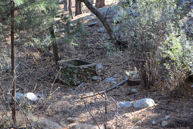
The spring is easy to spot by the metal fence surrounding it. At this point, the trail is indicated to be in the creek anyway, but there is no opening for hikers anywhere in the fence. Where it goes across the creek bed, it is swinging wood pieces that allow water surge to pass. It is more the illusion of a fence and since I want to see the spring, I duck under. There's water here and a pipe going to fill a trough just outside the fence. An old trough is now a natural planter and shooting target. The spring itself isn't much, but it is dry above and wet below.
I think I might have trail going around the left side of the enclosure and follow it, but it can't be trail. Many bushes have broken as a result of those passing on this, but none have ever been cut and it sticks with the creek after the proper trail is supposed to break off to the left. I find myself led to a grassy area with salt licks and a corral instead. I think I can see a trail or even a road cut through the chaparral heading south, but I'm done with trying to follow that. There's a spot where it goes the long way through a marked inholding. If it is this vanished where it is public, I might just find signs there.

Instead, I think I'll just go up the mountain the loop goes around. I was thinking I might from a point further along the loop anyway, and the brush is so easy to travel through, I might as well just go for it now. The peak is unnamed, but there is a Juniper Mesa Tank down on a lower flat.

I feel a band has been released from my heart as I step from the trail and start picking out my own way. I hadn't realized I'd been so constricted lately. It is a little bit of joy to have the freedom of going any which way. Well, within reason. There are a few cactus to avoid.


This must be open range, as the salt licks and trough indicate, and the trails left by the cows remain long after the cows have gone. I have plenty to choose from as I make my way up to the top.


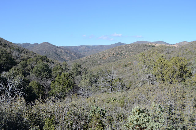
I would have just tagged the middle point marked with elevation had I come up along the bigger loop, but now I have time to poke around to all of the three bumps that could be the high point. It's definitely not the southeast one, but I think the north one might actually be higher than the middle, and that sort of on the northeast side. Being a bit of a mesa, it requires walking around to take in all the view anyway.


Down again... I'll try to hit the end of the road that is supposed to be there. Who knows what state it is in. It is a little harder to navigate the north side vegetation and the cows might not come through as often, but there are still plenty of ways. I make my way down to a saddle, thinking I see trail coming up the valley and then realizing that the trail I expect comes up toward the other side of the saddle. The map doesn't claim anything actually gets to the saddle, but there is trail, trail marker, a gate in the fence with a sign to keep it closed, and someone lost a hat.

I follow trail down to Medlar Spring as best I can, but it isn't distinct still. It's only supposed to be from Medlar Spring on around to the Ash Creek Well where I was going to be coming from anyway. I can't find the spring, but there is a change in vegetation. There's a short saddle before the road, which goes up to another random point on the mountain. There's as much trail heading over to the road as there has been anywhere else.

Current road, such as it is, goes up to the saddle and stops. Someone has been up it in an ATV recently. Someone was up it on a horse more recently.

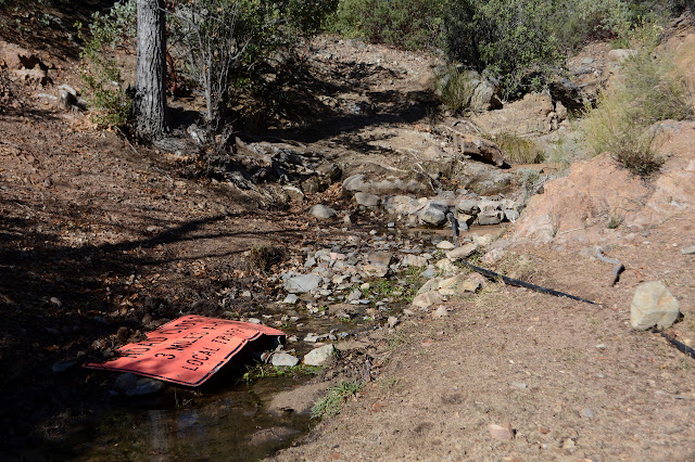
It grows a bit once down among the trees. There are even a couple nice camp sites and a couple more that look like prime areas for flooding when it rains. As expected, it runs into steadily larger roads. Lots of signs have been put up to discourage it, but anywhere a sign has suffered the slightest bit of damage folks have been taking liberties with the washes, too.


Even as I come to road that people use to get to their homes, it is something not maintained for wet weather travel or low clearance vehicles. There's not quite enough time, but once at the pavement, I think I will go up Crater Mountain and simply cross the road to take it to a mine and then hopefully connect up with a fuel break I can see climbing the mountain on the far side from the peak. If I can get down near the peak, I can basically skip all paving.

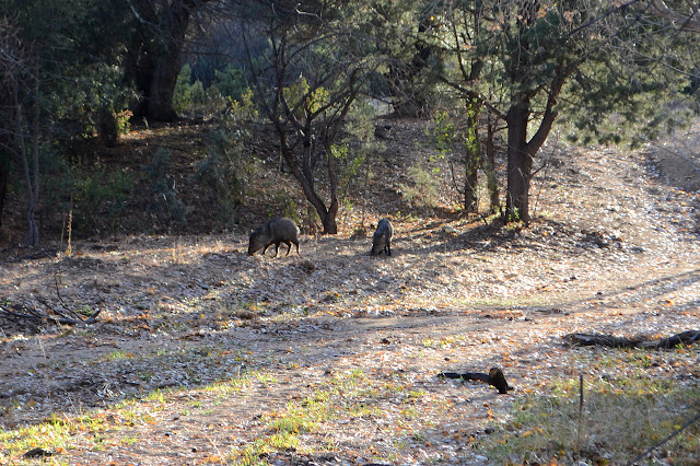
I'm not certain if I'll be able to pass the mine as I go around the gate marked road closed, but there are plenty of foot prints and when I get into the area, there's a slot for me to pass through the fence without messing with the horrible ranch gate. The fence surrounds Sunnybrook Spring, not the mine area, and there are pigs partaking in what the area has to offer as I arrive.
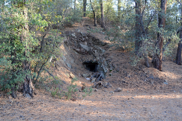
There's just a ranch gate to get back out of the spring area. Bother. On the far side is Sunnybrook Mine, which has a little bit left of itself.

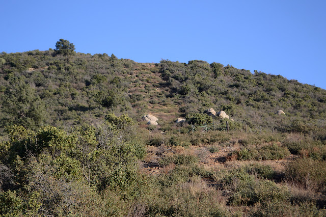
I follow the road around and then follow trail. When I can see the fuel break, it looks like I might not have followed in the correct direction, but things eventually meet up. People have been coming up it and there's a sort of trail through the regrowing brush.

Trail is more distinct at the top just past a lovely single shade tree. I follow it almost too far, because it starts down to follow the fuel break as it moves over to another peak instead of up to the top of Crater Mountain. I have to go cross country for that, but the vegetation at the top is easy to travel through. I can't help but notice that the last user of the trail was a mountain lion. The dirt changed as I climbed and the stuff up here sticks to my shoes. It doesn't seem to have stuck to the lion's paws quite so badly.


There is one last surge upward before the top and there happens to be some cliffs to avoid on the way. The lines on the map seemed so tame, too. I strike out between two of them to curve around to the peak and it works well. The very top is a rocky outcrop that is easy to climb. I don't see any sort of crater, though.

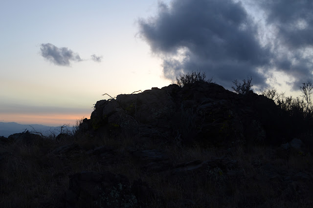
The landscape drops off precipitously on the far side of the peak.


After watching the sun go down, I head down. I am sure I saw a way when I was looking over to it, but as I move to the side from the top, the vegetation quickly becomes difficult. This is nothing to try to figure out in the dark. I'm quite confident of being able to follow the way I came up in the twilight. I expect it'll become another ordeal if I try to go the shorter way.
I do vary the route down near the bottom. There is supposed to be an old road that goes a little further west before meeting the pavement. It is a faint thing now, but I manage to follow it to a well used turnout. It's a little spooky because some campers have the area done in garden solar lights like it was a house rather than a tent. I hurry along as it gets colder and the dark has already set in.
©2019,2020 Valerie Norton
Written 3 Jan 2020
Liked this? Interesting? Click the three bars at the top left for the menu to read more or subscribe!


Comments