Big Rocks Wilderness and Pahroc Spring
Caliente Field Office BLM
(map link)
Camping at the edge of Big Rocks Wilderness by the "Welcome to Mecca!" sign, I decided that my goal for the day would be the Big Rocks Wilderness high point, which is also the North Pahroc Range high point. However, I did not want to walk up the road I had driven, nor did I want to risk driving it again with my inappropriate car, so I wouldn't be starting from the points west of the unnamed peak where the most successful attempts have originated. I would be traveling from the south, probably along a ridge. The one person who had traveled similarly from the north indicated that this was some of the most taxing terrain they'd been on. There is also a lower benchmark that would have been a more reasonable goal from my starting point, but no, it was not mine. I've been getting high points and here was another 4 miles off and I had all day to do it. I wanted another high point.

The most important message of the sign is please don't climb on the artwork, which we feel so strongly about that there's a law against it. There's petroglyphs out here to spot. I grabbed my pack already set with the day's supplies and started to climb the nearby ridge.


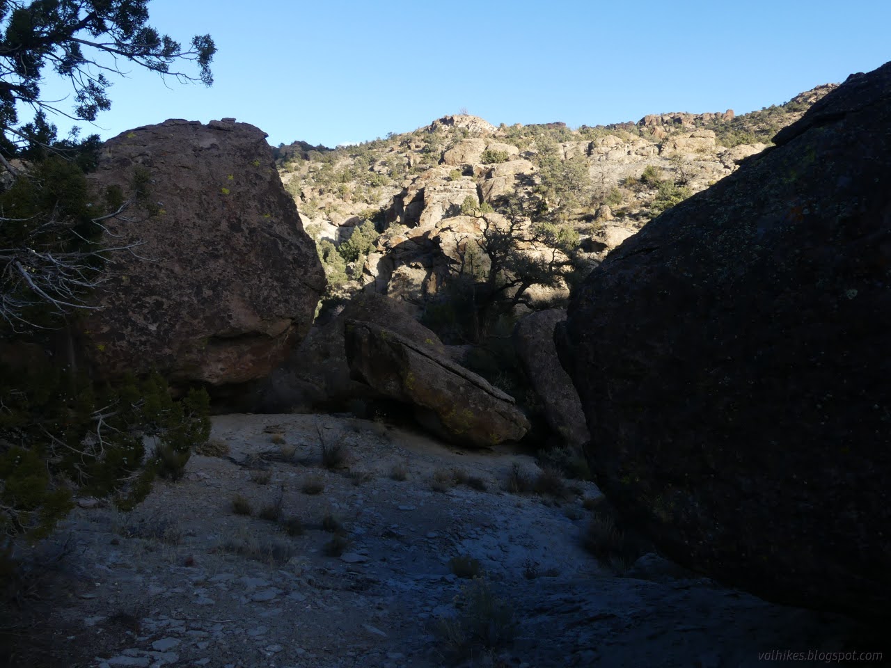
It quickly became clear that the ridges really aren't easy to travel. I'd been looking at a long ravine for travel anyway and so went to cross over to it.


I kept to the south side of the ravine until it looked like there would be no more places to walk on the south side. The wash bottom didn't look too inviting either. However, the far side had a ledge that looked very nice. I found a spot that wasn't too complicated to cross and got myself into some welcome sunshine.

Walking along the ledge worked quite well for a while. I did poke my way upward sometimes, but travel got harder where the boulders could cluster and cut off routes. Right near the edge was the best bet for a walkway. Presumably, the boulders roll off when they get too close leaving a little space.

I was surprised at how impenetrable the rock wall above the ledge was to simple, casual climbing. However, when the wash came too close and there was a need to change levels, that first change wasn't so hard.

The next transition of levels was not so easy. The wash split and the entirety around it looked like wall. I crossed the wash again going toward what looked like a usable spot to climb, but found access to that climb was problematic. The boulder field is a maze with mostly dead ends.


So I turned back. I hadn't spotted any artwork among the boulders, except that art by the prolific and varied hand of nature. I did see the odd selection of chalked up hand holds on a few rocks.

I decided to turn back and cross over to a second ravine that stretches a long way into these big rocks. On the way down, I found myself more tolerant of the higher routes and generally finding a way without impassible obstacles when I took them.


As I came around the edge to cross over to the next ravine, I was below a distinct layer of softer rocks in these monsters generally made of tuff. (Tuff is formed from volcanic ash fused together.)


I had a small ravine to cross before getting to the one that was my aim. I gave it all a look and picked out a route and used it, passing by a few cliffs with minimal scrambling.


The crossing wasn't bad, but I did see encouragement to quickly descend into the large wash once I got there.


Unlike the first wash, this one presented an easy route to follow right in the bottom. Sometimes it is sandy, but usually even that annoyance was not had.

And so I wandered my way upward. Eventually I was finding better hiking up on the northern side just a little bit.


As the time was getting late, I decided to head up a ridge for a little higher view and then found a nice spot to hang for a few minutes and a snack before turning around. The areas ahead were looking much more traversable than the first wash, but I also wasn't nearly as high up yet.


I headed back down. I had one last goal for the end of the day in stopping by Pahroc Spring and see its water. Walking was fine for the portion I'd come up and a little bit further.

Unfortunately, I came upon a waterfall where there was definitely no way down for me. There's not much easy way around either. I headed off to mirror the way I'd got there, leaving the wash to the south.


Besides getting across the smaller wash along the top of another waterfall, the walk south was very easy and even had some minor trail to follow.


But the spring is a bit to the south of the wash, too, so I was able to come down to it pretty easily. At the ridge, there was just easy hill dropping down the cliff layer. I did have to loop back a little to see the actual spring.


There is an old road to follow down, so I knew I was going to finish without trouble from things getting dark and hard to navigate. I could just follow roads back to the car.


So I didn't get anywhere near the high point. I quite enjoyed poking my way up the rocks anyway. The logs on Peakbagger were pretty good warning I likely wouldn't get there this way. I wouldn't mind trying different spots, but preferably with better access to other starts. Oh, and I still didn't spot any art even near the spring. It's supposed to be out there and not too uncommon.
*photo album*
©2023,2024 Valerie Norton
Written 23 Jan 2024
Liked this? Interesting? Click the three bars at the top left for the menu to read more or subscribe!


Comments