Geocaching and Finding Mecca
Caliente Field Office BLM
After stopping by the Oak Springs Trilobite Site a second time, I had a relaxed program of travel aiming at Mecca, #19 on the Ely District Recreation Opportunity Guide. It has a toilet and picnicking, so it would be easy to find although these circles aren't always well placed. (Crystal Wash Petroglyphs is marked on the wrong side of the highway, for instance.) It's not far, so I added in stops for a couple geocaches on the way. They were supposed to be stops during the first pass along this road. This time, I hit the "toggle talking" on c:geo so I could actually stop in the right place for these. It's annoying, but the Lincoln County High School radio station kept finding dead spots leaving nothing at all for my driving entertainment.I'd Go a Mile for a Smile-Yuccy Dead: Says it's "on a road you could take your mamma's Jetta." This really is a good road except for a little washboarding and part of the road that'll get you to the Chief Mountain West Trailhead (and campground) for the Silver State Trail, but appears to be maintained for other reasons. I found that if the phone shuts off the screen, it also shuts off updating the distance and direction but keeps on talking, so I ended up going more than a mile for this. There were a few hiccups, but I got things sorted out.
MOTEL STIX - DELAMAR: Right off the highway next to a one of Nevada's historic marker and a sign about the Joshua trees, which gave something to read and do since the geocache is, unfortunately, missing. And there were supposed to be eclipse stickers in there! Although it was considered a travel bug hotel, there were none listed when it went missing.

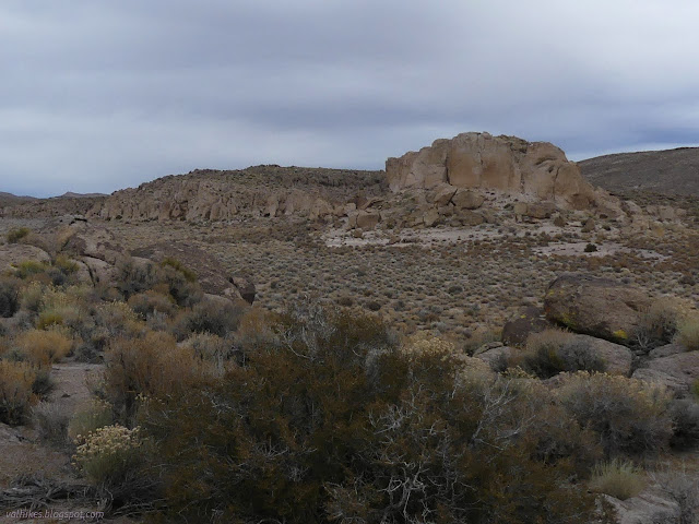
I'd Go a Mile for a Smile-Holes: Supposedly also "on a road you could take your mamma's Jetta," but since I am definitely on the hook for any fixes required for knocking the wrong bit of undercarriage, the little used and sage and hidden rock covered roads that do in fact lead near here (but are hard to discover) did not get driven. I stopped at a huge turnout on the highway and ducked through the range fence to walk the distance, which was much shorter than a mile. It's the one that got some photographs. It's quite an interesting spot.


Pack Your Lunch (LOG YOUR TRACKABLES!!!): Actually on the 25th, but may as well be with this collection. Another cool spot to check out. This one was hard because there's rocks to poke around and the coordinates were such that it could be high or low. I went high at first, which did mean I went well past the rated terrain, but I totally got to exactly where the coordinates pointed! It was wrong, of course. The terrain rating was pretty reasonable. I made another attempt with a different approach and got told I was right on it again, this time with something to find.
Pahroc Rocks: Just a quick walk from the good road to a quick find.
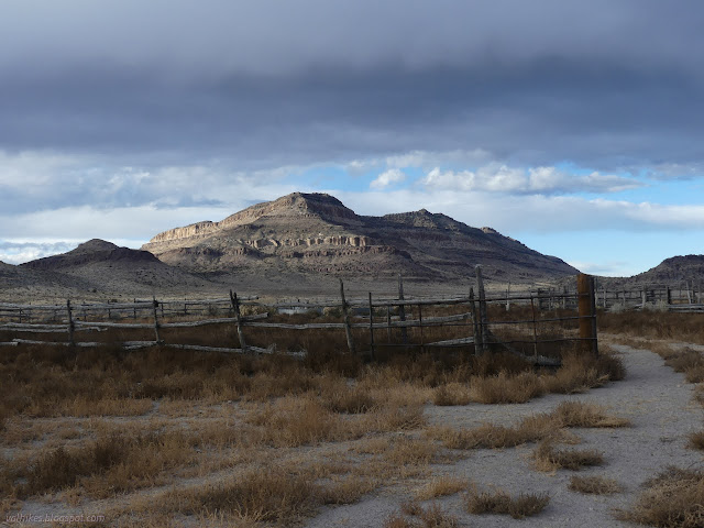
From the last geocache, I was on the correct road to get to Mecca. It's somewhere around intersection 13 on the Silver State Trail. That intersection is next to a corral, so that's easy to find. From there (and actually until there) I was looking for a toilet. I managed 2 miles up the 4WD road without seeing it. Some of it was a little surprising that there were no thumps on the undercarriage, but it looks like the road got maintenance after the last winter's massive rain storms. (Peakbagger logs indicate this road has been a lot rougher in the last couple years.) I didn't see anywhere to pull over for camp, especially since there were storm winds, but no rain, expected overnight, so I headed back to the corral to look more carefully on foot.

So I headed north again, including along a small spur road, on foot. At the end of a the spur was a small parking area and a sign proclaiming "Welcome to Mecca!" It and another sign about Big Rocks Wilderness near a short lollipopped 4WD road are the only infrastructure I found. No picnic tables and definitely no toilet. I did find a spot for my tent with a tree to protect it from the wind. I had camp and could decide what hiking would look like in this place with no formal trails.

As near as I can tell, it is climbers that call this area Mecca and it doesn't refer to a single spot. (As near as I can tell, climbers call all sorts of places they think are worth a pilgrimage "Mecca" so it gets to be a pretty common name. This area seems to have spots that are grand and spots that are mediocre leading to some mixed feelings among those who have made it.) There's a log on Peakbagger for the high point indicating they started at "the Mecca camping and climbing area" with a track starting just a little further up the road than I got. Maybe that's where the infrastructure is. The Guide also indicates that there's no camping there, which is what I was looking for even if I don't believe there's no camping. I was happy with my sign for verification of location. I made it to Mecca and had just enough sheltered space for a good camp.
*photo album*
©2023,2024 Valerie Norton
Written 22 Jan 2024
Liked this? Interesting? Click the three bars at the top left for the menu to read more or subscribe!
 After stopping by the


Comments