Highest Schells: South Fork Timber Creek
Humboldt-Toiyabe National Forest
(tan line, map link)
DAY 1 | DAY 2
The wind changed direction by morning and was buffeting away at the tent, but the temperature had barely dropped below freezing. I nommed away at my wonderful ginger chocolate pancakes, then had to work with care so nothing took off down the mountain while I packed up. While very noticeable, the wind wasn't going so hard that it was a fight.


Still in my puffies, I got moving toward Middle Schell (Schell Creek Peak 3595 on Peakbagger), which wouldn't take long. I found something like a wind shelter on the way, but wasn't sad I had taken the high perch instead. I expect it wouldn't have got me out of the wind quite so much. Um, until the morning, that is.


I went looking for a geocache as well as the register. It was waiting since 2016 for a first to find! It also happened to be set on the exact same day as the first set of register signatures. So... it's the register. It had been found and signed many times before.

It does have a nice wind shelter for sitting in, but it isn't big enough to sleep in. I had taken too long at this peak with searching for a geocache I'd already signed and got moving. Still many miles in the plan, after all.


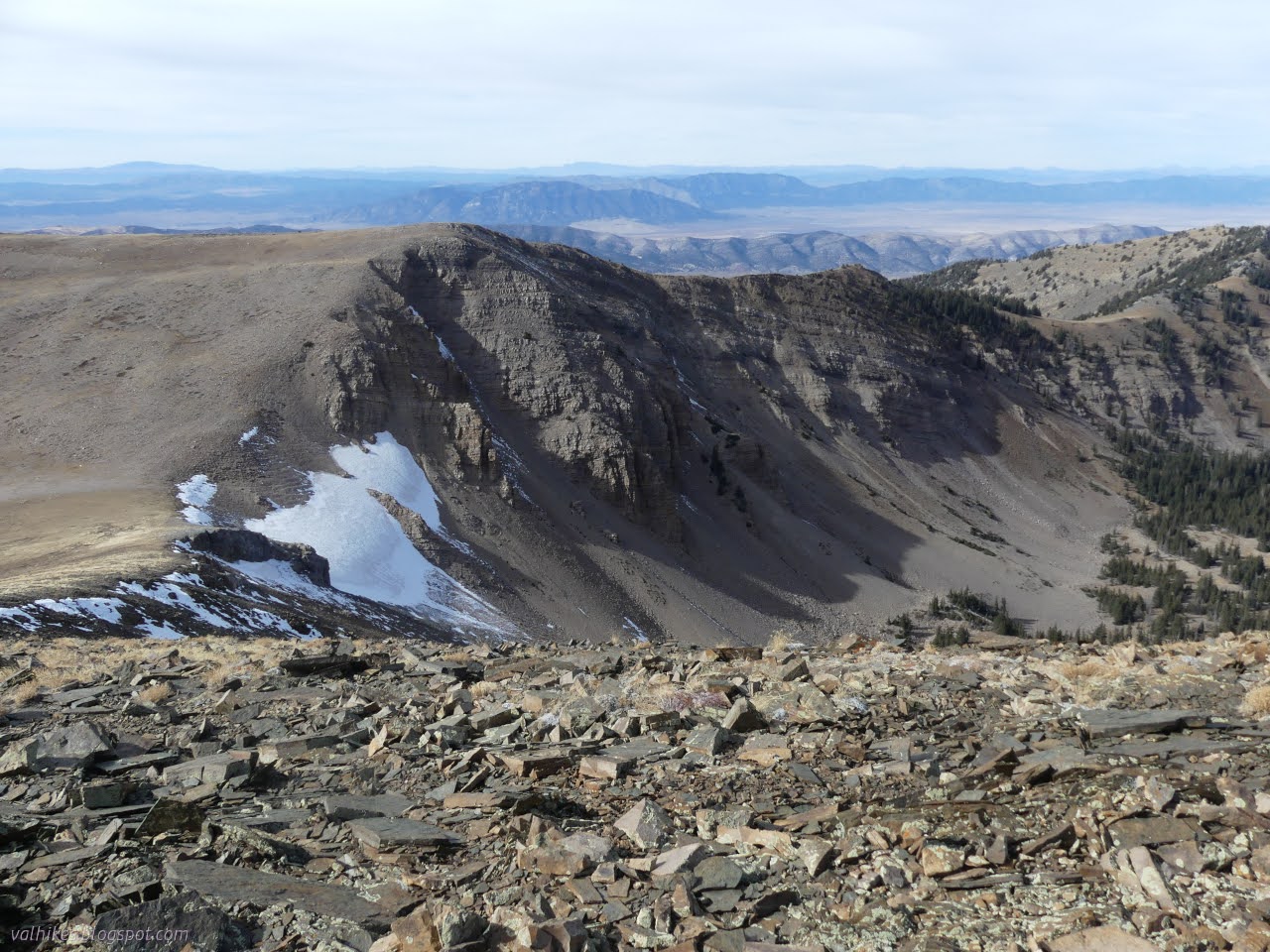
Looking across the canyon, I was realizing that the slopes over there really aren't good for controlled downward travel. This side would be a scree ski, but I was pretty sure I could handle it. The drop is about 600 feet, so I was pretty sure I'd rather not, but that is what the canyon has to offer.

I stashed my heavy gear among some trees beside the ridge near my exit point and continued on a little faster than before. South to the next peak, now above Berry Creek. There was another geocache to look for. This is when I finally realized they're just these registers.


I started down the slope toward Taft Peak realizing that I wasn't going the speed I needed to get all the way to South Schell Peak. There are long sections of what is basically rock hopping. Apparently it's been too long since I last did that sort of hike. It was really getting to me. The cold was getting to me. The wind was getting to me. Once the south peak was let go, I didn't have much motivation to bother with Taft Peak either. Not today, anyway. I still had my plan of coming up Black Mountain to South Schell Peak swirling around in my head and now it was mixing with the thought of how nice the Berry Creek area looked and how I would like to hike it too. I was getting pretty done with the Ely area for now, but I certainly wanted to be back. When it wasn't so cold and windy.

Plus I couldn't legally camp where I was parked, so having a little daylight left to go somewhere sure would be nice. I decided to leave the spur (and two more supposedly unfound geocaches) for another time, trying not to evaluate all the ifs that go into that ever happening. I turned back.


I stopped at the north end of "Uinta Peak", which happened to be ever so slightly higher as near as I could tell. (Entirely guesswork since I have no instruments for that.) It made a good perch for a final look around.


So down I went to the patch of pines by the ridge to pick up my gear. I finally pulled off my puffy pants in the shelter offered by those pines. I wasn't going to risk tearing them on the descent and I was finally getting warm, at least when out of the wind.

Once examined, the patch of pines turned out to be limber pine mixed in with spruce and common juniper. From there, down I went. Very carefully. I didn't want to drag the whole mountain with me, so I went slowly and steadily. Some places, I managed not to move much rock at all. Others, well, I rode the rock down a foot or two. I tried to avoid the plants with that and managed rather well.


I poured the rocks out of my shoes. Some of them got to travel quite far from where they started. Then I tried to make my way to spaces of easier walking down in that valley of more loose rocks.


The South Fork shows a bit more long term use. I found a few camps, but not much of a trail for a while. Things looked more likely to be cow paths. Eventually I found the faintly flattened widening of a long abandoned road.


I gradually came to more defined stream beds, but no actual water. Once among the aspen again, there are a lot of carvings, more so than along the North Fork. The trail got better defined and wasn't always on the road.


Eventually this fork, too, contains running water. The trail finds itself on the wrong side of the water and has to cross both streams to get to the trailhead.


And so I arrived back at the end of the road, but still had another mile to go. I hadn't really gone far enough to justify making it an overnight. So it goes.

I continued back down the rougher bit of road to the car. It had indeed been out of the way.

*the photo album*
©2023,2024 Valerie Norton
Written 5 Jan 2024
Liked this? Interesting? Click the three bars at the top left for the menu to read more or subscribe!


Comments