Grey Dome (Sugarloaf)
Caliente Field Office BLM
(map link)
Nevada boasts the first "nationally recognized" OHV trail system in their Silver State Trail. I suspect this is a similar status to a National Recreation Trail, but for motor vehicles. It spiders the area of Lincoln County between US-93 and NV-318. There are five developed trailheads that also serve as small campgrounds. I stopped at the Chief Mountain South Trailhead with the plan to hike to the top of Grey Dome. Since my Ely District Recreation Opportunity Guide says there is hiking at this spot, I expected to see some designated hiking trails shown on the sign, but there are only the practice trails for motorcycles. It is all unstructured hiking. Or on roads and ATV trails as most of my planned hike would be.

I headed out along a connector from the trailhead sign to the road I came in on. It gets visibly rougher, but I could still drive it in my little car, as it climbs easily to a saddle. There's a couple areas that look camped. They say this is the most popular trailhead and I could see it overflowing in a more popular season. Down the other side as Grey Dome comes into view, it would be wiser to have at least an AWD vehicle.


There's enough roads out here to actually give me choices as to how to get to the mountain. One passed the "Crows Nest Tank". Hoping it was some natural structure, I headed that way. Sometimes they're a natural depression for a "tank".


So I turned down Antelope Canyon, which comes over from the Oak Springs Trilobite Area for another option to hike to the peak. The canyon it is named for is over by Caliente. This part is still quite open and hilly area.

Then off to an ATV trail (for those less than 50 inches wide) that is part of the Chief Mountain Trails rather than the Silver State Trail. I wasn't sure what to expect.


The ATV trail is signed. In fact, it's the big Gs I've been seeing since the first turn. I'm basically following the G route, which is the Grey Dome Rim Trail, which goes all the way from the trailhead. Very thoughtful of them to supply all of the direction. The other side of the ATV portion is actually old Jeep trail, but this end quickly descends into and stays with a wash.

The wash was a little loose in places, but mostly not as unpleasant as expected to travel. I did take the little bits of trail off the side when they came up instead of staying in the gravel. These may be supplied by cows or motorcycles or both, but probably aren't official. At one point I saw a leaning "G" marker below me as I took a high route.

I found I had quite quickly sorted through the 4-ish miles to the saddle where I planned to start my cross country climb to the peak. Well, I actually planned to look for the rouge motorcycle trail, but the little cliffs have discouraged them from trying.


The little cliffs did not discourage me, although I did end up scrambling up a few of them. Views open up quickly. Horses have been here and leave evidence of standing about at some of the obvious viewpoints. Not recently, but they have been.


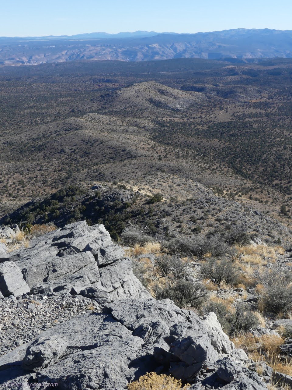
After no real challenge in going up, I had quite a lot more view from the top.


I got my last weather report for a week, not that I knew it. I'd be at the library in Caliente in a day after all. Then I turned my attention to the long ridge heading southerly. My plan was to walk it down to the road. Or maybe I should eventually find my way down to the east and follow a bit more road from a different point of view? It was looking like a long way on the ridge.
I walked around the little ledges and headed down. There was more old horse evidence. There had been prints in the wash and a couple great heaps of still moist manure on the road. Guess they stay where it is less exposed as the season wears on.


This time when the little birds came swarming by, I took the time to try to catch a few.


I found myself within 200 feet of my route up and the temptation for the easy walk without ups and downs and brush avoidance got to be too much. I headed over to the wash to finish the cross country section of the hike. I did try to lose myself near the end of the ATV trail by following a trail up the right side shortly before the official trail leaves via the left side, but that got worked out easily.


I headed back along the other road choices. This one seemed a little more like something you might find included in an OHV trail system. It's just a little more challenging a road.


This bit of road also follows a wash for a bit.


The wash doesn't last long and my route returns to the route out. One last easy climb got me back to the trailhead and campground.

It felt good to have a longer hike, especially one that got me back before dark even with the short days.
*photo album*
©2023,2024 Valerie Norton
Written 18 Jan 2024
Liked this? Interesting? Click the three bars at the top left for the menu to read more or subscribe!


Comments