Tule, Haymeadow, and Cold Springs Reservoirs

Wayne E. Kirch Wildlife Management Area


(map link)

The plan for this day was to visit the three smaller, further reservoirs starting with the furthest. It had rained heavily overnight and even the main road felt a little off, but I was really regretting leaving the driving to after the rain when I got to the last two miles to the Tule Reservoir Dam. After the turnoff for Haymeadow Reservoir, the road becomes narrow and lesser maintained. The turnoff for Tule Reservoir is so rough that I pulled out of the way of traffic at the corner and walked it. There's lots of room for parking at the intersection even though it is not marked as an official parking area on the reserve's map.

00: spots of open water
Tule Reservoir from atop the dam. A little cloud and distant rain remain.

02: open spot of trail
Old road on the far side is trail now.

03: below the dam and up the road
A look back over the occasionally flooded areas below the dam and back up the road.

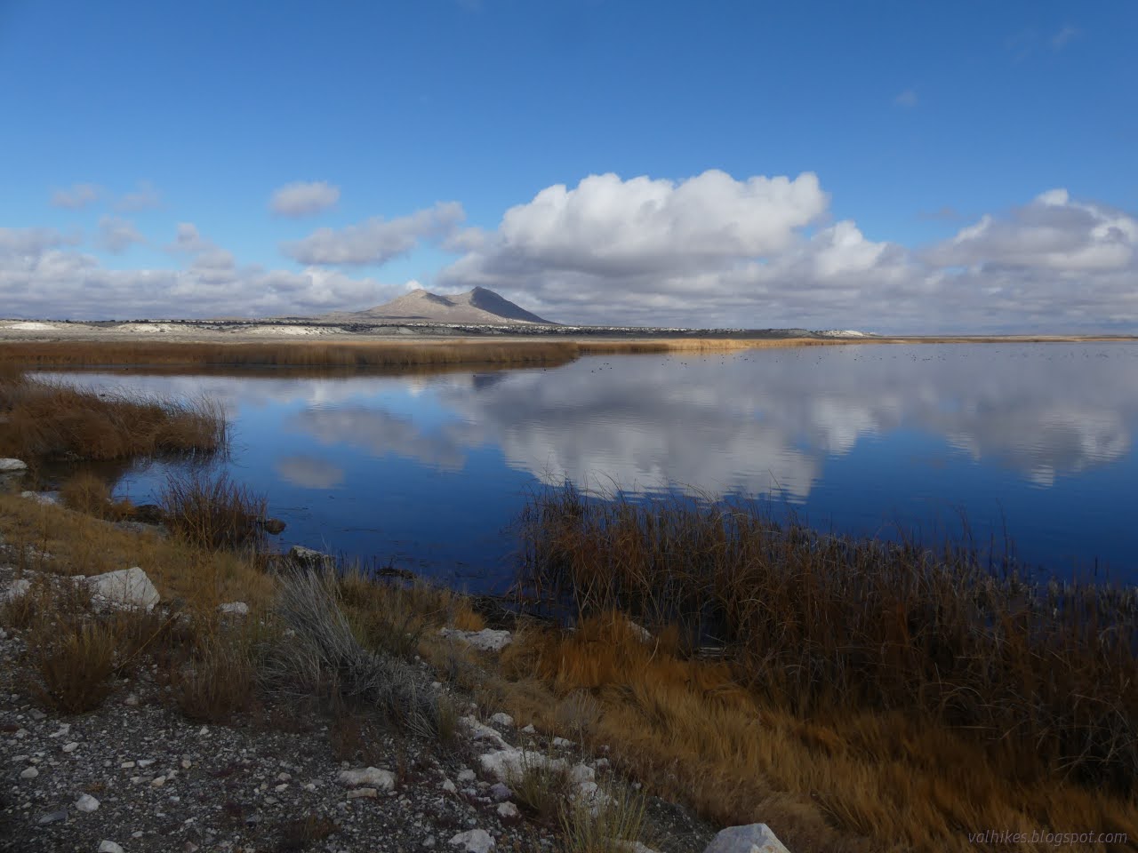
The great amount of reeds, for which the reservoir is named, got me to thinking I wouldn't actually see anything out on the water and mostly wouldn't even see water. I decided against actually walking along the whole thing, but there are some old roads to be trail.

05: red shouldered birds
And plenty of red-winged blackbirds zoomed about. They're more impressive when the sun hits.

06: tiny bird
Little song sparrows are in the bushes.

07: birds on a post
There's a lot more blackbirds.

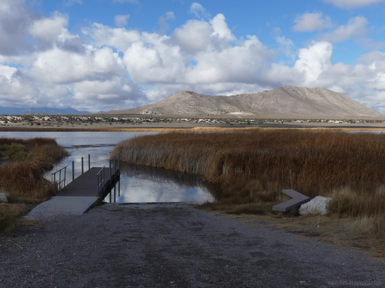
One step sank right down into the road surface as I walked back and I was pretty happy not to have driven that. I headed off to Haymeadow Reservoir and parked in the first lot near the boat launch. There's a second lot further down the access spur near the dam. It's very fancy with a dock and a bench and picnic table and toilet and information panels.

09: standing bird
A great blue heron waited on a bench.

10: big wings
It decided I was too close and took off.

I headed out onto the dock, so perhaps I was too close. Looking out, I saw loads of coots once more. I picked out a few birds that didn't quite match.

11: black spots on the lake
Looking out through the boat channel, there's a lot of coots.

12: black floats and ligher spots
Seeing a few lighter spots out there among the coots, like the young bufflehead in the middle.

I headed over to the dam. There was a worker out on it with his truck, but he headed off soon. The clay mud caked his tires much more thickly than the tread goes, but he managed.

13: dam and water and grass
The dam and reservoir (and tire tracks).

14: black spots of flight
Blackbirds roam about here, too.

15: clouds reflecting from the water
There might be some rain still in the distant Grant Mountains, but not on Haymeadow Reservoir here or Hot Creek Butte behind.

16: Tule Reservoir
The tangle of weeds below, on the way to Tule Reservoir.

17: spots on the water
There's a few birds a little closer today.

18: bird with wake
Still propelling themselves quickly away.

20: coot with grass
The coots have caught something!

21: brown and striped but not a coot
A ruddy duck paddled through the coots. Not as red as her male companions, but they didn't make an appearance.

22: big white head
The older buffleheads stand out against the coots a little better.

23: area downstream
Another look around the area downstream.

24: perching bird perching
A song sparrow tucked into the weeds.

In spite of the sun coming out, I wasn't much inspired to continue walking around this reservoir either. I headed back and over to Cold Springs Reservoir where I again stopped at the first parking area near the boat launch then headed toward the dam where there is a second parking area.

25: dock and bench
The boat launch at Cold Springs Reservoir is quite the same as the one at Haymeadow Reservoir.

26: upper reservoir
Distant water of the upper reservoir area.

But first I walked out on a trail beside the boat channel and got to see some coots a little closer. I didn't get to see their not-webbed feet (they aren't ducks) but still got to see more than a black dot on the water.

27: plenty of coots nearby
Coots just the other side of some grass.

28: black and white bird
The nearby American coot glides away.

29: white heads
The buffleheads really stand out among the coots. I missed the canvasback on the right, though.

32: water and reeds
The wider angle view of Cold Springs Reservoir and Hot Creek Butte from the path near the dock.

Then out to the dam where it is so much easier to look out at a lot of water.

33: zooming water fowl
Arriving at the dam and the coots, and a few others, are all zooming away.

34: red shoulders flashing in the sun
The red-winged blackbirds flashing in the sun.

35: red patches
And so they fly.

38: reeds
More swampy areas below on the way to Haymeadow Reservoir.

I did continue across the dam and around the far side a little on this reservoir. Not many had. Perhaps mostly cows and those much earlier in the season.

41: grasses and a little water
Not much to see of the water from here, but maybe there's something more interesting in the reeds.

I turned back to find a pair of fishermen were joining me on the dam.

43: panorama of water
The whole of Cold Springs Reservoir from the far end of the dam.

45: birds on water
Those dots include a couple pairs of ruddy ducks and some buffleheads among the coots.

46: water and mountains
I think it might still be raining over Shingle Pass.

I decided to leave the fishermen to it all.

48: long clouds climbing
Strange clouds out.

I did stop briefly at Adams-McGill Reservoir again as I passed by. I thought I saw something new, but it was just another young bufflehead.

49: black dots
A bunch more coots and maybe one other.

50: upturned animal
More coots in the shallows.

51: perching bird
And one more song sparrow.

*photo album*


©2023,2024 Valerie Norton
Written 16 Jan 2024


Liked this? Interesting? Click the three bars at the top left for the menu to read more or subscribe!


Comments

follow by email

popular posts:

Jennie Lakes: Belle Canyon and Rowell Meadow

Mount Lassic

Lost Coast: Cooskie Creek Route

If the Map's Wrong, Fix It!