Monte Cristo Canyons

Tonopah Field Office BLM


(map link)

I got a late start because, well, it's cold out there. I don't particularly want to deal with the part of the day that's below 20°F, quite frankly. A south facing slope and warming sun can fix it right up in a little time. It's bad enough when water freezes, but when the pancake batter or even the eggs freeze, it is really annoying. When I did start out, it was still too early for a raptor that I kept disturbing as I headed toward yesterday's missed Earthcache.

00: tan desert with white canyons cut through
My target, the line of white cut into the desert slope in the distance, more toward the bottom than the top.

02: wings in the sage
A disturbed raptor, probably a northern harrier, takes flight from the sagebrush.

I disturbed quite a lot of sage sparrows, too. The little flocks would flutter and swoosh and become dark spots on one turn and flashing white spots on other turns. I decided it was time to try to capture a flock with the camera as I walked across the less impressive landforms to the far canyons.

03: small bird flock
A little flock of sage sparrows heads south for the moment.

05: points and bumps
Peaks to the north hiding, not too far back, the Norman benchmark.

06: white underside
A couple flickers of white bird underside against the backdrop of the upcoming canyons.

07: road on hill
The road I might have followed yesterday, had I continued with the plan off Norman benchmark.

09: birds and a mountain
Birds behind me against a backdrop of Lone Mountain.

I came upon a pocket of white rocks, a section of the alluvium that had eroded away leaving a canyon of underlying strata, even though I was only halfway across. There would be an extra canyon to cross to get there.

11: rounded valleys
A minor obstacle along the way.

12: light and dark
Just some ups and downs.

14: steps in soft puff
Sometimes the dirt is as soft as it looks. Mostly it is not.

There's supposedly a road somewhere down the middle of these canyons, but I saw no sign. It's just wash.

20: dome and edges
Distinct hard layers form overhangs here.

21: more canyon
One last crossing.

25: canyon with structure
Off to the north, a canyon with a bit more structure.

26: spotted leaves and yellow buds
There's plants out here trying to make it work! It's a bit early for these suncups.

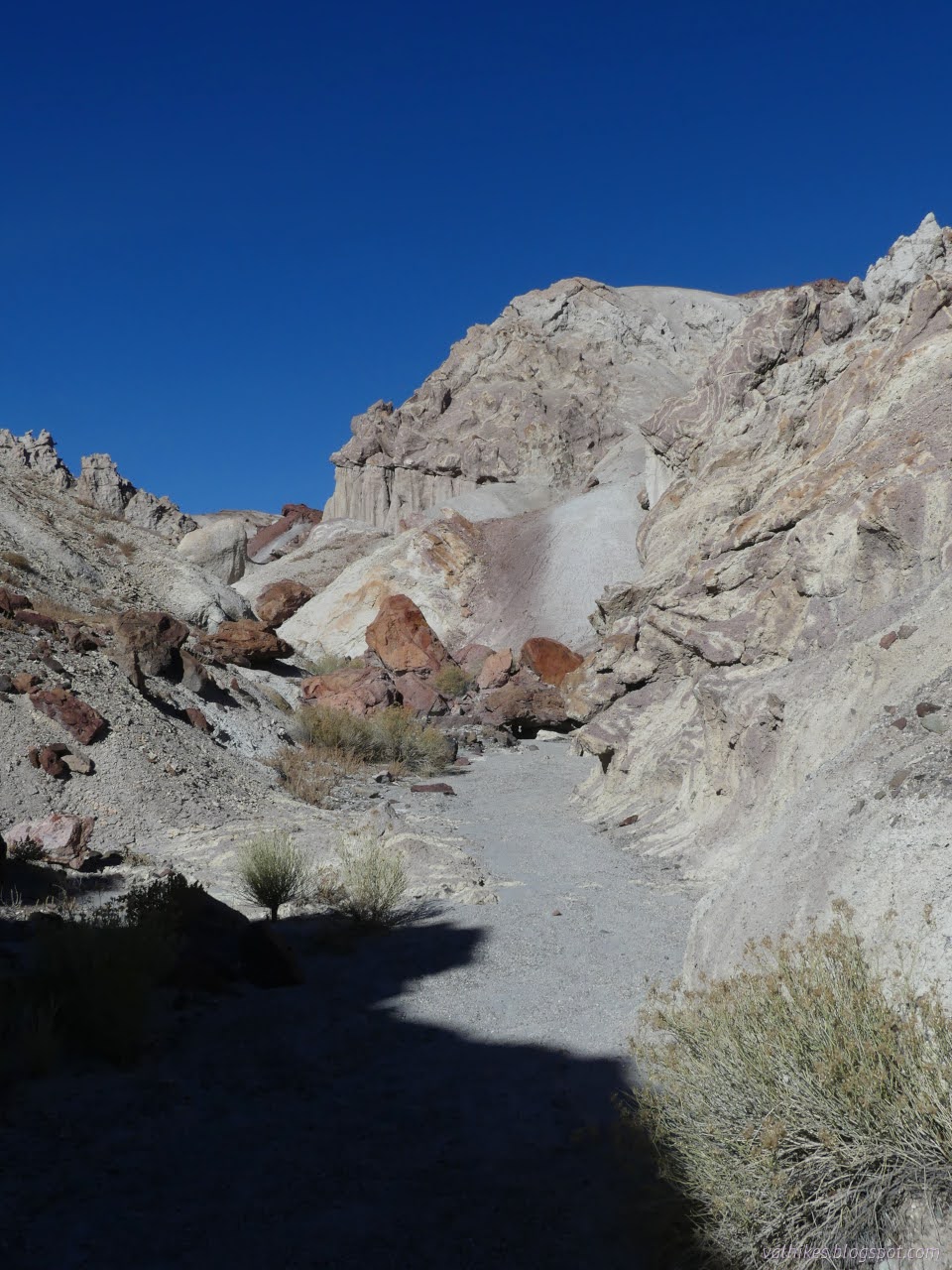
I left that canyon to cross over to the next. The road there, the one generally used to access the Earthcache, really does exist. Then there's an even more impressive canyon area.

28: jutting upward
Strange statuary in one section of the canyon ahead.

30: road section
The usual road. No idea how the rest looks but it is said to cross washes and sometimes need a true 4x4.

32: spines on the ground
Tiny sagebrush cholla that has captured some seeds from elsewhere.

I found a nice, gentle hill into the canyon where the Earthcache is marked.

33: layers in the rocks
A changing tilt of layers in the area.

35: pillars
No hard rock tops, but still hoodoo like.

After the Earthcache and a bit of lunch, I turned my attention to wandering up the canyons a bit. I selected one that was clearly signed against anyone trying to use it as a road. That's so weird since even the roads don't have road signs. The canyon quickly made certain no one was taking a motor vehicle up it. There were, however, footprints.

36: tame canyon
A look downstream, including the low spot I would eventually cross over.

38: abstract reaching upward
The canyon closes in with guards posted at the top.

39: metal steps
Perhaps there was a trail developed here once.

I found a ladder at the bottom of a chute. It could help me up a bit I didn't need help for. It was probably placed just a little higher originally. Now it is embedded in the sand below the chute and there would be no moving it back without extensive excavation. Maybe one could try a friction climb instead? So long as that one isn't me. I turned back. I was following a set of footprints up and over to the next canyon, too.

40: canyon with pillars
The next canyon over looks familiar at first.

42: hoodoos of topped and not sort
It's less familiar above.

45: those guards again?
Elaborate shapes in the rocks. They are eyeing me for sure.

I pondered popping back over to the west to see where the ladder had been heading, but ultimately did not. I did work over to the east gradually.

47: stacked rock look
Constant changes.

50: smoother canyon
High up a smoother bit of canyon.

51: more canyon
More canyon to the east.

52: dark rocks
The rocks darken where they are baked by magma intrusions or lava flows.

53: jutting out everywhere
I suspect water moving minerals around cause the mounds of points.

56: finding within
Across a wash to overhanging rocks.

58: hills behind
Leaving the hills behind.

59: overhanging bluffs
The bluffs below as the water carves in.

Eventually I had crossed the many canyons and was back looking across the second road to the gentler landscape.

63: road and hills with caves
There are hills with little caves in them across the road.

64: hills
The Norman benchmark is back there somewhere, hidden behind the somewhat shorter hills.

66: two tracks fading
That first road I crossed happens to be real after all and is visible past the canyons, though fading.

68: cliffy lava
Some more traditional desert structures, complete with silver cholla.

69: white rocks among dark
White rocks are just erratics out here, except that distant Castle Peak.

I got back to camp late in the afternoon. It was later than expected but still not half so late as yesterday. I couldn't help wondering what I missed for not doing the ridge walk from the Norman benchmark to the canyons, but I probably gained more.

*photo album*


©2023,2024 Valerie Norton
Written 14 Feb 2024


Liked this? Interesting? Click the three bars at the top left for the menu to read more or subscribe!


Comments

follow by email

popular posts:

Jennie Lakes: Belle Canyon and Rowell Meadow

Mount Lassic

Lost Coast: Cooskie Creek Route

If the Map's Wrong, Fix It!