Corey Peak
Stillwater Field Office BLM
(map link)
The sun came up leaving my apparently exposed camp in the shadow of the unnamed bulk north of Buller Mountain. I got to wishing this Trail Sense app didn't just tell me when the sun would come up, but would also show where, or at least give me a bearing. Then I could better plan to have a sunlit morning!


Of course, it's only a half hour to an hour more to get the sun. Still, more pleasant with it. I didn't have all that far to go (7-8 miles total) and all of it on clear road, so I didn't rush the start. The grader parked below got moving toward California eventually. The road wasn't smooth enough yet.

The road up to the peak officially starts a little lower, east of the pass. I had to find a road to jog over to it to really start climbing.


The road comes in an old version and a new version. The old version mercilessly climbs directly up the hill. The new one swings back and forth at a gentler slope up the mountain. Mostly, the vehicles have kept to the new one, but for some reason they have abandoned the lowest switchback for the direct route. Perhaps it's a trial by fire to eliminate the lesser vehicles.

I decided to walk up the old road. The first part of it was quite clear, the upper section brushy. I found that even that comes in two ages of road. The direct road looks like it could be a slide, but there's also one with little swings on a gentle slope. It might have been built to access some power poles that the new road misses but the old road passed by.

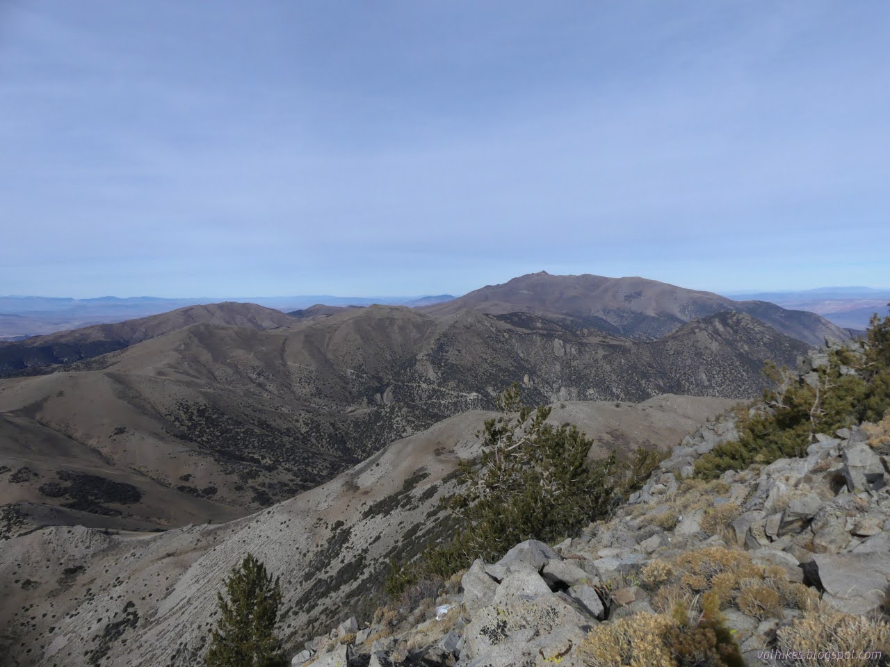
After a bit of working on my steps and then a flat section, I rejoined the main road up. It gets into a bit of traveling at that point, giving a changing view below.


While it wasn't climbing fast, the road was still hard to walk because it was sandy and soft. When I spotted utility road paralleling below it, old and disused, but solid, I went for that instead.


That didn't set me up well for catching the smaller road that leaves to climb to the top of Corey Peak. I had to climb a short way cross country to catch it only to find that the road had left the sand behind too. All the better to climb onward and upward.

I'm a little worried about the peak bagger 4x4 technique. A couple seem to state that there's "little tabs" at each switchback to allow for multipoint (9-13) turns. Not to tell the 4x4ers their business from the seat of my tiny car, but some of them were clearly set up for 1 point turns. You pull in, put it in reverse, and you back up the whole of the next section until you get to the next 1 point turn where you can shift it into first and pull out forward. Maybe it fell out of fashion with the longer and longer trucks people have been buying (when it is even harder to make that turn...), but it could make a return with all the backup cameras. It's not always safe to execute a full turn.

At the top, after all the nice easy switchbacks, the road takes a sudden and very steep turn upward. There's a bit of makeshift parking because even the people desperately trying to turn around in a space 12 inches longer than their vehicle aren't desperate enough to risk going end over end in a difficult scramble upward. There's also plenty of evidence a few of them try and make it. I walked up the side because the road is a mess.

Things were clouding over, so I started to hurry for that top. There was even some thin snow to make my way through. What looked like the most recent tracks all the way up had been shoe prints, and they came through the snow too.

I had a good look at Mount Grant wondering if I'd missed out by not trying to get permission to hike it while I traveled through Hawthorne on a business day during normal working hours. It's certainly fairly clear of snow, too. It's only 700 feet higher, but maybe it was time to get another county high point.

I also had a look for the benchmark and references. They didn't go all out with the references. They are just bolts with washers. I stumbled upon the geocache near the peak as I did. (Some of them expect to be able to turn around totally at every switchback, too.)


Eventually, I headed down. I found the bit of faint road cut that is not so steep to follow. I'm not sure it actually went to the peak, but it may very well be how the tool shed on a trailer got dragged there. I continued down taking the gentler road, even in the one abandoned spot at the bottom.

The gentler road near the bottom is all there, still, but there are some problems in traveling it. There's a couple trees down across it and it's a tiny bit brushy. But it is definitely road. I found a knocked off muffler and everything. I got down with enough time to move camp off to Tamarack Beach Campground at Walker Lake. It wasn't warmer, but it was noisier.
*photo album*
©2023,2024 Valerie Norton
Written 22 Feb 2024
Liked this? Interesting? Click the three bars at the top left for the menu to read more or subscribe!


Comments